
List of National Natural Landmarks in Oregon
There are 11 National Natural Landmarks in the U.S. state of Oregon.[1]
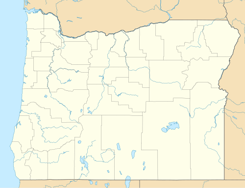

Oregon National Natural Landmarks (clickable map)
| Name | Image | Date | Location | County | Ownership | Description |
|---|---|---|---|---|---|---|
| Crown Point |  | 1971 | 45°32′22″N122°14′39″W / 45.5395°N 122.24422°W / 45.5395; -122.24422 (Crown Point) | Multnomah | state park | Promontory in Columbia Gorge |
| Fort Rock State Monument | 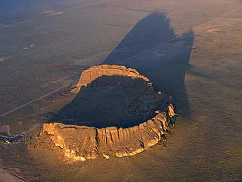 | 1976 | 43°22′19″N121°04′26″W / 43.372°N 121.074°W / 43.372; -121.074 (Fort Rock) | Lake | state park | Volcanic tuff ring |
| Horse Ridge Natural Area |  | 1967 | 43°55′26″N121°02′20″W / 43.924°N 121.039°W / 43.924; -121.039 (Horse Ridge)[2] | Deschutes | federal | Western juniper woodland on Bureau of Land Management property.[2] |
| John Day Fossil Beds |  | 1966 | 44°33′21″N119°38′43″W / 44.555833°N 119.645278°W / 44.555833; -119.645278 (John Day Fossil Beds) | Grant | federal | Contains a remarkable sequence of very diverse fossils. |
| The Island |  | 2011 | 44°33′31″N121°16′38″W / 44.558489°N 121.277143°W / 44.558489; -121.277143 (The Island) | Jefferson | federal | Native juniper savanna on an isolated plateau at the confluence of the Deschutes and Crooked Rivers. Part of Ochoco National Forest. |
| Lawrence Memorial Grassland Preserve | 1984 | 44°57′03″N120°47′56″W / 44.950889°N 120.7988834°W / 44.950889; -120.7988834 (Lawrence Memorial Grassland Preserve) | Oregon | private | An excellent illustration of "biscuit and scabland" topography.[3] | |
| Newberry Crater |  | 1976 | 43°41′21″N121°15′18″W / 43.689194°N 121.254889°W / 43.689194; -121.254889 (Newberry Volcano) | Deschutes | federal | Atypical shield volcano in Deschutes National Forest. |
| Mount Howard-East Peak | 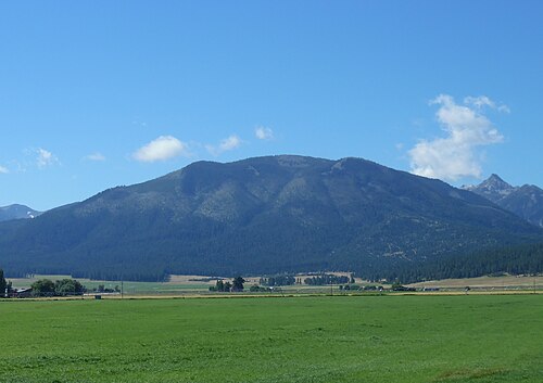 | 2016 | 45°15′40″N117°10′44″W / 45.260987°N 117.178778°W / 45.260987; -117.178778 (Mount Howard-East Peak) | Wallowa | federal | Contains botanically diverse montane grassland habitats and populations of endemic and rare plant species. |
| Round Top Butte | 2011 | 42°31′40″N122°41′02″W / 42.5277551°N 122.68381°W / 42.5277551; -122.68381 (Newberry Volcano)[4] | Jackson | federal | Exceptional native bunchgrass habitat. Located on Bureau of Land Management land.[5][6] | |
| Willamette Floodplain | 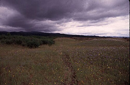 | 1987 | 44°21′50″N123°13′48″W / 44.364°N 123.23°W / 44.364; -123.23 (Willamette Floodplain) | Benton, Lane, Linn, Marion, Polk | federal | A bottomland interior valley grassland floodplain. Part of William L. Finley National Wildlife Refuge. |
| Zumwalt Prairie |  | 2013 | 45°32′N117°05′W / 45.54°N 117.09°W / 45.54; -117.09 (Zumwalt Prairie) | Wallowa | private | Largest contiguous remaining tract of bunchgrass prairie in the nation. |
See also
References
- ↑Hale, Jamie (August 10, 2016). "Oregon Travel News: Oregon's 11 National Natural Landmarks". The Oregonian. Oregonlive / The Oregonian. Retrieved August 10, 2017.
- 12"Horse Ridge Natural Area". Geographic Names Information System. United States Geological Survey, United States Department of the Interior. Retrieved April 5, 2009.
- ↑"Lawrence Memorial Grassland Preserve". Conservation Gateway. The Nature Conservancy. Retrieved August 10, 2017.
- ↑"Round Top Butte RNA". Pacific Northwest Interagency Natural Areas Network. Oregon State University, Forestry Sciences Laboratory. Retrieved August 31, 2017.
- ↑"Archived copy"(PDF). Archived from the original(PDF) on May 4, 2017. Retrieved September 1, 2017.
{{cite web}}: CS1 maint: archived copy as title (link) - ↑"Oregon Natural Areas Plan 2015"(PDF). Archived from the original(PDF) on February 21, 2016.
Categories:
- National Natural Landmarks in Oregon
- Lists of National Natural Landmarks by state
- Oregon geography-related lists