
State road D.060 (Turkey)
D-060 is a west–east state road in northeastern Turkey that serves the land border crossing to Armenia, which is currently closed. The 225 km (140 mi) route starts in the west at the intersection of D.950, 18 km (11 mi) east of Yusufeli, Artvin Province, and terminates at Turkey's Tiknis border checkpoint with Armenia12 km (7.5 mi) east of Akyaka, Kars.[1] The route D-060 continues in Armenia as M7.
Itinerary
| Province | City/Town | Distance fromprevious location | Distance fromWest end | Distance fromEast end |
|---|---|---|---|---|
| Artvin | Intersection 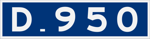 D.950 D.950 | 0 | 0 | 225 |
| Erzurum | Intersection  P.25-06 to Olur P.25-06 to Olur | 43 | 43 | 182 |
Intersection 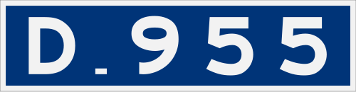 D.955Yolboyu, Oltu D.955Yolboyu, Oltu | 20 | 63 | 162 | |
Intersection  P.25-07 to Kömürlü, Yusufeli P.25-07 to Kömürlü, Yusufeli | 9 | 72 | 153 | |
Intersection  P.25-10 to SarıkamışIntersection P.25-10 to SarıkamışIntersection  P.25-14 to Şenkaya P.25-14 to Şenkaya | 8 | 80 | 145 | |
| Akşar, Şenkaya | 2 | 82 | 143 | |
| Aydoğdu, Şenkaya | 13 | 95 | 130 | |
| Ardahan | Göle | 17 | 112 | 113 |
| Intersection P.75-25 to Selim, Kars | 3 | 115 | 110 | |
| Balçeşme, Göle | 22 | 137 | 88 | |
| Kars | Intersection 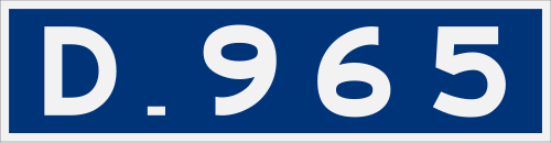 D.965 to Susuz D.965 to Susuz | 32 | 169 | 56 |
| Intersection D.965 to Kars | 3 | 172 | 53 | |
Intersection 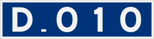 D.010 to Arpaçay D.010 to Arpaçay | 10 | 182 | 43 | |
| Şahnalar, Akyaka | 25 | 207 | 18 | |
| Akyaka, Kars | 6 | 213 | 12 | |
| Demirkent, Akyaka | 4 | 217 | 8 | |
| Tiknis border crossing | 8 | 225 | 0 | |
| 1.000 mi = 1.609 km; 1.000 km = 0.621 mi | ||||
Major intersections
See also
References
- ↑Türkiye Haritası (Map) (in Turkish). Karayolları Genel Müdürlüğü. Retrieved 2014-07-07.

Categories:
- State roads in Turkey
- Transport in Artvin Province
- Transport in Erzurum Province
- Transport in Ardahan Province
- Transport in Kars Province
- Akyazı