
Kan-etsu Expressway
The Kan-Etsu Expressway (関越自動車道, Kan'etsu Jidōsha-dō) is a national expressway in Japan. It is owned and managed by East Nippon Expressway Company.
Naming
Kan-Etsu (関越) is the kanji acronym of Kantō (関東) and the old Echigo Province (越後国) comprising modern-day Niigata Prefecture.
Officially, the Kan-Etsu consists of two routes. Both begin in Tokyo and end in Niigata Prefecture. The Kan-Etsu Expressway Niigata Route consists of the entire Kan-Etsu Expressway from Nerima to Nagaoka, as well as the Hokuriku Expressway beyond Nagaoka to its terminus in the city of Niigata. The Kan-Etsu Expressway Jōetsu Route is concurrent with the Niigata Route until Fujioka Junction, where it branches off as the Jōshin-etsu Expressway and traverses Nagano Prefecture to its terminus in Jōetsu, Niigata.[3]
Route description
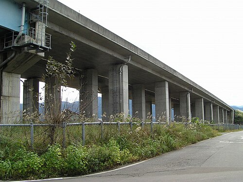

The expressway begins in Nerima Ward in the north of Tokyo; the Kan-etsu is the only national expressway linking Tokyo that does not have a direct connection with the urban Shuto Expressway network. A junction with the Tokyo Gaikan Expressway near the origin links the Kan-etsu with other expressways serving northern parts of the Tokyo urban area. From here the expressway follows a roughly northwesterly course to its terminus in Niigata Prefecture, passing through central areas of Saitama Prefecture and Gunma Prefecture. In Gunma the Kan-etsu Expressway provides access to Nagano Prefecture by way of the Jōshin-etsu Expressway at Fujioka Junction, and the completion of the Kita-Kantō Expressway in 2011[4] facilitated access to Tochigi Prefecture and Ibaraki Prefecture. The mountainous area separating Gunma and Niigata Prefectures is traversed by the Kan-Etsu Tunnel, the second longest road tunnel in Japan.[5] The expressway then passes through southern Niigata Prefecture before terminating at a junction with the Hokuriku Expressway in Nagaoka. The route is six lanes from Ōizumi Junction to Shibukawa-Ikaho Interchange, and all other sections are four lanes. The expressway parallels National Route 17 and the Jōetsu Shinkansen of East Japan Railway Company for most of its length.[6]
History
The first section opened in 1971 and the entire route was opened to traffic in 1985.[7]
On the night of 16 December 2020, about 1,000 vehicles were trapped on the expressway after a trailer blocked it off due to it becoming stuck in the snow. In response, the company that manages the route supplied drivers who were stuck on the road until the next morning.[8] The Japan Ground Self-Defense Force was also deployed to the expressway to aid in the distribution of supplies to the stranded drivers.[9]
In December 2025, a crash involving 50 vehicles in snowy conditions killed 2 people.[10][11]
List of interchanges and features

- IC - interchange, SIC - smart interchange, JCT - junction, SA - service area, PA - parking area, TB - toll gate, BS - bus stop, CB - snow chains, TN - tunnel, BR - bridge
| No. | Name | Connections | Dist. fromorigin | Dist. fromterminus | Bus stop | Notes | Speed limit | Location | |
|---|---|---|---|---|---|---|---|---|---|
| 1 | Nerima IC | Met. Route 24 (Nerima Tokorozawa Route / Mejiro Dōri) | 0.0 | 246.2 | 80 km/h | Nerima | Tokyo | ||
| 2 | Ōizumi JCT |  Tokyo Gaikan Expressway Tokyo Gaikan Expressway | 0.8 | 245.0 | IC entrance: Nagaoka-bound only | ||||
| Ōizumi IC | Met. Route 24 (Nerima Tokorozawa Route / Mejiro Dōri) | ||||||||
| TB | Niiza Toll Gate | ↓ | ↑ | Niiza | Saitama | ||||
| 100 km/h | |||||||||
| 3 | Tokorozawa IC |  National Route 463 (Urawa Tokorozawa Bypass) National Route 463 (Urawa Tokorozawa Bypass) | 9.4 | 237.6 | Tokorozawa | ||||
| PA | Miyoshi PA/SIC | 13.9 | 233.1 | Miyoshi | |||||
| 4 | Kawagoe IC |  National Route 16 National Route 16 | 21.2 | 225.9 | Kawagoe | ||||
| BS | Kawagoe-Matoba BS | ↓ | ↑ | ○ | |||||
| 4-1 | Tsurugashima JCT |   Ken-Ō Expressway Ken-Ō Expressway | 27.8 | 219.3 | Tsurugashima | ||||
| 5 | Tsurugashima IC |  National Route 407 National Route 407 | 29.6 | 217.5 | |||||
| 5-1 | Sakado-Nishi SIC | Pref. Route 39 (Kawagoe Sakado Moroyama Route) | 32.5 | 214.6 | Sakado | ||||
| SA | Takasaka SA | 34.7 | 212.4 | Higashi-matsuyama | |||||
| 6 | Higashi-matsuyama IC |  National Route 254Pref. Route 47 (Fukaya Higashimatsuyama Route) National Route 254Pref. Route 47 (Fukaya Higashimatsuyama Route) | 39.4 | 207.7 | |||||
| 6-1 | Ranzan-Ogawa IC | Pref. Route 11 (Kumagaya Ogawa Chichibu Route) | 47.4 | 199.7 | Ranzan | ||||
| PA | Ranzan PA | 50.1 | 197.0 | ||||||
| 7 | Hanazono IC |  National Route 140 National Route 140 | 56.1 | 191.0 | Fukaya | ||||
| 7-1PA | Yorii PA | 63.4 | 183.7 | SIC: Nagaoka-bound only | Fukaya/Yorii | ||||
| 8 | Honjō-Kodama IC |  National Route 462 National Route 462 | 69.6 | 177.5 | Honjō | ||||
| 8-1SA | Kamisato SA/SIC | 75.5 | 170.6 | Kamisato | |||||
| 9 | Fujioka JCT |  Jōshin-etsu Expressway Jōshin-etsu Expressway | 78.6 | 167.5 | Fujioka | Gunma | |||
| 9-1 | Takasaki-Tamamura SIC |  National Route 354 (Takasaki-Tamamura Bypass) National Route 354 (Takasaki-Tamamura Bypass) | 82.7 | 163.4 | Takasaki | ||||
| 9-2 | Takasaki JCT |  Kita-Kantō Expressway Kita-Kantō Expressway | 84.6 | 161.5 | |||||
| 10 | Takasaki IC | Pref. Route 27 (Takasaki Komagata Route) | 87.0 | 159.1 | |||||
| 11 | Maebashi IC |  National Route 17 National Route 17 | 92.1 | 154.0 | Takasaki/Maebashi | ||||
| 11-1PA | Komayose PA/SIC | 98.5 | 147.6 | Yoshioka | |||||
| 12 | Shibukawa-Ikaho IC | National Route 17 (Shibukawa Bypass) | 103.4 | 142.7 | Shibukawa | ||||
| 80 km/h | |||||||||
| BR | No.1 Tonegawa Bridge | ↓ | ↑ | Length: 784 m | |||||
| CB | Miharada CB | ↓ | ↑ | Nerima-bound only | |||||
| 12-1/PA | Akagi IC/PA | Pref. Route 70 (Ōmama Kamishiroi Route) | 111.2 | 134.9 | |||||
| SA | Akagi-kōgen SA | 118.5 | 127.6 | Shōwa | |||||
| 12-2 | Showa IC | Pref. Route 65 (Shōwa Inter Route) | 120.6 | 125.5 | |||||
| 13 | Numata IC |  National Route 120 National Route 120 | 125.8 | 120.3 | Numata | ||||
| CB | Numata CB | ↓ | ↑ | Nagaoka-bound only | |||||
| 14 | Tsukiyono IC | National Route 17 | 131.1 | 115.0 | Minakami | ||||
| PA | Shimomoku PA | 135.5 | 110.6 | ||||||
| BR | Ōmine Bridge | ↓ | ↑ | Length: 784 m | |||||
| 15 | Minakami IC |  National Route 291 National Route 291 | 141.0 | 105.1 | |||||
| PA | Tanigawadake PA | 146.0 | 100.1 | ||||||
| TN | Kan-Etsu Tunnel | ↓ | ↑ | Nerima-bound 11,055 mNagaoka-bound 10,926 m | 70 km/h | ||||
| Yuzawa | Niigata | ||||||||
| PA | Tsuchitaru PA | 157.5 | 88.6 | 80 km/h | |||||
| 16 | Yuzawa IC | National Route 17 | 167.0 | 79.1 | ○ | ||||
| TN | Ishiuchi Tunnel | ↓ | ↑ | Nerima-bound 1,590 mNagaoka-bound 1,502 m | Minami-uonuma | ||||
| SA | Shiozawa-Ishiuchi SA | (173.5) | 72.3 | Nerima-bound only | |||||
| 16-1/SA | Shiozawa-Ishiuchi IC/SA | Pref. Route 28 (Shiozawa Yamato Route) | 175.5 | 70.6 | SA: Nagaoka-bound only | ||||
| BR | Nakanojima Bridge | ↓ | ↑ | Length: 460 m | |||||
| 17 | Muikamachi IC |  National Route 253 National Route 253 | 186.9 | 59.2 | ○ | ||||
| BR | Hakkai Bridge | ↓ | ↑ | Length: 610 m | |||||
| 17-1/PA | Yamato PA/SIC | 198.3 | 47.8 | ||||||
| 18 | Uonuma IC | National Route 291 | 204.4 | 41.7 | ○ | Uonuma | |||
| 18-1/PA | Horinouchi IC/PA | Pref. Route 84 (Horinouchi Inter Route) | 212.1 | 34.0 | |||||
| BR | Kawaguchi Bridge | ↓ | ↑ | Nagaoka | |||||
| 19/SA | Echigo-Kawaguchi IC/SA | Pref. Route 83 (Kawaguchi Shiodono Route) | 220.9 | 25.2 | ○ | ||||
| TN | Yamamotosan Tunnel | ↓ | ↑ | Nerima-bound 1,838 mNagaoka-bound 1,804 m | Ojiya | ||||
| 20 | Ojiya IC | National Route 291 | 228.8 | 17.3 | ○ | ||||
| 100 km/h | |||||||||
| PA | Yamaya PA | 230.9 | 15.2 | ||||||
| BS | Katakai BS | 235.0 | 11.1 | ○ | |||||
| BS | Koshiji BS | 238.5 | 7.6 | ○ | Nagaoka | ||||
| 20-1 | Nagaokaminami-Koshiji SIC | Pref. Route 23 (Kashiwazaki Takahama Horinouchi Route) | ↓ | ↑ | |||||
| 21 | Nagaoka IC |  National Route 8Pref. Route 86 (Nagaoka Inter Route) National Route 8Pref. Route 86 (Nagaoka Inter Route) | 244.5 | 1.6 | ○ | ||||
| 80 km/h | |||||||||
| (37) | Nagaoka JCT |  Hokuriku Expressway Hokuriku Expressway | 246.1 | 0.0 | |||||
| Through to Hokuriku Expressway | |||||||||
References
- ↑Ministry of Land, Infrastructure and Transport, Kanto Regional Development Bureau. "Road Timetable". Archived from the original on 26 April 2008. Retrieved 16 April 2008.
{{cite web}}: CS1 maint: multiple names: authors list (link) - ↑"Expressway Opening Dates". Retrieved 16 April 2008.
- ↑Ministry of Land, Infrastructure and Transport. "High Standard Trunk Road Map"(PDF). Archived from the original(PDF) on 20 September 2011. Retrieved 13 April 2008.
- ↑"E-NEXCO Opening Schedule". Archived from the original on 2007-10-16. Retrieved 2008-04-15.
- ↑Nagasaki University Geo-Environment Laboratory. "Kanetsu Tunnel". Archived from the original on 2008-04-08. Retrieved 2008-04-16.
- ↑"高速道路案内図"[Expressway guide map] (in Japanese). Japan Automobile Federation. Archived from the original on 23 November 2019. Retrieved 19 December 2020.
- ↑Japan Civil Engineering Contractors Association. "Construction History of Japan, 1985". Archived from the original on 29 April 2008. Retrieved 16 April 2008.
- ↑Kyodo (17 December 2020). "Thousand vehicles stranded, 10,000 without electricity after heavy snowfall". The Japan Times. Retrieved 18 December 2020.
- ↑Yamamoto, Arata; Smith, Patrick (18 December 2020). "Huge traffic jam strands hundreds after heavy snowfall in Japan". NBC News. Retrieved 19 December 2020.
- ↑"Two dead in 50-vehicle pile up on Japan highway". www.bbc.com. 2025-12-27.
- ↑"Huge crash on highway in Japan kills one and injures 26". The Independent. 2025-12-28.
External links
- East Nippon Expressway Company(in Japanese)
- Expressways in Japan
- Roads in Gunma Prefecture
- Roads in Niigata Prefecture
- Roads in Saitama Prefecture
- Roads in Tokyo
- 1971 establishments in Japan