
Versam
Versam is a former municipality in the district of Surselva in the canton of Graubünden in Switzerland. The municipalities of Valendas, Versam, Safien and Tenna merged on 1 January 2013 into the new municipality of Safiental.[1]
History
Versam is first mentioned in 1050 as a valle Versamia.[2]
Geography
Versam had an area, as of 2006, of 16.8 km2 (6.5 sq mi). Of this area, 16.8% is used for agricultural purposes, while 70.6% is forested. Of the rest of the land, 2% is settled (buildings or roads) and the remainder (10.6%) is non-productive (rivers, glaciers or mountains).[3]
The former municipality is located in the Ilanz sub-district of the Surselva district. It is located above the Vorderrhein canyon at the entrance to the Safien Valley. It consists of the linear village of Versam and the hamlets of Versam-Station, Arezen, Calörtsch and Sculms.
 |  |
Demographics

As of 2011, Versam had a population of 226.[4] The historical population is as follows:[2]
| year | population |
|---|---|
| 2000 | 255 |
| 1950 | 354 |
| 1900 | 316 |
| 1850 | 396 |
| 1803 | 357 |
As of 2008, 4.0% of the population was made up of foreign nationals.[5]
As of 2000:
- most of the population speaks Swiss German (98.0%), with Romansh being second most common ( 1.6%) and Spanish being third ( 0.4%).[3]
- the gender distribution was 48.6% male and 51.4% female.[6]
- the age distribution was as follows:[5]
| Age group | Population | % of total |
|---|---|---|
| Children (0-9yrs) | 35 | 13.7% |
| Teenagers (10-19yrs) | 33 | 12.9% |
| Adults (20-29yrs) | 12 | 4.7% |
| Adults (30-39yrs) | 41 | 16.1% |
| Adults (40-49yrs) | 36 | 14.1% |
| Adults (50-59yrs) | 25 | 9.8% |
| Seniors (60-69yrs) | 29 | 11.4% |
| Seniors (70-79yrs) | 25 | 9.8% |
| Seniors (80-89yrs) | 15 | 5.9% |
| Seniors (90-99yrs) | 4 | 1.6% |
Education
In Versam about 78.9% of the population (between age 25–64) have completed either non-mandatory upper secondary education or additional higher education (either university or a Fachhochschule).[3] The nearest fachhochschules to Versam are in Chur, such as the Chur University of Applied Sciences and Fachhochschule Graubünden.
Politics
In the 2007 federal election the most popular party was the SVP which received 42.6% of the vote. The next three most popular parties were the SP (30.7%), the FDP (16.7%) and the CVP (9.1%).[3]
Economy

As of 2005, Versam has an unemployment rate of 0.52%. Employment and businesses were organized as follows:[3]
| Sector | People Employed | Businesses Involved |
|---|---|---|
| Primary (raw materials) | 41 | 17 |
| Secondary (manufacturing) | 7 | 3 |
| Tertiary (service) | 52 | 9 |
Transportation
Versam-Safien station, on the line of the Rhaetian Railway that links Chur and Disentis, is located and some 250 metres (820 ft) lower than the village of Versam, and about 3.6 km (2.2 mi) to the north. To solve this, a PostAuto bus service provides a direct connection between the railway station and the village, as well as to Thalkirch and Tenna.[7][8]
Versam was connected to Tenna in 1994 with the completion of the Aclatobel Tunnel.
 |  |  |
Gallery
 Ruinaulta canyon as seen from Islabord bus stop
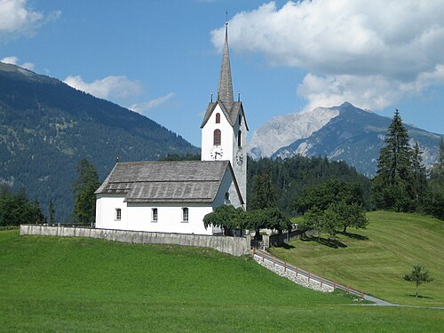
 Versam's church as seen from a PostAuto trip
 Chalets in Versam
 Safien Valley from Versam
 Chur from Versam
References
- ↑Amtliches Gemeindeverzeichnis der Schweiz published by the Swiss Federal Statistical Office (in German) accessed 2 January 2013
- 12"Versam" in German, French and Italian in the online Historical Dictionary of Switzerland.
- 1 2 3 4 5 المكتب الفيدرالي السويسري للإحصاء، مؤرشف في 5 يناير 2016، على موقع Wayback Machine، تم الوصول إليه في 20 نوفمبر 2009
- ^ مكتب الإحصاءات الفيدرالي السويسري – STAT-TAB أرشفة 16/11/2014 في آلة Wayback. Ständige und Nichtständige Wohnbevölkerung nach Region, Geschlecht, Nationalität und Alter (بالألمانية) تم الوصول إليه في 3 أكتوبر 2012
- 1 2 إحصاءات سكان غراوبوندن مؤرشفة في 27 أغسطس 2009، على موقع Wayback Machine (باللغة الألمانية) تم الوصول إليها في 21 سبتمبر 2009
- ↑ غراوبوندن بالأرقام، مؤرشف في 24 سبتمبر 2009، في آلة Wayback (باللغة الألمانية)، تم الوصول إليه في 21 سبتمبر 2009
- ↑ "1195 – سافينتال" (خريطة). فيرسام-سافين (طبعة 2016 ). 1:25000. الخريطة الوطنية 1:250000. المكتب الاتحادي للطبوغرافيا - swisstopo. 2014. ISBN 978-3-302-01195-0تم استرجاعها بتاريخ 2017-06-05 – عبر map.geo.admin.ch.
- ^ "محطة فيرسام-فيرسام دورف-ثالكيرش/تينا" [ الجدول الزمني الرسمي لسويسرا ] (PDF) . Offiziellen Kursbuches der Schweiz (باللغة الألمانية). أرشفة (PDF) من النسخة الأصلية بتاريخ 2017-06-06 . تم الاسترجاع 2017/06/06 .
روابط خارجية
- الموقع الرسمي (باللغة الألمانية)
- كلمة "Versam" باللغات الألمانية والفرنسية والإيطالية في القاموس التاريخي السويسري على الإنترنت .
- سافينتال
- قرى في غراوبوندن
- البلديات السابقة في غراوبوندن