
Victoria County, Ontario
The County of Victoria, or Victoria County, was a county in the Canadian province of Ontario. It was formed in 1854 as The United Counties of Peterborough and Victoria, and separated from Peterborough in 1863. In 2001, the county was dissolved and reformed as the city of Kawartha Lakes. While British settlement began in 1821, the area that was encompassed by Victoria County had already been inhabited by First Nations, including by the Wendat.
History
The history of Victoria County began with the passing of the Constitutional Act in 1791, dividing Canada into two provinces: Upper Canada (present day Ontario) and Lower Canada (present day Québec); and appointing a lieutenant-governor for each.[1]
The first lieutenant-governor of Upper Canada was Colonel John Graves Simcoe, who surveyed the province and set out tracts of land for immigrants with genuine interests.[2] Before the land that became Victoria County could be surveyed, however, speculators had Simcoe removed from office in 1796, and the land was secured from settlement for over 20 years.[3]
Following the War of 1812, a large wave of immigration prompted the province to purchase more land from local Indian tribes. On 5 November 1818, six Mississauga chiefs, Buckquaquet of the Eagles, Pishikinse of the Reindeers, Paudash of the Cranes, Cahgahkishinse of the Pike, Cahgageewin of the Snakes, and Pininse of the White Oaks, met in Port Hope. There they surrendered the rights to over four thousand square kilometres of land,[4] known as the "Mississauga Tract". In exchange, the Indians (numbering about 400) were to receive $750 per year in goods. However, the government later changed this to $10 per year for each living person born before the deal was signed.
The Mississauga Tract included all of Victoria and Peterborough counties, as well as parts of 28 adjacent townships.[5] Following the purchase, the land became Newcastle District in 1802.[6] In 1845, it was renamed Colborne District consisting of the County of Peterborough.[7] In 1851, Peterborough County was divided into the counties of Peterborough and Victoria, which were united for municipal purposes as the United Counties of Peterborough and Victoria.[8]
| مقاطعة بيتربورو | مقاطعة فيكتوريا |
|---|---|
|
|

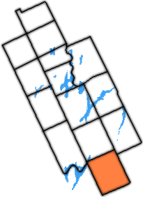
أُجيز استفتاء عام 1856 لتسهيل إنشاء مجلس مقاطعة مؤقت لفيكتوريا، [ 9 ] ولكن نظرًا لتأخر مجلس المقاطعات المتحدة في إجرائه، صدر قانون آخر عام 1861 لإلزامه بإجرائه، وبعد ذلك شُكّل المجلس المؤقت. [ 10 ] وانفصل رسميًا عام 1863. [ 11 ] [ 12 ]
أُجريت مسوحات لبلدات أخرى في السنوات اللاحقة، والتي أُلحقت بالمقاطعة، مما وسّع نطاقها شمالًا. في عام 1868، فُصلت بلدات رايد، ودريبر، وماكولي، وستيفنسون، وبرونيل، وماكلين، وأوكلي عن المقاطعة ونُقلت إلى منطقة موسكوكا الجديدة ، [ 13 ] وفُصلت بلدات ستيستيد، وشافي، وفرانكلين، وريدوت بطريقة مماثلة في عام 1873. [ 14 ] ولم تُسحب هذه البلدات للأغراض البلدية إلا بعد ضمها إلى مقاطعة سيمكو في عام 1877. [ 15 ] كما سُحبت بلدات أنسون، وهيندون، ولوتروورث من المقاطعة في عام 1874 ونُقلت إلى مقاطعة هاليبورتون المؤقتة الجديدة . [ 16 ]
في عام 1974، ونتيجة لإنشاء بلدية دورهام الإقليمية ، تم سحب بلدة مانفرز من مقاطعة دورهام ونقلها إلى مقاطعة فيكتوريا. [ 17 ]
في الأول من يناير عام 2001، تم حل مقاطعة فيكتوريا، وتم دمج بلداتها ومجتمعاتها المدمجة لتشكيل مدينة بحيرات كاوارثا ، [ 18 ] وهو اسم تم اختياره بسبب بروز البحيرات في جغرافية المنطقة. [ 19 ]
التنظيم قبل الاندماج في عام 2001
وقد شملت مساحة 2855.56 كيلومتر مربع (1102.54 ميل مربع ) [ 20 ]
البلدات
كانت مقاطعة فيكتوريا تتألف من 13 بلدة منفصلة و6 قرى مدمجة ذات حكومات محلية خاصة بها. [ 21 ]
Population centres are listed in parentheses:
|
The township of Laxton, Digby and Longford is an amalgamation of the once individual townships of Digby and Laxton, and half of the original Longford Township. The separate township of Longford is uninhabited, though dotted with abandoned logging towns.
Incorporated communities
|
|
Unincorporated communities and hamlets
Abandoned towns, post offices and church villages
Note:
Demographics
Historical census populations – Victoria County, Ontario | |||||||||||||||||||||||||||||||||||||||||||||||||||||||||||||||||
|
|
| |||||||||||||||||||||||||||||||||||||||||||||||||||||||||||||||
| Population counts are not adjusted for boundary changes.Source: Statistics Canada[23][24] | |||||||||||||||||||||||||||||||||||||||||||||||||||||||||||||||||
| + Census Canada | |||
| Township | Population | ||
|---|---|---|---|
| 1991 | 1996 | 2001 | |
| Bexley | 1,191[25] | 1,306[25] | 1,325[26] |
| Carden | 781[27] | 887[27] | 888[28] |
| Dalton | 423[29] | 442[29] | 474[30] |
| Eldon | 2,669[31] | 2,956[31] | 3,087[32] |
| Emily | 6,307[33] | 6,724[33] | 6,944[34] |
| Fenelon | 5,710[35] | 5,931[35] | 6,240[36] |
| Laxton, Digby and Longford | 1,086[37] | 1,114[37] | 1,052[38] |
| Manvers | 5,166[39] | 5,624[39] | 5,830[40] |
| Mariposa | 6,906[41] | 7,456[41] | 7,869[42] |
| Ops | 4,027[43] | 4,311[43] | 4,955[44] |
| Somerville | 2,045[45] | 2,238[45] | 2,241[46] |
| Verulam | 3,982[47] | 4,373[47] | 4,313[48] |
| Incorporated areas | |||
| Bobcaygeon | 2,562[49] | 2,753[49] | 2,854[50] |
| Fenelon Falls | 1,888[51] | 2,040[51] | 1,874[52] |
| Lindsay, Ontario | 16,696[53] | 17,638[53] | 16,930[54] |
| Lindsay census agglomeration (Ops including Lindsay) | 20,723[55] | 21,949[55] | 21,885[44][54] |
| Omemee | 1,103[56] | 1,271[56] | 1,319[57] |
| Sturgeon Point | 110[58] | 111[58] | 107[59] |
| Woodville | 680[60] | 751[60] | 871[61] |
| Total | |||
| Kawartha Lakes | 63,332[62] | 67,926[62] | 69,179[63] |
| Ontario | 10,084,885[64] | 10,753,573[64] | 11,410,046[65] |
The population is mostly rural, with only 34% living in urban areas.[66]
Infrastructure
Colonization roads
Victoria County was first opened up to settlement in the 1821.[67] At this time, the primary routes for entering the county-to-be were narrow trails. Settlers were offered land on the condition that they help further the progress of concession roads into the region. This was often met with the bare minimum, and progress was slow.
The Land Act of 1853 provided funding for the development of roads throughout the wilderness of Upper Canada. Grants were administered by the Department of Agriculture to survey and build the new roads. The roads followed the tradition of old Roman roads, and cut through the wilderness in a straight line, veering only when the terrain was impassable, but cutting through swamps and hills otherwise. Four primary roads were built: the Cameron Road, the Bobcaygeon Road, the Monck Road, and the Portage Road.
http://www.ontariogenealogy.com/Victoria/settleme.htmlhttp://www.ontariogenealogy.com/Victoria/history/victoriacountypioneers2.html
The Cameron road, now mostly encompassed by Highway 35, provided access from Lake Ontario to the northern limits of Victoria;
The Bobcaygeon Road, begun in 1853, traversed north and south along the present-day eastern boundary of the region, and is mostly encompassed by former Highway 121;
The Monck Road, which connected Lake Couchiching to Bancroft, encompassed partially by former Highway 503, now City Road 45;
The Portage Road, connecting Lake Simcoe to Balsam Lake, encompassed entirely by former Highway 48, now City Road 48
Education
At one time the Victoria County Board of Education provided educational services. In 1999 it was amalgamated into the Trillium Lakelands District School Board.[68]
See also
References
- ↑"The Constitutional Act of 1791". Retrieved 16 September 2009.
- ↑"Ontario Heritage Trust – John Graves Simcoe". Government of Ontario. Archived from the original on 15 June 2011. Retrieved 16 September 2009.
{{cite journal}}: Cite journal requires|journal=(help) - ↑Kirkconnell, Watson (1967). "County of Victoria, Centennial History". Victoria County Council. p. 1.
- ↑Government of Canada (1891). Indian Treaties and Surrenders. Vol. 1. King's Printer. p. 49.
- ↑Canadian Genealogy. "Stone age annals of Victoria County – The surrender of the soil". Retrieved 17 September 2009.
- ↑as authorized by An act for the better division of this province, S.U.C. 1798, c. 5, s. 25
- ↑An Act for better defining the limits of the Counties and Districts in Upper Canada, for erecting certain new Townships, for detaching Townships from some Counties and attaching them to others, and for other purposes relative to the division of Upper Canada into Townships, Counties and Districts, S.C. 1841, c. 7, s. 8 and Schedule B
- ↑An Act to make certain alterations in the Territorial Divisions of Upper Canada, S.C. 1851, c. 5, Sch. A-B
- ↑{{{short title}}}, S.Prov.C. 1856, c. 95
- ↑An Act to amend the Act to provide for the separation of the County of Victoria from the County of Peterborough, and to fix the County Town at Lindsay, S.Prov.C. 1861, c. 50
- ↑An Act to confirm the separation of the late United Counties of Peterborough and Victoria, and the several proceedings taken relative thereto, S.Prov.C. 1863, c. 10
- ↑Kirkconnell, Watson (1967). "County of Victoria, Centennial History". Victoria County Council. p. 2.
- ↑An Act to provide for the organization of the Territorial District of Muskoka, S.O. 1868, c. 35
- ↑An Act to organize the Municipality of the District of Muskoka for certain purposes, S.O. 1873, c. 49, s. 11-12
- ↑An Act respecting the Territorial and Temporary Judicial Districts of the Province, and the Provisional County of Haliburton, S.O. 1877, c. 24, s. 2
- ↑An Act to incorporate the Municipality of Haliburton, and to provide for its becoming a Provisional County, S.O. 1874, c. 65
- ↑The Regional Municipality of Durham Act, 1973, S.O. 1973, c. 78, s. 134(3)
- ↑"Order of the Commission made under the Municipal Act: County of Victoria"(PDF). Ontario Gazette. 133 (19): 892–898. 6 May 2000. ISSN 0030-2937. Archived from the original(PDF) on 20 December 2016. Retrieved 5 January 2018.; "Order of the Commission made under the Municipal Act: County of Victoria"(PDF). Ontario Gazette. 133 (27): 1227–1229. 1 July 2000. ISSN 0030-2937.
- ↑"Municipal Government for Victoria County – A New Beginning (Final Report)"(PDF). 19 April 2000. Archived from the original(PDF) on 21 July 2011. Retrieved 16 January 2010.
- ↑"Canadian Genealogy – Victoria County Geography, Topography, and Geology". Retrieved 25 September 2009.
- ↑"Algonquin Park and Kawarthas map" (Document). MapArt Corporation. 1998.
- ↑"Salem Corners". Geographical Names Data Base. Natural Resources Canada. Retrieved 11 December 2016.
- ↑Eighth Census of Canada 1941 - Volume II - Population by Local Subdivisions (Report). Dominion Bureau of Statistics. 1944. CS98-1941-2.
- ↑"1971 Census of Canada - Population Census Subdivisions (Historical)". Catalogue 92-702 Vol I, part 1 (Bulletin 1.1-2). Statistics Canada. July 1973.
- 1 2 "التعداد الكندي لعام 1996: بلدة بيكسلي، أونتاريو" . هيئة الإحصاء الكندية . تم الاطلاع عليه بتاريخ 21 سبتمبر 2009 .
- ↑ "التعداد الكندي لعام 2001: بلدة بيكسلي، أونتاريو" . هيئة الإحصاء الكندية . تم الاطلاع عليه بتاريخ 21 سبتمبر 2009 .
- 1 2 "التعداد الكندي لعام 1996: بلدة كاردن، أونتاريو" . هيئة الإحصاء الكندية . تم الاطلاع عليه بتاريخ 21 سبتمبر 2009 .
- ↑ "التعداد الكندي لعام 2001: بلدة كاردن، أونتاريو" . هيئة الإحصاء الكندية . تم الاطلاع عليه بتاريخ 21 سبتمبر 2009 .
- 1 2 "التعداد الكندي لعام 1996: بلدة دالتون، أونتاريو" . هيئة الإحصاء الكندية . تم الاطلاع عليه بتاريخ 21 سبتمبر 2009 .
- ↑ "التعداد الكندي لعام 2001: بلدة دالتون، أونتاريو" . هيئة الإحصاء الكندية . تم الاطلاع عليه بتاريخ 21 سبتمبر 2009 .
- 1 2 "التعداد الكندي لعام 1996: بلدة إلدون، أونتاريو" . هيئة الإحصاء الكندية . تم الاطلاع عليه بتاريخ 21 سبتمبر 2009 .
- ↑ "التعداد الكندي لعام 2001: بلدة إلدون، أونتاريو" . هيئة الإحصاء الكندية . تم الاطلاع عليه بتاريخ 21 سبتمبر 2009 .
- 1 2 "التعداد الكندي لعام 1996: بلدة إميلي، أونتاريو" . هيئة الإحصاء الكندية . تم الاطلاع عليه بتاريخ 21 سبتمبر 2009 .
- ↑ "التعداد الكندي لعام 2001: بلدة إميلي، أونتاريو" . هيئة الإحصاء الكندية . تم الاطلاع عليه بتاريخ 21 سبتمبر 2009 .
- 1 2 "التعداد الكندي لعام 1996: بلدة فينيلون، أونتاريو" . هيئة الإحصاء الكندية . تم الاطلاع عليه بتاريخ 21 سبتمبر 2009 .
- ↑ "التعداد الكندي لعام 2001: بلدة فينيلون، أونتاريو" . هيئة الإحصاء الكندية . تم الاطلاع عليه بتاريخ 21 سبتمبر 2009 .
- 1 2 "التعداد الكندي لعام 1996: لاكستون، ديجبي، وبلدة لونغفورد، أونتاريو" . هيئة الإحصاء الكندية . تم الاطلاع عليه بتاريخ 21 سبتمبر 2009 .
- ↑ "التعداد الكندي لعام 2001: لاكستون، ديجبي، وبلدة لونغفورد، أونتاريو" . هيئة الإحصاء الكندية . تم الاطلاع عليه بتاريخ 21 سبتمبر 2009 .
- 1 2 "التعداد الكندي لعام 1996: بلدة مانفرز، أونتاريو" . هيئة الإحصاء الكندية . تم الاطلاع عليه بتاريخ 21 سبتمبر 2009 .
- ↑ "التعداد الكندي لعام 2001: بلدة مانفرز، أونتاريو" . هيئة الإحصاء الكندية . تم الاطلاع عليه بتاريخ 21 سبتمبر 2009 .
- 1 2 "التعداد الكندي لعام 1996: بلدة ماريبوسا، أونتاريو" . هيئة الإحصاء الكندية . تم الاطلاع عليه بتاريخ 21 سبتمبر 2009 .
- ↑ "التعداد الكندي لعام 2001: بلدة ماريبوسا، أونتاريو" . هيئة الإحصاء الكندية . تم الاطلاع عليه بتاريخ 21 سبتمبر 2009 .
- 1 2 "التعداد الكندي لعام 1996: بلدة أوبس، أونتاريو" . هيئة الإحصاء الكندية . تم الاطلاع عليه بتاريخ 21 سبتمبر 2009 .
- 1 2 "التعداد الكندي لعام 2001: بلدة أوبس، أونتاريو" . هيئة الإحصاء الكندية . تم الاطلاع عليه بتاريخ 21 سبتمبر 2009 .
- 1 2 "التعداد الكندي لعام 1996: بلدة سومرفيل، أونتاريو" . هيئة الإحصاء الكندية . تم الاطلاع عليه بتاريخ 21 سبتمبر 2009 .
- ↑ "التعداد الكندي لعام 2001: بلدة سومرفيل، أونتاريو" . هيئة الإحصاء الكندية . تم الاطلاع عليه بتاريخ 21 سبتمبر 2009 .
- 1 2 "التعداد الكندي لعام 1996: بلدة فيرولام، أونتاريو" . هيئة الإحصاء الكندية . تم الاطلاع عليه بتاريخ 21 سبتمبر 2009 .
- ↑ "التعداد الكندي لعام 2001: بلدة فيرولام، أونتاريو" . هيئة الإحصاء الكندية . تم الاطلاع عليه بتاريخ 21 سبتمبر 2009 .
- 1 2 "التعداد الكندي لعام 1996: قرية بوبكايجون، أونتاريو" . هيئة الإحصاء الكندية . تم الاطلاع عليه بتاريخ 21 سبتمبر 2009 .
- ↑ "التعداد الكندي لعام 2001: قرية بوبكايجون، أونتاريو" . هيئة الإحصاء الكندية . تم الاطلاع عليه بتاريخ 21 سبتمبر 2009 .
- 1 2 "التعداد الكندي لعام 1996: قرية فينيلون فولز، أونتاريو" . هيئة الإحصاء الكندية . تم الاطلاع عليه بتاريخ 21 سبتمبر 2009 .
- ↑ "التعداد الكندي لعام 2001: قرية فينيلون فولز، أونتاريو" . هيئة الإحصاء الكندية . تم الاطلاع عليه بتاريخ 21 سبتمبر 2009 .
- 1 2 "التعداد الكندي لعام 1996: بلدة ليندسي، أونتاريو" . هيئة الإحصاء الكندية . تم الاطلاع عليه بتاريخ 21 سبتمبر 2009 .
- 1 2 "التعداد الكندي لعام 2001: بلدة ليندسي، أونتاريو" . هيئة الإحصاء الكندية . تم الاطلاع عليه بتاريخ 21 سبتمبر 2009 .
- 1 2 "التعداد الكندي لعام 1996: بلدة ليندسي، أونتاريو" . هيئة الإحصاء الكندية . تم الاطلاع عليه بتاريخ 21 سبتمبر 2009 .
- 1 2 "التعداد الكندي لعام 1996: قرية أوميمي، أونتاريو" . هيئة الإحصاء الكندية . تم الاطلاع عليه بتاريخ 21 سبتمبر 2009 .
- ↑ "التعداد الكندي لعام 2001: قرية أوميمي، أونتاريو" . هيئة الإحصاء الكندية . تم الاطلاع عليه بتاريخ 21 سبتمبر 2009 .
- 1 2 "التعداد الكندي لعام 1996: قرية ستورجون بوينت، أونتاريو" . هيئة الإحصاء الكندية . تم الاطلاع عليه بتاريخ 21 سبتمبر 2009 .
- ↑ "التعداد الكندي لعام 2001: قرية ستورجون بوينت، أونتاريو" . هيئة الإحصاء الكندية . تم الاطلاع عليه بتاريخ 21 سبتمبر 2009 .
- 1 2 "التعداد الكندي لعام 1996: قرية وودفيل، أونتاريو" . هيئة الإحصاء الكندية . تم الاطلاع عليه بتاريخ 21 سبتمبر 2009 .
- ↑ "التعداد الكندي لعام 2001: قرية وودفيل، أونتاريو" . هيئة الإحصاء الكندية . تم الاطلاع عليه بتاريخ 21 سبتمبر 2009 .
- 1 2 "التعداد الكندي لعام 1996: مقاطعة فيكتوريا، أونتاريو" . هيئة الإحصاء الكندية . تم الاطلاع عليه بتاريخ 21 سبتمبر 2009 .
- ↑ "التعداد الكندي لعام 2001: مدينة كاوارثا ليكس، أونتاريو" . هيئة الإحصاء الكندية . تم الاطلاع عليه بتاريخ 21 سبتمبر 2009 .
- 1 2 "التعداد الكندي لعام 1996: أونتاريو" . هيئة الإحصاء الكندية . تم الاطلاع عليه بتاريخ 21 سبتمبر 2009 .
- ↑ "التعداد الكندي لعام 2001: أونتاريو" . هيئة الإحصاء الكندية . تم الاطلاع عليه بتاريخ 21 سبتمبر 2009 .
- ↑ "التعداد الكندي لعام 2001: تعداد السكان في منطقة كاوارثا ليكس، أونتاريو" . تم الاطلاع عليه بتاريخ 25 سبتمبر 2009 .
- ↑ كيركونيل، واتسون (1921). "مقاطعة فيكتوريا، نشأة مقاطعة" . تم الاطلاع عليه بتاريخ 25 سبتمبر 2009 .
- ↑ "مشرف جديد لمجلس إدارة المدرسة"، ليندسي ديلي بوست ، 29 أغسطس 2003، A10.
- الولايات والأقاليم التي تأسست عام 1863
- الولايات والأقاليم التي تم حلها في عام 2001
- المقاطعات السابقة في أونتاريو
- تم إلغاء المناطق المأهولة بالسكان في عام 2001
- 1863 منشأة في غرب كندا
- عمليات إلغاء المؤسسات الدينية في أونتاريو عام 2001