رباعية اليونان
 خريطة رباعية هيلاس من بيانات مقياس الارتفاع بالليزر المداري للمريخ (MOLA). أعلى الارتفاعات باللون الأحمر وأدنى الارتفاعات باللون الأزرق. | |
| الإحداثيات | 47°30′S 270°00′W / 47.5°S 270°W / -47.5; -270 |
|---|---|

رباعية هيلاس هي واحدة من سلسلة من 30 خريطة رباعية للمريخ يستخدمها برنامج أبحاث علم الفلك الجيولوجي التابع لهيئة المسح الجيولوجي الأمريكية (USGS) . يُشار إلى رباعية هيلاس أيضًا باسم MC-28 (مخطط المريخ 28). [1] تغطي رباعية هيلاس المنطقة من 240 درجة إلى 300 درجة غربًا وخط عرض 30 درجة إلى 65 درجة جنوبًا على كوكب المريخ . داخل رباعية هيلاس تقع الميزات الكلاسيكية هيلاس بلانيتيا وبروميثي تيرا . تم اكتشاف العديد من الميزات المثيرة للاهتمام والغامضة في رباعية هيلاس، بما في ذلك وديان الأنهار العملاقة داو فاليس ونيجر فاليس وهارماخيس وريول فاليس - والتي ربما ساهمت جميعها في توفير المياه لبحيرة في حوض هيلاس في الماضي البعيد. [2] [3] [4] تظهر العديد من الأماكن في رباعية هيلاس علامات على وجود جليد في الأرض، وخاصة الأماكن ذات ميزات التدفق الشبيهة بالجليد.
حوض هيلاس
يحتوي رباعي هيلاس على جزء من حوض هيلاس ، أكبر حفرة صدمية معروفة على سطح المريخ وثاني أكبر حفرة في النظام الشمسي. يبلغ عمق الحفرة 7152 مترًا [5] (23000 قدم) تحت البيانات الطبوغرافية القياسية للمريخ. يقع الحوض في المرتفعات الجنوبية للمريخ ويُعتقد أنه قد تشكل منذ حوالي 3.9 مليار سنة، خلال القصف الثقيل المتأخر. تشير الدراسات إلى أنه عندما تسبب الاصطدام في إنشاء حوض هيلاس، تم تسخين سطح المريخ بالكامل مئات الدرجات، وسقط 70 مترًا من الصخور المنصهرة على الكوكب، وتشكل غلاف جوي من الصخور الغازية. كان غلاف هذا الغلاف الجوي الصخري أكثر سمكًا بعشر مرات من غلاف الأرض الجوي. في غضون أيام قليلة، تكثفت الصخور وغطت الكوكب بأكمله بـ 10 أمتار إضافية من الصخور المنصهرة. [2] يوجد في الجزء الشمالي الغربي من هيلاس بلانيتيا نوع غريب من السطح يسمى التضاريس المعقدة ذات النطاقات أو تضاريس السحب. لا تزال عملية تكوينها غير معروفة إلى حد كبير، على الرغم من أنها تبدو نتيجة لتآكل الرواسب الصلبة واللينة إلى جانب التشوه المرن. ينتج التشوه المرن عن تعرض الطبقات للإجهاد. [6]
في وقت مبكر من تاريخ الكوكب، كان يُعتقد أن بحيرة عملاقة كانت موجودة في حوض هيلاس. [7] وقد تم اكتشاف خطوط ساحلية محتملة. وهي واضحة في المقاعد والمنحدرات المتناوبة المرئية في صور الزاوية الضيقة للكاميرا التي تدور حول المريخ. بالإضافة إلى ذلك، تُظهر بيانات مقياس الارتفاع بالليزر الذي يدور حول المريخ (MOLA) أن اتصالات هذه الوحدات الرسوبية تحدد خطوط ارتفاع ثابتة لآلاف الكيلومترات، وفي حالة واحدة حول الحوض بالكامل. تدخل القنوات، التي يُعتقد أنها تشكلت بواسطة الماء، إلى الحوض. قد يكون حوض تصريف هيلاس ما يقرب من خُمس السهول الشمالية بأكملها. ستشكل بحيرة في هيلاس في مناخ المريخ اليوم جليدًا سميكًا في الأعلى والذي من شأنه أن يتسامى في النهاية. أي أن الجليد سيتحول مباشرة من مادة صلبة إلى غاز. وهذا مشابه لكيفية تصرف الجليد الجاف (ثاني أكسيد الكربون الصلب) على الأرض. [3] تم العثور على سمات جليدية ( مورينات طرفية ، وطبقات جليدية متكتلة ، وأسكيرات ) ربما تكون قد تشكلت عندما تجمد الماء. [2] [8]
-
![تضاريس منطقة حوض هيلاس. عمق الحفرة 7152 مترًا [5] (23000 قدم) تحت المستوى الطبوغرافي القياسي للمريخ.](https://file.arabipedia.wiki/wikipedia/commons/thumb/f/fc/Hellas_basin_topo.jpg/180px-Hellas_basin_topo.jpg) تضاريس منطقة حوض هيلاس. عمق الحفرة 7152 مترًا [5] (23000 قدم) تحت المستوى الطبوغرافي القياسي للمريخ.
تضاريس منطقة حوض هيلاس. عمق الحفرة 7152 مترًا [5] (23000 قدم) تحت المستوى الطبوغرافي القياسي للمريخ. -
![حوض هيلاس مع رسم بياني يوضح العمق الكبير للفوهة. إنها أعمق فوهة على المريخ ولديها أعلى ضغط سطحي: 1155 باسكال [5] (11.55 مليبار، 0.17 رطل/بوصة مربعة، أو 0.01 ضغط جوي).](https://file.arabipedia.wiki/wikipedia/commons/thumb/f/f0/False_color_of_Hellas_Planitia.jpeg/146px-False_color_of_Hellas_Planitia.jpeg)
-
 أرض ملتوية في اليونان، كما التقطتها كاميرا HiRISE . هذا مثال آخر على مدى صعوبة السير على المريخ.
![تضاريس منطقة حوض هيلاس. عمق الحفرة 7152 مترًا [5] (23000 قدم) تحت المستوى الطبوغرافي القياسي للمريخ.](https://file.arabipedia.wiki/wikipedia/commons/thumb/f/fc/Hellas_basin_topo.jpg/1280px-Hellas_basin_topo.jpg)
![حوض هيلاس مع رسم بياني يوضح العمق الكبير للفوهة. إنها أعمق فوهة على المريخ ولديها أعلى ضغط سطحي: 1155 باسكال [5] (11.55 مليبار، 0.17 رطل/بوصة مربعة، أو 0.01 ضغط جوي).](https://file.arabipedia.wiki/wikipedia/commons/thumb/f/f0/False_color_of_Hellas_Planitia.jpeg/1280px-False_color_of_Hellas_Planitia.jpeg)

مآزر الحطام الفصوصية
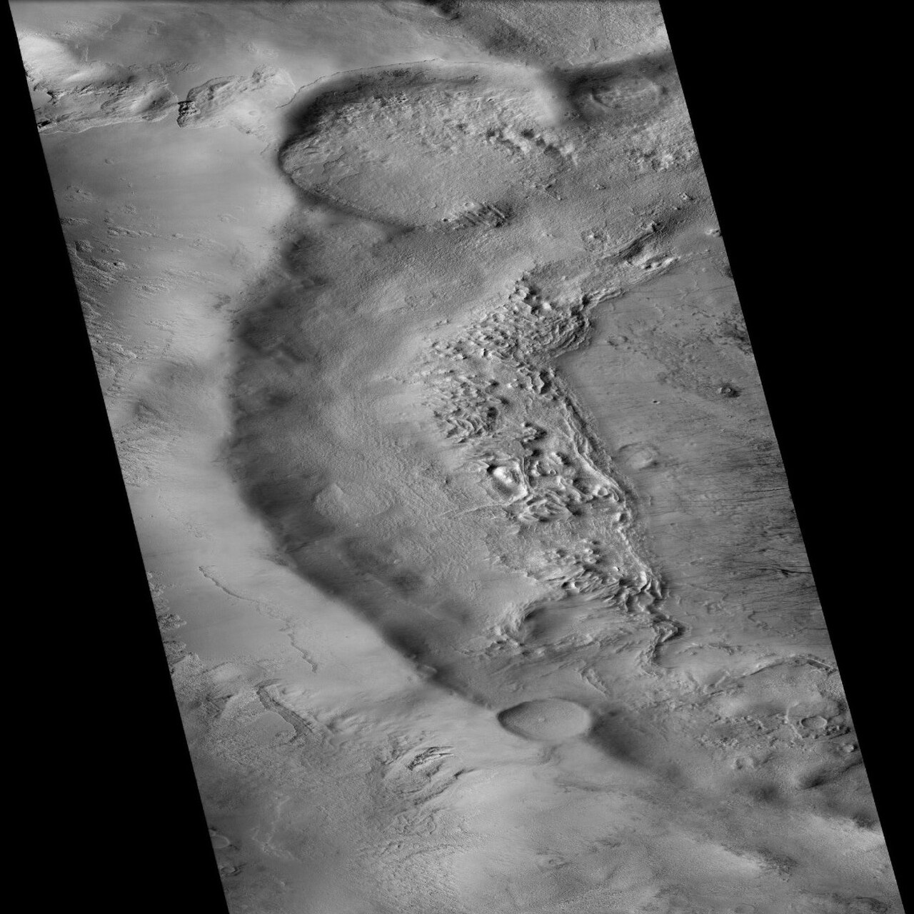
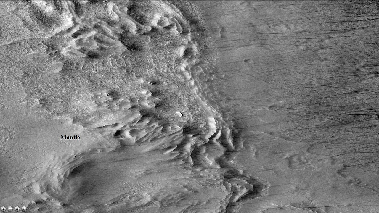
من أهم السمات المشتركة في شرق اليونان أكوام المواد المحيطة بالمنحدرات. ويطلق على هذا التكوين مئزر الحطام الفصي (LDA). ومؤخرًا، قدمت الأبحاث التي أجريت باستخدام الرادار الضحل على مركبة استطلاع المريخ دليلاً قويًا على أن مئزر الحطام الفصي عبارة عن أنهار جليدية مغطاة بطبقة رقيقة من الصخور. [9] [10] [11] [12] [13] ويُعتقد أن كميات كبيرة من الجليد المائي موجودة في مئزر الحطام الفصي. وتشير الأدلة المتاحة بقوة إلى أن الجزء الشرقي من اليونان تراكمت عليه الثلوج في الماضي. وعندما يزداد ميل المريخ، يطلق الغطاء الجليدي الجنوبي كميات كبيرة من بخار الماء. وتتنبأ نماذج المناخ بأنه عندما يحدث هذا، يتكثف بخار الماء ويسقط حيث توجد مئزر الحطام الفصي. ويتغير ميل الأرض قليلاً لأن قمرنا الكبير نسبيًا يحافظ على استقرارها. ولا يعمل القمران المريخيان الصغيران على تثبيت كوكبهما، لذا فإن المحور الدوراني للمريخ يخضع لتغيرات كبيرة. [14] قد تكون مآزر الحطام الفصوصية مصدرًا رئيسيًا للمياه لمستعمري المريخ في المستقبل. تتمثل ميزتها الرئيسية على مصادر المياه المريخية الأخرى في إمكانية رسم خرائطها بسهولة من المدار وهي أقرب إلى خط الاستواء، حيث من المرجح أن تهبط البعثات المأهولة.
-
 صورة مقربة لسطح مئزر حطام فصي الشكل. لاحظ الخطوط الشائعة في الأنهار الجليدية الصخرية على الأرض. تقع الصورة في رباعية اليونان.
 -
 صورة سياقية CTX للصورتين التاليتين لمئزر الحطام حول الكومة
 -
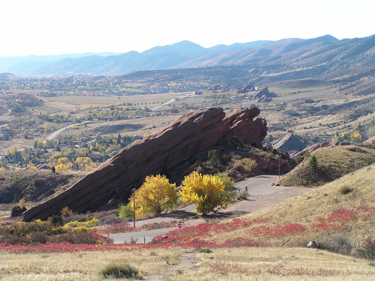
 سطح ساحة الحطام. هناك أيضًا سمة مشابهة للسمات الموجودة في متنزه ريد روكس ، كولورادو . يبدو أن السمة تتكون من طبقات صخرية مائلة. تم التقاط الصورة باستخدام HiRISE، ضمن برنامج HiWish .
 -
 سطح ساحة الحطام في Terra Cimmeria ، كما تم تصويره بواسطة HiRISE، ضمن برنامج HiWish. قد تكون الأجزاء الملونة عبارة عن رواسب جليدية.


رواسب الأرضية المخططة
توجد على أرضيات بعض القنوات سمات تسمى رواسب الأرضية الخطية أو حشو الوادي الخطي . وهي عبارة عن مواد متموجة ومحفورة تبدو وكأنها تنحرف حول العوائق. ويُعتقد أنها غنية بالجليد. وتُظهر بعض الأنهار الجليدية على الأرض مثل هذه السمات. وقد تكون رواسب الأرضية الخطية مرتبطة بأغطية الحطام الفصوصية، والتي ثبت أنها تحتوي على كميات كبيرة من الجليد. ويعرض رويل فاليس، كما هو موضح أدناه، هذه الرواسب. [15]
-
 سمات الصرف الصحي في وادي رويل كما يراها برنامج THEMIS . انقر على الصورة لرؤية العلاقة بين وادي رويل والسمات الأخرى.
 -
 رويل فاليس مع رواسب أرضية خطية، كما يراها THEMIS. انقر على الصورة لمعرفة العلاقة مع الميزات الأخرى.
 -
 حشوة الوادي المخططة، كما تم رصدها بواسطة HiRISE ضمن برنامج HiWish
 -
 أرضية Reull Vallis تظهر حشوة الوادي المخططة في الأعلى والمنخفضات بالقرب من القاع، كما تم رصدها بواسطة HiRISE ضمن برنامج HiWish
 -
 منظر قريب وملون لخط ملء الوادي، كما تم رؤيته بواسطة HiRISE ضمن برنامج HiWish
 -
 طبقات في Reull Vallis ، كما يراها THEMIS
 -
 التضاريس المضطربة بالقرب من رويل فاليس، كما تراها HiRISE
 -
 لقطة مقربة للتضاريس المزعجة بالقرب من وادي رول، كما تم تصويرها بواسطة HiRISE. قد يكون عبور هذه المنطقة أمرًا صعبًا.
 -
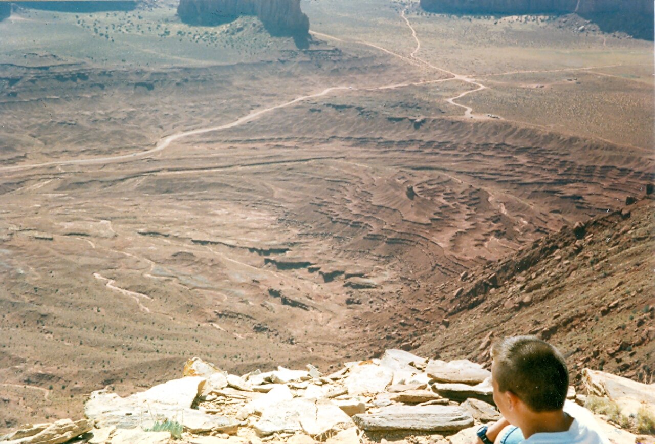
 الطبقات في وادي مونومنت. من المقبول أن هذه الطبقات تشكلت، على الأقل جزئيًا، نتيجة لترسب المياه. ولأن المريخ يحتوي على طبقات مماثلة، فإن المياه تظل السبب الرئيسي لتكوين الطبقات على المريخ.


الوشاح الغني بالجليد

يغطي سطح المريخ جزء كبير من سطحه طبقة سميكة وناعمة من الوشاح، ويُعتقد أنها عبارة عن مزيج من الجليد والغبار. ويغطي هذا الوشاح الغني بالجليد، الذي يبلغ سمكه بضعة أمتار، الأرض، لكنه يظهر في بعض الأماكن نسيجًا متعرجًا يشبه سطح كرة السلة. ولأن هناك عددًا قليلًا من الفوهات على هذا الوشاح، فإن هذا الوشاح حديث نسبيًا. وتُظهِر الصورة الموجودة على اليمين منظرًا جيدًا لهذا الوشاح الناعم حول وادي نيجر ، كما لوحظ باستخدام تلسكوب هاي رايز . تتسبب التغيرات في مدار المريخ وميله في حدوث تغييرات كبيرة في توزيع الجليد المائي من المناطق القطبية إلى خطوط العرض المكافئة لولاية تكساس. وخلال فترات مناخية معينة، يترك بخار الماء الجليد القطبي ويدخل الغلاف الجوي. ويعود الماء إلى الأرض عند خطوط العرض المنخفضة كرواسب من الصقيع أو الثلج مختلطة بسخاء بالغبار. ويحتوي الغلاف الجوي للمريخ على قدر كبير من جزيئات الغبار الناعم. ويتكثف بخار الماء على الجزيئات، ثم تسقط على الأرض بسبب الوزن الإضافي لطبقة الماء. عندما يعود الجليد الموجود أعلى طبقة الغطاء إلى الغلاف الجوي، فإنه يترك وراءه الغبار، الذي يعمل على عزل الجليد المتبقي. [16]
-
 عباءة ناعمة ذات طبقات، كما تظهرها HiRISE ضمن برنامج HiWish
 -
 منظر قريب للوشاح كما تم رصده بواسطة HiRISE ضمن برنامج HiWish
 -
 فوهة بركان تظهر مدى سماكة الوشاح في مكانه، كما تم رصدها بواسطة HiRISE ضمن برنامج HiWish
 -
 منظر قريب لحافة الوشاح، كما تم رصده بواسطة HiRISE ضمن برنامج HiWish


وحدة السهول العليا
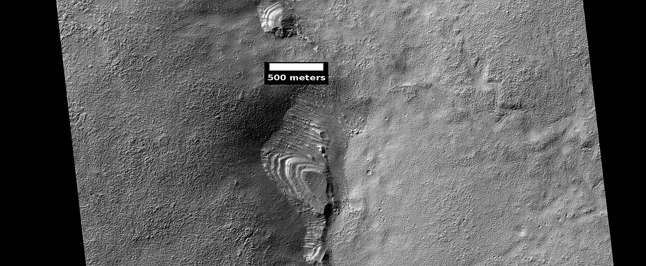
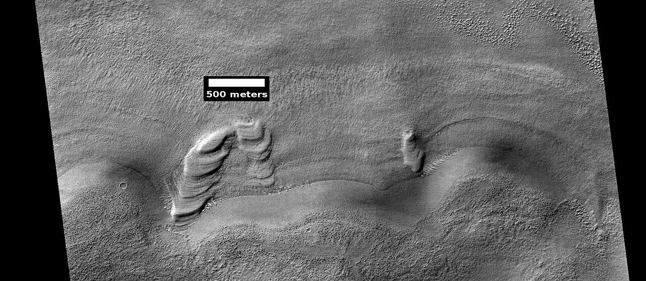
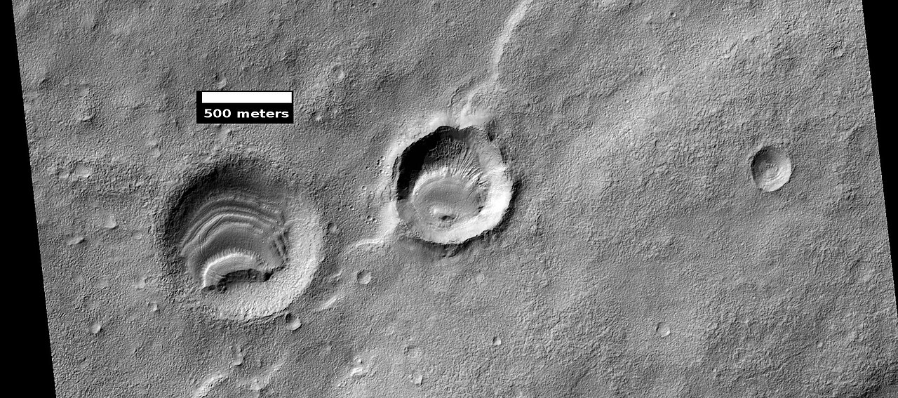
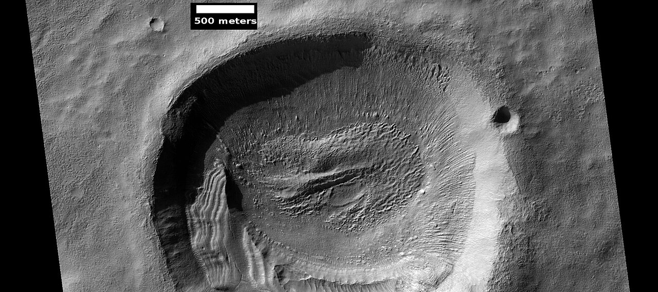
تم اكتشاف بقايا طبقة سميكة من الجليد يبلغ سمكها من 50 إلى 100 متر، تسمى وحدة السهول العليا ، في خطوط العرض الوسطى للمريخ. تم التحقيق فيها لأول مرة في منطقة Deuteronilus Mensae، ولكنها توجد في أماكن أخرى أيضًا. تتكون البقايا من مجموعات من الطبقات الغائرة في الحفر وعلى طول الهضاب. [17] قد تكون مجموعات الطبقات الغائرة بأحجام وأشكال مختلفة - بعضها يشبه أهرامات الأزتك من أمريكا الوسطى. تم تقديم فكرة واحدة عن أصلها في المؤتمر الخامس والخمسين لعلوم الجليد (2024) من قبل فريق دولي من الباحثين. يقترحون أن الطبقات من الصفائح الجليدية السابقة. [18]
-
 الطبقات المائلة كما تظهرها HiRISE ضمن برنامج HiWish
 -
 الطبقات المائلة كما تظهرها HiRISE ضمن برنامج HiWish
 -
 الطبقات المائلة كما تظهرها HiRISE ضمن برنامج HiWish


-
 سمة طبقية ربما تكونت نتيجة تآكل وحدة السهول العليا، كما تم رصدها بواسطة HiRISE ضمن برنامج HiWish
 -
 سمة طبقية في متنزه ريد روكس، كولورادو. أصلها مختلف عن السمات الموجودة على المريخ، لكنها تشبهها في الشكل. نشأت السمات الموجودة في منطقة ريد روكس نتيجة لارتفاع الجبال.
 -
 سمة متعددة الطبقات ربما تكون بقايا وحدة واسعة الانتشار سقطت من السماء، كما شاهدها HiRISE ضمن برنامج HiWish
 -
 الميزة الطبقية، كما يراها HiRISE ضمن برنامج HiWish
 -
 ميزة متعددة الطبقات في الحفرة، كما تم رصدها بواسطة HiRISE ضمن برنامج HiWish
 -
 ميزة متعددة الطبقات في الحفرة، كما تم رصدها بواسطة HiRISE ضمن برنامج HiWish
 -
 طبقات في الحفرة كما تم رصدها بواسطة HiRISE ضمن برنامج HiWish
 -
 الميزة الطبقية في الحفرة، كما تم رصدها بواسطة HiRISE ضمن برنامج HiWish



-
 الميزة الطبقية في الحفرة، كما تم رصدها بواسطة HiRISE ضمن برنامج HiWish
 -
 منظر ملون قريب لسمة طبقية في الحفرة، كما تم رصدها بواسطة HiRISE ضمن برنامج HiWish. الألوان المختلفة ترجع إلى المعادن المختلفة.


-
 هيكل متعدد الطبقات في فوهة بركانية ربما يكون ما تبقى من وحدة متعددة الطبقات كانت تغطي ذات يوم مساحة أكبر بكثير. سقطت المادة المكونة لهذه الوحدة من السماء على شكل غبار مغطى بالجليد. تم التقاط الصورة بواسطة HiRISE، ضمن برنامج HiWish.

تتحلل هذه الوحدة أيضًا إلى تضاريس الدماغ . تضاريس الدماغ هي منطقة من التلال الشبيهة بالمتاهة التي يتراوح ارتفاعها بين 3 و5 أمتار. قد تتكون بعض التلال من قلب جليدي، لذا فقد تكون مصادر للمياه للمستعمرين المستقبليين.
-
 منظر واسع لوحدة السهول العليا وهي تنقسم إلى تضاريس الدماغ، كما تم رصدها بواسطة HiRISE في إطار برنامج HiWish
 -
 منظر قريب لوحدة السهول العليا وهي تتفكك إلى تضاريس دماغية، كما تم رصدها بواسطة HiRISE ضمن برنامج HiWish. عندما يترك الجليد الأرض، ينهار الأرض وتدفع الرياح الغبار المتبقي بعيدًا.
 -
 بنية صغيرة متعددة الطبقات، كما تظهرها HiRISE ضمن برنامج HiWish. كما تظهر الصورة أيضًا تشكل تضاريس الدماغ.
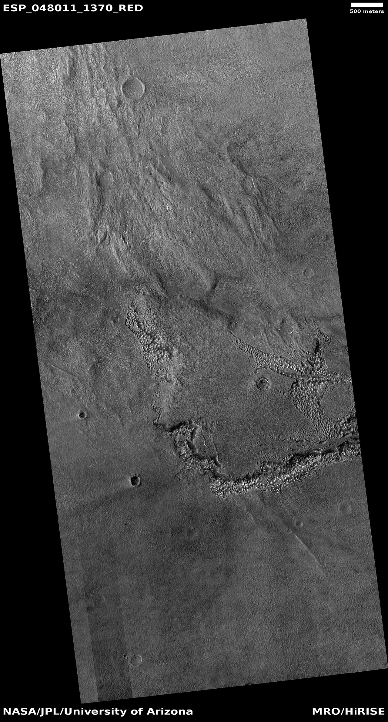
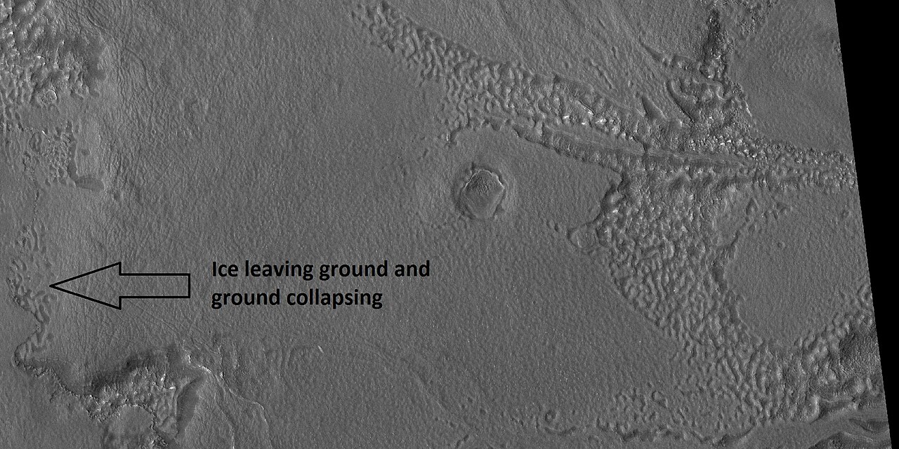

تظهر بعض مناطق وحدة السهول العليا كسورًا وأحواضًا كبيرة ذات حواف مرتفعة؛ وتسمى هذه المناطق بالسهول العليا المضلعة. ويُعتقد أن الكسور بدأت بشقوق صغيرة من الإجهادات. ويُقترح أن الإجهاد هو الذي بدأ عملية الكسر نظرًا لأن السهول العليا المضلعة شائعة عندما تتجمع مآزر الحطام معًا أو بالقرب من حافة مآزر الحطام - مثل هذه المواقع من شأنها أن تولد إجهادات انضغاطية. تعرض الشقوق المزيد من الأسطح، وبالتالي يتسامى المزيد من الجليد في المادة في الغلاف الجوي الرقيق للكوكب. في النهاية، تصبح الشقوق الصغيرة وديانًا أو أحواضًا كبيرة. غالبًا ما تحتوي الشقوق الصغيرة على حفر صغيرة وسلاسل من الحفر؛ ويُعتقد أن هذه ناتجة عن تسامي الجليد في الأرض. [19] [20] تحتوي مناطق كبيرة من سطح المريخ على جليد محمي بطبقة سميكة من الغبار ومواد أخرى يبلغ سمكها مترًا واحدًا. ومع ذلك، إذا ظهرت شقوق، فإن سطحًا جديدًا سيعرض الجليد للغلاف الجوي الرقيق. [21] [22] في وقت قصير، سيختفي الجليد في الغلاف الجوي البارد الرقيق في عملية تسمى التسامي . يتصرف الجليد الجاف بطريقة مماثلة على الأرض. على المريخ، لوحظ التسامي عندما اكتشف مسبار فينيكس قطعًا من الجليد اختفت في غضون أيام قليلة. [23] [24] بالإضافة إلى ذلك، شاهد HiRISE حفرًا جديدة مع جليد في القاع. بعد فترة، رأى HiRISE اختفاء رواسب الجليد. [25]
-
![اختفت كتل صغيرة الحجم من المواد الساطعة في خندق "دودو-جولديلوكس" الموسع على مدار أربعة أيام، مما يعني أنها كانت تتكون من الجليد الذي تصاعد بعد التعرض.[24][26]](https://file.arabipedia.wiki/wikipedia/commons/thumb/1/1d/Ice_sublimating_in_the_Dodo-Goldilocks_trench.gif/180px-Ice_sublimating_in_the_Dodo-Goldilocks_trench.gif) اختفت كتل صغيرة الحجم من المواد الساطعة في خندق "دودو-جولديلوكس" الموسع على مدار أربعة أيام، مما يعني أنها كانت تتكون من الجليد الذي تصاعد بعد التعرض. [24] [26]
اختفت كتل صغيرة الحجم من المواد الساطعة في خندق "دودو-جولديلوكس" الموسع على مدار أربعة أيام، مما يعني أنها كانت تتكون من الجليد الذي تصاعد بعد التعرض. [24] [26] -
 إصدارات ملونة من الصور التي تظهر تصعيد الجليد، مع تكبير الزاوية اليسرى السفلية للخندق في الإضافات الموجودة في الجزء العلوي الأيمن من الصور
![اختفت كتل صغيرة الحجم من المواد الساطعة في خندق "دودو-جولديلوكس" الموسع على مدار أربعة أيام، مما يعني أنها كانت تتكون من الجليد الذي تصاعد بعد التعرض.[24][26]](https://file.arabipedia.wiki/wikipedia/commons/thumb/1/1d/Ice_sublimating_in_the_Dodo-Goldilocks_trench.gif/1280px-Ice_sublimating_in_the_Dodo-Goldilocks_trench.gif)

يُعتقد أن وحدة السهول العليا سقطت من السماء. وهي تغطي أسطحًا مختلفة، كما لو كانت تسقط بالتساوي. وكما هي الحال بالنسبة لرواسب الوشاح الأخرى، فإن وحدة السهول العليا لها طبقات، وهي ذات حبيبات دقيقة، وغنية بالجليد. وهي منتشرة على نطاق واسع؛ ولا يبدو أن لها مصدرًا نقطيًا. ويعود المظهر السطحي لبعض مناطق المريخ إلى كيفية تدهور هذه الوحدة. وهو سبب رئيسي لظهور مآزر الحطام الفصوصي على السطح . [20] ويُعتقد أن طبقات وحدة السهول العليا ووحدات الوشاح الأخرى ناجمة عن تغييرات كبيرة في مناخ الكوكب. وتتنبأ النماذج بأن ميل أو ميل المحور الدوراني قد تراوح من 25 درجة الحالية إلى ما يزيد عن 80 درجة على مدار الزمن الجيولوجي. وستؤدي فترات الميلان العالي إلى إعادة توزيع الجليد في القمم القطبية وتغيير كمية الغبار في الغلاف الجوي. [27] [28] [29]
تغير المناخ تسبب في ظهور مناطق غنية بالجليد
يُعتقد أن العديد من السمات الموجودة على المريخ، بما في ذلك تلك الموجودة في رباعية هيلاس، تحتوي على كميات كبيرة من الجليد. النموذج الأكثر شيوعًا لأصل الجليد هو تغير المناخ الناجم عن التغيرات الكبيرة في ميل محور دوران الكوكب. في بعض الأحيان كان الميل أكبر من 80 درجة [30] [31] تفسر التغييرات الكبيرة في الميل العديد من السمات الغنية بالجليد على المريخ.
أظهرت الدراسات أنه عندما يصل ميل المريخ إلى 45 درجة من 25 درجة الحالية، لم يعد الجليد مستقرًا عند القطبين. [32] وعلاوة على ذلك، عند هذا الميل العالي، تتسامى مخزونات ثاني أكسيد الكربون الصلب (الجليد الجاف)، مما يزيد من الضغط الجوي. يسمح هذا الضغط المتزايد باحتجاز المزيد من الغبار في الغلاف الجوي. ستتساقط الرطوبة في الغلاف الجوي على شكل ثلج أو جليد متجمد على حبيبات الغبار. تشير الحسابات إلى أن هذه المادة ستتركز في خطوط العرض الوسطى. [33] [34] تتنبأ نماذج الدورة العامة للغلاف الجوي للمريخ بتراكمات من الغبار الغني بالجليد في نفس المناطق التي توجد بها ميزات غنية بالجليد. [31] عندما يبدأ الميل في العودة إلى قيم أقل، يتسامى الجليد (يتحول مباشرة إلى غاز) ويترك وراءه فجوة من الغبار. [35] [36] تغطي رواسب الفجوة المادة الأساسية، لذلك مع كل دورة من مستويات الميل العالية، تبقى بعض الوشاح الغني بالجليد. [37] لاحظ أن طبقة الوشاح السطحية الملساء ربما تمثل مادة حديثة نسبيًا فقط.
أصل داو فاليس

يبدأ داو فاليس بالقرب من بركان كبير يسمى هادرياكا باتيرا، لذا يُعتقد أنه تلقى الماء عندما أذابت الصهارة الساخنة كميات هائلة من الجليد في الأرض المتجمدة. [2] تشير المنخفضات الدائرية جزئيًا على الجانب الأيسر من القناة في الصورة المجاورة إلى أن استنزاف المياه الجوفية ساهم أيضًا في تراكم المياه. [38]
آثار الغبار الشيطاني

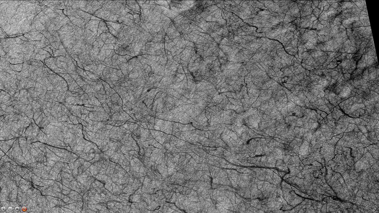
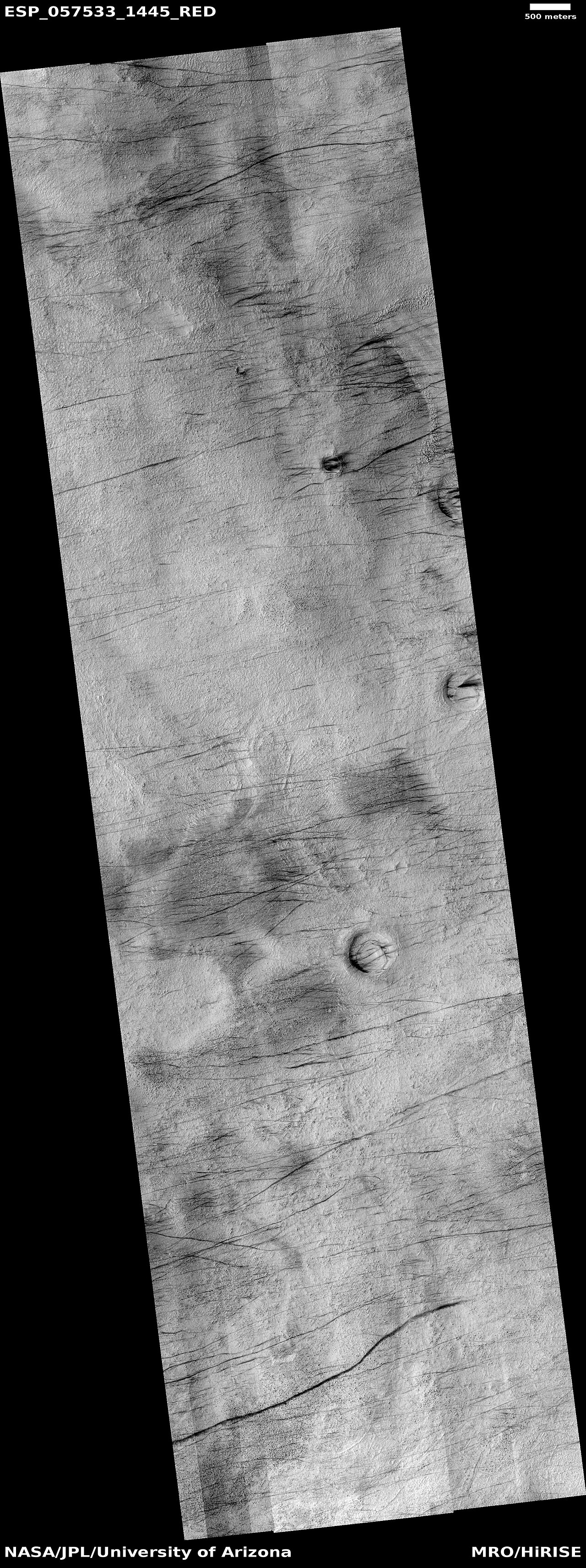
تشهد العديد من المناطق على المريخ، بما في ذلك رباعي هيلاس، مرور شياطين الغبار العملاقة . تغطي طبقة رقيقة من الغبار الناعم اللامع معظم سطح المريخ. عندما يمر شيطان الغبار فإنه ينفخ الطبقة ويكشف عن السطح المظلم الأساسي. شوهدت شياطين الغبار من الأرض ومن المركبات الفضائية التي تدور حول الكوكب. لقد نفخوا الغبار حتى عن الألواح الشمسية للمركبتين الجوالتين على المريخ، وبالتالي إطالة عمرهما بشكل كبير. [39] تم تصميم المركبتين الجوالتين التوأم لتدوم لمدة 3 أشهر، وبدلاً من ذلك استمرتا لأكثر من خمس سنوات. وقد ثبت أن نمط المسارات يتغير كل بضعة أشهر. [40] وجدت دراسة جمعت البيانات من كاميرا الاستريو عالية الدقة (HRSC) وكاميرا مسبار المريخ (MOC) أن بعض شياطين الغبار الكبيرة على المريخ يبلغ قطرها 700 متر وتستمر لمدة 26 دقيقة على الأقل. [41] بعض شياطين الغبار أطول من متوسط الأعاصير على الأرض. [42]
-
 آثار الغبار على أرضية فوهة والاس، كما تظهرها كاميرا CTX (على مركبة الاستطلاع المدارية Mars Reconnaissance Orbiter)
 -
 مسارات الغبار الشيطاني، كما تم رصدها بواسطة HiRISE ضمن برنامج HIWish
 -
 آثار الغبار والصخور الضخمة كما تم رصدها بواسطة HiRISE ضمن برنامج HIWish
 -
 منظر واسع لمسارات شيطان الغبار، كما تم رصدها بواسطة HiRISE ضمن برنامج HIWish
 -
 منظر ملون قريب لمسارات شيطان الغبار، كما تم رصدها بواسطة HiRISE ضمن برنامج HIWish
 -
 منظر ملون قريب لمسارات شيطان الغبار، كما تم رصدها بواسطة HiRISE ضمن برنامج HIWish
 -
 منظر ملون قريب لمسارات غبار الشياطين، كما تم رصدها بواسطة برنامج HiRISE تحت نمط الأرض المرئي في الخلفية.




أدلة على وجود مياه سائلة محتملة في الآونة الأخيرة

اكتشفت مركبة استطلاع المريخ تغييرات على جدار فوهة بنتيكتون بين عامي 1999 و2004. وكان أحد تفسيرات هذه التغييرات أنها ناجمة عن تدفق المياه على السطح. [43] وكشف تحليل آخر نُشر بعد عام تقريبًا أن الرواسب ربما تكون ناجمة عن تحريك الجاذبية للمواد إلى أسفل المنحدر ( انهيار أرضي ). وكان المنحدر الذي شوهدت فيه الرواسب قريبًا من حدود استقرار المواد الجافة غير المتماسكة. [44]
الحفر الأخرى
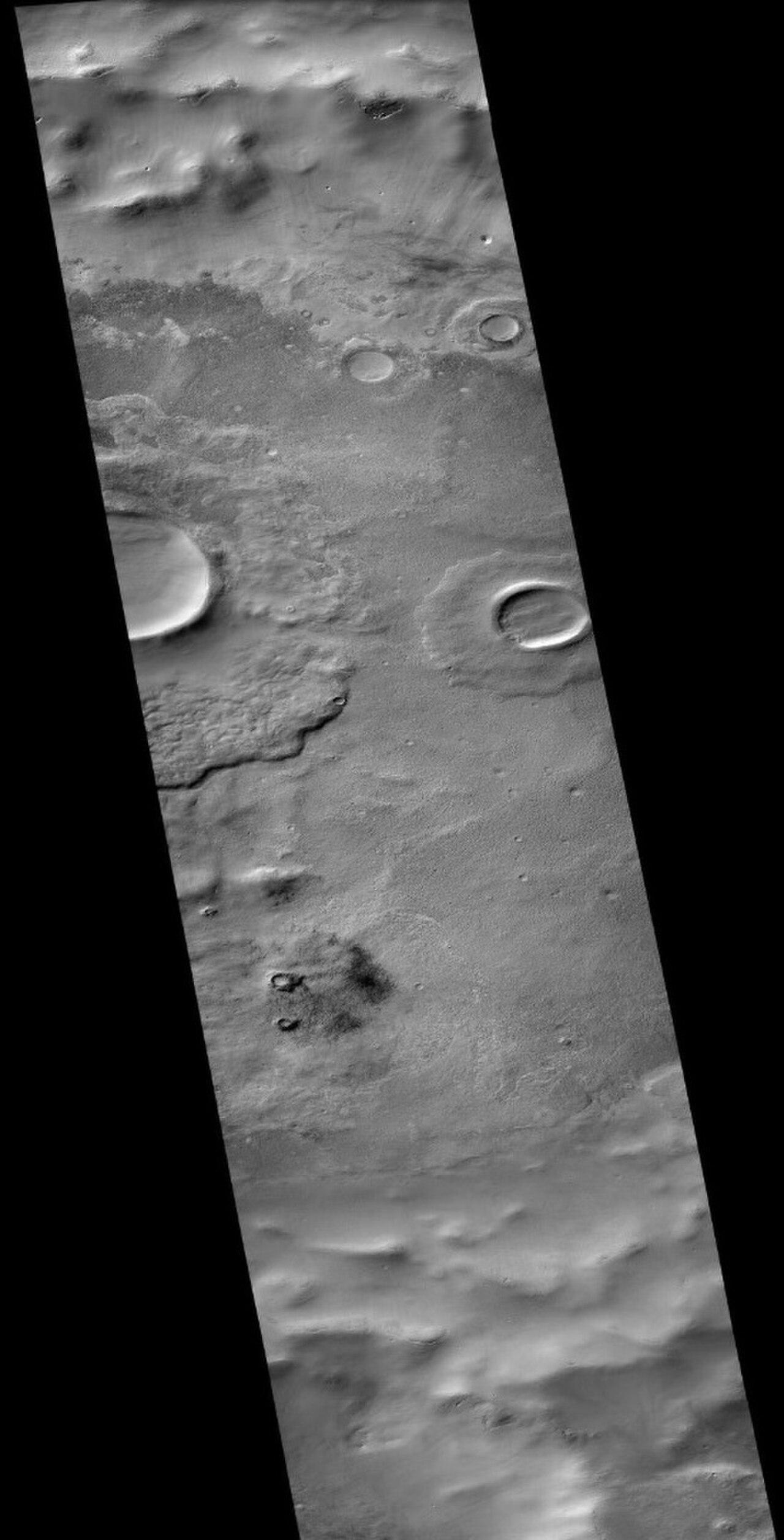
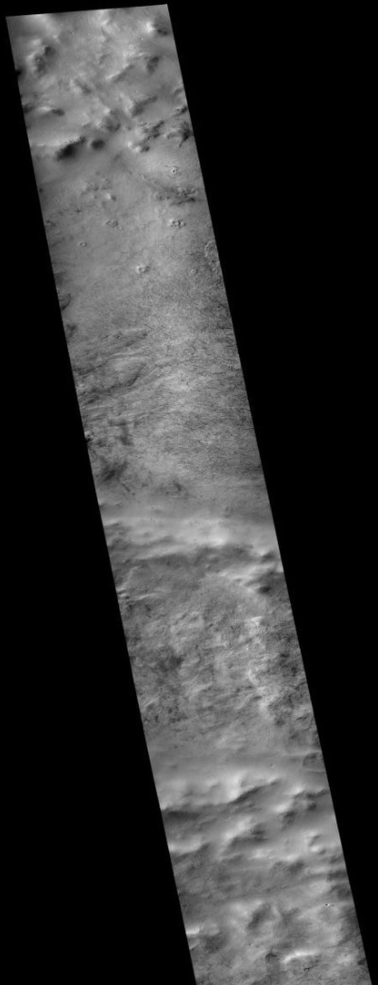
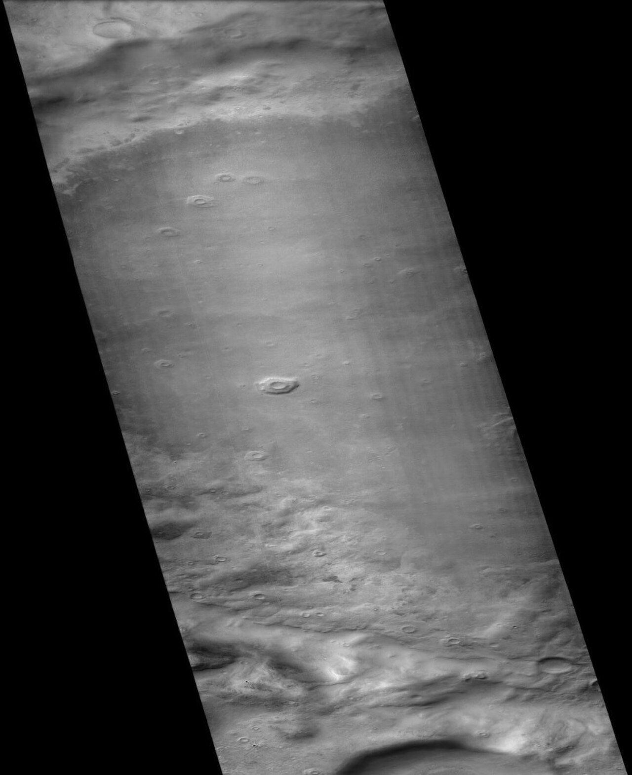
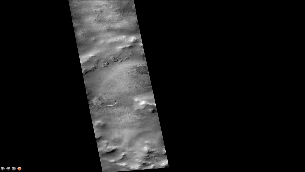
تتميز فوهات الاصطدام عادةً بحافة بها قذفات حولها، على النقيض من ذلك، لا تحتوي فوهات البراكين عادةً على حافة أو رواسب قذف. ومع ازدياد حجم الفوهات (قطرها أكبر من 10 كم)، فإنها عادةً ما يكون لها ذروة مركزية. [45] تحدث الذروة بسبب ارتداد أرضية الفوهة بعد الاصطدام. [46] في بعض الأحيان، تعرض الفوهات طبقات. يمكن أن تُظهر لنا الفوهات ما يكمن عميقًا تحت السطح.
-
 فوهة القاعدة كما تم رصدها بواسطة HiRISE ضمن برنامج HiWish
 -
![تتشكل فوهات القاعدة عندما تحمي المواد المقذوفة من الاصطدامات المواد الموجودة تحتها من التآكل. ونتيجة لهذه العملية، تظهر الفوهات مرتفعة فوق محيطها.[47] [48]](https://file.arabipedia.wiki/wikipedia/commons/thumb/d/d2/Pedestal_crater3.jpg/254px-Pedestal_crater3.jpg) تتشكل فوهات القاعدة عندما تحمي المواد المقذوفة من الاصطدامات المواد الموجودة تحتها من التآكل. ونتيجة لهذه العملية، تظهر الفوهات مرتفعة فوق محيطها. [47] [48]
تتشكل فوهات القاعدة عندما تحمي المواد المقذوفة من الاصطدامات المواد الموجودة تحتها من التآكل. ونتيجة لهذه العملية، تظهر الفوهات مرتفعة فوق محيطها. [47] [48] -
 يُظهِر الرسم فكرة لاحقة عن كيفية تشكل بعض فوهات القاعدة. وفقًا لهذه الطريقة في التفكير، تخترق المقذوفات المؤثرة طبقة غنية بالجليد - ولكن ليس أبعد من ذلك. تعمل الحرارة والرياح الناتجة عن التأثير على تصلب السطح ضد التآكل. يمكن تحقيق هذا التصلب عن طريق ذوبان الجليد مما ينتج عنه محلول ملحي / معدني وبالتالي تثبيت السطح.
 -
 الحفر الموجودة على القاعدة، كما تم رصدها بواسطة HiRISE ضمن برنامج HiWish
 -
 هضاب متدرجة في الرواسب الداخلية لحفرة سبالانزاني ، كما تم رصدها بواسطة جهاز THEMIS
 -
 منظر جانبي للحفرة التي حفرها جدار، كما شاهدها HiRISE ضمن برنامج HiWish. كما تظهر في هذا المنظر حفر أخرى.
 -
 أخاديد فوهة بنتيكتون كما تم رصدها بواسطة HiRISE
 -
 قنوات فوهة ليبيك كما تم رصدها بواسطة تلسكوب THEMIS
 -
 فوهة تيخوف ، كما تم تصويرها بواسطة كاميرا CTX (على مركبة الاستطلاع المريخية )
 -
 أرضية فوهة والاس ، كما تظهرها كاميرا CTX (على مركبة الاستطلاع المدارية المريخية)
 -
آثار الغبار الشيطاني على أرضية فوهة والاس، كما تظهرها كاميرا CTX (على مركبة الاستطلاع المريخية). لاحظ أن هذه الصورة مكبرة للصورة السابقة لأرضية فوهة والاس.
-
 فوهة هكسلي كما تم تصويرها بواسطة كاميرا CTX (على مركبة الاستطلاع المريخية)
 -
 فوهة جليديل كما تم تصويرها بواسطة كاميرا CTX (على متن مركبة الاستطلاع المريخية)
 -
 فوهة ريدي ، كما تم تصويرها بواسطة كاميرا CTX (على مركبة الاستطلاع المدارية المريخية)
 -
 فوهة ريدي، تظهر آثار الغبار والغطاء، كما تظهرها كاميرا CTX (على مركبة الاستطلاع المريخية). ملاحظة: هذه صورة مكبرة للصورة السابقة لفوهة ريدي.

![تتشكل فوهات القاعدة عندما تحمي المواد المقذوفة من الاصطدامات المواد الموجودة تحتها من التآكل. ونتيجة لهذه العملية، تظهر الفوهات مرتفعة فوق محيطها.[47] [48]](https://file.arabipedia.wiki/wikipedia/commons/thumb/d/d2/Pedestal_crater3.jpg/1280px-Pedestal_crater3.jpg)


السمات الجليدية
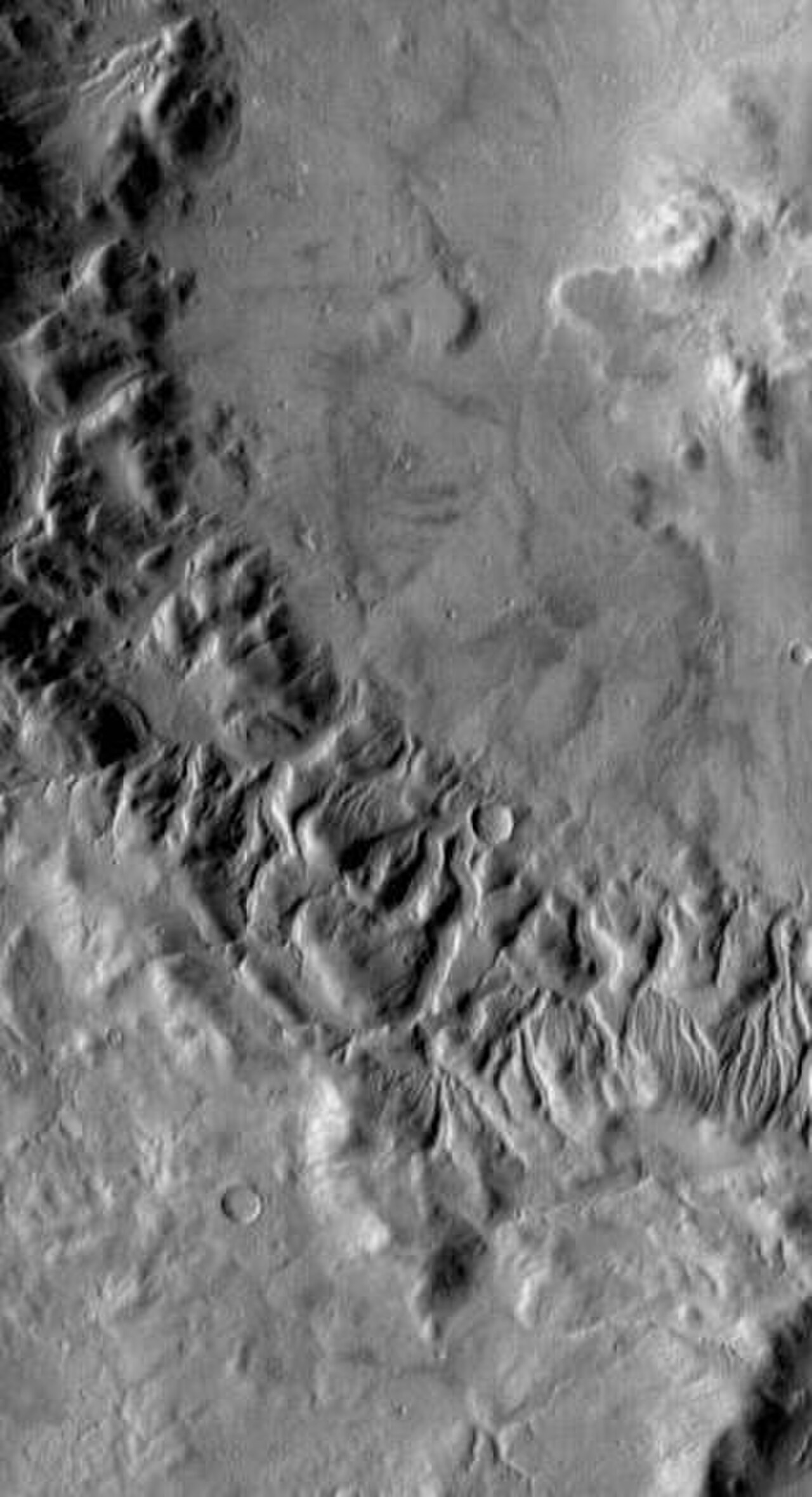
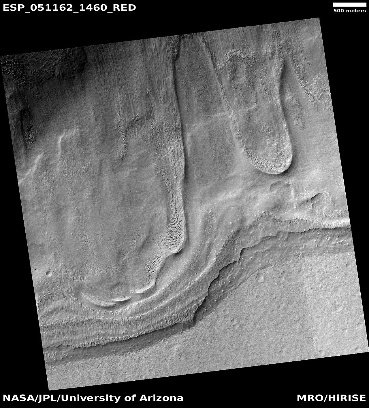
يُعتقد أن الأنهار الجليدية ، والتي تُعرف بشكل فضفاض بأنها بقع من الجليد المتدفق حاليًا أو مؤخرًا، موجودة عبر مناطق كبيرة ولكن محدودة من سطح المريخ الحديث، ويُستنتج أنها كانت منتشرة على نطاق أوسع في أوقات سابقة. [49] [50] تُعتبر الآن السمات المحدبة الفصوصية على السطح والمعروفة باسم سمات التدفق اللزج ومآزر الحطام الفصوصية ، والتي تُظهر خصائص التدفق غير النيوتوني ، أنها أنهار جليدية حقيقية بالإجماع تقريبًا. [49] [51] [52] [53 ] [54] [55] [56] [57] [58]
وجد نموذج مناخي، نُشر في مجلة ساينس في عام 2006، أن كميات كبيرة من الجليد من المفترض أن تتراكم في منطقة اليونان، في نفس الأماكن التي تُرصد فيها الأنهار الجليدية. تنتقل المياه من المنطقة القطبية الجنوبية إلى شمال اليونان وتتساقط على شكل أمطار. [59]
-
 التدفقات كما يراها HiRISE في إطار برنامج HiWish
 -
 منظر ملون قريب للتدفق كما يراه HiRISE ضمن برنامج HIWish
 -
 التدفقات كما يراها HiRISE في إطار برنامج HiWish
 -
 التدفق كما يراه HiRISE ضمن برنامج HiWish
 -
 منظر ملون قريب للتدفق كما تم تصويره بواسطة HiRISE ضمن برنامج HiWish. تظهر الأرضية ذات النمط في الصورة.
 -
 التدفق كما يراه HiRISE ضمن برنامج HiWish
 -
 التدفق كما يراه HiRISE ضمن برنامج HiWish
 -
 التدفق كما يراه HiRISE ضمن برنامج HiWish
 -
 التدفق كما يراه HiRISE ضمن برنامج HiWish
 -
 منظر قريب لخطم التدفق، كما تم رصده بواسطة HiRISE ضمن برنامج HiWish. يمكن رؤية الأرض ذات النمط المتعدد الأضلاع .
 -
 منظر واسع للأنهار الجليدية على شكل لسان، كما تم رصدها بواسطة HiRISE ضمن برنامج HiWish
 -
 منظر قريب للأنهار الجليدية على شكل لسان، كما تم رصدها بواسطة HiRISE ضمن برنامج HiWish. تظهر الأشكال المتعددة الأضلاع.
 -
 السمات السطحية التي تظهر الحركة إلى أسفل التل، كما يراها HiRISE
 -
 صورة سياقية CTX لـ Hellas Planitia تُظهر موقع الصورتين التاليتين
 -
 السطح في رباعية اليونان، كما تم تصويره بواسطة HiRISE، ضمن برنامج HiWish
 -
 من المحتمل أن يكون هناك سيرك جليدي في هيلاس بلانيتيا ، كما تم رصده بواسطة HiRISE، ضمن برنامج HiWish. من المحتمل أن تكون الخطوط ناتجة عن حركة منحدرة.
 -
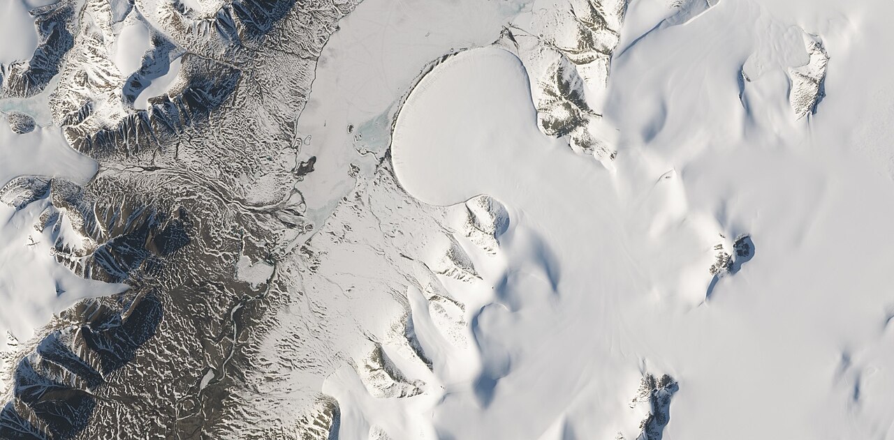
 نهر الفيل الجليدي في بحيرة رومر في القطب الشمالي للأرض، كما صوره القمر الصناعي لاندسات 8. تظهر هذه الصورة العديد من الأنهار الجليدية التي لها نفس شكل العديد من المعالم على كوكب المريخ والتي يُعتقد أنها أيضًا أنهار جليدية.
 -
 ميزة التدفق التي ربما كانت عبارة عن نهر جليدي، كما تم رصدها بواسطة HiRISE ضمن برنامج HiWish
 -
 التلال المتدفقة، كما رصدتها HiRISE في إطار برنامج HiWish. ربما تكونت التلال في نهاية نهر جليدي قديم.
 -
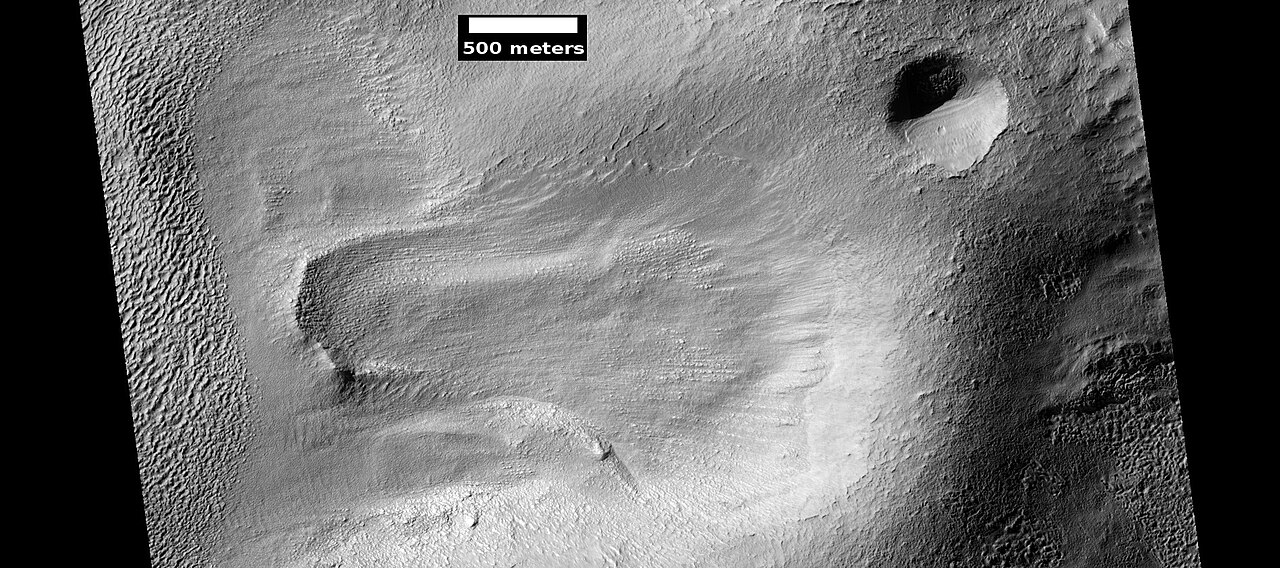
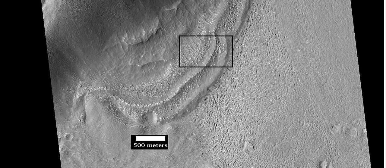
 سياق الصورة التالية لنهاية أحد معالم التدفق أو أحد الأنهار الجليدية. الموقع هو ساحة اليونان.
 -
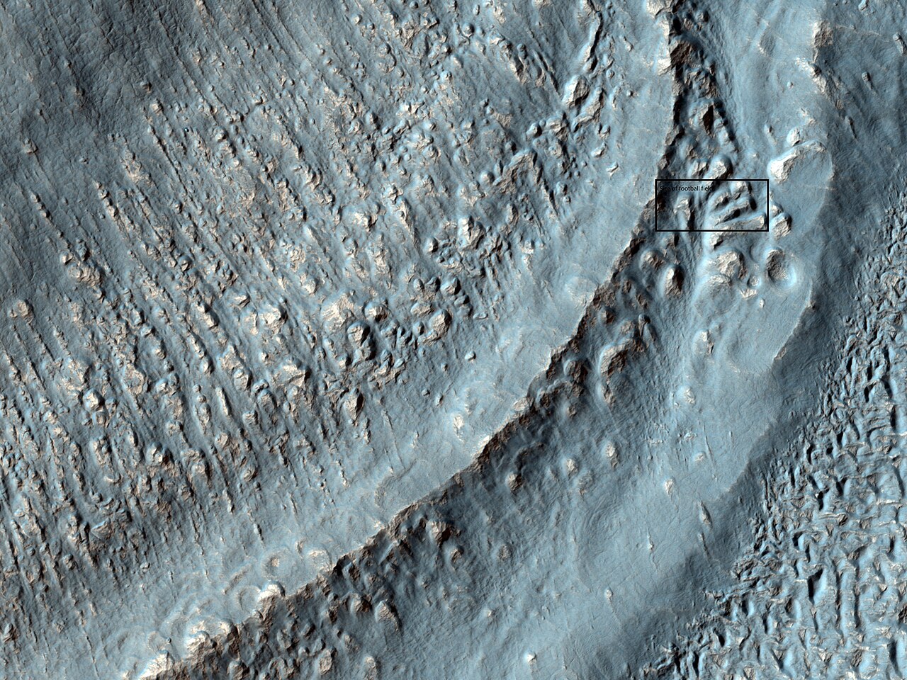
 صورة مقربة للمنطقة الموجودة في المربع في الصورة السابقة. قد يطلق البعض على هذه المنطقة اسم الركام الجليدي. من أجل تحديد المقياس، يظهر المربع الحجم التقريبي لملعب كرة قدم. تم التقاط الصورة باستخدام HiRISE ضمن برنامج HiWish. الموقع هو ساحة اليونان.
 -
 مادة تتدفق عبر حافة فوهة بركانية، كما تظهرها HiRISE، ضمن برنامج HiWish. تم وضع علامات على الركام الجانبي.
 -
 الأنهار الجليدية كما تظهرها HiRISE، ضمن برنامج HiWish. يبدو النهر الجليدي على اليسار رقيقًا لأنه فقد الكثير من الجليد. أما النهر الجليدي على اليمين، فهو سميك؛ فهو لا يزال يحتوي على الكثير من الجليد الموجود تحت طبقة رقيقة من الأوساخ والصخور.
 -
 نهر جليدي على شكل لسان، كما رصدته HiRISE في إطار برنامج HiWish. ربما يوجد الجليد في النهر الجليدي، حتى اليوم، أسفل طبقة عازلة من التراب.
 -
 صورة مقربة لنهر جليدي على شكل لسان، كما تم رصده بواسطة HiRISE ضمن برنامج HiWish. تبلغ الدقة حوالي متر واحد، لذا يمكن للمرء أن يرى أشياء يبلغ عرضها بضعة أمتار في هذه الصورة. قد يوجد الجليد في النهر الجليدي، حتى اليوم، أسفل طبقة عازلة من التراب.
 -
 الأنهار الجليدية على شكل لسان موضحة بالسهام، كما تم رصدها بواسطة HiRISE ضمن برنامج HiWish
 -
 منظر قريب لخطم نهر جليدي، كما تم تصويره بواسطة HiRISE ضمن برنامج HiWish. تظهر مضلعات مركزية عالية. يوضح المربع حجم ملعب كرة القدم.
 -
 منظر قريب لمضلعات مركزية عالية بالقرب من نهر جليدي، كما تم رصدها بواسطة HiRISE ضمن برنامج HiWish
 -
 منظر قريب لمضلعات مركزية عالية بالقرب من نهر جليدي، كما تم رصدها بواسطة HiRISE ضمن برنامج HiWish
 -
 منظر قريب لمضلعات مركزية عالية بالقرب من نهر جليدي، كما تم رصدها بواسطة HiRISE ضمن برنامج HiWish. يوضح المربع حجم ملعب كرة القدم.
 -
 منظر قريب لمضلعات مركزية عالية بالقرب من نهر جليدي، كما تم رصدها بواسطة HiRISE ضمن برنامج HiWish
 -
 نهر جليدي على شكل لسان، كما تم تصويره بواسطة HiRISE ضمن برنامج HiWish
 -
 منظر واسع للتدفقات على شكل لسان، كما تم رصدها بواسطة HiRISE ضمن برنامج HiWish
 -
 منظر قريب للتدفقات على شكل لسان، كما تم رصدها بواسطة HiRISE ضمن برنامج HiWish
 -
 منظر قريب للتدفقات على شكل لسان والتضاريس المتعددة الأضلاع (المسماة)، كما تم رصدها بواسطة HiRISE ضمن برنامج HiWish
 -
 منظر قريب للتضاريس المتعددة الأضلاع بالقرب من التدفقات على شكل لسان، كما تم رصدها بواسطة HiRISE ضمن برنامج HiWish
 -
 الأخاديد الناتجة عن حركة الجليد، كما تم رصدها بواسطة HiRISE ضمن برنامج HiWish
 -
 منظر ملون قريب للمضلعات كما يراها HiRISE ضمن برنامج HiWish. المضلعات شائعة في الأراضي الغنية بالجليد.
 -
 تدفقات على شكل لسان تتدفق عبر جدار الحفرة، كما تم رصدها بواسطة HiRISE







القنوات
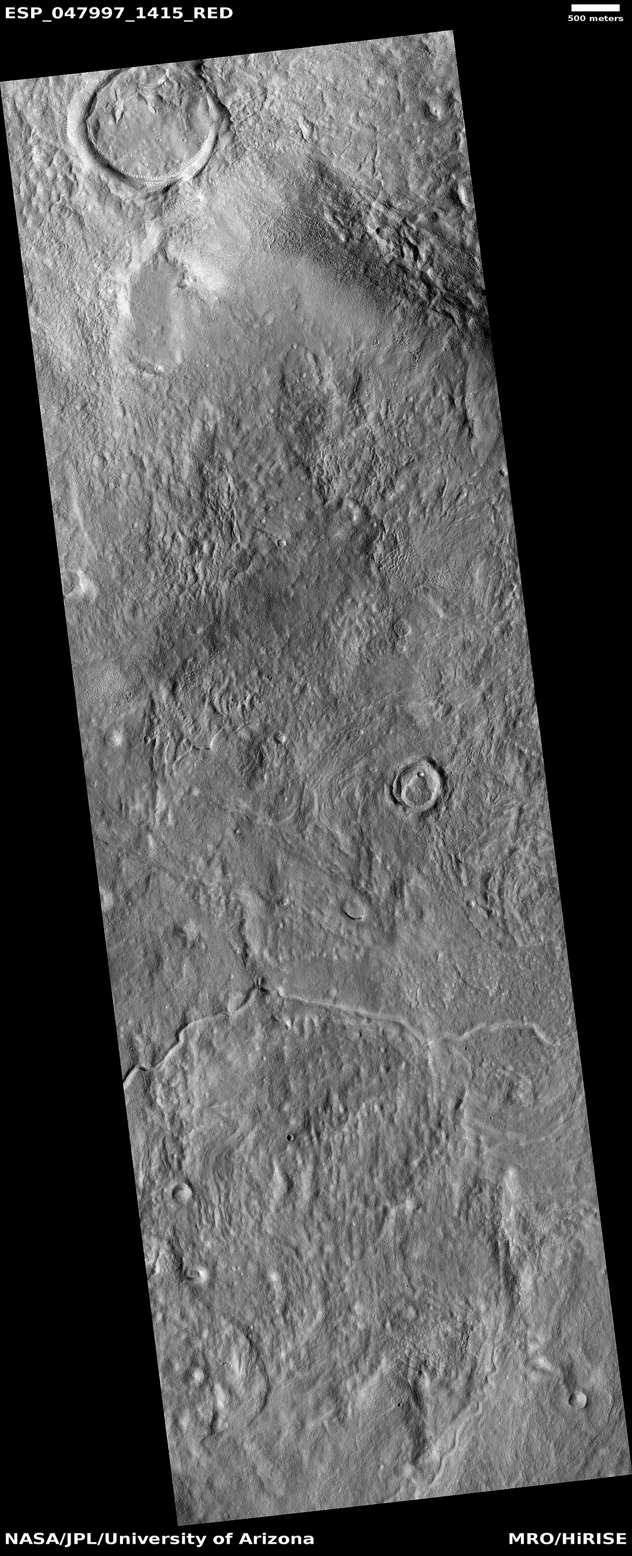
هناك أدلة هائلة على أن الماء كان يتدفق ذات يوم في وديان الأنهار على المريخ. [60] [61] وقد شوهدت صور للقنوات المنحنية في صور من مركبات المريخ الفضائية التي يعود تاريخها إلى أوائل سبعينيات القرن العشرين مع مركبة مارينر 9 المدارية . [62] [63] [64] [65] في الواقع، حسبت دراسة نُشرت في يونيو 2017 أن حجم المياه اللازمة لنحت جميع القنوات على المريخ كان أكبر حتى من المحيط المقترح الذي ربما كان الكوكب يمتلكه. ربما تم إعادة تدوير المياه عدة مرات من المحيط إلى هطول الأمطار حول المريخ. [66] [67]
-
 ماد فاليس ، كما تم تصويره بواسطة HiRISE. الصورة الموجودة على اليمين عبارة عن تكبير لجزء من الصورة الأخرى.
 -
 القنوات كما يراها HiRISE ضمن برنامج HiWish
 -
 شكل انسيابي في وادي النهر القديم، كما تم رصده بواسطة HiRISE ضمن برنامج HiWish. الشكل الانسيابي دليل على وجود مياه جارية.
 -
 القناة كما يراها HiRISE ضمن برنامج HiWish
 -
 القناة كما يراها HiRISE ضمن برنامج HiWish
 -
 القنوات كما يراها HiRISE ضمن برنامج HiWish


-
 منظر واسع للقنوات الصغيرة، كما يراها HiRISE ضمن برنامج HiWish
 -
 منظر قريب للقنوات كما يراها HiRISE ضمن برنامج HiWish


-
 منظر واسع لشبكة القنوات كما يراها HiRISE ضمن برنامج HiWish. يبلغ عرض الشريط الملون في المنتصف حوالي 1 كم.
 -
 شبكة القنوات كما يراها HiRISE ضمن برنامج HiWish
 -
 الوادي كما يراه HiRISE ضمن برنامج HiWish
 -
 القناة كما تم رصدها بواسطة HiRISE ضمن برنامج HiWish. تشير الأسهم إلى وجود دليل على وجود انحناء.
 -
 منظر قريب للقنوات الصغيرة التي يبدو أنها تنشأ في طبقة الوشاح، كما تم رصدها بواسطة HiRISE ضمن برنامج HiWish
 -
 القنوات كما يراها HiRISE ضمن برنامج HiWish


الطبقات
تظهر العديد من الأماكن على المريخ صخورًا مرتبة في طبقات. يمكن للصخور تكوين طبقات بطرق متنوعة. يمكن للبراكين أو الرياح أو المياه إنتاج طبقات. [68] يمكن العثور على مناقشة مفصلة للطبقات مع العديد من الأمثلة المريخية في الجيولوجيا الرسوبية للمريخ . [69]
-
 الطبقات كما يراها HiRISE ضمن برنامج HiWish
 -
 الطبقات كما يراها HiRISE ضمن برنامج HiWish
 -
 منظر قريب للطبقات كما يراها HiRISE تحت برنامج HiWish. كما تظهر الصخور أيضًا في الصورة.
 -
 منظر واسع للطبقات كما يراها HiRISE ضمن برنامج HiWish
 -
 منظر قريب للرواسب الطبقية في الحفرة، كما تم رصدها بواسطة HiRISE ضمن برنامج HiWish
 -
 منظر قريب للطبقات كما يراها HiRISE ضمن برنامج HiWish
 -
 Layered formation, as seen by HiRISE under HiWish program
 -
 Close view of layers from previous image, as seen by HiRISE under HiWish program
 -
 Layers, as seen by HiRISE under HiWish program
 -
 Wide view of layers, as seen by HiRISE under HiWish program
 -
 Channel of a gully indicated with arrows. Picture enlarged from previous image.
 -
 Close view of layers, as seen by HiRISE under HiWish program


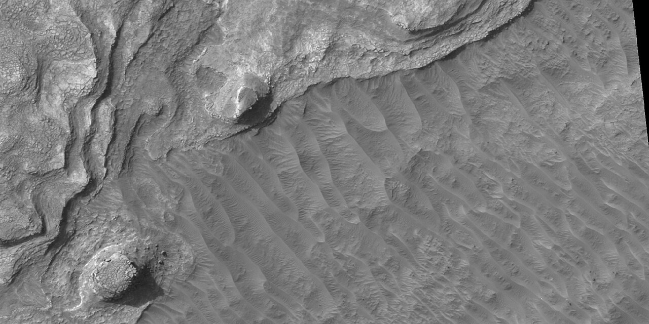
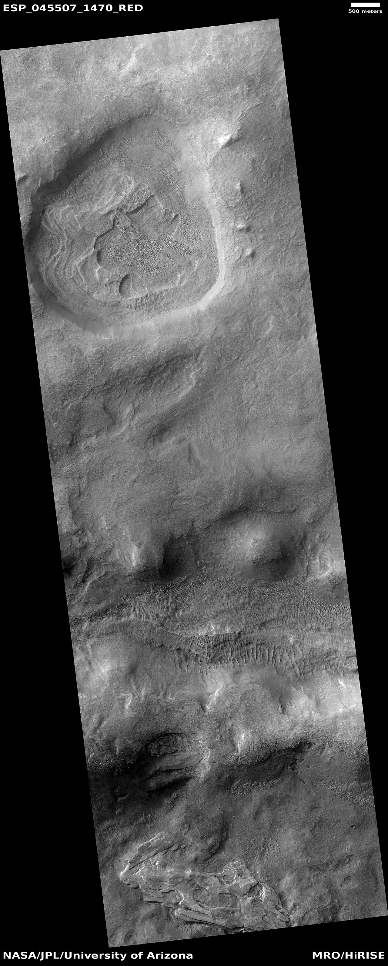


-
 Wide view of layers, as seen by HiRISE under HiWish program
 -
 Close view of layers, as seen by HiRISE under HiWish program
 -
 Close view of layers, as seen by HiRISE under HiWish program. Some of the layers are breaking up into large blocks.
 -
 Close view of layers, as seen by HiRISE under HiWish program. Some of the layers are breaking up into large blocks.
 -
 Layers, as seen by HiRISE under HiWish program
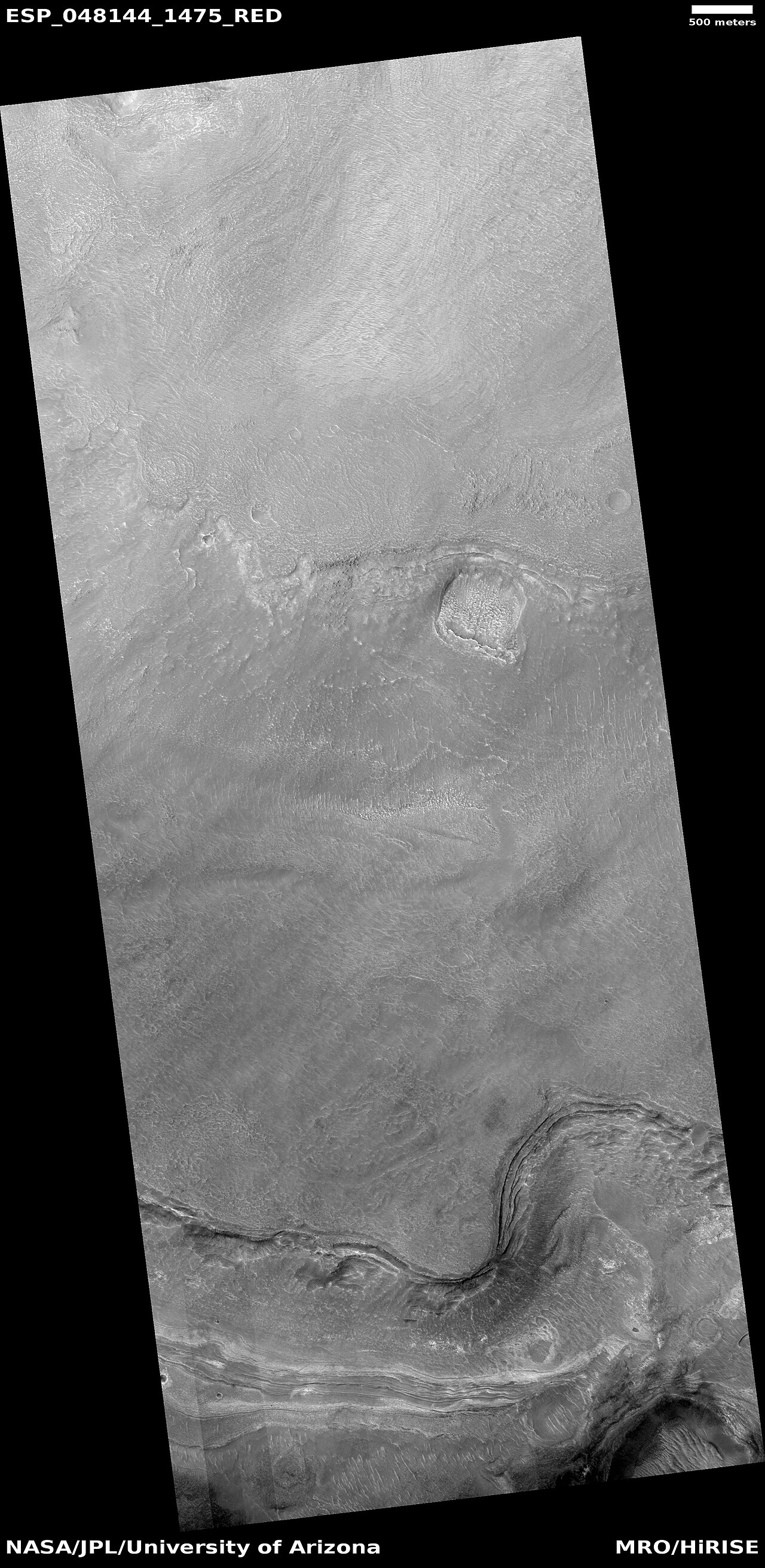


-
 Layers, as seen by HiRISE under HiWish program. Some layers are light-toned which means that they may have been associated with water.
 -
 Close view of layers, as seen by HiRISE under HiWish program. Some layers are light-toned which means that they may have been associated with water.
 -
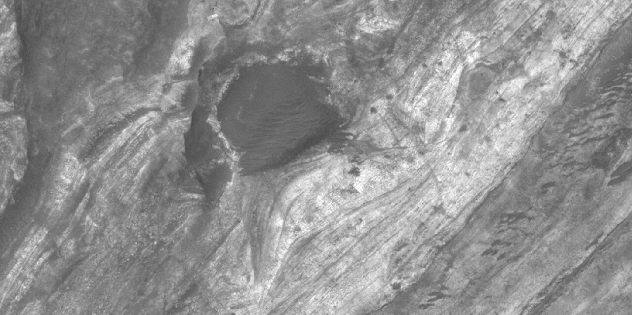
 Close view of light-toned materials, as seen by HiRISE under HiWish program. Light-toned materials have been associated with water.
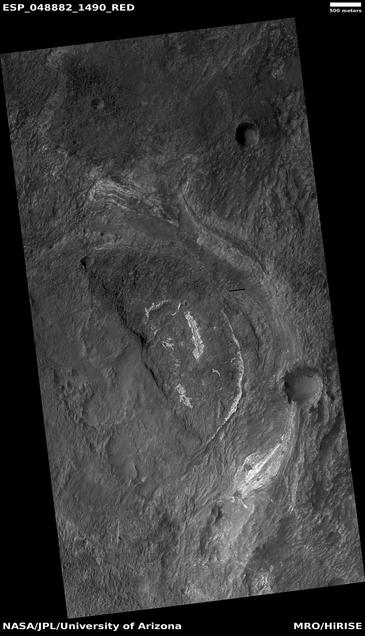

-
 Wide view of light and dark toned layers, as seen by HiRISE under HiWish program
 -
 Close view of light and dark toned layers, as seen by HiRISE under HiWish program
 -
 Close view of light and dark toned layers, as seen by HiRISE under HiWish program
 -
 Close, color view of layers, as seen by HiRISE under HiWish program. The different colors represent different minerals.


-
 Wide view of light and dark toned layers, as seen by HiRISE under HiWish program
 -
 Close, color view of layers, as seen by HiRISE under HiWish program. The different colors represent different minerals.
 -
 Close, color view of layers, as seen by HiRISE under HiWish program


-
 Wide view of layers in mounds, as seen by HiRISE under HiWish program
 -
 Close view of layers in mound, as seen by HiRISE under HiWish program


Honeycomb terrain
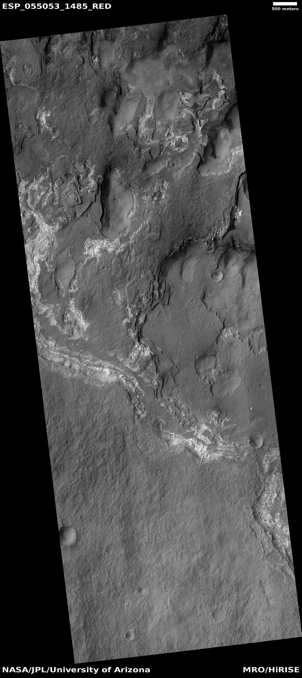
These relatively flat-lying "cells" appear to have concentric layers or bands, similar to a honeycomb. This "honeycomb" terrain was first discovered in the northwestern part of Hellas.[70] The geologic process responsible for creating these features remains unresolved.[71] Some calculations indicate that this formation may have been caused by ice moving up through the ground in this region. The ice layer would have been between 100 m and 1 km thick.[72][73][70] When one substance moves up through another denser substance, it is called a diapir. So, it seems that large masses of ice have pushed up layers of rock into domes that were eroded. After erosion removed the top of the layered domes, circular features remained.
Diapirs are thought to be responsible for features on Neptune's moon Triton, Jupiter's moon Europa, Saturn's moon Enceladus, and Uranus's moon Miranda.[74]
-
 Concentric bands and layers that has been called "honeycomb terrain". Picture was taken by HiRISE under the HiWish program.
 -
 Circular layers, as seen by HiRISE under HiWish program
 -
 layers and ridges that form strange patterns, as seen by HiRISE under HiWish program
 -
 Close view of ridges forming strange patterns, as seen by HiRISE under HiWish program


-
 Honeycomb terrain, as seen by HiRISE under HiWish program
 -
 Close, color view of honeycomb terrain, as seen by HiRISE under HiWish program
 -
 Close view of honeycomb terrain, as seen by HiRISE under HiWish program
 -
 Close view of honeycomb terrain, as seen by HiRISE under HiWish program. This enlargement shows material breaking up into blocks. Arrow indicates a cube-shaped block.
 -
 Ridges, as seen by HiRISE under HiWish program
 -
 Close view of concentric and parallel ridges, as seen by HiRISE under HiWish program
 -
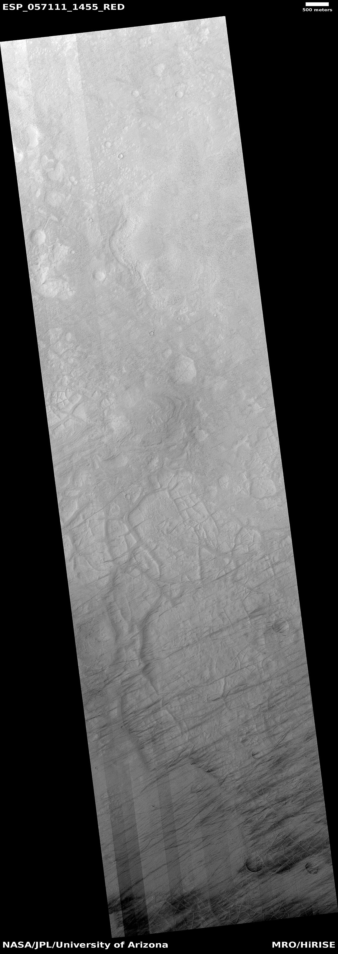
 Wide view of ridge network, as seen by HiRISE under HiWish program
 -
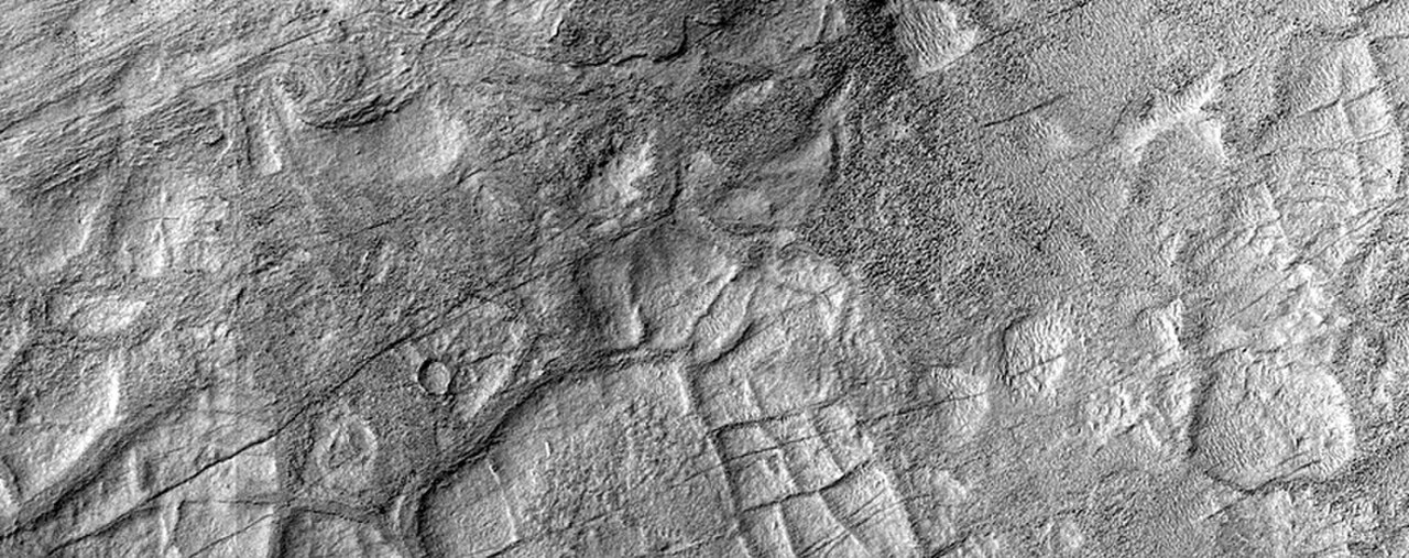
 Close view of ridge network, as seen by HiRISE under HiWish program
 -
 Close view of ridge network, as seen by HiRISE under HiWish program


Gullies
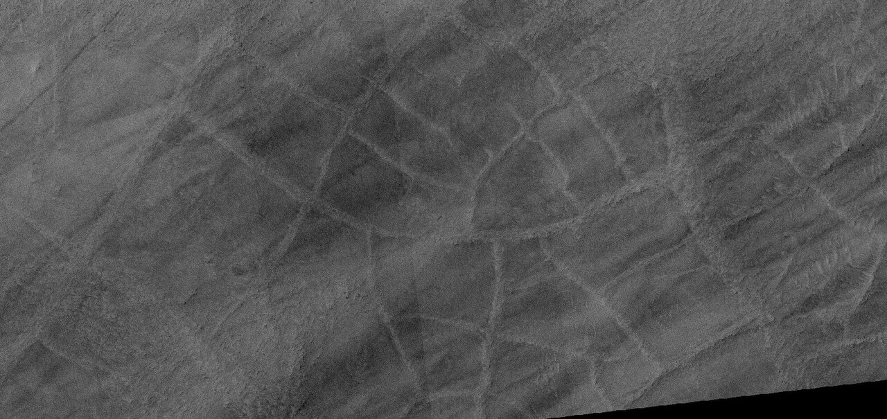
Gullies occur on steep slopes, especially on the walls of craters. Gullies are believed to be relatively young because they have few, if any craters. Moreover, they lie on top of sand dunes which themselves are considered to be quite young. Usually, each gully has an alcove, channel, and apron. Some studies have found that gullies occur on slopes that face all directions,[75] others have found that the greater number of gullies are found on poleward facing slopes, especially from 30-44 S.[76]
For years, many believed that gullies were formed by running water, but further observations demonstrate that they may be formed by dry ice. Recent studies describe using the High Resolution Imaging Science Experiment (HiRISE) camera on MRO to examine gullies at 356 sites, starting in 2006. Thirty-eight of the sites showed active gully formation. Before-and-after images demonstrated the timing of this activity coincided with seasonal carbon dioxide frost and temperatures that would not have allowed for liquid water. When dry ice frost changes to a gas, it may lubricate dry material to flow especially on steep slopes.[77][78][79] In some years frost, perhaps as thick as 1 meter, triggers avalanches. This frost contains mostly dry ice, but also has tiny amounts of water ice.[80]
-
 Gullies in crater, as seen by HiRISE under HiWish program
 -
 Close view of gullies in crater, as seen by HiRISE under HiWish program. Polygons are visible in this close view.
 -
 Wide view of layers and gullies, as seen by HiRISE under HiWish program. Arrows point to small gullies.
 -
 Close view of small gully, as seen by HiRISE under HiWish program
 -
 Wide view of gullies, as seen by HiRISE under HiWish program
 -
 Close, color view of gullies, as seen by HiRISE under HiWish program
 -
 Close view of gullies, as seen by HiRISE under HiWish program. Curves in channels are evidence that these gullies were not created by landslides.
 -
 Wide view of gullies, as seen by HiRISE. The gullies range from very samll to large, as such they may represent different stages in the formation of gullies. The colored strip is about 1 km wide.
 -
 Gullies, as seen by HiRISE. The gullies range from very samll to large, as such they may represent different stages in the formation of gullies. The colored strip is about 1 km wide.
 -
 Small gully This gully may be in its initial state of formation.
 -
 Gully, as seen by HiRISE
 -
 Wide view of gullies
 -
 Close view of gully alcoves Picture is about 1 km across.
 -
 Close view of gully alcoves Picture is about 1 km across.
 -
 Close view of gully channels Picture is about 1 km across.


Polygons
Some surfaces on Mars display polygons. These may be of different sizes. Polygons are an example of patterned ground. Polygonal, patterned ground is quite common in some regions of Mars.[81][82][83][84][85][86][87]
-
 Group of polygons, as seen by HiRISE under HiWish program
 -
 Patterned ground in Hellas, as seen by HiRISE under HiWish program. The rectangle shows the size of a football field.


-
 Wide view of polygons, as seen by HiRISE under HiWish program. Parts of this image are enlarged in following images.
 -
 Polygons, as seen by HiRISE under HiWish program
 -
 Close view of polygons, as seen by HiRISE under HiWish program. Arrow point to boulders that sit inside of small craters.
 -
 Close view of polygons, as seen by HiRISE under HiWish program
 -
 Close view of polygons, as seen by HiRISE under HiWish program


Exposed ice sheets
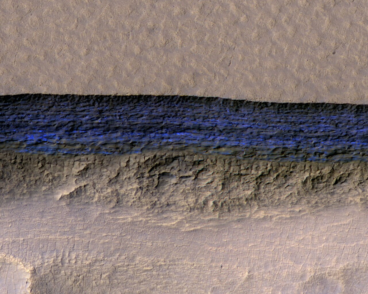
Thick deposits of ice were found by a team of researchers using instruments on board the Mars Reconnaissance Orbiter (MRO).[88] The scientists found eight eroding slopes showing exposed water ice sheets as thick as 100 meters. Seven of the locations were in the southern hemisphere. Much evidence of buried ice under the ground on vast regions of Mars has already been found by past studies, but this study found that the ice was only covered by a layer of about 1 or 2 meters thick of soil.[89][90][91] Shane Byrne of the University of Arizona Lunar and Planetary Laboratory, Tucson, one of the co-authors remarked that future colonists of the Red Planet would be able to gather up ice with just a bucket and shovel.[92] The layered ice is exposed in triangular shaped depressions. One wall is very steep and faces the pole. The fact that water-ice makes up the layers was confirmed by Compact Reconnaissance Imaging Spectrometer for Mars (CRISM) on board the Mars Reconnaissance Orbiter (MRO). The spectra gathered by CRISM showed strong signals of water.[93] The layers are especially prominent in depressions in Hellas quadrangle as shown in the enlarged views below.
-
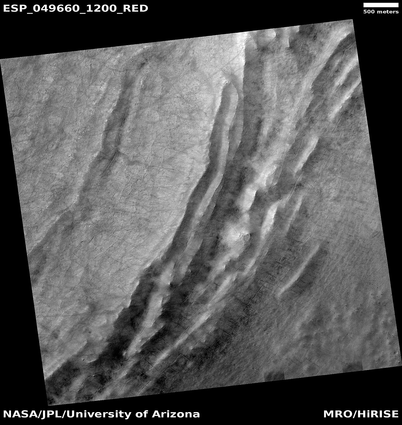
![Wide view of triangular depression, as seen by HiRISE The colored strip shows the part of the image that can be seen in color. The wall at the top of the depression contains pure ice. This wall faces the south pole. Location is Hellas quadrangle.[94]](https://file.arabipedia.wiki/wikipedia/commons/thumb/5/5e/PIA22078_hireswideview.jpg/190px-PIA22078_hireswideview.jpg) Wide view of triangular depression, as seen by HiRISE The colored strip shows the part of the image that can be seen in color. The wall at the top of the depression contains pure ice. This wall faces the south pole. Location is Hellas quadrangle.[94]
Wide view of triangular depression, as seen by HiRISE The colored strip shows the part of the image that can be seen in color. The wall at the top of the depression contains pure ice. This wall faces the south pole. Location is Hellas quadrangle.[94] -
 Close, color view of wall containing ice from previous image, as seen by HiRISE
![Wide view of triangular depression, as seen by HiRISE The colored strip shows the part of the image that can be seen in color. The wall at the top of the depression contains pure ice. This wall faces the south pole. Location is Hellas quadrangle.[94]](https://file.arabipedia.wiki/wikipedia/commons/thumb/5/5e/PIA22078_hireswideview.jpg/1280px-PIA22078_hireswideview.jpg)
-
![Wide view of triangular depression, as seen by HiRISE. The wall which faces the south pole contains ice in distinct layers that are visible in next image. Location is Hellas quadrangle.[94]](https://file.arabipedia.wiki/wikipedia/commons/thumb/8/8c/ESP_050345_1230icelayersangles.jpg/190px-ESP_050345_1230icelayersangles.jpg) Wide view of triangular depression, as seen by HiRISE. The wall which faces the south pole contains ice in distinct layers that are visible in next image. Location is Hellas quadrangle.[94]
Wide view of triangular depression, as seen by HiRISE. The wall which faces the south pole contains ice in distinct layers that are visible in next image. Location is Hellas quadrangle.[94] -
![Close view of wall of triangular depression, as seen by HiRISE layers are visible in the wall. The lower layers are tilted, while layers near the surface are more or less horizontal. Such an arrangement of layers is called an "angular unconformity."[94]](https://file.arabipedia.wiki/wikipedia/commons/thumb/7/7e/50345_1230icelayersangular.jpg/190px-50345_1230icelayersangular.jpg) Close view of wall of triangular depression, as seen by HiRISE layers are visible in the wall. The lower layers are tilted, while layers near the surface are more or less horizontal. Such an arrangement of layers is called an "angular unconformity."[94]
Close view of wall of triangular depression, as seen by HiRISE layers are visible in the wall. The lower layers are tilted, while layers near the surface are more or less horizontal. Such an arrangement of layers is called an "angular unconformity."[94] -
![Wide view of triangular depression, as seen by HiRISE. The wall which faces the south pole contains ice in distinct layers that are visible in next image. Location is Hellas quadrangle.[94]](https://file.arabipedia.wiki/wikipedia/commons/thumb/9/93/ESP_050477_1220icelayers.jpg/190px-ESP_050477_1220icelayers.jpg) Wide view of triangular depression, as seen by HiRISE. The wall which faces the south pole contains ice in distinct layers that are visible in next image. Location is Hellas quadrangle.[94]
Wide view of triangular depression, as seen by HiRISE. The wall which faces the south pole contains ice in distinct layers that are visible in next image. Location is Hellas quadrangle.[94] -
 Close view of wall of triangular depression, as seen by HiRISE layers are visible in the wall. The lower layers are tilted, while layers near the surface are more or less horizontal. Such an arrangement of layers is called an "angular unconformity."
![Wide view of triangular depression, as seen by HiRISE. The wall which faces the south pole contains ice in distinct layers that are visible in next image. Location is Hellas quadrangle.[94]](https://file.arabipedia.wiki/wikipedia/commons/thumb/8/8c/ESP_050345_1230icelayersangles.jpg/1280px-ESP_050345_1230icelayersangles.jpg)
![Close view of wall of triangular depression, as seen by HiRISE layers are visible in the wall. The lower layers are tilted, while layers near the surface are more or less horizontal. Such an arrangement of layers is called an "angular unconformity."[94]](https://file.arabipedia.wiki/wikipedia/commons/thumb/7/7e/50345_1230icelayersangular.jpg/1280px-50345_1230icelayersangular.jpg)
![Wide view of triangular depression, as seen by HiRISE. The wall which faces the south pole contains ice in distinct layers that are visible in next image. Location is Hellas quadrangle.[94]](https://file.arabipedia.wiki/wikipedia/commons/thumb/9/93/ESP_050477_1220icelayers.jpg/1280px-ESP_050477_1220icelayers.jpg)
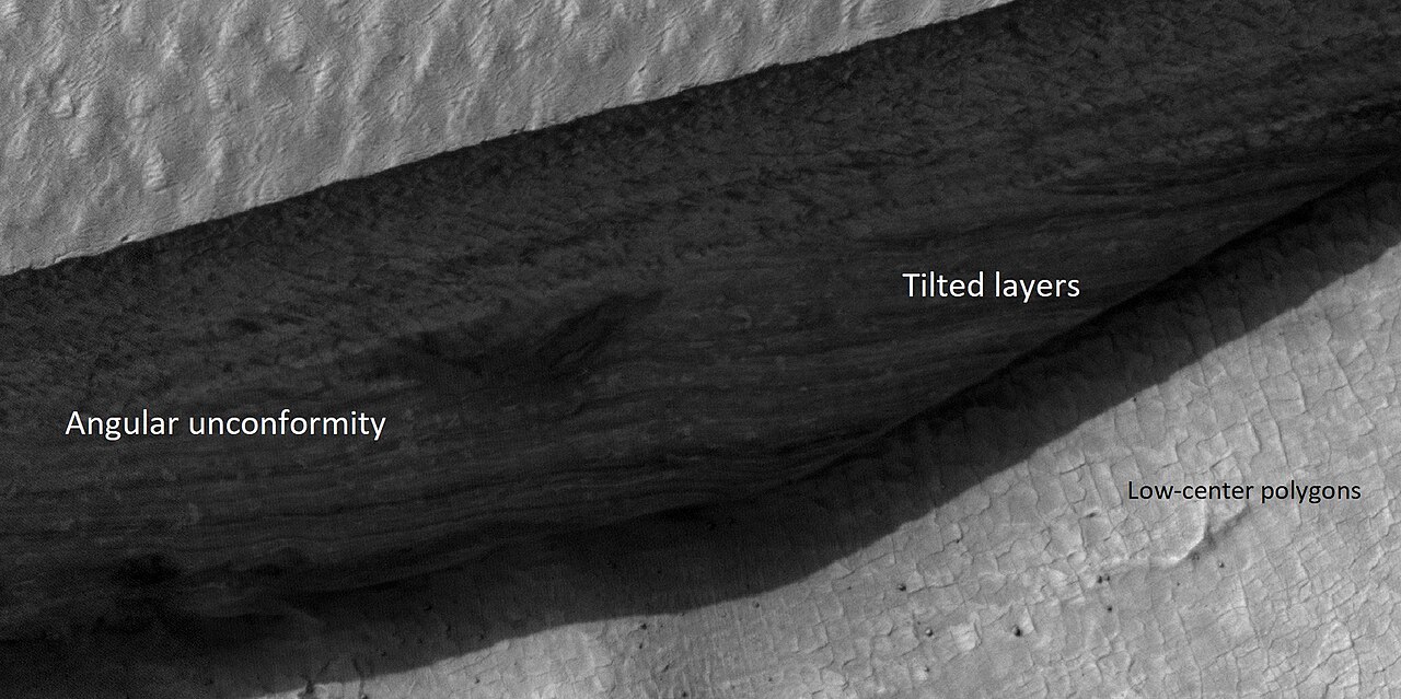
Besides being of great value to future explorers, these ice layers could help us better understand the climate history of Mars. They provide a record of the past. The large variations in the tilt of the planet cause dramatic climate variations. Mars does not possess a large moon to keep its tilt stable. Today, ice is concentrated at the poles, with a greater tilt, more ice will exist at mid-latitudes. These climate changes may be able to be measured with study of these layers.
These triangular depressions are similar to those in scalloped terrain. However scalloped terrain, displays a gentle equator-facing slope and is rounded.
Scalloped topography
Scalloped topography is common in the mid-latitudes of Mars, between 45° and 60° north and south. It is particularly prominent in the region of Utopia Planitia,[95][96] in the northern hemisphere, and in the region of Peneus and Amphitrites Paterae[97][98] in the southern hemisphere. Such topography consists of shallow, rimless depressions with scalloped edges, commonly referred to as "scalloped depressions" or simply "scallops". Scalloped depressions can be isolated or clustered and sometimes seem to coalesce. A typical scalloped depression displays a gentle equator-facing slope and a steeper pole-facing scarp.[99] Scalloped depressions are believed to form from the removal of subsurface material, possibly interstitial ice, by sublimation (direct transition of a material from the solid to the gas phase with no intermediate liquid stage). This process may still be happening at present.[100] This topography may be of great importance for future colonization of Mars because it may point to deposits of pure ice.[101]
-
![Stages in scalop formation, as seen by HiRISE. These formations probably form from the sublimation of ground rich in pure water ice many meters in depth.[102]](https://file.arabipedia.wiki/wikipedia/commons/thumb/d/d2/Scalop_formation.jpg/190px-Scalop_formation.jpg) Stages in scalop formation, as seen by HiRISE. These formations probably form from the sublimation of ground rich in pure water ice many meters in depth.[102]
Stages in scalop formation, as seen by HiRISE. These formations probably form from the sublimation of ground rich in pure water ice many meters in depth.[102] -
 Scalloped terrain, as seen by HiRISE under HIWish program. Dust devil tracks are also visible.
![Stages in scalop formation, as seen by HiRISE. These formations probably form from the sublimation of ground rich in pure water ice many meters in depth.[102]](https://file.arabipedia.wiki/wikipedia/commons/thumb/d/d2/Scalop_formation.jpg/1280px-Scalop_formation.jpg)

Pits
Some places on Mars display pits. It is believed that a void was created and material collapsed into the pits. These pits are probably most commonly formed when ice leaves the ground thereby creating a void. In the thin atmosphere of Mars, ice will sublimate, especially if a crack occurs. Sublimation is when a solid turns directly into a gas. Dry ice does this on the Earth. Some pits are associated with cracks in the surface.[103][104][105][106][107]
-
 Wide view of pits, as seen by HiRISE under HIWish program
 -
 Close view of pits, as seen by HiRISE under HIWish program. The box shows the size of the pits. Some pits are as wide as a football field is long.


-
 Wide view of pits and dust devil tracks, as seen by HiRISE under HiWish program
 -
 Close view of pits as seen by HiRISE under HiWish program. Box shows size of football field. Pits in image may be around 10–20 meters across.
 -
 Pits, as seen by HiRISE under HIWish program


Additional images
-
 Hellas quadrangle map showing two large river valleys that slope left, toward the floor of the crater
 -
 Field of hollows, as seen by HiRISE under HiWish program
 -
 Surface features, as seen by HiRISE under HiWish program
 -
 Hollows on floor of Reull Vallis, as seen by HiRISE under HiWish program
 -
 Banded or taffy-pull terrain in Hellas, as seen by Mars Global Surveyor. Origin is unknown at present.
 -
 Centauri Montes, as seen by HiRISE. Scale bar is 500 meters long. The original enlargement of the image at the left is full of rich detail on all parts of the picture.
 -
 Ausonia Mensa, as seen by MGS, under the MOC Public Targeting Program. This eroded mensa has many channels.
 -
Stages in scalop formation, as seen by HiRISE. These formations probably form from the sublimation of ground rich in pure water ice many meters in depth.[102]
-
 Possible dike and troughs, as seen by HiRISE under HiWish program The arrows point to the possible dike along the left edge of picture. Straight features are rare in nature; they are often due to dikes and joints.
 -
 Odd shapes, as seen by HiRISE under HiWish program. Part of this image is enlarged in next image.
 -
 Ridges forming from cracks, as seen by HiRISE under HiWish program. Box in upper left shows size of football field.
 -
 Dunes, as seen by HiRISE under HiWish program
 -
 Wide view of brain terrain, as seen by HiRISE under HiWish program
 -
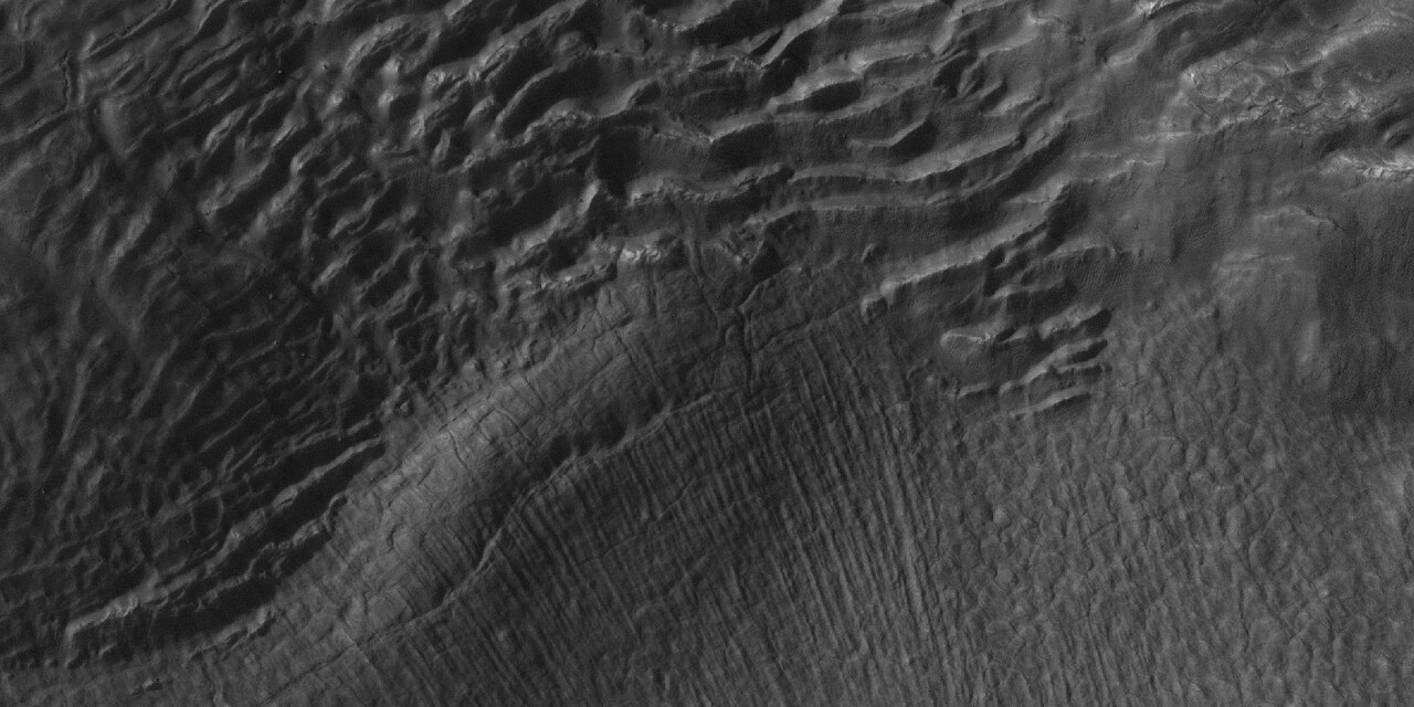
 Close, side view of brain terrain from previous image, as seen by HiRISE under HiWish program



-
 Out of place rock, as seen by HiRISE under HiWish program The arrow points to a large rock that is definitely out of place. It may be a meteorite or it may have been tossed here by a nearby impact.
 -
 Close view of out of place rock, as seen by HiRISE under HiWish program. It may be a meteorite or it may have been tossed here by a nearby impact.


Other Mars quadrangles
Interactive Mars map

 Interactive image map of the global topography of Mars. Hover your mouse over the image to see the names of over 60 prominent geographic features, and click to link to them. Coloring of the base map indicates relative elevations, based on data from the Mars Orbiter Laser Altimeter on NASA's Mars Global Surveyor. Whites and browns indicate the highest elevations (+12 to +8 km); followed by pinks and reds (+8 to +3 km); yellow is 0 km; greens and blues are lower elevations (down to −8 km). Axes are latitude and longitude; Polar regions are noted.
See also
- Brain terrain
- Climate of Mars
- Diapir
- Dust devil tracks
- Geology of Mars
- Glacier
- Glaciers on Mars
- HiRISE
- HiWish program
- Impact crater
- Latitude dependent mantle
- Lakes on Mars
- Lineated valley fill
- List of quadrangles on Mars
- Lobate debris apron
- Martian Gullies
- Ore resources on Mars
- Pedestal crater
- Phoenix (spacecraft)
- Polygonal patterned ground
- Scalloped topography
- Upper Plains Unit
- Vallis
- Water on Mars
References
- ^ Davies, M.E.; Batson, R.M.; Wu, S.S.C. (1992). "Geodesy and Cartography". In Kieffer, H.H.; Jakosky, B.M.; Snyder, C.W.; et al. (eds.). Mars. Tucson: University of Arizona Press. ISBN 978-0-8165-1257-7.
- ^ a b c d Carr, Michael H. (2006). The Surface of Mars. Cambridge University Press. p. [page needed]. ISBN 978-0-521-87201-0.
- ^ a b Moore, J; Wilhelms, Don E. (2001). "Hellas as a possible site of ancient ice-covered lakes on Mars". Icarus. 154 (2): 258–276. Bibcode:2001Icar..154..258M. doi:10.1006/icar.2001.6736. hdl:2060/20020050249. S2CID 122991710.
- ^ Cabrol, N. and E. Grim (eds). 2010. Lakes on Mars
- ^ a b c Martian Weather Observation Archived 2008-05-31 at the Wayback Machine MGS radio science measured 11.50 mbar at 34.4° S 59.6° E -7152 meters.
- ^ http://hirise.lpl.arizonai.edu/P/sP_008559_1405[permanent dead link]
- ^ Voelker, M., et al. 2016. DISTRIBUTION AND EVOLUTION OF LACUSTRINE AND FLUVIAL FEATURES IN HELLAS PLANITIA, MARS, BASED ON PRELIMINARY RESULTS OF GRID-MAPPING. 47th Lunar and Planetary Science Conference (2016) 1228.pdf.
- ^ Kargel, J.; Strom, R. (1991). "Terrestrial glacial eskers: analogs for martian sinuous ridges" (PDF). LPSC. XXII: 683–684. Bibcode:1991LPI....22..683K.
- ^ Head, JW; Neukum, G; Jaumann, R; Hiesinger, H; Hauber, E; Carr, M; Masson, P; Foing, B; et al. (2005). "Tropical to mid-latitude snow and ice accumulation, flow and glaciation on Mars". Nature. 434 (7031): 346–350. Bibcode:2005Natur.434..346H. doi:10.1038/nature03359. PMID 15772652. S2CID 4363630.
- ^ "Mars' climate in flux: Mid-latitude glaciers | Mars Today - Your Dail…". Archived from the original on 5 December 2012.
- ^ "Glaciers Reveal Martian Climate Has Been Recently Active".
- ^ Plaut, Jeffrey J.; Safaeinili, Ali; Holt, John W.; Phillips, Roger J.; Head, James W.; Seu, Roberto; Putzig, Nathaniel E.; Frigeri, Alessandro (2009). "Radar Evidence for Ice in Lobate Debris Aprons in the Mid-Northern Latitudes of Mars" (PDF). Geophysical Research Letters. 36 (2): n/a. Bibcode:2009GeoRL..36.2203P. doi:10.1029/2008GL036379. S2CID 17530607.
- ^ Holt, J.W.; Safaeinili, A.; Plaut, J. J.; Young, D. A.; Head, J. W.; Phillips, R. J.; Campbell, B. A.; Carter, L. M.; Gim, Y.; Seu, R.; Sharad Team (2008). "Radar Sounding Evidence for Ice within Lobate Debris Aprons near Hellas Basin, Mid-Southern Latitudes of Mars" (PDF). Lunar and Planetary Science. XXXIX (1391): 2441. Bibcode:2008LPI....39.2441H.
- ^ Holt, J. W.; Safaeinili, A.; Plaut, J. J.; Head, J. W.; Phillips, R. J.; Seu, R.; Kempf, S. D.; Choudhary, P.; et al. (2008). "Radar Sounding Evidence for Buried Glaciers in the Southern Mid-Latitudes of Mars". Science. 322 (5905): 1235–8. Bibcode:2008Sci...322.1235H. doi:10.1126/science.1164246. hdl:11573/67950. PMID 19023078. S2CID 36614186.
- ^ "Reull Vallis (Released 22 October 2002) | Mars Odyssey Mission THEMIS". Archived from the original on 2010-06-17. Retrieved 2010-12-19.
- ^ MLA NASA/Jet Propulsion Laboratory (December 18, 2003). "Mars May Be Emerging From An Ice Age". ScienceDaily. Retrieved February 19, 2009.
- ^ Carr, M. 2001.
- ^ Blanc, E., et al. 2024. ORIGIN OF WIDESPREAD LAYERED DEPOSITS ASSOCIATED WITH MARTIAN DEBRIS COVERED GLACIERS. 55th LPSC (2024). 1466.pdf
- ^ Morgenstern, A., et al. 2007
- ^ a b Baker, D., J. Head. 2015. Extensive Middle Amazonian mantling of debris aprons and plains in Deuteronilus Mensae, Mars: Implication for the record of mid-latitude glaciation. Icarus: 260, 269-288.
- ^ Mangold, N (2003). "Geomorphic analysis of lobate debris aprons on Mars at Mars Orbiter Camera scale: Evidence for ice sublimation initiated by fractures". J. Geophys. Res. 108 (E4): 8021. Bibcode:2003JGRE..108.8021M. doi:10.1029/2002je001885.
- ^ Levy, J. et al. 2009. Concentric
- ^ Bright Chunks at Phoenix Lander's Mars Site Must Have Been Ice Archived 2016-03-04 at the Wayback Machine – Official NASA press release (19.06.2008)
- ^ a b "NASA.gov". Archived from the original on 2016-03-04. Retrieved 2015-08-31.
- ^ Byrne, S. et al. 2009. Distribution of Mid-Latitude Ground Ice on Mars from New Impact Craters: 329.1674-1676
- ^ Smith, P., et al. 2009. H2O at the Phoenix Landing Site. Science: 325, 58-61.
- ^ Head, J. et al. 2003.
- ^ Madeleine, et al. 2014.
- ^ Schon; et al. (2009). "A recent ice age on Mars: Evidence for climate oscillations from regional layering in mid-latitude mantling deposits". Geophys. Res. Lett. 36 (15): L15202. Bibcode:2009GeoRL..3615202S. doi:10.1029/2009gl038554.
- ^ Touma, J.; Wisdom, J. (1993). "The Chaotic Obliquity of Mars". Science. 259 (5099): 1294–1297. Bibcode:1993Sci...259.1294T. doi:10.1126/science.259.5099.1294. PMID 17732249. S2CID 42933021.
- ^ a b Laskar, J.; Correia, A.; Gastineau, M.; Joutel, F.; Levrard, B.; Robutel, P. (2004). "Long term evolution and chaotic diffusion of the insolation quantities of Mars" (PDF). Icarus. 170 (2): 343–364. Bibcode:2004Icar..170..343L. doi:10.1016/j.icarus.2004.04.005. S2CID 33657806.
- ^ Levy, J.; Head, J.; Marchant, D.; Kowalewski, D. (2008). "Identification of sublimation-type thermal contraction crack polygons at the proposed NASA Phoenix landing site: Implications for substrate properties and climate-driven morphological evolution". Geophys. Res. Lett. 35 (4): L04202. Bibcode:2008GeoRL..35.4202L. doi:10.1029/2007GL032813. S2CID 1321019.
- ^ Levy, J.; Head, J.; Marchant, D. (2009). "Thermal contraction crack polygons on Mars: Classification, distribution, and climate implications from HiRISE observations". J. Geophys. Res. 114 (E1): E01007. Bibcode:2009JGRE..114.1007L. doi:10.1029/2008JE003273.
- ^ Hauber, E., D. Reiss, M. Ulrich, F. Preusker, F. Trauthan, M. Zanetti, H. Hiesinger, R. Jaumann, L. Johansson, A. Johnsson, S. Van Gaselt, M. Olvmo. 2011. Landscape evolution in Martian mid-latitude regions: insights from analogous periglacial landforms in Svalbard. In: Balme, M., A. Bargery, C. Gallagher, S. Guta (eds). Martian Geomorphology. Geological Society, London. Special Publications: 356. 111-131
- ^ Mellon, M.; Jakosky, B. (1995). "The distribution and behavior of Martian ground ice during past and present epochs". J. Geophys. Res. 100 (E6): 11781–11799. Bibcode:1995JGR...10011781M. doi:10.1029/95je01027. S2CID 129106439.
- ^ Schorghofer, N (2007). "Dynamics of ice ages on Mars". Nature. 449 (7159): 192–194. Bibcode:2007Natur.449..192S. doi:10.1038/nature06082. PMID 17851518. S2CID 4415456.
- ^ Madeleine, J., F. Forget, J. Head, B. Levrard, F. Montmessin. 2007. Exploring the northern mid-latitude glaciation with a general circulation model. In: Seventh International Conference on Mars. Abstract 3096.
- ^ "Dao Vallis | Mars Odyssey Mission THEMIS".
- ^ NASA.gov
- ^ "Mars Exploration: Features". Archived from the original on 2011-10-28. Retrieved 2012-01-19.
- ^ Reiss, D.; et al. (2011). "Multitemporal observations of identical active dust devils on Mars with High Resolution Stereo Camera (HRSC) and Mars Orbiter Camera (MOC)". Icarus. 215 (1): 358–369. Bibcode:2011Icar..215..358R. doi:10.1016/j.icarus.2011.06.011.
- ^ "How tall is a tornado?". 23 February 2023.
- ^ Malin, M. C.; Edgett, K. S.; Posiolova, L. V.; McColley, S. M.; Dobrea, E. Z. N. (2006). "Present-Day Impact Cratering Rate and Contemporary Gully Activity on Mars". Science. 314 (5805): 1573–1577. Bibcode:2006Sci...314.1573M. doi:10.1126/science.1135156. PMID 17158321. S2CID 39225477.
- ^ McEwen, AS; Hansen, CJ; Delamere, WA; Eliason, EM; Herkenhoff, KE; Keszthelyi, L; Gulick, VC; Kirk, RL; et al. (2007). "A Closer Look at Water-Related Geologic Activity on Mars". Science. 317 (5845): 1706–1709. Bibcode:2007Sci...317.1706M. doi:10.1126/science.1143987. PMID 17885125. S2CID 44822691.
- ^ "Stones, Wind, and Ice: A Guide to Martian Impact Craters".
- ^ Kieffer, Hugh H. (1992). Mars. Tucson: University of Arizona Press. pp. [, page needed], . ISBN 0-8165-1257-4.
- ^ S.J. Kadish, J.W. Head. 2011. Impacts into non-polar ice-rich paleodeposits on Mars: excess ejecta craters, perched craters and pedestal craters as clues to Amazonian climate history. Icarus, 215, pp. 34-46
- ^ S.J. Kadish, J.W. Head. 2014. The ages of pedestal craters on Mars: evidence for a late Amazonian extended periodic emplacement of decameters-thick mid-latitude ice deposits. Planet. Space Sci., 91, pp. 91-100
- ^ a b "The Surface of Mars" Series: Cambridge Planetary Science (No. 6) ISBN 978-0-511-26688-1 Michael H. Carr, United States Geological Survey, Menlo Park
- ^ Hugh H. Kieffer (1992). Mars. University of Arizona Press. ISBN 978-0-8165-1257-7. Retrieved March 7, 2011.
- ^ Milliken, R. E.; Mustard, J. F.; Goldsby, D. L. (2003). "Viscous flow features on the surface of Mars: Observations from high-resolution Mars Orbiter Camera (MOC) images". Journal of Geophysical Research. 108 (E6): 5057. Bibcode:2003JGRE..108.5057M. doi:10.1029/2002je002005. S2CID 12628857.
- ^ Squyres, S.W.; Carr, M.H. (1986). "Geomorphic evidence for the distribution of ground ice on Mars". Science. 213 (4735): 249–253. Bibcode:1986Sci...231..249S. doi:10.1126/science.231.4735.249. PMID 17769645. S2CID 34239136.
- ^ Head, J.W.; Marchant, D.R.; Dickson, J.L.; Kress, A.M. (2010). "Criteria for the recognition of debris-covered glacier and valley glacier landsystem deposits". Earth Planet. Sci. Lett. 294 (3–4): 306–320. Bibcode:2010E&PSL.294..306H. doi:10.1016/j.epsl.2009.06.041.
- ^ Holt, J.W.; et al. (2008). "Radar sounding evidence for buried glaciers in the southern mid-latitudes of Mars". Science. 322 (5905): 1235–1238. Bibcode:2008Sci...322.1235H. doi:10.1126/science.1164246. hdl:11573/67950. PMID 19023078. S2CID 36614186.
- ^ Morgan, G.A.; Head, J.W.; Marchant, D.R. (2009). "Lineated valley fill (LVF) and lobate debris aprons (LDA) in the Deuteronilus Mensae northern dichotomy boundary region, Mars: Constraints on the extent, age and episodicity of Amazonian glacial events". Icarus. 202 (1): 22–38. Bibcode:2009Icar..202...22M. doi:10.1016/j.icarus.2009.02.017.
- ^ Plaut, J.J.; Safaeinili, A.; Holt, J.W.; Phillips, R.J.; Head, J.W.; Sue, R.; Putzig, A. (2009). "Frigeri Radar evidence for ice in lobate debris aprons in the mid-northern latitudes of Mars". Geophys. Res. Lett. 36 (2): L02203. Bibcode:2009GeoRL..36.2203P. doi:10.1029/2008gl036379. S2CID 17530607.
- ^ Baker, D.M.H.; Head, J.W.; Marchant, D.R. (2010). "Flow patterns of lobate debris aprons and lineated valley fill north of Ismeniae Fossae, Mars: Evidence for extensive mid-latitude glaciation in the Late Amazonian". Icarus. 207 (1): 186–209. Bibcode:2010Icar..207..186B. doi:10.1016/j.icarus.2009.11.017.
- ^ Arfstrom, J. (2005). "Terrestrial analogs and interrelationships". Icarus. 174 (2): 321–335. Bibcode:2005Icar..174..321A. doi:10.1016/j.icarus.2004.05.026.
- ^ Forget, F., et al. 2006. Formation of Glaciers on Mars by Atmospheric Precipitation at High Obliquity. Science: 311, 368-371.
- ^ Baker, V.; et al. (2015). "Fluvial geomorphology on Earth-like planetary surfaces: a review". Geomorphology. 245: 149–182. Bibcode:2015Geomo.245..149B. doi:10.1016/j.geomorph.2015.05.002. PMC 5701759. PMID 29176917.
- ^ Carr, M. 1996. in Water on Mars. Oxford Univ. Press.
- ^ Baker, V. 1982. The Channels of Mars. Univ. of Tex. Press, Austin, TX
- ^ Baker, V.; Strom, R.; Gulick, V.; Kargel, J.; Komatsu, G.; Kale, V. (1991). "Ancient oceans, ice sheets and the hydrological cycle on Mars". Nature. 352 (6336): 589–594. Bibcode:1991Natur.352..589B. doi:10.1038/352589a0. S2CID 4321529.
- ^ Carr, M (1979). "Formation of Martian flood features by release of water from confined aquifers". J. Geophys. Res. 84: 2995–300. Bibcode:1979JGR....84.2995C. doi:10.1029/jb084ib06p02995.
- ^ Komar, P (1979). "Comparisons of the hydraulics of water flows in Martian outflow channels with flows of similar scale on Earth". Icarus. 37 (1): 156–181. Bibcode:1979Icar...37..156K. doi:10.1016/0019-1035(79)90123-4.
- ^ "How Much Water Was Needed to Carve Valleys on Mars? - SpaceRef". 5 June 2017.[permanent dead link]
- ^ Luo, W.; et al. (2017). "New Martian valley network volume estimate consistent with ancient ocean and warm and wet climate". Nature Communications. 8: 15766. Bibcode:2017NatCo...815766L. doi:10.1038/ncomms15766. PMC 5465386. PMID 28580943.
- ^ "HiRISE | High Resolution Imaging Science Experiment". Hirise.lpl.arizona.edu?psp_008437_1750. Retrieved 2012-08-04.
- ^ Grotzinger, J. and R. Milliken (eds.). 2012. Sedimentary Geology of Mars. SEPM.
- ^ a b Bernhardt, H.; et al. (2016). "The honeycomb terrain on the Hellas basin floor, mars: a case for salt or ice diapirism: hellas honeycombs as salt/ice diapirs". J. Geophys. Res. 121 (4): 714–738. Bibcode:2016JGRE..121..714B. doi:10.1002/2016je005007.
- ^ "HiRISE | to Great Depths (ESP_049330_1425)".
- ^ Weiss, D., J. Head. 2017. HYDROLOGY OF THE HELLAS BASIN AND THE EARLY MARS CLIMATE: WAS THE HONEYCOMB TERRAIN FORMED BY SALT OR ICE DIAPIRISM? Lunar and Planetary Science XLVIII. 1060.pdf
- ^ Weiss, D.; Head, J. (2017). "Salt or ice diapirism origin for the honeycomb terrain in Hellas basin, Mars?: Implications for the early martian climate". Icarus. 284: 249–263. Bibcode:2017Icar..284..249W. doi:10.1016/j.icarus.2016.11.016.
- ^ Cassini Imaging Central Laboratory for Operations, Enceladus Rev 80 Flyby: Aug 11 '08 Archived 2016-03-03 at the Wayback Machine. Retrieved 2008-08-15.
- ^ Edgett, K.; Malin, M. C.; Williams, R. M. E.; Davis, S. D. (2003). "Polar-and middle-latitude martian gullies: A view from MGS MOC after 2 Mars years in the mapping orbit" (PDF). Lunar Planet. Sci. 34. p. 1038, Abstract 1038. Bibcode:2003LPI....34.1038E.
- ^ Dickson, J; Head, J; Kreslavsky, M (2007). "Martian gullies in the southern mid-latitudes of Mars: Evidence for climate-controlled formation of young fluvial features based upon local and global topography" (PDF). Icarus. 188 (2): 315–323. Bibcode:2007Icar..188..315D. doi:10.1016/j.icarus.2006.11.020. Archived from the original (PDF) on 2017-07-06. Retrieved 2017-06-30.
- ^ NASA.gov
- ^ "HiRISE | Activity in Martian Gullies (ESP_032078_1420)".
- ^ "Gullies on Mars Carved by Dry Ice, Not Water". Space.com. 16 July 2014.
- ^ "Frosty Gullies on Mars - SpaceRef". 2 August 2014.[permanent dead link]
- ^ http://www.diss.fu-berlin.de/diss/servlets/MCRFileNodeSe[permanent dead link] rvlet/FUDISS_derivate_000000003198/16_ColdClimateLandforms-13-utopia.pdf?hosts=
- ^ Kostama, V.-P.; Kreslavsky, M.; Head, J. (2006). "Recent high-latitude icy mantle in the northern plains of Mars: Characteristics and ages of emplacement". Geophys. Res. Lett. 33 (11): L11201. Bibcode:2006GeoRL..3311201K. doi:10.1029/2006GL025946. S2CID 17229252.
- ^ Malin, M.; Edgett, K. (2001). "Mars Global Surveyor Mars Orbiter Camera: Interplanetary cruise through primary mission". J. Geophys. Res. 106 (E10): 23429–23540. Bibcode:2001JGR...10623429M. doi:10.1029/2000je001455.
- ^ Milliken, R.; et al. (2003). "Viscous flow features on the surface of Mars: Observations from high-resolution Mars Orbiter Camera (MOC) images". J. Geophys. Res. 108 (E6): 5057. Bibcode:2003JGRE..108.5057M. doi:10.1029/2002JE002005. S2CID 12628857.
- ^ Mangold, N (2005). "High latitude patterned grounds on Mars: Classification, distribution and climatic control". Icarus. 174 (2): 336–359. Bibcode:2005Icar..174..336M. doi:10.1016/j.icarus.2004.07.030.
- ^ Kreslavsky, M.; Head, J. (2000). "Kilometer-scale roughness on Mars: Results from MOLA data analysis". J. Geophys. Res. 105 (E11): 26695–26712. Bibcode:2000JGR...10526695K. doi:10.1029/2000je001259.
- ^ Seibert, N.; Kargel, J. (2001). "Small-scale martian polygonal terrain: Implications for liquid surface water". Geophys. Res. Lett. 28 (5): 899–902. Bibcode:2001GeoRL..28..899S. doi:10.1029/2000gl012093. S2CID 129590052.
- ^ Dundas, E., et al. 2018. Exposed subsurface ice sheets in the martian mid-latitudes. Science. 359. 199.
- ^ Steep Slopes on Mars Reveal Structure of Buried Ice. NASA Press Release. 11 January 2018.
- ^ Ice cliffs spotted on Mars. Science News. Paul Voosen. 11 January 2018.
- ^ "Exposed subsurface ice sheets in the Martian mid-latitudes". 13 January 2018.
- ^ "Steep Slopes on Mars Reveal Structure of Buried Ice - SpaceRef". 11 January 2018.[permanent dead link]
- ^ Dundas, Colin M.; et al. (2018). "Exposed subsurface ice sheets in the Martian mid-latitudes". Science. 359 (6372): 199–201. Bibcode:2018Sci...359..199D. doi:10.1126/science.aao1619. PMID 29326269.
- ^ a b c d Supplementary Materials Exposed subsurface ice sheets in the Martian mid-latitudes Colin M. Dundas, Ali M. Bramson, Lujendra Ojha, James J. Wray, Michael T. Mellon, Shane Byrne, Alfred S. McEwen, Nathaniel E. Putzig, Donna Viola, Sarah Sutton, Erin Clark, John W. Holt
- ^ Lefort, A.; Russell, P.; Thomas, N.; McEwen, A.S.; Dundas, C.M.; Kirk, R.L. (2009). "HiRISE observations of periglacial landforms in Utopia Planitia". Journal of Geophysical Research. 114 (E4): E04005. Bibcode:2009JGRE..114.4005L. doi:10.1029/2008JE003264. S2CID 129442086.
- ^ Morgenstern, A; Hauber, E; Reiss, D; van Gasselt, S; Grosse, G; Schirrmeister, L (2007). "Deposition and degradation of a volatile-rich layer in Utopia Planitia, and implications for climate history on Mars" (PDF). Journal of Geophysical Research: Planets. 112 (E6): E06010. Bibcode:2007JGRE..112.6010M. doi:10.1029/2006je002869.
- ^ Lefort, A.; Russell, P.; Thomas, N. (2009). "Scalloped terrains in the Peneus and Amphitrites Paterae region of Mars as observed by HiRISE". Icarus. 205 (1): 259–268. Bibcode:2010Icar..205..259L. doi:10.1016/j.icarus.2009.06.005.
- ^ Zanetti, M., Hiesinger,H., Reiss, D., Hauber, E. and Neukum, G. (2009), "Scalloped Depression Development on Malea Planum and the Southern Wall of the Hellas Basin, Mars", 40th Lunar and Planetary Science Conference, abstract 2178
- ^ "HiRISE | Pitted Landforms in Southern Hellas Planitia (ESP_038821_1235)".
- ^ "Scalloped Topography in Peneus Patera Crater". HiRISE Operations Center. 2007-02-28. Archived from the original on 2016-10-01. Retrieved 2014-11-24.
- ^ Dundas, C.; Bryrne, S.; McEwen, A. (2015). "Modeling the development of martian sublimation thermokarst landforms". Icarus. 262: 154–169. Bibcode:2015Icar..262..154D. doi:10.1016/j.icarus.2015.07.033.
- ^ a b Dundas, C., S. Bryrne, A. McEwen. 2015. Modeling the development of martian sublimation thermokarst landforms. Icarus: 262, 154-169.
- ^ Mangold, N. 2010. Ice sublimation as a geomorphic process: A planetary perspective. Geomorphology: 126, 1-17.
- ^ Sulci Collapse Pits | Mars Odyssey Mission THEMIS
- ^ Vamshi, G. T.; Martha, T. R.; Vinod Kumar, K. (28 November 2014). "Origin of collapsed pits and branched valleys surrounding the Ius chasma on Mars" (PDF). The International Archives of the Photogrammetry, Remote Sensing and Spatial Information Sciences. XL-8: 485–491. Bibcode:2014ISPAr.XL8..485V. doi:10.5194/isprsarchives-XL-8-485-2014. Retrieved 17 November 2022.
- ^ Vamshi, G., et al. 2014. Origin of collapsed pits and branched valleys surrounding the Ius chasma on Mars. ISPRS Technical Commission VIII Symposium
- ^ "HiRISE | Pits, Cracks, and Polygons in Western Utopia Planitia (PSP_002202_2250)".
- ^ Morton, Oliver (2002). Mapping Mars: Science, Imagination, and the Birth of a World. New York: Picador USA. p. 98. ISBN 0-312-24551-3.
- ^ "Online Atlas of Mars". Ralphaeschliman.com. Retrieved December 16, 2012.
- ^ "PIA03467: The MGS MOC Wide Angle Map of Mars". Photojournal. NASA / Jet Propulsion Laboratory. February 16, 2002. Retrieved December 16, 2012.
External links

- Lakes on Mars - Nathalie Cabrol (SETI Talks)
- Martian Ice - Jim Secosky - 16th Annual International Mars Society Convention
- T. Gordon Wasilewski - Water on Mars - 20th Annual International Mars Society Convention Describes how to get water from ice in the ground
| Geography | |||||||||||
|---|---|---|---|---|---|---|---|---|---|---|---|
| Astronomy |
| ||||||||||
| Exploration |
| ||||||||||
| متعلق ب | |||||||||||
| |||||||||||