
Arcus cloud
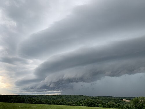
An arcus cloud is a low, horizontal cloud formation, usually appearing as an accessory cloud to a cumulonimbus. Roll clouds and shelf clouds are the two main types of arcus clouds. They most frequently form along the leading edge or gust fronts of thunderstorms; some of the most dramatic arcus formations mark the gust fronts of derecho-producing convective systems. Roll clouds may also arise in the absence of thunderstorms, forming along the shallow cold air currents of some sea breeze boundaries and cold fronts.
Types
Shelf cloud
A shelf cloud is a low, horizontal, wedge-shaped arcus cloud attached to the base of the parent cloud, which is usually a thunderstorm cumulonimbus, but could form on any type of convective clouds. Rising air motion can often be seen in the leading (outer) part of the shelf cloud, while the underside can often appear as turbulent and wind-torn. Cool, sinking air from a storm cloud's downdraft spreads out across the land surface, with the leading edge called a gust front. This outflow cuts under warm air being drawn into the storm's updraft. As the lower and cooler air lifts the warm moist air, its water condenses, creating a cloud which often rolls with the different winds above and below (wind shear).
People seeing a shelf cloud may believe they have seen a wall cloud. This is likely to be a mistake, since an approaching shelf cloud appears to form a wall made of cloud. Shelf clouds usually appear on the leading edge of a storm, while wall clouds are usually at the rear of the storm.
A sharp, strong gust front will cause the lowest part of the leading edge of a shelf cloud to be ragged and lined with rising fractus clouds. In a severe case there will be vortices along the edge, with twisting masses of scud that may reach to the ground or be accompanied by rising dust. A very low shelf cloud accompanied by these signs is the best indicator that a potentially violent wind squall is approaching. An extreme example of this phenomenon looks almost like a tornado and is known as a gustnado.[1]
 Underside of a weak shelf cloud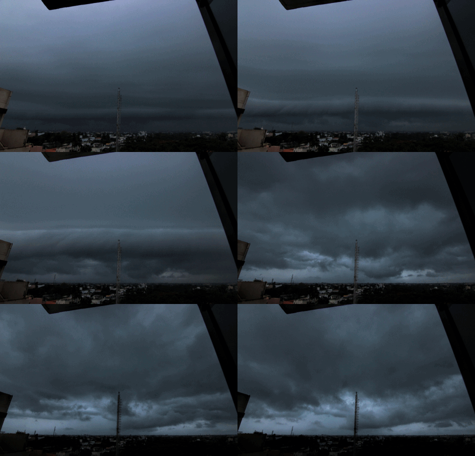
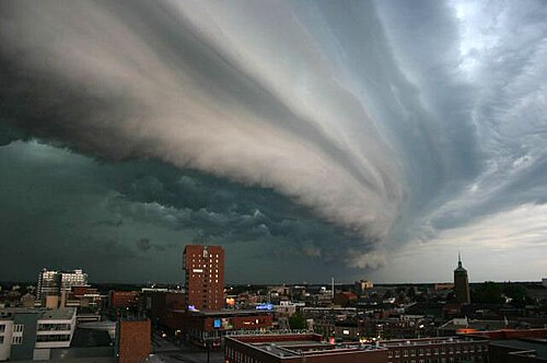 سحابة الرف فوق انشيده ، هولندا
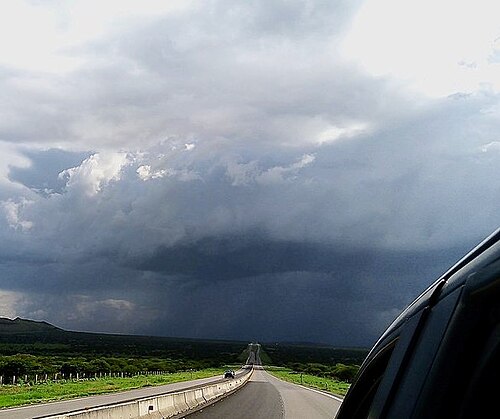 سحابة جرفية في دورانجو، المكسيك
سحابة دوارة
السحابة الأسطوانية ( اسمها في أطلس السحب volutus ) هي نوع منخفض، أفقي، أنبوبي الشكل، ونادر نسبيًا من السحب القوسية. تختلف عن السحب الرفية بكونها منفصلة تمامًا عن باقي السحب. عادةً ما تبدو السحب الأسطوانية وكأنها "تتدحرج" حول محور أفقي. وهي عبارة عن موجة منفردة تُسمى السوليتون ، وهي موجة ذات قمة واحدة وتتحرك دون تغيير في سرعتها أو شكلها. ويعود هذا التدحرج إلى اختلاف سرعة واتجاه الرياح مع الارتفاع ( قص الرياح ). [ 2 ]
من أشهر الظواهر الجوية المتكررة سحابة مجد الصباح في كوينزلاند ، أستراليا ، والتي قد تظهر حتى أربعة أيام من أصل عشرة أيام في شهر أكتوبر. [ 3 ] أحد الأسباب الرئيسية لظهور سحابة مجد الصباح هو الدوران المتوسط النطاق المصاحب لنسيم البحر الذي يتشكل فوق شبه جزيرة كيب يورك وخليج كاربنتاريا . وقد شوهدت هذه السحب الساحلية في العديد من الأماكن، بما في ذلك كاليفورنيا ، والقناة الإنجليزية ، وجزر شتلاند ، وساحل بحر الشمال، والمناطق الساحلية لأستراليا، ونوم في ألاسكا.
مع ذلك، يمكن أن تتشكل ظواهر مشابهة بفعل التيارات الهوائية الهابطة الناتجة عن العواصف الرعدية أو الجبهات الباردة المتقدمة، ولا تقتصر هذه الظواهر على المناطق الساحلية فقط. [ 2 ] وقد تم الإبلاغ عنها في مواقع مختلفة داخل البلاد، بما في ذلك ولاية كانساس . [ 4 ]
لم يتم ربط السحب الأسطوانية بالسحب القمعية أو الأعاصير ، لأنها عبارة عن دوامة أفقية. [ 2 ]
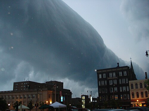 سحابة أسطوانية مصاحبة لعاصفة رعدية شديدة فوق راسين، ويسكونسن ، الولايات المتحدة الأمريكية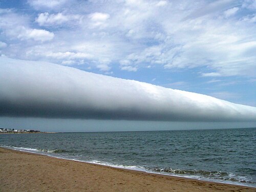
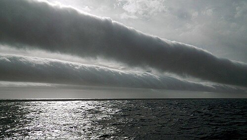
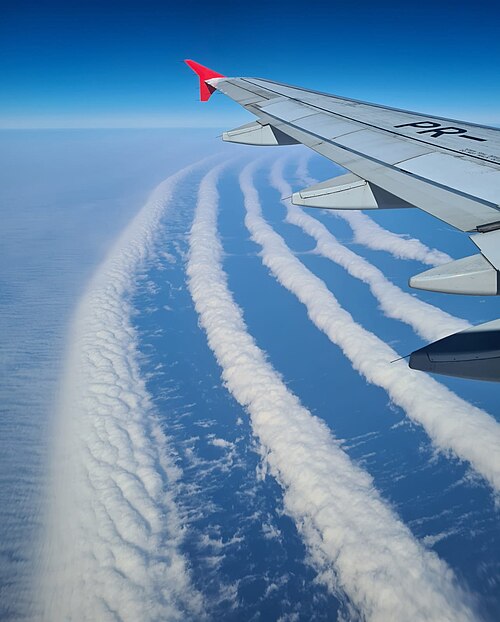 تتشكل السحب فوق جنوب البرازيل
انظر أيضاً
مراجع
- ↑Meteorological Service of Canada (December 19, 2002). "Gust fronts and wind squalls". Severe Weather Watcher Handbook. Environment Canada. Archived from the original on June 23, 2006. Retrieved 2008-06-22.
- 123Dan Bush (January 17, 2006). "Astronomy Picture of the Day Archive". NASA. Retrieved June 1, 2014..
- ↑Clarke, R. H.; Smith, R. K.; Reid, D. G. (1981). "The Morning Glory of the Gulf of Carpentaria: An Atmospheric Undular Bore". Mon. Wea. Rev. 109 (8): 1726–1750. Bibcode:1981MWRv..109.1726C. doi:10.1175/1520-0493(1981)109<1726:TMGOTG>2.0.CO;2.
- ↑"Roll clouds slide over Wichita". ktvb.com. 28 April 2020. Retrieved 2023-07-24.
- ↑Sutherland, Scott (March 23, 2017). "Cloud Atlas joins the digital age while adding a dozen new cloud types". The Weather Network. Pelmorex Media. Retrieved 13 August 2025.
External links
- Meteorological Service of Canada (May 14, 1999). "Spotter training : Identifying Clouds". Environment Canada. Archived from the original on July 15, 2013. Retrieved 2010-10-07.
- "Stunning shelf cloud captured in Dorset before storm hit". BBC News. 6 September 2022. Retrieved 10 September 2022.
- Cumulus
- Accessory clouds