
Philadelphia and Lancaster Turnpike
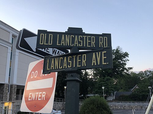
The Philadelphia and Lancaster Turnpike, first used in 1795, is the first long-distance paved road built in the United States, according to engineered plans and specifications.[3] It links Lancaster, Pennsylvania, and Philadelphia at 34th Street, stretching for sixty-two miles. It was later extended by the Lancaster and Susquehanna Turnpike to the Susquehanna River in Columbia.[4] The route is now designated Pennsylvania Route 462 from the western terminus to US 30 just southeast of Lancaster, at which point US 30 (and US 30 Business in Chester County) follows the route to Philadelphia, with this stretch of the roadway commonly known as Lancaster Avenue or Lancaster Pike. The US 30 portion ends at Girard Avenue in the Parkside neighborhood of Philadelphia, where State Route 3012 is designated on the road to Belmont Avenue. At Belmont Avenue, the road changes designation to State Route 3005 and runs to the eastern terminus at 34th Street. Historically, Lancaster Pike terminated at Market Street before Drexel University took over the stretch between 32nd and 34th Streets and turned the road into a pedestrian walkway known as Lancaster Walk.[5]

It was the first turnpike of importance, and because the Commonwealth of Pennsylvania could not afford to pay for its construction, it was privately built by the Philadelphia and Lancaster Turnpike Road Company, making it an early example of a public-private partnership for American infrastructure.[6][7] Credited as the country's first engineered road, its ground was broken in 1792.[8] By the 1840s, the use of railroads and canals dealt a serious blow to the companies who specialized in the manufacture of wagons and coaches. During the next fifty years, the road suffered from lack of use and maintenance, but later saw recovery with the invention of the automobile.

In 1876, the parallel Pennsylvania Railroad bought the turnpike from 52nd Street in Philadelphia west to Paoli for $20,000 (equal to $604,688 today) to prevent competing streetcar companies from building along it. In 1913, the turnpike became part of the transcontinental Lincoln Highway, and tolls continued to be collected until 1917, when the State Highway Department bought it for $165,000, equal to $4,146,429 today.[9] In 1926 it was designated as part of U.S. Route 30 along with the rest of the original United States Numbered Highways.
Major intersections
| County | Location | mi[1] | km | Destinations | Notes | |||
|---|---|---|---|---|---|---|---|---|
| Lancaster | Columbia | 0.00 | 0.00 |   PA 462 west (Chestnut Street) – Wrightsville PA 462 west (Chestnut Street) – Wrightsville | Continuation west into Wrightsville on the Columbia-Wrightsville Bridge | |||
  North 3rd Street to PA 441 – Washington Boro, Marietta North 3rd Street to PA 441 – Washington Boro, Marietta | ||||||||
| Lancaster Township | 7.73 | 12.44 |  PA 741 (Rorherstown Road / Millersville Road) – East Petersburg, New Danville PA 741 (Rorherstown Road / Millersville Road) – East Petersburg, New Danville | |||||
| Lancaster | 9.76 | 15.71 |  PA 23 west (College Avenue) PA 23 west (College Avenue) | West end of PA 23 westbound overlap | ||||
| 10.48 | 16.87 |  PA 999 west (Manor Street) PA 999 west (Manor Street) | Eastern terminus of PA 999; eastbound access only | |||||
| 10.74 | 17.28 |  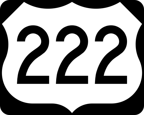 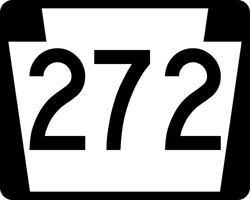 US 222 south / PA 272 south (Prince Street) US 222 south / PA 272 south (Prince Street) | Southbound one-way pair of US 222/PA 272 | |||||
| 10.86 | 17.48 |   PA 72 north (Queen Street) PA 72 north (Queen Street) | Northbound one-way PA 72 | |||||
| 11.10 | 17.86 | US 222 south / PA 272 north (Lime Street) | Northbound one-way pair of US 222/PA 272 | |||||
| 11.84 | 19.05 |  PA 23 east (Broad Street) PA 23 east (Broad Street) | East end of PA 23 westbound overlap | |||||
| 12.74 | 20.50 |  PA 340 east (Old Philadelphia Pike) PA 340 east (Old Philadelphia Pike) | Western terminus of PA 340 | |||||
| East Lampeter Township | 14.54 | 23.40 |   US 30 west to PA 283 west – York, Harrisburg US 30 west to PA 283 west – York, Harrisburg PA 462 ends PA 462 ends | Interchange; eastern terminus of PA 462; west end of US 30 overlap | ||||
| Ronks | 17.03 | 27.41 |  PA 896 (Eastbrook Road / Hartman Bridge Road) – Strasburg PA 896 (Eastbrook Road / Hartman Bridge Road) – Strasburg | |||||
| Gap | 25.92 | 41.71 | 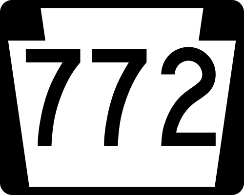 PA 772 west (Newport Road) PA 772 west (Newport Road) | Eastern terminus of PA 772 | ||||
| 26.32 | 42.36 | 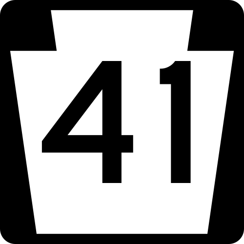 PA 41 south (Gap–Newport Pike) – Wilmington, DE PA 41 south (Gap–Newport Pike) – Wilmington, DE | Northern terminus of PA 41 | |||||
| 26.66 | 42.91 | 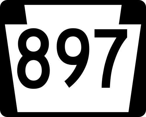 PA 897 north (White Horse Road) PA 897 north (White Horse Road) | Southern terminus of PA 897 | |||||
| Chester | West Sadsbury Township | 31.10 | 50.05 |  PA 10 (Octorara Trail) – Honey Brook, Parkesburg PA 10 (Octorara Trail) – Honey Brook, Parkesburg | ||||
| 31.50 | 50.69 | US 30 east (Coatesville–Downingtown Bypass) – Coatesville, Downingtown  US 30 Bus. begins US 30 Bus. begins | Interchange; eastbound exit and westbound entrance; east end of US 30 overlap; western terminus of US 30 Bus. | |||||
| Coatesville | 36.59 | 58.89 |  PA 82 south (Strode Avenue) PA 82 south (Strode Avenue) | West end of PA 82 overlap | ||||
| 37.00 | 59.55 | PA 82 north (North 1st Avenue) to US 30 | East end of PA 82 overlap | |||||
| Thorndale | 41.24 | 66.37 | PA 340 west (Bondsville Road) – Wagontown | Eastern terminus of PA 340 | ||||
| Downingtown | 43.48 | 69.97 |  US 322 west (Manor Avenue) to US 30 US 322 west (Manor Avenue) to US 30 | West end of US 322 overlap | ||||
| 43.66 | 70.26 | US 322 east (Brandywine Avenue) – West Chester US 322 Truck begins US 322 Truck begins | East end of US 322 overlap; west end of US 322 Truck overlap | |||||
| 43.80 | 70.49 |  PA 282 west (Green Street) PA 282 west (Green Street) | Eastern terminus of PA 282 | |||||
| 44.18 | 71.10 |    PA 113 north (West Uwchlan Avenue) to Penna Turnpike PA 113 north (West Uwchlan Avenue) to Penna Turnpike | Southern terminus of PA 113 | |||||
| East Caln Township | 45.26 | 72.84 | Quarry Road (US 322 Truck east) to US 30 east – King of Prussia | Eastern end of US 322 Truck concurrency | ||||
| 45.41 | 73.08 | US 30 west (Coatesville–Downingtown Bypass) – Coatesville, Lancaster | Interchange; access to and from westbound US 30 | |||||
| Exton | 47.98 | 77.22 |  PA 100 (Pottstown Pike) to Penna Turnpike – Pottstown, West Chester PA 100 (Pottstown Pike) to Penna Turnpike – Pottstown, West Chester | |||||
| West Whiteland Township | 50.29 | 80.93 | US 30 west (Exton Bypass) – Downingtown US 202 – King of Prussia, West Chester US 30 Bus. ends US 202 – King of Prussia, West Chester US 30 Bus. ends | Interchange; eastern terminus of US 30 Bus.; west end of US 30 overlap | ||||
| Frazer | 51.65 | 83.12 |  PA 352 south (Sproul Road) – Chester, Immaculata University PA 352 south (Sproul Road) – Chester, Immaculata University | Northern terminus of PA 352 | ||||
| Malvern | 53.21 | 85.63 |  PA 401 west (Conestoga Road) – Elverson PA 401 west (Conestoga Road) – Elverson | الطرف الشرقي لطريق بنسلفانيا 401 | ||||
| 53.62 | 86.29 |  الطريق السريع PA 29 شمالاً (طريق مورهول) إلى الطريق السريع US 202 – فينيكسفيل الطريق السريع PA 29 شمالاً (طريق مورهول) إلى الطريق السريع US 202 – فينيكسفيل | الطرف الجنوبي من الطريق السريع رقم 29 في ولاية بنسلفانيا | |||||
| باولي | 56.14 | 90.35 |  الطريق السريع PA 252 (طريق بير هيل / طريق ليوبارد) – فالي فورج ، ساحة نيوتاون الطريق السريع PA 252 (طريق بير هيل / طريق ليوبارد) – فالي فورج ، ساحة نيوتاون | |||||
| ولاية ديلاوير | فيلانوفا | 62.93 | 101.28 |  الطريق السريع I-476 (طريق مقاطعة ميد) – بليموث ميتينغ ، تشيستر الطريق السريع I-476 (طريق مقاطعة ميد) – بليموث ميتينغ ، تشيستر | المخرج رقم 13 على الطريق السريع I-476 | |||
| 63.26 | 101.81 |  الطريق السريع PA 320 (طريق نورث سبرينغ ميل / طريق سبرول) الطريق السريع PA 320 (طريق نورث سبرينغ ميل / طريق سبرول) | ||||||
| مونتغمري | لا توجد تقاطعات رئيسية | |||||||
| ولاية ديلاوير | لا توجد تقاطعات رئيسية | |||||||
| خط مقاطعة مونتغمري - فيلادلفيا | بلدة لوير ميريون – خط فيلادلفيا | 69.35 | 111.61 |  الولايات المتحدة 1 (شارع المدينة) - بالا سينويد ، داربي العليا الولايات المتحدة 1 (شارع المدينة) - بالا سينويد ، داربي العليا | ||||
| فيلادلفيا | فيلادلفيا | 71.56 | 115.16 | الطريق السريع الأمريكي 30 شرقاً ( شارع جيرارد ) يبدأ الطريق السريع SR 3012 | الطرف الشرقي لتقاطع الطريق السريع الأمريكي 30؛ الطرف الغربي للطريق السريع 3012 | |||
| 72.00 | 115.87 | الطريق السريع 3005 (شارع بلمونت) / نهاية الطريق السريع 3012 في شارع 44 | الطرف الشرقي للطريق السريع 3012؛ الطرف الغربي للطريق السريع 3005 | |||||
| 73.04 | 117.55 |  الطريق السريع الأمريكي رقم 13 (شارع باولتون) الطريق السريع الأمريكي رقم 13 (شارع باولتون) | ||||||
| 73.33 | 118.01 | ينتهي شارع نورث 34th ستريت SR 3005 | الطرف الشرقي للطريق السريع SR 3005؛ يتحول المسار إلى ممر للمشاة يسمى "ممشى لانكستر". | |||||
| 74.33 | 119.62 |  PA 3 ( شارع السوق ) PA 3 ( شارع السوق ) | المحطة الشرقية | |||||
1.000 ميل = 1.609 كم؛ 1.000 كم = 0.621 ميل
| ||||||||
انظر أيضاً
 بوابة الطرق الأمريكية
 بوابة بنسلفانيا
 بوابة فيلادلفيا
- طريق العربات العظيم
- طريق لينكولن السريع
- جسر "العملاق"، 1813
مراجع
- 1 2 أطلس شوارع ديلورم 2007، أداة قياس التبديل. تم استرجاعه في 2 يوليو 2007.
- ↑ "بحث عن العلامات التاريخية لهيئة بنسلفانيا التاريخية والمتاحف" (قاعدة بيانات قابلة للبحث) . هيئة بنسلفانيا التاريخية والمتاحف . ولاية بنسلفانيا . تم الاطلاع عليه بتاريخ 25 يناير 2014 .
- ↑ "طريق فيلادلفيا ولانكستر السريع" . إدارة الطرق السريعة الفيدرالية . تم الاطلاع عليه في 29 مايو 2006 .
- ↑ "مجموعة الجسور والطرق والمسارات، 1767-1968" . تاريخ لانكستر . تم الاطلاع عليه في 10 ديسمبر 2020 .
- ↑ "مقاطعة فيلادلفيا" (ملف PDF) . وزارة النقل في ولاية بنسلفانيا ( FTP ). 2005. ص 1. تم الاطلاع عليه في 2 يوليو 2007 . (للاطلاع على المستندات، انظر صفحة المساعدة: FTP )
- ↑ بوكسباوم، جيفري ن. (2009). صنع القرار في القطاع العام للشراكات بين القطاعين العام والخاص . واشنطن العاصمة: مجلس أبحاث النقل. ص 9. ISBN 978-0-309-09829-8.
- ↑ "طريق فيلادلفيا ولانكستر السريع" . التعلم مدى الحياة عبر الإنترنت . مؤرشف من الأصل في 27 أغسطس 2002. تم الاطلاع عليه في 29 مايو 2006 .
- ↑ "طريق فيلادلفيا ولانكستر السريع" . استكشف تاريخ بنسلفانيا . تم الاطلاع عليه بتاريخ 29 مايو 2006 .
- ↑ بوتكو، برايان. طريق لينكولن السريع: دليل المسافر إلى بنسلفانيا . الصفحات 50-51 . ISBN 0-8117-2497-2.
روابط خارجية
- الطرق السريعة في ولاية بنسلفانيا: الطريق السريع الأمريكي 30
- شارع لانكستر: مطلع الألفية . صور فوتوغرافية على طول طريق لانكستر السريع في فيلادلفيا.
40°02′12″ شمالاً 76°18′44″ غرباً / 40.0367° شمالاً 76.3122° غرباً / 40.0367; -76.3122
- طريق لينكولن السريع
- الطرق السريعة قبل إنشاء الطرق السريعة في الولايات المتحدة
- تاريخ مدينة لانكستر، بنسلفانيا
- شوارع في فيلادلفيا
- الطريق السريع الأمريكي رقم 30
- 1795 منشأة في ولاية بنسلفانيا
- المسارات والطرق التاريخية في ولاية بنسلفانيا
- النقل في لانكستر، بنسلفانيا
- النقل في مقاطعة مونتغومري، بنسلفانيا
- النقل في مقاطعة لانكستر، بنسلفانيا
- النقل في مقاطعة تشيستر، بنسلفانيا
- النقل في مقاطعة ديلاوير، بنسلفانيا