
U.S. Route 16 in Michigan
US Highway 16 (US 16), also called Grand River Avenue for much of its length in the state, was a principal road prior to the post-World War II construction of freeways in the state of Michigan. Before the creation of the United States Numbered Highway System in 1926, the highway had been designated as a state highway numbered M-16. The modern route of Grand River Avenue cuts across the Lower Peninsula in a northwest–southeast fashion from near Grand Rapids to Detroit. Before the late 1950s and early 1960s, US 16 followed other roads between Muskegon and Grand Rapids, and then Grand River Avenue through Lansing to Detroit. In the years immediately preceding the creation of the Interstate Highway System, US 16 was shifted from older roads to newer freeways. Later, it was co-designated as an Interstate Highway. When the gap in the freeway was filled in around Lansing, the US 16 designation was decommissioned in the state. The freeway was solely designated Interstate 96 (I-96) east of Grand Rapids and I-196 west of that city.
The original pathway along the Grand River Avenue corridor was an Indian trail, a footpath used by the native population. The first European settlers to the area also used this trail and in some areas enlarged it for the passage of wagons. In Detroit, Grand River is one of five major avenues (along with Woodward, Michigan, Gratiot, and Jefferson) planned by Judge Augustus Woodward in 1805 that extended from Downtown Detroit in differing radial directions; Grand River Avenue extends northwesterly from the city's downtown. In the middle of the 19th century, the trail was expanded into a plank road that formed the basis for one of the first state trunkline highways as M-16 in the early 20th century. Later, the highway was rerouted to replace M-126 and create M-104. Current segments of the roadway are still part of the state highway system as sections of M-5, M-11, M-43 or business loops off I-96. The portion of Grand River Avenue in Detroit between I-96 and the intersection with Cass Avenue and Middle Street in Downtown Detroit was formerly an unsigned state trunkline, sometimes referred to as Old Business Spur I-96 (Old BS I-96) until 2016 when it was designated as an extension of M-5.
Route description

عند إيقاف تشغيلها، كانت الطريق السريع الأمريكي 16 تبدأ مسارها عبر ميشيغان من أرصفة سكة حديد غراند ترانك ويسترن في موسكيغون. وكانت السفينة إس إس ميلووكي كليبر تعمل كعبّارة سيارات عبر بحيرة ميشيغان ، رابطةً موسكيغون بمدينة ميلووكي في ولاية ويسكونسن ، حيث كانت الطريق السريع الأمريكي 16 تتابع مسارها غربًا. من الأرصفة، كانت الطريقان السريعان الأمريكي 16 و M-46 يسيران بالتوازي جنوبًا ثم شرقًا عبر وسط مدينة موسكيغون. عند شارع بيك، كانت الطريق السريع الأمريكي 16 تنعطف جنوبًا على طول الطريق السريع التجاري الأمريكي 31 (Bus. US 31). كان هذان الطريقان السريعان يسيران بالتوازي خارج المدينة جنوبًا عبر مرتفعات موسكيغون إلى نورتون شورز . هناك، كان الطريق التجاري ينتهي عند الطريق السريع الأمريكي 31 ، وتلتقي الطريق السريع الأمريكي 16 بالطريق السريع I-196 المتجه شرقًا. (لاحقًا، تم عكس تسميات الطريقين السريعين I-96 وI-196 غرب غراند رابيدز، [ 5 ] ولكن في الفترة التي سبقت إيقاف تشغيل الطريق السريع US 16 في ولاية ميشيغان، لم يكن هذا قد تمت الموافقة عليه بعد. [ 6 ] ) امتد الطريق السريع I-196/US 16 جنوب شرق نورتون شورز عبر غابات في مقاطعة موسكيغون الريفية، موازيًا لمسار الطريق السريع US 16 السابق عبر فروتبورت إلى نونيكا في مقاطعة أوتاوا . ثم اتجه الطريق السريع شرقًا بشكل مباشر في نونيكا متجاوزًا المحطة الشرقية للطريق M-104 ، واستمر عبر تضاريس مختلطة من الغابات والمراعي لخدمة مجتمعات كوبرسفيل ومارن . [ 3 ]
As the freeway approached Kent County, it met the western terminus of M-11 which was the former routing of US 16 through the Grand Rapids metropolitan area. I-196/US 16 continued eastward around the north side of the metropolitan area through the suburbs of Walker and Comstock Park. The freeway intersected the contemporaneous routing of US 131 along the East Beltline and curved south through the eastern edge of Grand Rapids to meet the end of I-96 east of downtown. There I-196 ended and US 16 was transferred to the I-96 freeway. I-96/US 16 continued southward intersecting Cascade Road, which was previously US 16. Cascade Road east of this interchange meets the westernmost part of Grand River Avenue, which carried US 16 east continuously to Downtown Detroit.[3][a]

M-50 also joined the freeway at Cascade Road headed east, and together I-96/US 16/M-50 continued through eastern Kent County. M-50 departed to the south near Lowell, and the freeway crossed into southern Ionia County. Passing south of Portland, the freeway crossed east into Clinton County. North of Grand Ledge, I-96 ended and US 16 followed Wright Road off the freeway to Grand River Avenue. From there east, US 16 resumed its historic routing into the city of Lansing. Grand River Avenue carried the highway past the Capital City Airport and east to Larch Street, where US 16 turned south along US 27 north of downtown Lansing. At Saginaw Street, eastbound US 16 turned east on the one-way street, while westbound traffic ran a block north on Grand River Avenue. The two directions of travel merge at the east end of Saginaw Street in East Lansing. Grand River Avenue through East Lansing follows a tree-lined boulevard that forms the division between the campus of Michigan State University to the south and the rest of the city to the north. US 16 continued east in Ingham County through Okemos and rural parts of the county through Williamston and Webberville.[3]

Grand River Avenue crosses to the east into Livingston County through Fowlerville to Howell. In Howell, Grand River Avenue meets Hartland Road which carries M-59; the highway also met M-155 in downtown, which at the time provided access to the Howell State Hospital. In the approach to Brighton, Grand River Avenue passes through rural southeast Michigan lake country. In Brighton, Grand River Avenue crossed the western end of the I-96 freeway. US 16 merged onto the freeway, and I-96/US 16 met the northern end of the US 23 freeway. I-96/US 16 continued east into Oakland County through Wixom and Novi.[3]
Near Farmington, I-96/US 16 continued to the southeast of the present-day I-96/I-275/I-696/M-5 interchange along the current M-5 freeway. Grand River Avenue through there was Business Loop I-96 (BL I-96). The freeway ends at a junction with Grand River Avenue that also marked the end of the business loop and the eastern end of I-96 at the time. From there, US 16 continued along Grand River Avenue the rest of way into Downtown Detroit. Along that routing, it intersected US 24 at Telegraph Road and M-39 at Southfield Road. US 16 continued past the eastern terminus of M-14 at Plymouth Road, which until 1956 had carried US 12, which had then been concurrent with US 16 to Cadillac Square. There US 16 terminated at a common point with US 10 (Woodward Avenue) and US 12 (Michigan Avenue), which had replaced US 112 less than a year earlier. US 25 ran through the square on Fort Street and Gratiot Avenue.[3]
History
The history of Grand River Avenue, and US 16 in Michigan, dates back to before the earliest settlement of Michigan by Europeans. The route has been the basis for an Indian trail, a pathway for European settlers, a state highway, a part of the US Highway System, and a section of the Interstate Highway System.
Indian trail to state highway
كانت طرق النقل الرئيسية عام ١٧٠١ هي ممرات المشاة الهندية التي تعبر ما سيصبح لاحقًا ولاية ميشيغان؛ وكان درب نهر غراند أحد هذه الدروب الثلاثة عشر آنذاك. في عام ١٨٠٥، أنشأت ديترويت ممرات بعرض ١٢٠ قدمًا (٣٧ مترًا) للشوارع الرئيسية في المدينة، بما في ذلك شارع غراند ريفر. [ ١٠ ] وقد وضع أوغسطس وودوارد وآخرون مخطط الشوارع هذا عقب حريق مدمر في ديترويت. [ ١١ ] وفي عام ١٨٢٠، أُجيز مشروع مدته عشر سنوات لإنشاء طريق خشبي بين ديترويت وهويل على طول درب نهر غراند. [ ١٠ ] وفي عام ١٨٢٥، أدرج الحاكم لويس كاس شارع غراند ريفر ضمن الطرق العسكرية الخمسة الكبرى ، إلى جانب طريق النهر، وشارع ميشيغان، وشارع وودوارد، وشارع غراتيوت. [ ١٢ ] وقد سمّى بنيامين ويليامز، أحد مؤسسي أوسو ، طريق غراند ريفر، وهو الطريق الذي سبق شارع غراند ريفر الحديث . [ 13 ] كان الاسم الأصلي للنهر عند السكان الأصليين لأمريكا هو Wash-ten-ong sibi، ويعني "النهر الذي يمتد بعيدًا" أو "بعيدًا في الداخل"، والذي تُرجم إلى La Grande Riviere ، وهو الاسم الفرنسي للنهر؛ ثم أُطلق هذا الاسم على اسم المسار الذي يوازي نصف طول النهر على الأقل. [ 14 ]
The opening of the Erie Canal in New York in 1826 brought new settlers to the Great Lakes region, and to the future state of Michigan. Many of these settlers began their inland journeys in Detroit. At first the Grand River Road was a "deep rutted, ditch bordered road".[15] The road branched into two at Rouge (now Redford); the southern branch roughly followed the modern route of Grand River Avenue and the northern route ran by way of Pontiac along Woodward Avenue and the modern M-21 to the north of the Lansing area.[16] From Bancroft, several trails branched off, including the northern branch of the Grand River Road and the Saginaw Trail.[17] The two branches merged back together near Dewitt and continued west toward Ionia and on to Grand Rapids and Newton (now Grand Haven).[18] The early travelers plied the road in wagons pulled by oxen or horses, and drivers charged between four and seven cents a mile (equivalent to $1.11–1.94/mi in 2024[19]). The horses were exchanged every 12–15 miles (19–24 km) with the speed averaging around 8–10 miles per hour (13–16 km/h) with few obstacles.[20]
Congress further aided the road in 1835 with an appropriation of $25,000 (equivalent to $800,000 in 2024[21]) for a 20-foot-wide (6 m) road on 100 feet (30 m) of right-of-way.[22] These improvements included removing brush and debris and the construction of bridges across the Rouge, Shiawassee, Red Cedar and Grand rivers.[23] The Grand River Road was a major route for settlers headed inland to Grand Rapids in 1836, as the shortest route for travelers coming from Detroit.[24] An economic panic in 1837 drove settlers from New York to Michigan; these were the travelers who followed the Grand River Road. New settlements were created along the route, every six miles (9.7 km) or so, that distance being a good day's travel by horse. Approximately 120 wagons left Detroit each day between August and November 1843.[25]
After statehood in 1837, Michigan assumed the costs for construction work to the Grand River Trail. At that time, about 60 miles (97 km) had been surveyed from Detroit westward. The new state lacked the money to continue improvements to the road, and Michigan petitioned Congress for the better part of the next decade for money to complete the work.[26] When the state capital was moved to Lansing in 1847, an improved road was needed to the capital city.[25] The first segments of roadway were privatized starting in 1844.[26] In 1850, the Michigan State Legislature established the Lansing and Howell Plank Road Company,[27] which set about converting various Indian trails into the Lansing–Howell Plank Road, a task the company completed by 1853. At Howell the road connected with the Detroit–Howell Plank Road, establishing the first improved connection direct from the state capital to Michigan's largest metropolis. The Lansing–Detroit Plank Road was a toll road until the 1880s, and it eventually evolved into the eastern part of the modern Grand River Avenue.[28]

By 1900, only a short stretch of the Detroit–Howell Plank Road was still made of planks; most of the other plank roads had been converted to gravel by this time.[29] On May 13, 1913, the Michigan Legislature passed the State Reward Trunk Line Highway Act (Public Act 334 of 1913) that created the original state highway system. In that act, Grand River Avenue between Detroit and Grand Rapids was included as Division 9 of the system.[30] The state highways were signposted starting in 1919,[31] and on the first maps published on July 1 of that year, the Michigan State Highway Department (MSHD) had applied the M-16 number to Grand River Avenue across the state between Grand Haven and Detroit.[8] M-16 was rerouted in the Lansing area in 1925, running along Grand River Avenue from Grand Ledge to East Lansing. The former routing through Downtown Lansing on Michigan Avenue became part of M-39 and the section north of Grand Ledge was eventually redesignated M-100. A second realignment moved M-16 to follow Grand River Avenue from Ionia through Ada. The former alignment became a part of M-21.[32] On August 7, 1926, the state completed paving on M-16, opening it to traffic as "the first paved highway across the state".[33]
The M-16 designation lasted for seven years. As the states were meeting with the American Association of State Highway Officials (AASHO, now AASHTO) to plan the United States Numbered Highway System, the route of M-16 was originally planned for inclusion in US 18.[34] When the system was created on November 11, 1926,[2] Grand River Avenue and M-16 became part of US 16.[9]
US Highway to Interstate
في عام ١٩٢٩، وضع آلان ويليامز طاولة نزهة على جانب الطريق على طول الطريق السريع الأمريكي ١٦ جنوب سارانك. كان ويليامز مهندس مقاطعة إيونيا المسؤول عن الطرق المختلفة في المقاطعة، ويُعتبر هذا الموقع "ما يعتبره الكثيرون أول طاولة على جانب الطريق في البلاد". [ ٣٧ ] [ ب ] أُجري أول تغيير على مسار الطريق السريع الأمريكي ١٦ في عام ١٩٣٣ عندما تم نقل الطريق السريع لتجاوز فارمنجتون، مع الاحتفاظ بالمسار القديم كطريق سريع تابع للولاية. [ ٣٩ ] [ ٤٠ ] في العام التالي، ١٩٣٤، تم إنشاء الطريق السريع M-١٢٦ بين نونيكا وموسكيجون. [ ٣٥ ] في عام ١٩٤٠، أُعيد توجيه الطريق السريع الأمريكي ١٦ ليحل محل الطريق السريع M-١٢٦، وأُعيد تسمية المسار السابق للطريق السريع الأمريكي ١٦ بين نونيكا وجراند هافن إلى الطريق السريع M-١٠٤ . [ 36 ] أُجري تغييران إضافيان خلال عامي 1941-1942، حيث تم تغيير مسار الطرف الغربي في موسكيغون لينتهي عند أرصفة عبّارات السيارات . سابقًا، كان على سائقي السيارات سلوك طرق أخرى من الطرف الغربي للوصول إلى نقطة اتصال العبّارة ببقية الطريق السريع الأمريكي 16 في ولاية ويسكونسن. أما التغيير الثاني، فقد حوّل مسار الطريق الالتفافي الأمريكي 16 (Byp. US 16) عبر شارع 28 وشارع ويلسون (الذي كان يُعرف سابقًا بقسمي الحزام الجنوبي والحزام الغربي من الطريق السريع M-114 ) في منطقة غراند رابيدز. [ 41 ] في عام 1953، تم تغيير تسمية الطريق السريع الأمريكي 16 ليحل محل Byp. US 16، بينما أُعيد تسمية المسار السابق الذي يمر عبر وسط مدينة غراند رابيدز إلى الطريق التجاري الأمريكي 16 (Bus. US 16). [ 42 ] [ 43 ]

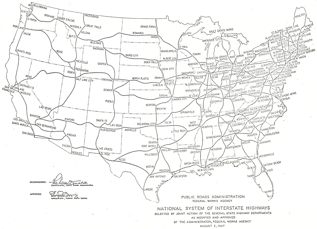
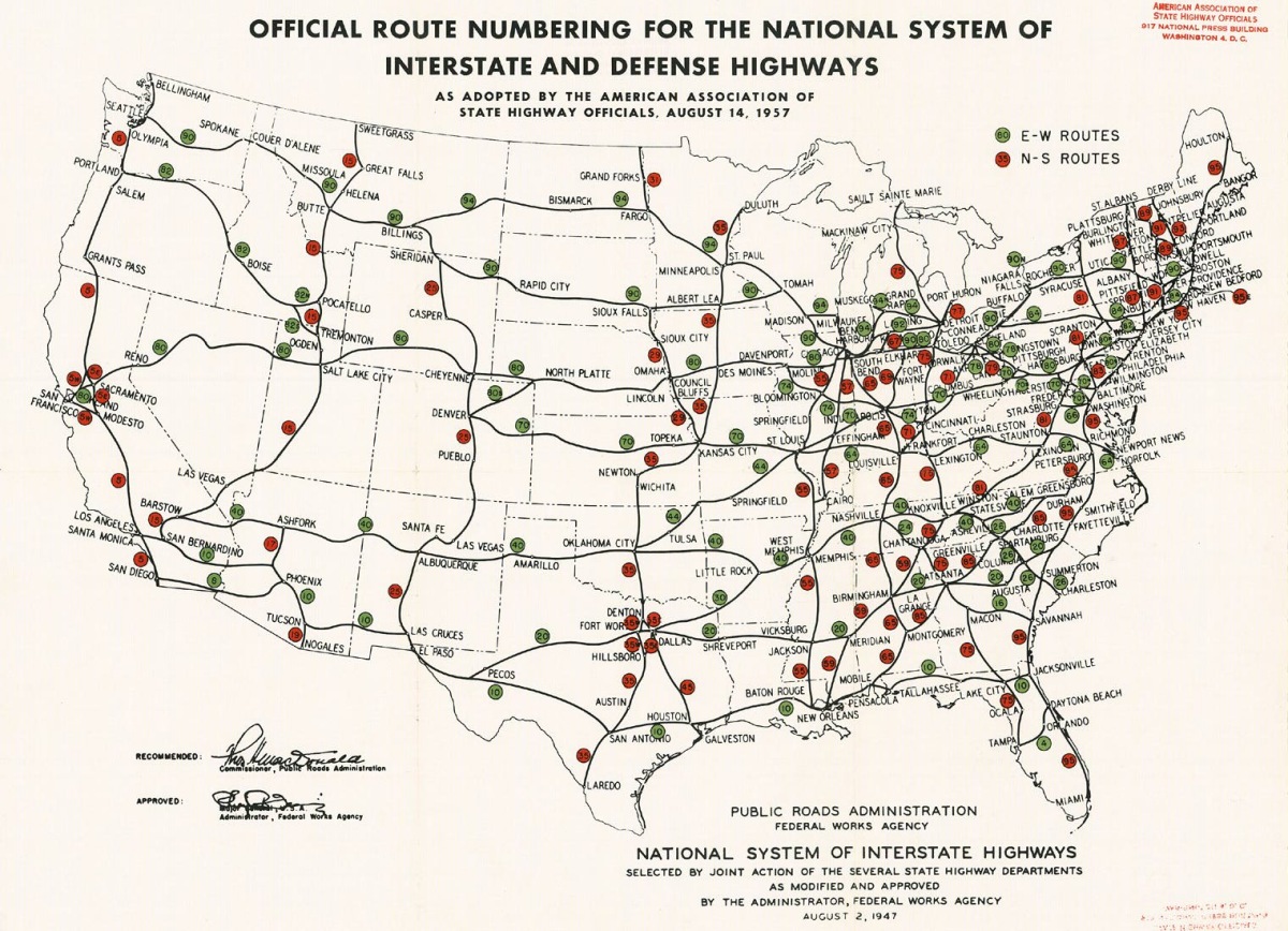
MSHD had plans to upgrade the US 16 corridor to freeway standards in the middle of the 20th century. The first planning map in 1947 for what later became the Interstate Highway System showed a highway in the corridor.[44] The General Location of National System of Interstate Highways Including All Additional Routes at Urban Areas Designated in September 1955, showed generalized plans for the locations of Interstate Highways as designated in 1955. This also included a highway in the US 16 corridor.[45] The 1957 approval for the Interstate Highway System replaced the Grand Rapids–Detroit section of US 16 with a portion of Interstate 94 (I-94), with the remainder to be I-94N.[46] MSHD submitted a recommended numbering plan for the Interstates in 1958 that showed I-96 following the US 16 corridor.[47] When initially approved, the Muskegon–Grand Rapids segment of US 16 was to be numbered as I-196 while the remainder was part of I-96.[48]
Segments of the road were upgraded in 1956 between Coopersville and Marne, Portland and Eagle, and Brighton and Farmington.[49] By 1962, freeway construction allowed motorists to travel between Muskegon and the Lansing area on a freeway, bypassing the old Grand River Avenue route.[3] The final connection between Lansing and Brighton was completed in late 1962. At that time, the US 16 designation, which had been applied alongside the I-96 and I-196 designations, was decommissioned. Segments of the old highway were retained in the state highway system under different numbers. Sections through Portland, Lansing, Howell, Farmington and Detroit were given Business Loop (BL) or Business Spur (BS) I-96 designations. The section between Lansing and Webberville became part of an extended M-43.[3][4] Other sections in the Detroit area became parts of M-102, M-5, or unsigned state highway.[50][51]
Post-Interstate era
After US 16 was transferred to the new freeway, Grand River Avenue lost its state highway status along most of its length. Today the roadway remains the "Main Street" of over a dozen Michigan cities and a scenic route through one of the state's most populated corridors. In 1995, major reconstruction work along Grand River Avenue in East Lansing uncovered rotting logs, buried about 2 feet (0.61 m) below the present grade, that had been used as underlayment for the plank road surface in a low, swampy area. The logs had been in place for nearly 150 years.[52] In 2004, the state transferred several blocks at the eastern end of Grand River Avenue to the City of Detroit. State trunkline control now ends at the corner of Grand River Avenue, Middle Street, and Cass Avenue.[53][54]
Community leaders in Lansing have proposed renaming a section of Grand River Avenue in Old Town Lansing for César Chávez, the Mexican American civil rights activist. The group "Lansing for Cesar E. Chavez" was raising funds to rename the section between Oakland and Pine streets in Old Town. Previously, a section of Grand Avenue was renamed for Chávez in 1994, but the voters overturned the decision.[55] The renaming proposal was even mentioned as a way to untangle a maze of different branches of Grand River Avenue running through Old Town. Currently, East Grand River Avenue and North Grand River Avenue bridge between sections of Grand River Avenue, in addition to Grand Avenue which runs along the Grand River near downtown.[56] While Lansing's Latino community supported the proposal, the business community opposed it. One shop owner said she would have $10,000 in costs associated with a name change, adding, "I think there's many beautiful ways to honor such an incredible man. Changing five blocks of a street doesn't seem to do justice."[57] Another business owner cited the work the Old Town Commercial Association has done to market the area using the Grand River Avenue name, marketing that would be useless after a name change.[57] The compromise solution reached in August 2010 was to rename lot 56, where Old Town holds festivals, to Cesar Chavez Plaza. Street signs would be installed marking parts of Grand River Avenue as Cesar E. Chavez Avenue, but only in a memorial capacity; the street would still be officially named Grand River Avenue.[58]
Memorial highway designations
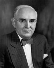
Born in Grand Rapids in 1884, Arthur H. Vandenberg was appointed to the United States Senate upon the death in office of Woodbridge N. Ferris in 1928. Vandenberg, a Republican, served as a member of the "isolationist bloc", and was an active opponent of the New Deal policies of Franklin D. Roosevelt. The senator declined a nomination for Vice President in 1936. In the aftermath of World War II, Vandenberg's world view changed significantly. He helped to draft the United Nations Charter and worked to secure its unanimous ratification in the Senate. He also worked to secure passage of the Marshall Plan and helped to establish the North Atlantic Treaty Organization. After his death in 1951, Michigan residents wanted to memorialize Vandenberg. The following year, the Michigan Legislature dedicated the length of US 16 from Muskegon to Detroit as the Arthur Vandenberg Memorial Highway by enacting Public Act 70 of 1952.[59]

Vandenberg was not the only national figure honored with a memorial designation along the route of US 16 in Michigan. For a period from the 1930s through the 1950s, the highway used a few blocks of Washington Boulevard to connect between Grand River and Michigan avenues on its route through Detroit to its terminus at Cadillac Square. This street was named in honor of George Washington for his service as the "father of his country". The street was named by Judge Woodward as a part of his general street plan for the city of Detroit in 1807.[60]
Major intersections
| County | Location | mi[1] | km | Destinations | Notes |
|---|---|---|---|---|---|
| Muskegon | Muskegon | 0.000 | 0.000 | Car ferry docks  M-46 east (Mart Street) M-46 east (Mart Street) | SS Milwaukee Clipper connected to US 16 in Wisconsin; western terminus of M-46 |
| 1.100 | 1.770 |    Bus. US 31 north / M-46 east (Peck Street) Bus. US 31 north / M-46 east (Peck Street) | Northern end of Bus. US 31 concurrency; eastern end of M-46 concurrency | ||
| Norton Shores | 6.160 | 9.914 |   I-196 eastUS 31 – Ludington, HollandBus. US 31 north (Airline Highway) I-196 eastUS 31 – Ludington, HollandBus. US 31 north (Airline Highway) | Western end of I-196 concurrency; southern end of Bus. US 31 concurrency | |
| Ottawa | Nunica | 15.452 | 24.868 |   M-104 west – Grand Haven M-104 west – Grand Haven | Eastern terminus of M-104 |
| Tallmadge Township | 30.099 | 48.440 |    الحافلة: الطريق السريع الأمريكي 16 شرقًا / الطريق السريع M-11 شرقًا (طريق الذكرى) – غراند رابيدز الحافلة: الطريق السريع الأمريكي 16 شرقًا / الطريق السريع M-11 شرقًا (طريق الذكرى) – غراند رابيدز | الطرف الغربي لـ M-11 | |
| كينت | ووكر | 36.455 | 58.669 |   الطريق السريع M-37 شمالاً (شارع ألبين) – مدينة ترافيرس الطريق السريع M-37 شمالاً (شارع ألبين) – مدينة ترافيرس | الطرف الغربي من مسار الطريق السريع M-37 |
| غراند رابيدز | 39.223 | 63.123 |  الحافلة رقم 131 (شارع بلينفيلد) الحافلة رقم 131 (شارع بلينفيلد) | ||
| 43.233 | 69.577 |  الطريق السريع I-196 غرباً، الطريق السريع I-96 شرقاً الطريق السريع I-196 غرباً، الطريق السريع I-96 شرقاً | الطرف الشرقي لتقاطع الطريق السريع I-196؛ الطرف الغربي لتقاطع الطريق السريع I-96 | ||
| 43.961 | 70.748 |  الطريق السريع الأمريكي 131 / الطريق السريع M-37 جنوبًا (شارع إيست بيلتلاين) – كاديلاك ، كالامازو ، هاستينغز الطريق السريع الأمريكي 131 / الطريق السريع M-37 جنوبًا (شارع إيست بيلتلاين) – كاديلاك ، كالامازو ، هاستينغز | الطرف الشرقي من مسار الطريق السريع M-37 | ||
| بلدة غراند رابيدز | 44.897 | 72.255 | 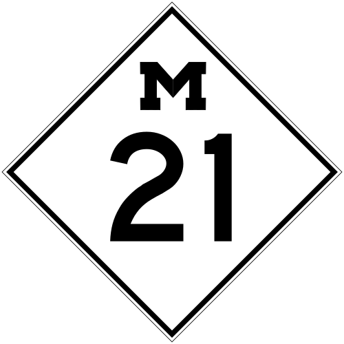 الطريق السريع M-21 (شارع فولتون) – هولاند ، فلينت الطريق السريع M-21 (شارع فولتون) – هولاند ، فلينت | ||
| 46.174 | 74.310 |  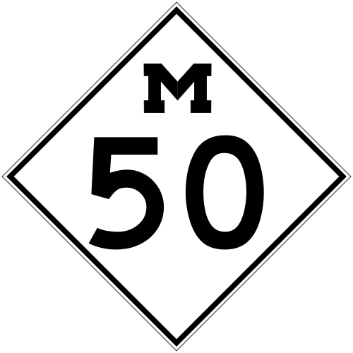 الحافلة. الطريق السريع الأمريكي 16 غربًا / الطريق السريع M-50 غربًا (طريق كاسكيد) – غراند رابيدز الحافلة. الطريق السريع الأمريكي 16 غربًا / الطريق السريع M-50 غربًا (طريق كاسكيد) – غراند رابيدز | الطرف الغربي من تقاطع الطريق السريع M-50 | ||
| بلدة كاسكيد | 49.146 | 79.093 | الطريق السريع M-11 غرباً (شارع 28) | المحطة الشرقية للطريق السريع M-11 | |
| بلدة لويل | 58.463 | 94.087 | 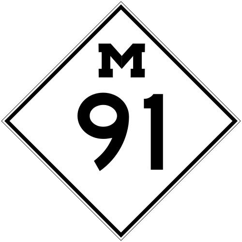 الطريق السريع M-50 شرقًا / الطريق السريع M-91 شمالًا – جاكسون ، غرينفيل الطريق السريع M-50 شرقًا / الطريق السريع M-91 شمالًا – جاكسون ، غرينفيل | الطرف الشرقي لتقاطع الطريق السريع M-50؛ الطرف الجنوبي للطريق السريع M-91 | |
| إيونيا | بلدة برلين | 73.587 | 118.427 | 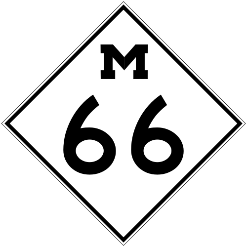 الطريق السريع M-66 – إيونيا ، باتل كريك الطريق السريع M-66 – إيونيا ، باتل كريك | |
| كلينتون | بلدة إيجل | 92.578 | 148.990 | الطريق السريع I-96 غرباً M-100 – جراند ليدج | انتهى الطريق السريع I-96 مؤقتًا هنا؛ ويتبع الطريق السريع US 16 شارع جراند ريفر شرقًا. |
| إنجام | لانسينغ | 101.738 | 163.731 |  الطريق السريع M-174 شمالاً (شارع لوغان) الطريق السريع M-174 شمالاً (شارع لوغان) | |
| 103.103 | 165.928 |  الطريق السريع الأمريكي 27 (شارع لارش) – كلير الطريق السريع الأمريكي 27 (شارع لارش) – كلير | الطرف الشمالي من الطريق السريع الأمريكي 27 | ||
| 103.630 | 166.776 |   الطريق السريع M-43 غربًا / الطريق السريع M-78 (شارع ساجينو) – الطريق السريع الأمريكي 27 جنوبًا (شارع لارش) الطريق السريع M-43 غربًا / الطريق السريع M-78 (شارع ساجينو) – الطريق السريع الأمريكي 27 جنوبًا (شارع لارش) | الطرف الشرقي للطريق السريع M-43؛ الطرف الجنوبي للطريق السريع الأمريكي 27 | ||
| بلدة ليروي | 121.099 | 194.890 |  الطريق السريع M-47 شمالاً الطريق السريع M-47 شمالاً | الطرف الجنوبي للطريق السريع M-47 | |
| ليفينغستون | هاول | 157.476 | 253.433 |  الطريق السريع M-59 شرقاً – بونتياك الطريق السريع M-59 شرقاً – بونتياك | الطرف الغربي للطريق السريع M-59 |
| 160.154 | 257.743 |  الطريق السريع M-155 غرباً الطريق السريع M-155 غرباً | المحطة الشرقية للطريق السريع M-155 | ||
| برايتون | 168.676 | 271.458 | الطريق السريع I-96 شرقاً | الطرف الغربي من الطريق السريع I-96 | |
| بلدة برايتون | 171.212 | 275.539 | 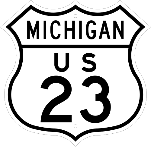 الطريق السريع الأمريكي 23 – فلينت ، آن أربور الطريق السريع الأمريكي 23 – فلينت ، آن أربور | ||
| أوكلاند | غرب نوفي | 182.782 | 294.159 | 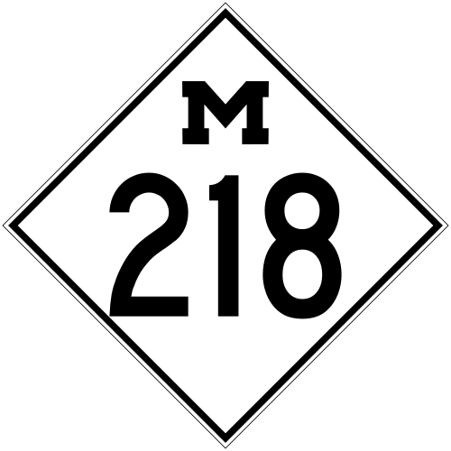 الطريق السريع M-218 شرقاً (طريق ويكسوم) – بونتياك الطريق السريع M-218 شرقاً (طريق ويكسوم) – بونتياك | الطرف الغربي للطريق السريع M-218 |
| فارمنجتون | 189.210 | 304.504 |   الطريق السريع I-96 شرقاً الطريق السريع I-96 شرقاً | ||
| 193.314 | 311.109 | الطريق السريع I-96 غرباً BL الطريق السريع I-96 غرباً | Eastern end of I-96 freeway concurrency | ||
| Oakland–Wayne county line | Farmington Township–Livonia city line | 194.590 | 313.162 | 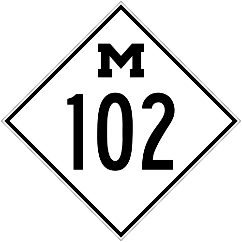 M-102 east (8 Mile Road) M-102 east (8 Mile Road) | 8 Mile Road is the county and city line; western terminus of M-102 |
| Wayne | Detroit | 197.135 | 317.258 |  US 24 (Telegraph Road) – Toledo US 24 (Telegraph Road) – Toledo | |
| 200.584 | 322.809 | 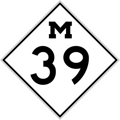 M-39 (Southfield Road) M-39 (Southfield Road) | |||
| 204.499 | 329.109 |  M-14 west (Plymouth Road) – Ann Arbor M-14 west (Plymouth Road) – Ann Arbor | Eastern terminus of M-14 | ||
| 207.727 | 334.304 |  I-94 (Edsel Ford Freeway) I-94 (Edsel Ford Freeway) | |||
| 209.431 | 337.047 |  BS I-696 (John C. Lodge Freeway) BS I-696 (John C. Lodge Freeway) | |||
| 210.643 | 338.997 |   US 10 west (Woodward Avenue) – Pontiac US 10 west (Woodward Avenue) – Pontiac
 US 25 (Fort Street, Gratiot Avenue) – Port Huron, Toledo US 25 (Fort Street, Gratiot Avenue) – Port Huron, Toledo | Cadillac Square served as the common terminus for US 10, US 12 and US 16 | ||
1.000 mi = 1.609 km; 1.000 km = 0.621 mi
| |||||
Related trunklines
Grand Rapids bypass
Bypass US Highway 16 (Byp. US 16) was a bypass route of US 16 in the Grand Rapids area. The highway became a part of the state highway system c.1930 as a part of M-114, which was a beltline around the Grand Rapids area.[61] By 1942, the trunkline was completed and reassigned a Byp. US 16 designation along the southern and western legs. The designation connected to US 16 in Walker Township (now the city of Walker) and ran south along what is now Wilson Avenue over the Grand River into Grandville. From there it turned easterly along what is now 28th Street through Wyoming and Paris townships (now the cities of Wyoming and Kentwood) before terminating at US 16 in Cascade Township.[62] The designation was used until the mainline US 16 was rerouted over the bypass in 1953.[63][64]
Grand Rapids business loop
Business US Highway 16 (Bus. US 16) was a business route in the Grand Rapids area in the 1950s and 1960s. When US 16 was rerouted to replace Byp. US 16 around the southern and western sides of the city in 1953, the former route of the mainline through downtown was redesignated as the business loop.[42][43] That loop followed Remembrance Avenue southeasterly to Leonard Avenue in Walker Township. From there, the loop turned easterly on Leonard over the Grand River to Monroe Avenue before turning south parallel to the river along Monroe into downtown. In downtown Grand Rapids, Bus. US 16 turned eastward on Fulton Avenue into East Grand Rapids. There the loop followed Cascade Road into Cascade Township where it reconnected to US 16 at the intersection with 28th Street. Bus. US 16 lasted until 1962 when US 16 was decommissioned in Michigan.[3][4]
Farmington alternate route
US Highway 16A (US 16A) was an alternate route for US 16 that bypassed Farmington. It was designated in 1933[40] for a new highway that bypassed downtown along what is now Freedom Road.[67] In 1956, the designation was decommissioned when mainline US 16 was rerouted out of downtown Farmington, replacing US 16A. At the same time, the former route of the mainline through downtown was redesignated Bus. US 16.[49][66]
Farmington business loop
Business US Highway 16 (Bus. US 16) was a business loop through downtown Farmington along Grand River Avenue. Its western terminus was at the junction of US 16 and Grand River Avenue west of the city, and the eastern terminus was at the intersection between US 16 and Grand River Avenue southeast of Farmington. This highway was the original route of US 16 through downtown Farmington. In 1933, US 16 was routed onto a bypass route which had been constructed south of the city (the present-day Freedom Road) and the route through Farmington was retained as state trunkline.[39][40] In 1956, a new bypass freeway was built just to the south of the old bypass as part of the "Brighton–Farmington Expressway" and the route through downtown was designated Bus. US 16.[49][66] The original plans for I-96 called for it to replace US 16 and to run parallel to Grand River Avenue all the way from Farmington into downtown Detroit. In 1959, the Farmington bypass freeway was given the I-96 designation in addition to the US 16 moniker,[69] and the business route was redesignated as Business Loop I-96 two years later.[3][68]
See also
 Michigan Highwaysportal
Notes
- ↑Grand River Avenue ends at Cascade Road, but the historic routing carried it through Ada and Plainfield Township along the Grand River. The western end is at East Beltline, short of its westernmost extent in Grand Rapids.[7]
- ↑Other sources state that the first roadside park in the United States was created by Herbert Larson along what is now US 2 near Iron River in 1919–20.[38]
References
- 1234567Michigan Department of Transportation (2021). Next Generation PR Finder (Map). Michigan Department of Transportation. Retrieved October 11, 2021.
- 12McNichol, Dan (2006). The Roads that Built America. New York: Sterling. p. 74. ISBN 1-4027-3468-9. OCLC 63377558.
- 123456789101112Michigan State Highway Department (1962). Official Highway Map (Map). [c. 1:918,720]. Lansing: Michigan State Highway Department. §§ K8–M14. OCLC 12701120, 173191490. Retrieved October 17, 2019– via Michigan History Center.
- 123Michigan State Highway Department (1963). Official Highway Map (Map). [c. 1:918,720]. Lansing: Michigan State Highway Department. §§ K8–M14. OCLC 12701120. Retrieved October 17, 2019– via Michigan History Center.
- ↑"New Numbers Seen for Road". The Holland Evening Sentinel. United Press International. October 23, 1963. p. 4. ISSN 1050-4044. OCLC 13440201. Retrieved April 12, 2016– via Newspapers.com.
- ↑"Would Shift Route Number: Mackie Seeks Int. 96 Designation for Grand Rapids–Muskegon Stretch". The Grand Rapids Press. May 1, 1963. p. 32. OCLC 9975013.
- ↑City of Lansing (n.d.). "Lansing History". City of Lansing. Archived from the original on December 20, 2012. Retrieved March 21, 2008.
- 12Michigan State Highway Department (July 1, 1919). State of Michigan (Map). Scale not given. Lansing: Michigan State Highway Department. Lower Peninsula sheet. OCLC 15607244. Retrieved October 17, 2019– via Michigan History Center.
- 12Bureau of Public Roads & American Association of State Highway Officials (November 11, 1926). United States System of Highways Adopted for Uniform Marking by the American Association of State Highway Officials (Map). 1:7,000,000. Washington, DC: United States Geological Survey. OCLC 32889555. Retrieved November 7, 2013– via Wikimedia Commons.
- 12Lingeman, Stanley D. (April 6, 2001). Michigan Highway History Timeline 1701–2001: 300 Years of Progress. Lansing: Library of Michigan. p. 1. OCLC 435640179.
- ↑Baulch, Vivian M. (June 13, 1999). "Woodward Avenue, Detroit's Grand Old 'Main Street'". The Detroit News. Retrieved September 5, 2010.
{{cite news}}: CS1 maint: deprecated archival service (link) - ↑Wayne County Department of Public Services (n.d.). "History: The River Road". Detroit: Wayne County Department of Public Services. Archived from the original on December 19, 2007. Retrieved September 6, 2010.
- ↑Woodard, Sadie G. (1966). Grand River Road: A Traveler's View of a Historic Route that Traversed Early Michigan. Lansing, Michigan: Plane Tree Press. p. 12. OCLC 433271.
- ↑Walton, Ivan (Spring 1955). "Indian Place Names in Michigan". Midwest Folklore. Vol. 5, no. 1 (Michigan ed.). pp. 23–34. ISSN 0544-0750. JSTOR 4317501. OCLC 681735082.
- ↑Woodard (1966), p. 6.
- ↑Woodard (1966), pp. 8–10.
- ↑Woodard (1966), pp. 10–11.
- ↑Woodard (1966), pp. 11–12.
- ↑1634–1699: McCusker, J. J. (1997). How Much Is That in Real Money? A Historical Price Index for Use as a Deflator of Money Values in the Economy of the United States: Addenda et Corrigenda(PDF). American Antiquarian Society. 1700–1799: McCusker, J. J. (1992). How Much Is That in Real Money? A Historical Price Index for Use as a Deflator of Money Values in the Economy of the United States(PDF). American Antiquarian Society. 1800–present: Federal Reserve Bank of Minneapolis. "Consumer Price Index (estimate) 1800–". Retrieved February 29, 2024.
- ↑Woodard (1966), p. 13.
- ↑Johnston, Louis & Williamson, Samuel H. (2023). "What Was the U.S. GDP Then?". MeasuringWorth. Retrieved November 30, 2023. United States Gross Domestic Product deflator figures follow the MeasuringWorth series.
- ↑Lingeman (2001), p. 2.
- ↑Woodard (1966), p. 28.
- ↑Fisher, Ernest B., ed. (1918). Grand Rapids and Kent County, Michigan: Historical Account of Their Progress from First Settlement to the Present Time. Vol. 1. Chicago: Robert O. Law. p. 78. OCLC 13781280.
- 12Woodard (1966), pp. 24–29.
- 12Barnett, LeRoy (2004). A Drive Down Memory Lane: The Named State and Federal Highways of Michigan. Allegan Forest, Michigan: Priscilla Press. p. 93. ISBN 1-886167-24-9. OCLC 57425393.
- ↑Michigan Legislature (March 20, 1850). "An Act to Incorporate the Lansing and Howell Plank Road Company". Michigan Department of Natural Resources. Archived from the original on October 10, 2010. Retrieved September 6, 2010.
- ↑Towar, James DeLoss (1933). History of the City of East Lansing. East Lansing, Michigan: East Lansing Public Library. pp. 24–25. hdl:2027/mdp.39015071337409. OCLC 605707523.
- ↑Mason, Philip P. (1959). Michigan Highways from Indian Trails to Expressways. Ann Arbor, Michigan: Braun-Brumfield. p. 11. OCLC 23314983.
- ↑Michigan Legislature (1915) [enacted May 13, 1913]. "Chapter 91: State Reward Trunk Line Highways". In Shields, Edmund C.; Black, Cyrenius P.; Broomfield, Archibald (eds.). The Compiled Laws of the State of Michigan. Vol. 1. Lansing, Michigan: Wynkoop, Hallenbeck, Crawford. pp. 1868–72. OCLC 44724558. Retrieved January 24, 2012.
- ↑"Michigan May Do Well Following Wisconsin's Road Marking System". The Grand Rapids Press. September 20, 1919. p. 10. OCLC 9975013.
- ↑ إدارة الطرق السريعة بولاية ميشيغان (1 سبتمبر 1925). خريطة حالة الطرق السريعة الرسمية (خريطة). [مقياس 1:823,680 تقريبًا]. لانسينغ: إدارة الطرق السريعة بولاية ميشيغان. مؤرشفة من الأصل في 10 مايو 2017. تم الاطلاع عليها في 18 ديسمبر 2016 - عبر أرشيفات ميشيغان.
- ↑ بارنيت (2004) ، ص 94 .
- ↑ المجلس المشترك للطرق السريعة بين الولايات (1925). "الملحق السادس: أوصاف الطرق السريعة المختارة بين الولايات، مع الأرقام المخصصة لها" . تقرير المجلس المشترك للطرق السريعة بين الولايات، 30 أكتوبر 1925، معتمد من قبل وزير الزراعة، 18 نوفمبر 1925 (تقرير). واشنطن العاصمة: وزارة الزراعة الأمريكية. ص 50. OCLC 733875457 ، 55123355 ، 71026428. تم الاطلاع عليه في 14 نوفمبر 2017 - عبر ويكي مصدر .
- ١ ٢ إدارة الطرق السريعة بولاية ميشيغان وشركة راند ماكنالي (١ سبتمبر ١٩٣٤). خريطة الطرق السريعة الرسمية لولاية ميشيغان (خريطة). [مقياس ١:٨٥٠,٠٠٠]. لانسينغ: إدارة الطرق السريعة بولاية ميشيغان. § K8. OCLC ١٢٧٠١١٤٣ .
- ١ ٢ إدارة الطرق السريعة بولاية ميشيغان وراند ماكنالي (١ ديسمبر ١٩٤٠). خريطة الطرق السريعة الرسمية لولاية ميشيغان (خريطة) ( طبعة شتوية). [مقياس ١:٨٥٠,٠٠٠]. لانسينغ: إدارة الطرق السريعة بولاية ميشيغان. § K8. OCLC ١٢٧٠١١٤٣ .
- ↑ إليسون، غاريت (4 يوليو 2011). " مقاطعة إيونيا تفتخر بأول طاولة نزهة على جانب الطريق، إحدى جواهر غرب ميشيغان الخفية" . صحيفة غراند رابيدز برس . OCLC 9975013. مؤرشف من الأصل في 14 أكتوبر 2012. تم الاطلاع عليه في 6 يوليو 2011 .
- ↑ بليك، كريستينا (20 أبريل 2015). "الراحة على جانب الطريق: الحدائق ومناطق الاستراحة ومواقف السيارات تساعد المسافرين". مجلة التعدين . ماركيت، ميشيغان. ص 1أ. الرقم الدولي الموحد للدوريات 0898-4964 . رقم OCLC 9729223 .
- ١ ٢ ٣ إدارة الطرق السريعة بولاية ميشيغان وراند ماكنالي (١ مايو ١٩٣٣). خريطة الطرق السريعة الرسمية لولاية ميشيغان (خريطة). [مقياس ١:٨٤٠,٠٠٠]. لانسينغ: إدارة الطرق السريعة بولاية ميشيغان. §§ M١٢–M١٣. OCLC ١٢٧٠١٠٥٣. مؤرشفة من الأصل في ١٠ مايو ٢٠١٧. تم استرجاعها في ١٨ ديسمبر ٢٠١٦ – عبر أرشيفات ميشيغان.
- 1234Michigan State Highway Department & Rand McNally (September 1, 1933). Official Michigan Highway Map (Map). [c. 1:840,000]. Lansing: Michigan State Highway Department. §§ M12–M13. OCLC 12701053.
- 12Michigan State Highway Department & Rand McNally (June 1, 1942). Official Michigan Highway Map (Map) (Summer ed.). [c. 1:850,000]. Lansing: Michigan State Highway Department. §§ K8–L9. OCLC 12701143.
- 1234Michigan State Highway Department (April 15, 1953). Official Highway Map (Map). [c. 1:918,720]. Lansing: Michigan State Highway Department. §§ K9–L9. OCLC 12701120.
- 1234Michigan State Highway Department (October 1, 1953). Official Highway Map (Map). [c. 1:918,720]. Lansing: Michigan State Highway Department. §§ K9–L9. OCLC 12701120. Retrieved October 17, 2019– via Michigan History Center.
- ↑Public Roads Administration (August 2, 1947). National System of Interstate Highways (Map). Scale not given. Washington, DC: Federal Works Agency. OCLC 77721014, 30326602.
- ↑Bureau of Public Roads (September 1955). General Location of National System of Interstate Highways Including All Additional Routes at Urban Areas Designated in September 1955 (Map). Scale not given. Washington, DC: Government Printing Office. OCLC 416597– via Wikimedia Commons.
- ↑Public Roads Administration (August 14, 1957). Official Route Numbering for the National System of Interstate and Defense Highways (Map). Scale not given. Washington, DC: Public Roads Administration. Retrieved September 4, 2010.
- ↑Michigan State Highway Department (April 25, 1958). Recommended Interstate Route Numbering for Michigan (Report). Lansing: Michigan State Highway Department. Archived from the original on August 5, 2004. Retrieved September 4, 2010.
- ↑Bureau of Public Roads (1977) [c. 1963]. "National System of Interstate and Defense Highways" (Map). In Federal Highway Administration (ed.). America's Highways 1776–1976. Scale not given. Washington, DC: Government Printing Office. p. 277. OCLC 3280344. Retrieved September 4, 2010– via Wikimedia Commons.
- 12345Michigan State Highway Department (October 1, 1956). Official Highway Map (Map). [c. 1:918,720]. Lansing: Michigan State Highway Department. §§ K8, L10, M12–M13. OCLC 12701120. Retrieved October 17, 2019– via Michigan History Center.
- ↑Michigan Department of Transportation (2007). Michigan: Official Department of Transportation Map (Map). c. 1:158,400. Lansing: Michigan Department of Transportation. Detroit Area inset. OCLC 42778335. Archived from the original on August 27, 2019. Retrieved August 26, 2019– via Archives of Michigan.
- ↑Michigan Department of Transportation (2008). Truck Operator's Map (Map). c. 1:221,760. Lansing: Michigan Department of Transportation. Detroit and Vicinity inset. OCLC 261183721.
- ↑Michigan Historical Museum (n.d.). "An Old Plank Road in East Lansing ..."Settling a State. Michigan Department of Natural Resources. Archived from the original on September 20, 2011. Retrieved September 14, 2007.
- ↑Michigan Department of Transportation (2004). Truck Operator's Map (Map). c. 1:221,760. Lansing: Michigan Department of Transportation. Detroit and Vicinity inset.
- ↑Michigan Department of Transportation (2005). Truck Operator's Map (Map). c. 1:221,760. Lansing: Michigan Department of Transportation. Detroit and Vicinity inset.
- ↑Leppek, Kyle (April 14, 2010). "Avenida Chavez: Naming a Street after the Labor Leader Hopes to Avoid Pitfalls of Last Go-Around". City Pulse. Lansing, Michigan. OCLC 48427464. Archived from the original on July 28, 2011. Retrieved September 6, 2010.
- ↑ ميلين، كايل (16 يونيو 2010). "حملة شارع سيزار إي. تشافيز" . سيتي بالس . لانسينغ، ميشيغان. OCLC 48427464. مؤرشف من الأصل في 9 نوفمبر 2013. تم الاطلاع عليه في 6 سبتمبر 2010 .
- 1 2 بول، سكوت (15 يونيو 2010). "محاولة تغيير اسم شارع غراند ريفر في البلدة القديمة بمدينة لانسينغ تواجه مقاومة" . لانسينغ، ميشيغان: WKAR-AM . مؤرشف من الأصل في 4 ديسمبر 2014. تم الاطلاع عليه في 6 سبتمبر 2010 .
- ↑ ماكي، جيسيكا (13 أغسطس 2010). "سيتم تكريم أنصار هابي تشافيز". لانسينغ، ميشيغان: WLNS -TV.
- ↑ بارنيت (2004) ، ص 25-26 .
- ↑ بارنيت (2004) ، ص 235 .
- ↑ إدارة الطرق السريعة بولاية ميشيغان و HM Gousha (1 يناير 1930). خريطة رسمية لهيئة الطرق السريعة (خريطة). المقياس غير مُحدد. لانسينغ: إدارة الطرق السريعة بولاية ميشيغان. مُلحق غراند رابيدز. OCLC 12701195 ، 79754957 .
- ↑ إدارة الطرق السريعة بولاية ميشيغان وراند ماكنالي (1 يونيو 1942). خريطة الطرق السريعة الرسمية لولاية ميشيغان (خريطة) ( طبعة صيفية). المقياس غير مُحدد. لانسينغ: إدارة الطرق السريعة بولاية ميشيغان. مُلحق غراند رابيدز. OCLC 12701143 .
- ↑ إدارة الطرق السريعة بولاية ميشيغان (15 أبريل 1953). خريطة الطرق السريعة الرسمية (خريطة). المقياس غير مُحدد. لانسينغ: إدارة الطرق السريعة بولاية ميشيغان. جزء مُصغّر من غراند رابيدز. OCLC 12701120 .
- ↑ إدارة الطرق السريعة بولاية ميشيغان (1 أكتوبر 1953). خريطة الطرق السريعة الرسمية (خريطة). المقياس غير مُحدد. لانسينغ: إدارة الطرق السريعة بولاية ميشيغان. مُلحق غراند رابيدز. OCLC 12701120. تم الاطلاع عليها في 17 أكتوبر 2019 - عبر مركز تاريخ ميشيغان.
- ↑ إدارة الطرق السريعة بولاية ميشيغان (1963). خريطة الطرق السريعة الرسمية (خريطة). المقياس غير مُحدد. لانسينغ: إدارة الطرق السريعة بولاية ميشيغان. خريطة مُصغّرة لمنطقة ديترويت. OCLC 12701120. تم الاطلاع عليها في 17 أكتوبر 2019 - عبر مركز تاريخ ميشيغان.
- ١ ٢ ٣ ٤ إدارة الطرق السريعة بولاية ميشيغان (١٥ أبريل ١٩٥٦). خريطة الطرق السريعة الرسمية (خريطة). المقياس غير مُحدد. لانسينغ: إدارة الطرق السريعة بولاية ميشيغان. خريطة مُصغّرة لمنطقة ديترويت. OCLC ١٢٧٠١١٢٠ .
- ↑"Overview Map of Former US 16A in Farmington" (Map). Google Maps. Retrieved January 16, 2016.
- 12Michigan State Highway Department (1961). Official Highway Map (Map). Scale not given. Lansing: Michigan State Highway Department. Detroit Area inset. OCLC 12701120, 51857665. Retrieved October 17, 2019– via Michigan History Center. (Includes all changes through July 1, 1961)
- ↑"Michigan Delays Road Number System". Toledo Blade. June 4, 1959. p. 11. OCLC 12962635. Retrieved November 21, 2010– via Google News.
Further reading
External links
- Historic US 16 at Michigan Highways
- Historic US 16 Timeline at Michigan Highways
- Former M-126 at Michigan Highways
- Former BS I-96 at Michigan Highways
- Unsigned Old BS I-96 at Michigan Highways
- The Old Plank Road at A Brief History of East Lansing, Michigan
- Former U.S. Highways in Michigan
- U.S. Route 16
- Grand River Avenue
- Interstate 96
- Transportation in Muskegon County, Michigan
- Transportation in Ottawa County, Michigan
- Transportation in Kent County, Michigan
- Transportation in Ionia County, Michigan
- Transportation in Clinton County, Michigan
- Transportation in Ingham County, Michigan
- Transportation in Livingston County, Michigan
- Transportation in Oakland County, Michigan
- Transportation in Wayne County, Michigan