
طريق سريع ذو وصول محدود


الطريق السريع ذو الوصول المُتحكم به هو نوع من الطرق السريعة المصممة لحركة مرور المركبات عالية السرعة، حيث يتم تنظيم جميع تدفقات المرور - الدخول والخروج. من المصطلحات الشائعة في اللغة الإنجليزية: الطريق السريع ( freeway ) ، والطريق السريع (motorway ) ، والطريق السريع (expressway) . ومن المصطلحات المشابهة الأخرى: الطريق السريع ( throughway) أو الطريق السريع ( thruway ) ، والطريق السريع المخصص للمتنزهات (parkway) . قد تكون بعض هذه الطرق طرقًا سريعة ذات وصول محدود ، على الرغم من أن هذا المصطلح قد يشير أيضًا إلى فئة من الطرق السريعة ذات عزلة أقل نوعًا ما عن حركة المرور الأخرى.
في الدول التي تتبع اتفاقية فيينا ، فإن شرط استخدام الطريق السريع يعني أن المشي والوقوف ممنوعان.
يُوفر الطريق السريع ذو الوصول المُتحكم به بالكامل انسيابيةً تامةً لحركة المرور، دون إشارات مرور أو تقاطعات أو مداخل للممتلكات . وهو خالٍ من أي تقاطعات سطحية مع طرق أخرى أو خطوط سكك حديدية أو ممرات للمشاة، حيث يتم نقلها عبر جسور علوية وأنفاق . وتُوفر مداخل ومخارج الطريق السريع عند التقاطعات عبر منحدرات (طرق فرعية)، مما يسمح بتغيير السرعة بين الطريق السريع والطرق الرئيسية والفرعية . في الطريق السريع ذي الوصول المُتحكم به، يتم فصل اتجاهات السير المُتقابلة عادةً بواسطة جزيرة وسطية تحتوي على حاجز مروري أو عشب. ويُؤدي القضاء على التداخل مع اتجاهات المرور الأخرى إلى تحسين السلامة بشكل كبير، [ 2 ] مع زيادة سعة المرور وسرعته.
تطورت الطرق السريعة ذات الوصول المُتحكم به خلال النصف الأول من القرن العشرين. وكانت إيطاليا أول دولة في العالم تربط المدن بطرق سريعة ذات وصول مُتحكم به، مخصصة لحركة المرور السريعة والمركبات الآلية فقط. [ 3 ] [ 4 ] افتتحت إيطاليا أول طريق سريع لها (أوتوسترادا ) عام 1924، وهو الطريق A8 ، الذي يربط ميلانو بفاريزي . أما ألمانيا، فقد خططت منذ عام 1907 لبناء طريق AVUS في برلين، وبدأت بالفعل في بنائه عام 1913 ، إلا أن هذا "الطريق المخصص لتدريب وتدريب السيارات" كان عبارة عن حلبة مغلقة ذات مسارين مستقيمين طويلين، حيث يمكن للمركبات الوصول إلى سرعتها القصوى مرتين قبل العودة إلى المدخل. افتُتح طريق AVUS عام 1921، واستُخدم بشكل أساسي للاختبار والسباقات لعقدين من الزمن، ثم رُبط عام 1940 بشبكة الطرق السريعة الوطنية (رايخس أوتوبان) ، التي طُرحت في عشرينيات القرن الماضي من خلال مبادرات مختلفة، وتأخر إنشاؤها بسبب الكساد الكبير ، وبُنيت في ثلاثينيات القرن الماضي بأموال الضرائب. في عام ١٩٣٢، اكتمل بناء أول طريق سريع مُتحكم بالوصول وبدون حدود للسرعة بين مدينتي كولونيا وبون في غرب ألمانيا . وكان يُشار إلى الجزء الذي يبلغ طوله ٣٠ كيلومترًا (١٩ ميلًا) على ما يُعرف الآن بالطريق السريع A555 باسم الطريق السريع المزدوج . وبفضل الخطط الموضوعة مسبقًا، سارعت ألمانيا إلى إنشاء أول شبكة طرق من هذا النوع على مستوى البلاد. وافتُتحت أولى الطرق السريعة في أمريكا الشمالية (المعروفة باسم باركويز) في منطقة مدينة نيويورك في عشرينيات القرن الماضي. أما بريطانيا، التي تأثرت بشدة بالسكك الحديدية، فلم تُنشئ أول طريق سريع لها ، وهو طريق بريستون الالتفافي ( M6 )، إلا في عام ١٩٥٨.
تتميز معظم الدول المتقدمة تكنولوجياً بشبكة واسعة من الطرق السريعة لتوفير تنقل حضري عالي السعة، أو تنقل ريفي عالي السرعة، أو كليهما. ولدى العديد منها نظام ترقيم للطرق على المستوى الوطني أو حتى الدولي (مثل الطريق الأوروبي E ) .
معايير التعريف


توجد عدة معايير دولية تُقدم بعض التعريفات لمصطلحات مثل "الطرق السريعة"، ولكن لا يوجد تعريف رسمي مُعتمد عالميًا للمصطلحات الإنجليزية مثل " freeway" و "motorway" و "expressway" ، أو للمصطلحات المُقابلة لها في لغات أخرى مثل "autoroute " و " Autobahn " و "autostrada" و "autocesta" و"autoput" . في أغلب الأحيان، تُحدد هذه المصطلحات بموجب القوانين المحلية أو معايير التصميم أو المعاهدات الدولية الإقليمية. ومن بين الأوصاف الشائعة الاستخدام:
- "الطريق السريع" يعني طريقًا مصممًا ومبنيًا خصيصًا لحركة مرور السيارات ولا يخدم العقارات المجاورة له، وأن:
يظهر رمز أخضر أو أزرق واحد (مثل  أو
أو  ) عند مداخل الطرق السريعة في الدول التي تتبع اتفاقية فيينا. أما المخارج فتُعلّم برمز آخر:
  أو
أو  .
.
إن تعريفات "الطريق السريع" من منظمة التعاون الاقتصادي والتنمية [ 7 ] و PIARC [ 8 ] متطابقة تقريبًا.
- الطريق السريع : طريق مزدوج ذو وصول محدود ، لا تتقاطع معه مسارات المرور الأخرى على نفس المستوى ، وهو مخصص للاستخدام الحصري لفئات معينة من المركبات الآلية.
- معهد تكنولوجيا المعلومات (بما في ذلك CITE )
- الطريق السريع : طريق رئيسي مقسم مع تحكم كامل في الوصول إليه، ولا توجد به تقاطعات على مستوى الأرض. ينطبق هذا التعريف على الطرق المدفوعة وغير المدفوعة على حد سواء.
- الطريق السريع أ : يُشير هذا التصنيف إلى الطرق ذات التعقيد البصري العالي وحجم حركة المرور الكثيف. عادةً ما يوجد هذا النوع من الطرق السريعة في المناطق الحضرية، في قلب المدينة أو بالقرب منه، ويعمل خلال معظم ساعات المساء الأولى المظلمة بكامل طاقته الاستيعابية أو بالقرب منها.
- الطريق السريع ب : هذا يحدد جميع الطرق المقسمة الأخرى التي تتمتع بالتحكم الكامل في الوصول حيثما تكون الإضاءة مطلوبة.
- الطريق السريع : طريق رئيسي مقسم مع تحكم كامل في الوصول إليه، ولا توجد به تقاطعات على مستوى الأرض. ينطبق هذا التعريف على الطرق المدفوعة وغير المدفوعة على حد سواء.
في الاتحاد الأوروبي ، ولأغراض إحصائية وأمنية، قد يُفرّق بين الطريق السريع والطريق السريع الرئيسي . على سبيل المثال، يمكن اعتبار الطريق الشرياني الرئيسي على النحو التالي:
الطرق التي تخدم المسافات الطويلة، وخاصةً حركة المرور بين المدن. تشمل الطرق السريعة (الحضرية أو الريفية) والطرق الرئيسية (الطرق التي لا تخدم العقارات المجاورة لها، والمزودة بمسارات منفصلة لحركة المرور في كلا الاتجاهين). قد تعبر الطرق الرئيسية المناطق الحضرية، لتخدم حركة المرور في الضواحي. تتميز حركة المرور بالسرعات العالية والتحكم الكامل أو الجزئي في الوصول (التقاطعات أو التقاطعات التي تُدار بإشارات المرور). تتصل الطرق الأخرى المؤدية إلى الطريق الرئيسي به عبر طرق فرعية. [ 9 ]
من هذا المنظور، يظل تعريف منظمة CARE قائماً بأن الطريق السريع يُفهم على أنه
طريق عام ذو مسارين، كل مسار يتألف من حارتين على الأقل. جميع المداخل والمخارج مزودة بلوحات إرشادية، وجميع التقاطعات منفصلة المستويات. يوجد حاجز وسطي أو جزيرة وسطية على طول الطريق. يُمنع عبور الطريق، بينما يُسمح بالتوقف فقط في حالات الطوارئ. دخول المركبات الآلية محدود، ويُحظر على المشاة والحيوانات والدراجات الهوائية والدراجات النارية الصغيرة والمركبات الزراعية المرور. لا تقل السرعة الدنيا عن 50 كم/ساعة (31 ميل/ساعة) ولا تزيد السرعة القصوى عن 130 كم/ساعة (81 ميل/ساعة) (باستثناء ألمانيا حيث لا توجد حدود للسرعة). [ 9 ]
صُممت الطرق السريعة لنقل حركة المرور الكثيفة بسرعات عالية مع أقل عدد ممكن من الحوادث. كما صُممت لتجميع حركة المرور لمسافات طويلة من الطرق الأخرى، لتجنب التداخل بين حركة المرور لمسافات طويلة وحركة المرور المحلية. [ 10 ] وفقًا للتعريف الأوروبي الموحد، يُعرَّف الطريق السريع بأنه "طريق مصمم ومُنشأ خصيصًا لحركة المرور، ولا يخدم العقارات المجاورة له، ويتميز بما يلي: (أ) وجود مسارات منفصلة لاتجاهي المرور، باستثناء نقاط محددة أو مؤقتًا، مفصولة إما بشريط فاصل غير مخصص لحركة المرور، أو استثنائيًا بوسائل أخرى؛ (ب) عدم تقاطعه مع أي طريق أو سكة حديد أو خط ترام أو ممر للمشاة؛ (ج) وجود لافتات خاصة تدل على أنه طريق سريع، وهو مخصص لفئات محددة من المركبات الآلية." [ 11 ] يشمل هذا التعريف أيضًا الطرق السريعة الحضرية. مع ذلك، قد تختلف التعريفات الوطنية وأنواع الطرق المشمولة اختلافًا طفيفًا بين دول الاتحاد الأوروبي. [ 12 ]
تاريخ

ظهرت النسخة الأولى من الطرق السريعة الحديثة ذات الوصول المحدود خلال النصف الأول من القرن العشرين. وكان طريق لونغ آيلاند موتور باركواي في لونغ آيلاند ، نيويورك ، الذي افتُتح عام ١٩٠٨ كمشروع خاص، أول طريق ذي وصول محدود في العالم. وقد تضمن العديد من الميزات الحديثة، بما في ذلك المنعطفات المائلة ، وحواجز الأمان ، والأسفلت الخرساني المسلح . [ ١٣ ] كان بإمكان حركة المرور الانعطاف يسارًا بين الطريق السريع والوصلات، مع عبور حركة المرور القادمة، لذا لم يكن طريقًا سريعًا ذا وصول محدود (أو "طريقًا سريعًا" كما عرّفه لاحقًا دليل الحكومة الفيدرالية بشأن أجهزة التحكم المروري الموحدة ).
ظهرت الطرق السريعة الحديثة ذات التحكم في الوصول في أوائل عشرينيات القرن الماضي استجابةً للزيادة السريعة في استخدام السيارات ، والطلب على التنقل بشكل أسرع بين المدن، ونتيجةً للتحسينات في عمليات الرصف وتقنياته ومواده. كانت هذه الطرق السريعة الأصلية تُعرف باسم " الطرق السريعة المزدوجة "، وقد تم تحديثها ولا تزال قيد الاستخدام حتى اليوم.

كانت إيطاليا أول دولة في العالم تُنشئ طرقًا سريعة ذات تحكم في الوصول، مخصصة لحركة المرور السريعة والمركبات الآلية فقط. [ 3 ] [ 4 ] ربط طريق أوتوسترادا دي لاغي ("طريق البحيرات") ميلانو ببحيرتي كومو وماجوري ، وهو الآن جزء من الطريقين السريعين A8 و A9 . صممه بييرو بوريتشيلي وافتُتح عام 1924. [ 4 ] كان هذا الطريق السريع، المسمى أوتوسترادا ، يحتوي على حارة واحدة فقط في كل اتجاه، دون أي تقاطعات. أما طريق برونكس ريفر باركواي، فكان أول طريق في أمريكا الشمالية يستخدم جزيرة وسطية لفصل الحارات المتقابلة، وقد شُيّد عبر حديقة، حيث تتقاطع الشوارع فوق الجسور. [ 14 ] [ 15 ] افتُتح طريق ساوثرن ستيت باركواي عام 1927، بينما أُغلق طريق لونغ آيلاند موتور باركواي عام 1937 واستُبدل بطريق نورثرن ستيت باركواي (افتُتح عام 1931) وطريق غراند سنترال باركواي المتصل به (افتُتح عام 1936). في ألمانيا، بدأ بناء طريق بون-كولونيا السريع (أوتوبان) عام 1929 وافتتحه كونراد أديناور ، عمدة كولونيا آنذاك ، عام 1932. [ 16 ] أصبح الأوتوبان الألماني أول نظام طرق سريعة على مستوى البلاد. [ 17 ]
في كندا ، كان أول طريق سريع ذو تحكم جزئي في الوصول هو طريق ميدل رود بين هاميلتون وتورنتو ، والذي تميز بوجود فاصل وسطي بين اتجاهي المرور، بالإضافة إلى أول تقاطع على شكل ورقة البرسيم في البلاد . تطور هذا الطريق السريع ليصبح طريق الملكة إليزابيث ، الذي تميز بتقاطع على شكل ورقة البرسيم وتقاطع على شكل بوق عند افتتاحه عام 1937، وحتى الحرب العالمية الثانية ، كان يضم أطول امتداد مضاء من الطرق. [ 18 ] بعد عقد من الزمن، تم افتتاح أول قسم من الطريق السريع 401 ، استنادًا إلى تصاميم سابقة. ومنذ ذلك الحين، أصبح أكثر الطرق السريعة ازدحامًا في العالم.
استُخدم مصطلح "الطريق السريع" لأول مرة في فبراير 1930 من قِبل إدوارد إم. باسيت . [ 19 ] [ 20 ] [ 21 ] [ 22 ] جادل باسيت بضرورة تصنيف الطرق إلى ثلاثة أنواع أساسية: الطرق السريعة، والطرق المخصصة للحدائق ، والطرق السريعة. [ 19 ] في نظام باسيت القائم على قوانين تقسيم المناطق والملكية ، يتمتع مالكو العقارات المجاورة بحقوق الضوء والهواء والوصول إلى الطرق السريعة، ولكن ليس إلى الطرق المخصصة للحدائق أو الطرق السريعة؛ ويُفرّق بين النوعين الأخيرين بأن الغرض من الطريق المخصص للحدائق هو الترفيه، بينما الغرض من الطريق السريع هو الحركة. [ 19 ] وبالتالي، وكما تم تصوره في الأصل، فإن الطريق السريع هو ببساطة شريط من الأراضي العامة مخصص للحركة، ولا يتمتع مالكو العقارات المجاورة بحقوق الضوء أو الهواء أو الوصول إليه. [ 19 ]
تصميم

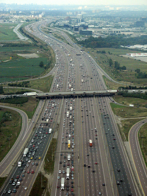

لا تتقاطع الطرق السريعة، بحكم تعريفها، مع الطرق الأخرى أو خطوط السكك الحديدية أو المسارات متعددة الاستخدامات . لذا، لا حاجة لإشارات المرور، ولا يُطلب عادةً من حركة المرور العابرة على الطرق السريعة التوقف عند إشارات المرور. تسمح بعض الدول، كالولايات المتحدة، باستثناءات محدودة: فبعض الجسور المتحركة ، مثل جسر إنترستيت على الطريق السريع 5 بين ولايتي أوريغون وواشنطن ، تتطلب من السائقين التوقف لإفساح المجال لحركة السفن .
عادةً ما يتم عبور الطرق السريعة من طرق أخرى عبر فصل المستويات، إما عن طريق الأنفاق أو الجسور . بالإضافة إلى الأرصفة المتصلة بالطرق التي تعبر الطريق السريع، قد تُنشأ جسور أو أنفاق مخصصة للمشاة . تُمكّن هذه المنشآت المشاة وراكبي الدراجات من عبور الطريق السريع عند تلك النقطة دون الحاجة إلى الالتفاف إلى أقرب معبر.
عادةً ما يُتاح الوصول إلى الطرق السريعة فقط عند التقاطعات ذات المستويات المنفصلة، مع إمكانية استخدام مداخل ومخارج يمين أقل تطورًا (أو يسارًا في الدول التي تسير فيها المركبات على اليسار) للوصول المباشر إلى الطرق الجانبية. في كثير من الحالات، تسمح التقاطعات المتطورة بانتقالات سلسة ومتواصلة بين الطرق السريعة المتقاطعة والطرق الرئيسية المزدحمة . مع ذلك، قد يكون من الضروري أحيانًا الخروج إلى طريق فرعي للانتقال من طريق سريع إلى آخر. ومن الأمثلة على ذلك في الولايات المتحدة (المعروفة بازدحامها المروري الناتج) الوصلة بين الطريق السريع 70 وطريق بنسلفانيا السريع ( الطريق السريع 70 والطريق السريع 76 ) عبر بلدة بريزوود في ولاية بنسلفانيا . [ 23 ]
تكون حدود السرعة أعلى عمومًا على الطرق السريعة، وقد تنعدم أحيانًا (كما هو الحال في معظم شبكة الأوتوبان الألمانية ). ولأن السرعات العالية تقلل من وقت اتخاذ القرار، تُجهز الطرق السريعة عادةً بعدد أكبر من اللوحات الإرشادية مقارنةً بالطرق الأخرى، وتكون هذه اللوحات أكبر حجمًا. غالبًا ما تُثبت اللوحات الإرشادية على الجسور أو الرافعات العلوية لتمكين السائقين من رؤية مسار كل حارة. تُستمد أرقام المخارج عادةً من المسافة بين المخرج وبداية الطريق السريع، سواءً بالكيلومترات أو الأميال. في بعض المناطق، توجد استراحات عامة أو مناطق خدمات على الطرق السريعة، بالإضافة إلى هواتف طوارئ على جانب الطريق على فترات منتظمة.
في الولايات المتحدة، تبدأ علامات الأميال عادةً من أقصى نقطة جنوبية أو غربية على الطريق السريع (إما نهايته أو حدود الولاية). تستخدم كاليفورنيا وأوهايو ونيفادا أنظمة علامات الأميال التي تشير إلى المسافة عبر مقاطعات الولاية. مع ذلك، تستخدم نيفادا وأوهايو أيضًا نظام علامات الأميال القياسي بالتزامن مع أنظمتهما الخاصة. تُرقّم كاليفورنيا مخارج طرقها السريعة وفقًا لنظام علامات الأميال ، لكنها لا تستخدم علامات الأميال.
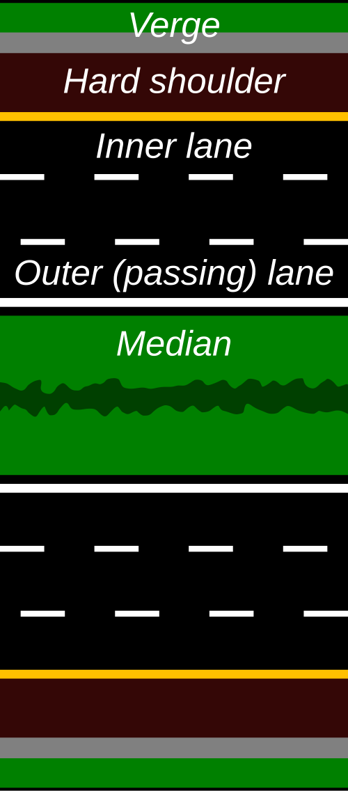
في أوروبا وبعض الدول الأخرى، تتميز الطرق السريعة عادةً بخصائص متشابهة مثل:
- سرعة التصميم النموذجية تتراوح بين 100 و130 كم/ساعة (62-81 ميل/ساعة)
- القيم الدنيا لنصف قطر المنحنى الأفقي حوالي 750 إلى 900 متر (2460 إلى 2950 قدم) .
- لا تتجاوز التدرجات الطولية القصوى عادةً 4% إلى 5%.
- المقاطع العرضية التي تتضمن حداً أدنى من مسارين لحركة المرور لكل اتجاه من اتجاهات السير، بعرض نموذجي يتراوح من 3.50 إلى 3.75 متر (من 11 قدمًا و6 بوصات إلى 12 قدمًا و4 بوصات) لكل منها، مفصولة بجزيرة وسطية.
- منطقة خالية من العوائق تتراوح من 4.5 إلى 10 أمتار (15 إلى 33 قدمًا) ، أو بدلاً من ذلك تركيب أنظمة تقييد المركبات المناسبة.
- التصميم المناسب للتقاطعات ذات المستويات المنفصلة لتوفير حركة المرور بين طريقين أو أكثر على مستويات مختلفة.
- بناء الأنفاق والجسور العلوية بشكل أكثر تواتراً (مقارنة بأنواع الطرق الأخرى)، مما يتطلب معدات وأساليب تشغيل معقدة.
- تركيب معدات الطرق وأجهزة التحكم المروري عالية الكفاءة. [ 24 ]
المقاطع العرضية
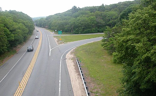
قد يكون الطريق السريع ذو الوصول المُتحكم به عبارة عن مسارين يُعرف باسم الطريق السريع ذي المسارين . غالبًا ما تكون هذه الطرق غير مقسمة، ويتم إنشاؤها أحيانًا عندما تكون حركة المرور منخفضة (ولكن يمكن تطويرها لاحقًا)، أو عندما تكون مساحة الطريق محدودة، أو بسبب نقص التمويل. قد تُصمم هذه الطرق لتسهيل تحويلها إلى جانب واحد من طريق سريع بأربعة مسارات، وقد تكون مساحة الطريق مُتاحة بالفعل. (على سبيل المثال، معظم طريق ماونتن باركواي في شرق كنتاكي عبارة عن مسارين، ولكن العمل جارٍ على تحويله بالكامل إلى أربعة مسارات). تُسمى هذه الطرق غالبًا بالطرق السريعة ذات المسارين . تشتهر العديد من هذه الطرق بارتفاع معدل الحوادث المميتة؛ نتيجة لتصميمها بمسافات رؤية قصيرة (كافية للطرق السريعة بدون حركة مرور قادمة، ولكنها غير كافية لسنوات الخدمة كطريق ذي مسارين مع حركة مرور قادمة). مثال على هذا "الطريق إلى الجحيم" هو الطريق الأوروبي E4 من جافلي إلى أكسمارتافلان ، السويد. لم يتوقف ارتفاع معدل الحوادث التي تُسفر عن إصابات بالغة على تلك الطرق (وما شابهها) إلا بعد تركيب حاجز تصادم وسطي، مما حوّل الحوادث المميتة إلى حوادث غير مميتة. وبخلاف ذلك، تحتوي الطرق السريعة عادةً على حارتين على الأقل في كل اتجاه؛ وقد يصل عدد حارات بعض الطرق المزدحمة إلى 16 حارة أو أكثر .
في سان دييغو، كاليفورنيا ، يمتلك الطريق السريع بين الولايات رقم 5 نظامًا مشابهًا من المسارات السريعة والمحلية بعرض أقصى يبلغ 21 مسارًا على امتداد 3.2 كيلومتر ( ميلين) بين الطريق السريع بين الولايات رقم 805 وطريق ولاية كاليفورنيا رقم 56. وفي ميسيسوجا ، أونتاريو، يستخدم الطريق السريع رقم 401 مسارات تجميع سريعة بإجمالي 18 مسارًا عند تقاطعه مع الطريق السريع رقم 403 / الطريق السريع رقم 410 والطريق السريع رقم 427 .
قد تستخدم هذه الطرق السريعة العريضة مسارات تجميع ومسارات سريعة منفصلة لفصل حركة المرور العابرة عن حركة المرور المحلية، أو مسارات خاصة بالمركبات عالية الإشغال ، إما كقيد خاص على المسار الداخلي أو كطريق منفصل، لتشجيع مشاركة السيارات . يمكن أن تكون هذه المسارات ، أو الطرق المفتوحة لجميع أنواع المرور، قابلة للعكس ، مما يوفر سعة أكبر في اتجاه حركة المرور الكثيفة، ويعكس الاتجاه قبل تغيير مسار المرور. في بعض الأحيان، يتحول طريق التجميع/التوزيع ، وهو نسخة أقصر من المسار المحلي، من التداخل بين التقاطعات المتقاربة إلى طريق منفصل أو يلغي هذا التداخل تمامًا.
في بعض أنحاء العالم، ولا سيما في أجزاء من الولايات المتحدة ، تُشكّل الطرق الجانبية جزءًا لا يتجزأ من شبكة الطرق السريعة. توفر هذه الطرق السطحية الموازية انتقالًا سلسًا بين حركة المرور السريعة العابرة وحركة المرور المحلية. وتتيح منحدرات التحويل المتكررة الوصول بين الطريق السريع والطريق الجانبي، مما يوفر بدوره وصولًا مباشرًا إلى الطرق المحلية والمتاجر. [ 25 ]
باستثناء بعض الطرق السريعة ذات المسارين (ونادرًا جدًا على الطرق السريعة الأوسع)، يفصل حاجز وسطي بين اتجاهي المرور. قد يكون هذا الحاجز بسيطًا كمنطقة عشبية، أو قد يشمل حاجزًا واقيًا مثل " حاجز خرساني " أو "جدار أونتاريو العالي" لمنع التصادمات الأمامية . [ 26 ] في بعض الطرق السريعة، يُبنى المساران على امتدادين مختلفين؛ وقد يُفعل ذلك للاستفادة من الممرات المتاحة في المناطق الجبلية أو لتوفير ممرات أضيق عبر المناطق الحضرية المكتظة .
التحكم في الوصول
يرتبط التحكم في الوصول بوضع قانوني يحد من أنواع المركبات التي يمكنها استخدام الطريق السريع، بالإضافة إلى تصميم الطريق الذي يحد من النقاط التي يمكنها الوصول إليها.
غالبًا ما تخضع الطرق الشريانية الرئيسية لنظام تحكم جزئي في الوصول ، ما يعني أن الطرق الفرعية تتقاطع مع الطريق الرئيسي على مستوى الأرض، بدلًا من استخدام التقاطعات، ولكن قد لا تتصل المداخل مباشرةً بالطريق الرئيسي، ويتعين على السائقين استخدام الطرق المتقاطعة للوصول إلى الأراضي المجاورة. عند التقاطعات الشريانية ذات الطرق الفرعية الهادئة نسبيًا، تُنظَّم حركة المرور بشكل أساسي بواسطة إشارات التوقف ثنائية الاتجاه التي لا تُسبب انقطاعات كبيرة في حركة المرور على الطريق السريع الرئيسي. تُستخدم الدوارات بكثرة عند التقاطعات الأكثر ازدحامًا في أوروبا لأنها تُساعد على تقليل انقطاعات حركة المرور، بينما لا تزال إشارات المرور التي تُسبب تداخلًا أكبر في حركة المرور مُفضَّلة في أمريكا الشمالية. قد توجد تقاطعات عرضية مع طرق شريانية رئيسية أخرى. ومن الأمثلة على ذلك الطريق السريع الأمريكي 23 بين الطرف الشرقي للطريق السريع 15 ومدينة ديلاوير بولاية أوهايو ، بالإضافة إلى الطريق السريع 15 بين طرفه الشرقي والطريق السريع بين الولايات 75 ، والطريق السريع الأمريكي 30 ، والطريق السريع 29 / الطريق السريع الأمريكي 33 ، والطريق السريع الأمريكي 35 في غرب ووسط ولاية أوهايو. يُطلق على هذا النوع من الطرق أحيانًا اسم الطريق السريع .
الوصول غير الآلي على الطرق السريعة
عادةً ما تقتصر الطرق السريعة على المركبات ذات القدرة أو الوزن الأدنى؛ وقد تمنع اللافتات مرور الدراجات والمشاة والخيول ، وتفرض حدًا أدنى للسرعة. ويمكن لحركة المرور غير الآلية استخدام المرافق الموجودة ضمن نفس حرم الطريق، مثل الأرصفة المبنية على طول الجسور ذات المواصفات القياسية للطرق السريعة، والممرات متعددة الاستخدامات المجاورة للطرق السريعة، مثل ممر صن كوست على طول طريق صن كوست باركواي في فلوريدا .

في بعض الولايات الأمريكية، وخاصةً حيث تحل الطرق السريعة محل الطرق القائمة، يُسمح باستخدام المركبات غير الآلية على الطرق السريعة . وتختلف القوانين من ولاية لأخرى. ففي أريزونا، قد يُحظر ركوب الدراجات على الطرق السريعة فقط في حال وجود طريق بديل يُعتبر مكافئًا أو أفضل لركوب الدراجات. [ 27 ] أما وايومنغ ، ثاني أقل الولايات كثافة سكانية، فتسمح بركوب الدراجات على جميع الطرق السريعة. بينما تسمح أوريغون بركوب الدراجات باستثناء بعض الطرق السريعة الحضرية في بورتلاند وميدفورد . [ 28 ]
في دول مثل المملكة المتحدة، يتطلب إنشاء طرق سريعة جديدة قانونًا برلمانيًا لضمان حق المرور المقيد. ونظرًا لأن ترقية طريق قائم (طريق الملك السريع) إلى طريق سريع كامل سيؤدي إلى إلغاء حق المرور لبعض الفئات، مثل المشاة وراكبي الدراجات وحركة المرور البطيئة، فإن العديد من الطرق ذات الوصول المقيد لا تُعتبر طرقًا سريعة كاملة. [ 29 ] في بعض الحالات، تُربط الطرق السريعة بأجزاء قصيرة من الطرق حيث لا يكون من الممكن توفير حقوق مرور بديلة، مثل معبر دارتفورد (أبعد معبر عام لنهر التايمز باتجاه المصب )، أو حيث لم يكن من المجدي اقتصاديًا بناء طريق سريع بجانب الطريق القائم، مثل ممر كمبرلاند سابقًا . يُعد الطريق A1 مثالاً جيداً على الترقية التدريجية إلى مستوى الطريق السريع - اعتبارًا من يناير 2013، كان الطريق الذي يبلغ طوله 639 كيلومترًا (397 ميلًا) يحتوي على خمسة أجزاء من الطريق السريع (المصنفة باسم A1(M))، وانخفض إلى أربعة أجزاء في مارس 2018 مع اكتمال الطريق A1(M) عبر شمال يوركشاير .
تقنيات البناء

تُبنى الطرق السريعة في أغلب الأحيان من الصفر بعد إزالة العوائق كالغابات والمباني. وفي بعض الأحيان، تُستنزف الأراضي الزراعية، ولكن طُوّرت طرق أخرى لأسباب اقتصادية واجتماعية وحتى بيئية.
تُنشأ الطرق السريعة الكاملة أحيانًا بتحويل الطرق السريعة السطحية أو باستبدال التقاطعات السطحية بجسور علوية؛ إلا أنه في الولايات المتحدة، غالبًا ما يبقى أي تقاطع سطحي ينتهي عنده طريق سريع تقاطعًا سطحيًا. وفي كثير من الأحيان، عندما يكون هناك طريق سريع غير مقسم ذو مسارين، يُحوّل بإنشاء ممر موازٍ له، مع ترك جزيرة وسطية بين اتجاهي السير. ويصبح مسار السير على جانب الجزيرة الوسطية من الممر القديم ذي الاتجاهين مسارًا للتجاوز.
وتشمل التقنيات الأخرى بناء طريق جديد على جانب طريق سريع مقسم يحتوي على الكثير من الوصول الخاص على جانب واحد، وأحيانًا يحتوي على ممرات طويلة على الجانب الآخر نظرًا لوجود حق انتفاع للتوسيع، خاصة في المناطق الريفية.
عند إضافة طريق ثالث ، قد يؤدي ذلك أحيانًا إلى تغيير اتجاه الطريق الرئيسي بمقدار 20-60 مترًا (50-200 قدم) (أو ربما أكثر حسب مساحة الأرض المتاحة) كوسيلة للحفاظ على إمكانية الوصول الخاص من جانب واحد على حساب الجانب الآخر. وتشمل الطرق الأخرى إنشاء طريق خدمة يُقصر الطرق الطويلة (عادةً بأقل من 100 متر (330 قدمًا) ).
نقاط التبادل والوصول
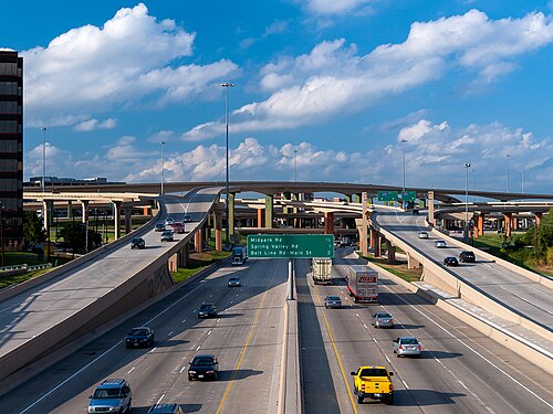

التقاطع أو المفترق هو تصميم طريق سريع يسمح بمرور المركبات من طريق سريع ذي وصول مُتحكم به إلى طريق آخر والعكس صحيح، بينما نقطة الوصول هي تصميم طريق سريع يسمح بمرور المركبات من طريق فرعي أو محلي إلى طريق سريع ذي وصول مُتحكم به. بعض الدول، كالمملكة المتحدة ، لا تُميز بينهما، بينما تُفرق دول أخرى بينهما؛ فمثلاً، تستخدم ألمانيا مصطلحي " Kreuz " (تقاطع) أو " Dreieck " (مثلث) للأول، و " Ausfahrt " (مخرج) للثاني. في جميع الأحوال، يتقاطع الطريقان عبر جسر أو نفق، وليس عبر معبر سطحي .
يمكن أن تتبع الطرق الفرعية، أو الطرق المتصلة ، التي تربط بين الطريقين، أنماطًا متعددة. ويتحدد النمط الفعلي بناءً على عدة عوامل، منها تضاريس المنطقة، وكثافة حركة المرور، وتكلفة الأرض، وتكاليف البناء، ونوع الطريق، وغيرها. في بعض المناطق، تُعدّ مسارات التغذية/التوزيع شائعة، لا سيما عند التقاطعات ذات الشكل الورقي ؛ بينما في مناطق أخرى، كالمملكة المتحدة، حيث تكثر التقاطعات الدائرية ، نادرًا ما تُرى مسارات التغذية/التوزيع.
تُفرّق الطرق السريعة في أوروبا عادةً بين المخارج والتقاطعات. يؤدي المخرج إلى الخروج من شبكة الطرق السريعة، بينما يُمثّل التقاطع نقطة التقاء بين طريقين سريعين أو نقطة تفرع/اندماج بينهما. تنتهي قواعد المرور على الطرق السريعة عند المخارج، ولكن ليس عند التقاطعات. مع ذلك، في بعض الجسور، تنتهي الطرق السريعة مؤقتًا، دون تغيير مظهرها، بين أقرب مخرجين إلى الجسر (أو النفق)، وتستمر كطرق مزدوجة . يهدف هذا إلى إتاحة الفرصة للمركبات الأبطأ لاستخدام الجسر. يُعد جسر الملكة إليزابيث الثانية / نفق دارتفورد في لندن أوربيتال مثالًا على ذلك. لندن أوربيتال، أو الطريق السريع M25، هو طريق سريع يُحيط بلندن ، ولكن عند آخر معبر لنهر التايمز قبل مصبه، لا تُطبّق قواعد المرور على الطرق السريعة. (عند هذا المعبر، يُشار إلى لندن أوربيتال بالرمز A282).
فيما يلي بعض أنواع التقاطعات الأكثر شيوعًا: [ 30 ] [ 31 ] [ 32 ]
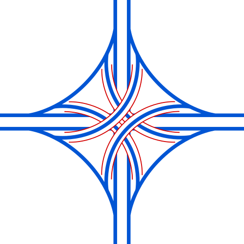 مفترق طرق رباعي المستويات : يُستخدم كمفترق رئيسي، وعادةً ما يكون لمفترقات الطرق السريعة
 تقاطع دوار : شائع جدًا في المملكة المتحدة إما كمفترق طرق أو مخرج
 تقاطع على شكل ورقة البرسيم : يُستخدم بشكل أساسي كتقاطع
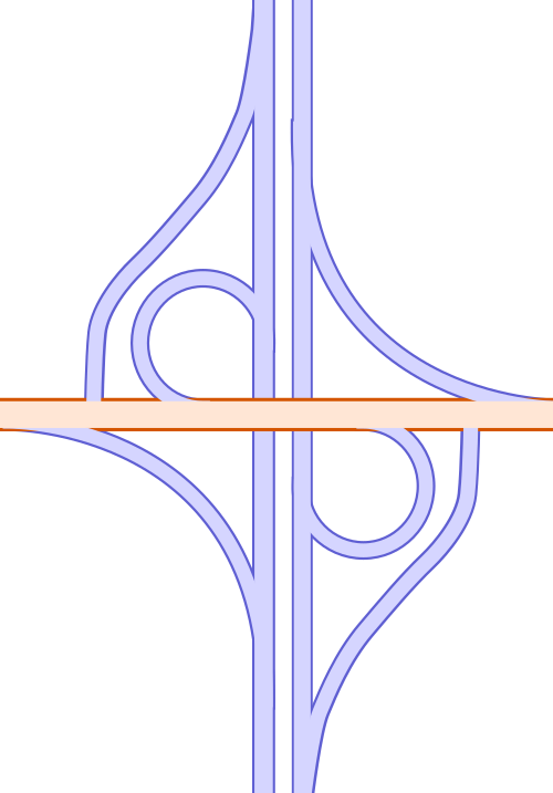 تقاطع باركلو (تقاطع جزئي على شكل ورقة البرسيم): يُستخدم غالبًا لربط طريق فرعي بتقاطع طرق
 تقاطع على شكل حرف "T" على الطرق السريعة، يُستخدم عندما يمثل التقاطع نهاية أحد الطريقين؛ وهو شائع أيضًا على الطرق ذات الرسوم لأنه لا يتطلب سوى كشك واحد لدفع الرسوم.
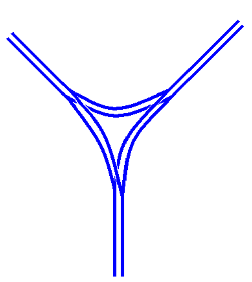 تقسيم أو دمج الطرق السريعة؛ المنطق الأساسي يشبه التقاطع على شكل حرف T
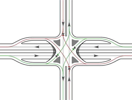 التقاطع الحضري ذو النقطة الواحدة ، أو SPUI؛ يُستخدم في المناطق الحضرية المكتظة لتقليل المساحة الأرضية التي يشغلها التقاطع
 تقاطع ماسي متفرع ؛ مصمم لتحسين انسيابية المرور والسلامة من خلال تقليل عدد المنعطفات التي يجب أن تعبر مسارات المرور القادمة
أمان
توجد اختلافات عديدة بين الدول في جغرافيتها واقتصادها ونمو حركة المرور وحجم شبكة الطرق السريعة ودرجة التحضر وانتشار السيارات، وغيرها؛ وكلها عوامل يجب أخذها في الاعتبار عند إجراء المقارنات. [ 33 ] ووفقًا لبعض وثائق الاتحاد الأوروبي، فإن التقدم المحرز في مجال السلامة على الطرق السريعة هو نتيجة لعدة تغييرات، تشمل سلامة البنية التحتية وسلوك مستخدمي الطريق (السرعة أو استخدام حزام الأمان)، في حين أن لأمور أخرى، مثل سلامة المركبات وأنماط التنقل، تأثيرًا لم يُقاس كميًا. [ 34 ]
الطرق السريعة والطرق الأخرى
تُعتبر الطرق السريعة أكثر الطرق أمانًا بحكم تصميمها. ورغم أنها تمثل أكثر من ربع إجمالي الكيلومترات المقطوعة بالسيارة، إلا أنها لم تُسهم إلا بنسبة 8% فقط من إجمالي وفيات حوادث الطرق في أوروبا عام 2006. [ 2 ] وقد قدم المعهد الاتحادي الألماني لأبحاث الطرق السريعة إحصاءات قاعدة البيانات الدولية لحركة المرور والحوادث (IRTAD) لعام 2010، مُقارنًا معدلات الوفيات الإجمالية بمعدلات الطرق السريعة (بغض النظر عن كثافة حركة المرور):
| دولة | جميع الطرق | الطرق السريعة | |
|---|---|---|---|
| 2010 | 2010 | 2020 | |
| النمسا | 7.32 | 2.15 | 1.28 |
| بلجيكا | 8.51 | 2.87 | |
| الجمهورية التشيكية | 16.22 | 3.38 | 2.53 |
| الدنمارك | 5.65 | 1.92 | 0.91 |
| فنلندا | 5.05 | 0.61 | 1.24 |
| فرنسا | 7.12 | 1.79 | 1.56 |
| ألمانيا | 5.18 | 1.98 | 1.48 |
| سلوفينيا | 7.74 | 3.77 | 1.01 |
| سويسرا | 5.25 | 1.04 | 0.85 |
| الولايات المتحدة | 6.87 | 3.62 | 4.19 (مؤقت) |
| المصادر: IRTAD-BAST-2020 [ 35 ] [ 36 ] | |||
تُجسّد شبكة الطرق السريعة الألمانية (الأوتوبان) المفاضلات المتعلقة بالسلامة في الطرق السريعة ذات الوصول المُتحكّم به. فمعدل حوادث الإصابات منخفض جدًا على الأوتوبان، [ 37 ] بينما يبلغ عدد الوفيات 22 شخصًا لكل 1000 حادث إصابة. ورغم أن معدل الوفيات على الأوتوبان أقل من معدل الوفيات على الطرق الريفية التقليدية (29 حالة وفاة لكل 1000 حادث إصابة)، إلا أنه أعلى من معدل الخطر على الطرق الحضرية. وتكون السرعات أعلى على الطرق الريفية والأوتوبان مقارنةً بالطرق الحضرية، مما يزيد من احتمالية وقوع حوادث خطيرة. [ 38 ]
بحسب المجلس الأوروبي لسلامة النقل، فإن الطرق السريعة الألمانية التي لا يوجد بها حد للسرعة، ولكن مع توصية بالسرعة القصوى 130 كم/ساعة (81 ميل/ساعة) ، أكثر فتكاً بنسبة 25% من الطرق السريعة التي يوجد بها حد للسرعة. [ 39 ]
كما فرضت ألمانيا حدود سرعة تبلغ حوالي 130 كم/ساعة (81 ميل/ساعة) على أجزاء مختلفة من الطرق السريعة التي لم تكن تخضع لحدود السرعة. وقد أدى ذلك إلى انخفاض عدد الوفيات بنسبة تتراوح بين 20% و50% على تلك الأجزاء. [ 40 ]
أسباب الحوادث
تُعتبر السرعة في أوروبا أحد العوامل الرئيسية المساهمة في حوادث التصادم. وقد حققت بعض الدول، مثل فرنسا وسويسرا، انخفاضًا في عدد الوفيات بفضل تحسين مراقبة السرعة. وتشمل الأدوات المستخدمة لمراقبة السرعة زيادة كثافة حركة المرور، وتحسين تطبيق قوانين السرعة، وتشديد اللوائح التي قد تؤدي إلى سحب رخص القيادة، وكاميرات المراقبة، ونظام النقاط المرورية، وفرض غرامات أعلى. وتستخدم بعض الدول الأخرى كاميرات مراقبة السرعة الآلية (المعروفة أيضًا باسم كاميرات مراقبة المقاطع ) للتحكم في السرعة. [ 34 ]
يُعتبر الإرهاق عامل خطر أكثر تحديدًا على الطرق الرتيبة كالطرق السريعة، على الرغم من أن هذه البيانات لا تُرصد أو تُسجل في العديد من البلدان. [ 34 ] ووفقًا لبيانات شركة فينسي أوتوروت ، فإن ثلث الحوادث على الطرق السريعة الفرنسية ناتجة عن القيادة أثناء النعاس. [ 41 ]
23% من الأشخاص الذين لقوا حتفهم على الطرق السريعة الفرنسية لم يكونوا يرتدون أحزمة الأمان، بينما كان 98% من ركاب المقاعد الأمامية و87% من ركاب المقاعد الخلفية يرتدون أحزمة الأمان. [ 34 ]
اتجاهات الوفيات
على الرغم من أن نتائج السلامة لا تتغير كثيراً من عام لآخر، فقد لوحظت بعض التغييرات في أوروبا: انخفضت الوفيات على الطرق السريعة بنسبة 41% خلال العقد 2006-2015، لكنها زادت بنسبة 10% بين عامي 2014 و2015. ومع ذلك، عند الأخذ في الاعتبار طول شبكة الطرق السريعة ليعكس التعرض، تُظهر البيانات أن الوفيات لكل ألف كيلومتر انخفضت إلى النصف بين عامي 2006 و2015. [ 42 ]
| سنة | الوفيات | المعدل لكل مليون نسمة | معدل لكل 1000 كيلومتر من الطرق السريعة |
|---|---|---|---|
| 2006 | 3485 | 7.1 | 54.4 |
| 2010 | 2329 | 4.7 | 32.9 |
| 2015 | 2048 | 4.1 | 27.3 |
| المصدر: حقائق أساسية عن السلامة المرورية 2017، الطرق السريعة [ 42 ] | |||
تأثير الرسوم
تشير دراسة أجرتها جامعة برشلونة إلى أنه في حال تطبيق رسوم مرور على الطرق السريعة ذات الوصول المحدود، قد يلجأ السائقون إلى طرق بديلة لتجنب دفع الرسوم. وقد يؤدي ذلك إلى انخفاض مستوى السلامة على الطرق غير المصممة لاستيعاب حركة مرور كثيفة. [ 43 ]
السلامة في المناطق الحضرية
في المملكة المتحدة، توجد دراسات قليلة جداً حول تأثير حوادث المرور على الطرق السريعة الحضرية القائمة والجديدة. [ 44 ] وعلى وجه الخصوص، لا تساهم الطرق السريعة الحضرية الجديدة في الحد من حوادث المرور.
في إيطاليا، أظهرت دراسة أجريت على الطريق السريع الحضري A56 Tangenziale di Napoli أن خفض السرعة يؤدي إلى انخفاض في الحوادث. [ 45 ]
في مدينة مرسيليا الفرنسية، خلال الفترة من يونيو 2009 إلى مايو 2010، أجرى مركز CEREMA، وهو المركز الفرنسي لدراسات المخاطر والتنقل والبيئة، دراسةً حول شبكة الطرق السريعة الحضرية "ماريوس" . وقد أثبتت هذه الدراسة وجود صلة بين الحوادث ومتغيرات المرور: [ 46 ]
- بالنسبة لحوادث المركبات الفردية، يتم حساب متوسط السرعة لمدة 6 دقائق في المسار السريع؛ والفاصل الزمني بين المركبات (في كل مسار).
- بالنسبة لحوادث المركبات المتعددة، يتم تحديد عدد الركاب والفاصل الزمني بين المركبات (للمسار الأوسط).
يبلغ طول شبكة ماريوس 150 كيلومترًا (93 ميلًا) ويبلغ عدد حوادث الإصابات أو الوفيات 292 حادثًا لكل 1.5 مليار كيلومتر من المركبات، أي 189 حادثًا للإصابات أو وفيات لكل مليار كيلومتر من المركبات.
قامت بعض الدول الأوروبية بتحسين سلامة الطرق السريعة الحضرية، من خلال مجموعة من التدابير لإدارة تدفق حركة المرور بشكل ديناميكي استجابةً لتغير الأحجام والسرعات والحوادث، بما في ذلك:
- حدود السرعة المتغيرة، والتحكم في الخط، وتنسيق السرعة
- الجري على جانب الطريق مع مناطق اللجوء في حالات الطوارئ
- تحذير قائمة الانتظار ورسائل متغيرة
- مراقبة حركة المرور على مدار الساعة طوال أيام الأسبوع باستخدام الكاميرات و/أو أجهزة الاستشعار الموجودة في الرصيف (كلاهما للكشف عن الحوادث وتحديد متى يجب تخفيض حدود السرعة).
- إدارة الحوادث
- تطبيق آلي
- خوارزميات متخصصة لتشغيل الأكتاف المؤقتة، وحدود السرعة المتغيرة، و/أو اكتشاف الحوادث وإدارتها
- قياس المنحدر (وظيفة منسقة أو مستقلة) [ 47 ]
في عام 1994، كان يُفترض أن إنارة الطرق السريعة الحضرية ستوفر مزيدًا من الأمان مقارنة بالطرق غير المضاءة. [ 48 ]
في كاليفورنيا ، في عام 2001، أثبتت دراسة، بالنسبة للطرق السريعة الحضرية، بعض العلاقات بين حوادث الطرق السريعة الحضرية، وتدفق حركة المرور، والطقس، وظروف الإضاءة: [ 49 ]
- يُرسّخ هذا التمييز بين الطرق السريعة الجافة في ضوء النهار والطرق السريعة المبتلة في الظلام
- ويؤكد ذلك أن حوادث الاصطدام في المسار الأيسر من المرجح أن تكون ناجمة عن تأثيرات الحجم، في حين أن حوادث الاصطدام في المسار الأيمن ترتبط ارتباطًا وثيقًا باختلافات السرعة في المسارات المجاورة (في كاليفورنيا، يقود الناس في المسار الأيمن إلا عند التجاوز).
التأثيرات البيئية
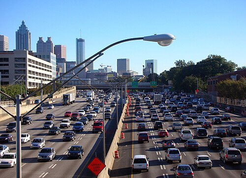


تم إنشاء طرق سريعة ذات تحكم في الوصول بين المدن الكبرى وداخلها، مما أدى إلى التوسع العمراني الهائل في الضواحي المحيطة بمعظم المدن الحديثة. وقد وُجهت انتقادات حادة للطرق السريعة بسبب الضوضاء [ 50 ] والتلوث والتغيرات الاقتصادية التي تُحدثها. [ 51 ] بالإضافة إلى ذلك، انتقدها السائقون لعدم كفاءتها في التعامل مع حركة المرور خلال ساعات الذروة. [ 52 ] [ 53 ] [ 54 ]
غالبًا ما تفتح الطرق السريعة الريفية مساحات شاسعة أمام التنمية الاقتصادية والخدمات البلدية، مما يرفع قيمة العقارات عمومًا. في المقابل، تُعدّ الطرق السريعة فوق مستوى سطح الأرض في المناطق الحضرية مصدرًا لانخفاض قيمة العقارات، مما يُسهم في تدهور المدن . وحتى مع وجود الجسور والأنفاق، تظل الأحياء مُقسّمة، لا سيما الأحياء الفقيرة حيث يقلّ احتمال امتلاك السكان سيارات، أو امتلاكهم النفوذ السياسي والاقتصادي اللازم لمقاومة مشاريع البناء. [ 55 ] منذ أوائل سبعينيات القرن الماضي، حدّد الكونغرس الأمريكي الطرق السريعة وغيرها من الطرق الحضرية باعتبارها مسؤولة عن معظم التعرّض للضوضاء لدى سكان الولايات المتحدة. [ 56 ] لاحقًا، طُوّرت نماذج حاسوبية لتحليل ضوضاء الطرق السريعة والمساعدة في تصميمها للحدّ من التعرّض للضوضاء. [ 57 ]
قامت بعض المدن بتنفيذ سياسات إزالة الطرق السريعة ، والتي بموجبها تم هدم الطرق السريعة واستصلاحها كشوارع أو حدائق، لا سيما في سيول ( تشيونغ غيتشون )، وبورتلاند ( هاربور درايف )، ومدينة نيويورك ( ويست سايد إيليفيتد هاي واي )، وبوسطن ( سنترال آرتري )، وسان فرانسيسكو ( إمباركاديرو فري واي )، وسياتل ( ألاسكان واي فيادكت )، وميلووكي ( بارك إيست فري واي ).
يُعدّ إنشاء الطرق السريعة الحضرية تحت الأرض باستخدام تقنيات الأنفاق بديلاً عن بناء الطرق السريعة السطحية أو فوق الأرض. وقد طُبّق هذا الأسلوب في مدريد وبراغ ، بالإضافة إلى المدن الأسترالية سيدني (التي تضم خمسة طرق سريعة من هذا النوع)، وبريسبان (التي تضم ثلاثة)، وملبورن (التي تضم اثنين). وقد تمثّلت فائدة هذا الأسلوب في تجنّب إنشاء طرق سطحية مكتظة بالسيارات، وفي حالة طريق إيست لينك السريع في ملبورن ، فقد حال دون تدمير منطقة حساسة بيئيًا.
تواجه مدن أسترالية أخرى مشاكل مماثلة (نقص الأراضي المتاحة، وتكلفة شراء المنازل، والمشاكل الجمالية، ومعارضة المجتمع). أما مدينة بريسبان ، التي تواجه أيضًا تحديات حدودها الجغرافية ( نهر بريسبان ) والزيادة السكانية السريعة، فقد تبنت فكرة الطرق السريعة تحت الأرض. يوجد حاليًا ثلاثة أنفاق مفتوحة لحركة المرور ( نفق كليم جونز (CLEM7)، ووصلة المطار ، وطريق ليجاسي واي )، ونفق رابع ( وصلة الشرق والغرب ) قيد التخطيط. صُممت جميع الأنفاق لتكون بمثابة طريق دائري أو نظام التفافي داخل المدينة، وتتضمن توفير وسائل النقل العام، سواء تحت الأرض أو في مساحات مُستصلحة على السطح. [ 58 ] ومع ذلك، فإن الطرق السريعة لا تُفيد خدمات النقل العام البرية، لأن محدودية الوصول إلى الطريق تجعل من الصعب على الركاب الوصول إلى نقاط الصعود المحدودة إلا إذا قادوا سياراتهم إليها، مما يُفقدها جدواها إلى حد كبير. [ 59 ]
في كندا، تم تصميم امتداد الطريق السريع 401 باتجاه ديترويت ، والمعروف باسم طريق هيرب غراي باركواي ، بالعديد من الأنفاق والجسور التي توفر أرضًا للحدائق والاستخدامات الترفيهية.
وجد معارضو الطرق السريعة أن توسيعها غالبًا ما يأتي بنتائج عكسية، إذ يؤدي ببساطة إلى زيادة الازدحام المروري. بمعنى آخر، حتى لو تم تحويل الازدحام المروري مبدئيًا من الشوارع المحلية إلى طريق سريع جديد أو موسع، سيبدأ الناس في استخدام سياراتهم بشكل أكبر والتنقل من مناطق أبعد. وبمرور الوقت، يعود الازدحام إلى الطريق السريع والمناطق المحيطة به مع ازدياد متوسط عدد الرحلات ومسافتها. تُعرف هذه الظاهرة بالطلب المُستحث . [ 60 ] [ 61 ]
يرى خبراء التخطيط الحضري، مثل دروسيلا فان هينجل وجوزيف ديمينتو وشيري رايان، أنه على الرغم من أن الطرق السريعة المصممة والمُصانة جيدًا قد تكون مريحة وآمنة، على الأقل بالمقارنة مع الطرق غير المُدارة، إلا أنها قد لا تُوسّع فرص الترفيه والعمل والتعليم بالتساوي بين مختلف المجموعات العرقية، أو بين سكان أحياء مُحددة في أي مدينة. [ 62 ] ومع ذلك، فقد تُتيح أسواقًا جديدة لبعض الشركات الصغيرة . [ 63 ]
أدى إنشاء الطرق السريعة الحضرية لنظام الطرق السريعة بين الولايات الأمريكية ، والذي بدأ في أواخر الخمسينيات، إلى هدم آلاف الأحياء السكنية وتشريد آلاف أخرى من السكان. وردّ سكان العديد من المناطق الحضرية الداخلية بانتفاضات ضد الطرق السريعة . ومن خلال دراسة استجابة واشنطن ، يتضح أن التغييرات الأكثر فعالية لم تنبع من إجراءات تنفيذية أو تشريعية، بل من تطبيق السياسات. وكان من أهم مبررات إنشاء وزارة النقل الأمريكية الحاجة إلى وكالة للتوسط بين المصالح المتضاربة للطرق السريعة بين الولايات والمدن. في البداية، اتخذت هذه السياسات شكل تنظيم من قبل إدارات الطرق السريعة في الولايات. ومع مرور الوقت، أعاد مسؤولو وزارة النقل الأمريكية تركيز بناء الطرق السريعة من المستوى الوطني إلى المستوى المحلي. ومع هذا التحول في المنظور، جاء التشجيع على وسائل النقل البديلة، وهيئات التخطيط المحلية. [ 64 ]
في الوقت الحاضر، توقف توسيع الطرق السريعة إلى حد كبير في الولايات المتحدة ، وذلك بسبب عوامل متعددة اجتمعت في السبعينيات: متطلبات الإجراءات القانونية الواجبة الأعلى قبل الاستيلاء على الملكية الخاصة ، وارتفاع قيم الأراضي، وارتفاع تكاليف مواد البناء، والمعارضة المحلية للطرق السريعة الجديدة في المراكز الحضرية، وإقرار قانون السياسة البيئية الوطنية (الذي فرض شرط أن يكون لكل مشروع جديد ممول اتحاديًا بيان أو تقرير عن الأثر البيئي ) وانخفاض عائدات ضريبة البنزين نتيجة لطبيعة الضريبة الثابتة (فهي لا يتم تعديلها تلقائيًا وفقًا للتضخم)، وحركة التمرد الضريبي ، [ 65 ] والدعم الشعبي المتزايد لوسائل النقل الجماعي عالية السرعة بدلاً من الطرق السريعة الجديدة.
ترقيم المسارات
المملكة المتحدة
بريطانيا العظمى

إنجلترا وويلز
في إنجلترا وويلز ، اتبعت أرقام الطرق السريعة الرئيسية نظام ترقيم منفصل عن نظام ترقيم شبكة الطرق الرئيسية (A)، مع أنها تستند إلى نفس مبدأ المناطق. بدءًا من الطريق السريع M1 باتجاه عقارب الساعة ، حُددت المناطق من 1 إلى 4 بناءً على الطرق السريعة المقترحة M2 و M3 و M4 . أما الطريقان السريعان M5 و M6 فقد خُصصا للطريقين السريعين الآخرين المخطط لهما للمسافات الطويلة. كان من المفترض أن يُرقم طريق بريستون الالتفافي ، أول طريق سريع في المملكة المتحدة، بالرمز A6(M) وفقًا للخطة المعتمدة، ولكن تقرر الإبقاء على الرقم M6 لأنه سبق استخدامه.
أصدرت وزارة النقل الحربي خريطة توضح النمط المستقبلي للطرق الوطنية الرئيسية عام 1946، قبيل صدور قانون الطرق الخاصة لعام 1949 الذي سمح بتقييد استخدام الطرق لفئات محددة من المركبات. افتُتح أول قسم من الطريق السريع، وهو الطريق الالتفافي M6 بريستون ، عام 1958، تلاه أول قسم رئيسي من الطريق السريع ( M1 بين كريك وبيريجروف في واتفورد )، الذي افتُتح عام 1959. ومنذ ذلك الحين وحتى ثمانينيات القرن العشرين، افتُتحت الطرق السريعة على فترات متقاربة؛ وبحلول عام 1972، كان قد تم بناء أول 1600 كيلومتر (1000 ميل) من الطرق السريعة.
بينما استمر بناء الطرق خارج المناطق الحضرية طوال سبعينيات القرن الماضي، ازدادت معارضة الطرق الحضرية وضوحًا. ومن أبرز الأمثلة على ذلك، إلغاء خطط مجلس لندن الكبرى لإنشاء سلسلة من الطرق الدائرية بعد احتجاجات واسعة النطاق على الطرق وارتفاع التكاليف. وفي عام 1986، تم الانتهاء من الطريق السريع M25 ذي الحلقة الواحدة كحل وسط. وفي عام 1996، بلغ إجمالي طول الطرق السريعة 3200 كيلومتر (2000 ميل) .
تتميز الطرق السريعة في بريطانيا العظمى، كما هو الحال في العديد من الدول الأوروبية، بالخصائص التالية في أغلب الأحيان:
- لا توجد إشارات مرور (باستثناء بعض الأحيان على الطرق الفرعية قبل الوصول إلى الطريق الرئيسي).
- يكون المخرج دائمًا تقريبًا عبر تقاطع مرقم وطريق فرعي، مع استثناءات طفيفة نادرة.
- يُحظر مرور المشاة وراكبي الدراجات والمركبات التي تقل سعة محركها عن حجم محدد.
- يوجد حاجز وسطي يفصل حركة المرور في الاتجاهين المتعاكسين. (الاستثناء الوحيد لذلك هو الطريق A38(M) في برمنغهام، حيث يُستبدل الحاجز الوسطي بمسار آخر يتغير فيه اتجاه حركة المرور تبعًا لوقت اليوم. كان هناك طريق سريع فرعي صغير آخر بالقرب من مانشستر بدون حاجز وسطي ثابت، ولكن تم إلغاء تصنيفه كطريق سريع في العقد الأول من الألفية الثانية).
- لا توجد دوارات على الطريق الرئيسي. ينطبق هذا فقط على الطرق السريعة التي تبدأ بحرف M (ما يُسمى بالفئة M). أما في حالة الطرق A المُحسّنة التي تنتهي أرقامها بحرف M (مثل Ax(M))، فقد توجد دوارات على الطريق الرئيسي عند تقاطعها مع الطرق السريعة من الفئة M. في جميع الطرق السريعة من الفئة M باستثناء طريقين، لا توجد دوارات إلا عند نقطة نهاية الطريق السريع أو عند انتهاء تصنيفه. الاستثناءات الوحيدة لهذه القاعدة في بريطانيا العظمى هي:
- الطريق السريع M271 في ساوثهامبتون والذي يحتوي على دوار على الطريق الرئيسي حيث يلتقي بالطريق السريع M27، ولكنه يستمر بعد ذلك كطريق M271 بعد التقاطع.
- على الطريق السريع M60 . جاء هذا التغيير نتيجةً لإعادة ترقيم أجزاء من الطريقين السريعين M62 و M66 بالقرب من مانشستر ليصبحا الطريق M60، لتشكيل حلقة حول المدينة. ما كان يُعرف سابقًا بتقاطع الطريقين M62 وM66، أصبح الآن يتضمن مرور الطريق M60 باتجاه عقارب الساعة عبر دوار، بينما تستمر حركة المرور المتجهة شرقًا على الطريق M62 وشمالًا على الطريق M66 مباشرةً من الطريق M60. وقد وُجهت انتقادات لهذا التقاطع، المعروف باسم جزيرة سيميستر ، بسبب وجود الدوار وانعطاف الطريق المرقم.
- تم بناء الطريق A1(M) بين الطريق M62 في شمال يوركشاير وواشنطن في تاين ووير وفقًا لمعايير الفئة "M" الكاملة دون أي دوارات. وقد اقتُرح إعادة تصنيف هذا الجزء من الطريق A1(M) باعتباره الامتداد الشمالي للطريق M1. [ 66 ]
في عام 2013، اقتُرح استخدام رمز Ax(M) لأعلى مستوى من تصنيف جديد للطرق يُشار إليه في إنجلترا باسم " الطرق السريعة "، وهي طرق لا تحتوي على دوارات عادية أو منعطفات يمين عبر الجزيرة الوسطى، وتتميز بتقاطعات مُدرّجة. وتخضع هذه الطرق لقيود مماثلة لتلك الموجودة في الطرق السريعة الرئيسية، ولكنها مزودة بحواجز طوارئ بدلاً من أكتاف صلبة قياسية.
اسكتلندا
في اسكتلندا، حيث كان القرار بيد المكتب الاسكتلندي (الذي حلّت محله الحكومة الاسكتلندية عام ١٩٩٩) وليس وزارة النقل والطيران المدني ، لا يوجد نظام مناطقي، بل يُطبّق قانون الطرق الرئيسية (A-road) بصرامة. وقد تقرر تخصيص الأرقام ٧ و٨ و٩ لاسكتلندا. يتبع الطريق السريع M8 مسار الطريق A8 ، وأصبح الطريق A90 جزءًا من M90 عندما أُعيد توجيهه على طول مسار الطريق A85 .
تتبع الطرق السريعة نمط "M"، باستثناء حالتين: الطريق A823(M) بالقرب من روسيث الذي يربط الطريق A823 بالطريق M90، والطريق A74(M) بين الطريق الإنجليزي M6 في جريتنا والطريق M74 في أبينغتون .
أيرلندا الشمالية
يُستخدم في أيرلندا الشمالية نظام ترقيم خاص يختلف عن بقية المملكة المتحدة ، على الرغم من أن تصنيف الطرق وفقًا للأحرف A وB وC هو نظام موحد في جميع أنحاء المملكة المتحدة وجزيرة مان . ووفقًا لإجابة مكتوبة على سؤال برلماني موجه إلى وزير التنمية الإقليمية في أيرلندا الشمالية ، لا يوجد سبب معروف لكيفية وضع نظام ترقيم الطرق في أيرلندا الشمالية. [ 67 ] ومع ذلك، تُرقّم الطرق السريعة، كما هو الحال في بقية المملكة المتحدة، بالحرف M، حيث يُرقّم الطريقان السريعان الرئيسيان القادمان من بلفاست بالحرفين M1 و M2 . ويُعدّ الطريق M12 فرعًا قصيرًا من الطريق M1، بينما يُعدّ الطريق M22 امتدادًا قصيرًا (كان من المفترض في الأصل أن يكون فرعًا) من الطريق M2. وهناك طريقان سريعان آخران، هما الطريق M3 القصير ، والطريق M5 ، وجزء من الطريق السريع A8 يُعرف باسم A8(M) .
أيرلندا

في أيرلندا ، منذ صدور قانون الطرق لعام 1993، أصبحت جميع الطرق السريعة جزءًا من الطرق الوطنية الرئيسية أو تشكل جزءًا منها . تُرقّم هذه الطرق في سلاسل (عادةً، تنطلق عكس اتجاه عقارب الساعة من دبلن ، بدءًا من N1/M1) باستخدام الأرقام من 1 إلى 33 (و50 بشكل منفصل عن السلسلة). تستخدم الطرق السريعة رقم الطريق الذي تشكل جزءًا منه، مع إضافة الحرف M كبادئة بدلًا من N للطرق الوطنية (أو نظريًا، بدلًا من R للطرق الإقليمية ). [ 68 ] في معظم الحالات، يُبنى الطريق السريع كطريق جانبي لطريق كان يشكل سابقًا الطريق الوطني (مثل M7 الذي يلتف حول الطرق التي كانت تشكل سابقًا N7 ) - تُعاد تصنيف الطرق التي تم تجاوزها كطرق إقليمية ، على الرغم من أن اللافتات المحدثة قد لا تُوفّر لبعض الوقت، والالتزام باتفاقيات ألوان اللافتات متساهل (الطرق الإقليمية لها لافتات اتجاهية سوداء على خلفية بيضاء، بينما تستخدم الطرق الوطنية لافتات بيضاء على خلفية خضراء).
بموجب التشريع السابق، قانون الحكم المحلي (الطرق والطرق السريعة) لعام ١٩٧٤، كانت الطرق السريعة نظريًا مستقلة عن الطرق الوطنية. مع ذلك، فإن الأجزاء القصيرة من الطرق السريعة التي تم افتتاحها بموجب هذا القانون، باستثناء الطريق السريع M50، كانت تحمل دائمًا رقم الطريق الوطني الذي تتجاوزه. لم يتم تخفيض تصنيف الطريق الأقدم في ذلك الوقت (في الواقع، لم تكن الطرق الإقليمية مُشرّعة في تلك المرحلة). يمكن ملاحظة اللافتات القديمة عند بعض التقاطعات على الطريقين السريعين M7 وM11، والتي تعكس هذا النظام السابق، حيث يمكن رؤية الطريقين N11 وM11 متجاورين، على سبيل المثال.
يُعدّ الطريق السريع M50 ، وهو طريق وطني جديد كليًا، استثناءً من عملية التوريث المعتادة، إذ لا يحلّ محلّ طريق كان يحمل سابقًا الرقم N. ومع ذلك، فقد تمّ تشريع M50 في عام 1994 كطريق N50 (كان يحتوي فقط على قسم قصير غير مخصص للطرق السريعة من التقاطع 11 تالاغت إلى التقاطع 12 فيرهاوس حتى امتداده ليصبح طريق ساوثرن كروس السريع). وقد تمّ اختيار تسمية M50 لتمييزها. اعتبارًا من عام 2010، أصبح N34 هو التسمية التالية غير المستخدمة للطرق الوطنية الرئيسية. من الناحية النظرية، يمكن أن يشكّل الطريق السريع في أيرلندا جزءًا من طريق إقليمي. [ 68 ]
أستراليا
في أستراليا ، تستخدم أرقام الطرق السريعة والطرق الرئيسية (وتسمى أيضًا الطرق السريعة أو الطرق السريعة) إما علامات طريق أبجدية رقمية مع بادئة M للطرق السريعة والطرق السريعة والطرق السريعة أو علامات طريق وطنية / ولاية.
قبل تطبيق نظام العلامات الأبجدية الرقمية للطرق، كانت الطرق السريعة ذات الوصول المحدود تُعلّم بعلامات "ميترواد" أو "الطريق السريع الوطني" أو "الطريق الوطني" أو "طريق الولاية". في سيدني ، استُخدمت علامات "ميترواد" للطرق السريعة، باستثناء طريق المحيط الهادئ السريع (الذي كان يُعرف آنذاك باسم طريق F3 السريع)، والذي كان يُعلّم بعلامة "الطريق السريع الوطني". في بريسبان ، استُخدمت علامات "ميترواد" و"طرق الولاية" للطرق السريعة. في ملبورن ، استُخدمت علامات "طرق الولاية" لجميع الطرق السريعة. في غرب أستراليا، تُستخدم علامات "الطريق الوطني" للطرق السريعة.
بعد تطبيق نظام علامات الطرق الأبجدية الرقمية، استُبدلت جميع علامات الطرق المستخدمة على الطرق السريعة في بريسبان وملبورن وسيدني بعلامة "M". أما في غرب أستراليا، فلم يُطبّق النظام الجديد بعد.
 علامة مسار أبجدية رقمية. حلت محل جميع علامات المسار السابقة باستثناء غرب أستراليا.
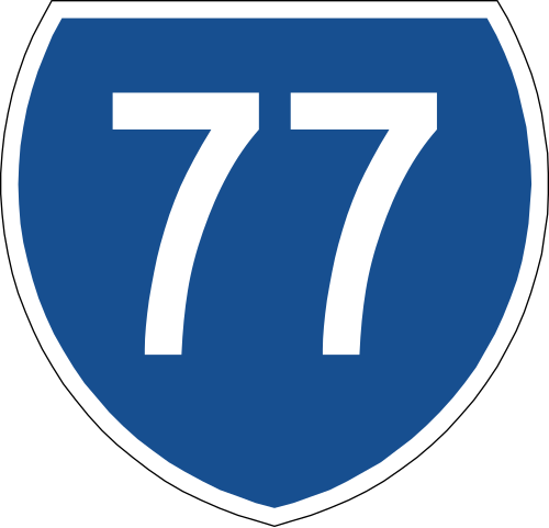 علامة طريق الولاية، المستخدمة للطرق السريعة في غرب أستراليا وكوينزلاند (فقط طريق سميث ستريت السريع وطريق صن شاين السريع).
 تم استخدام مترو الأنفاق (الذي توقف استخدامه) في سيدني الكبرى وبريسبان.
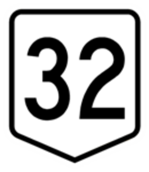 تم استخدام علامات الطريق الوطني (التي لم تعد مستخدمة) في سيدني وغرب أستراليا.
 الطريق السريع الوطني، المستخدم لبعض الطرق السريعة في تسمانيا.
في أماكن أخرى
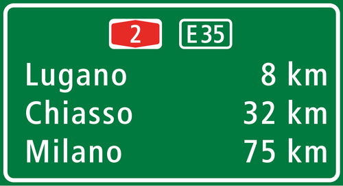
في المجر ، كما هو الحال في أيرلندا، يمكن اشتقاق أرقام الطرق السريعة من أرقام الطرق الوطنية الأصلية (1-7)، مع إضافة البادئة M، على سبيل المثال، الطريق M7 يقع على مسار الطريق السريع القديم رقم 7 من بودابست باتجاه بحيرة بالاتون وكرواتيا . أما الطرق السريعة الجديدة التي لا تتبع نظام الطرق السريعة الشعاعية الأصلي المتمركز حول بودابست، فتحصل على الأرقام M8، M9، إلخ، أو M0 في حالة الطريق الدائري حول بودابست.
في هولندا ، يمكن اشتقاق أرقام الطرق السريعة من أرقام الطرق السريعة الوطنية الأصلية، ولكن مع إضافة البادئة A ( Autosnelweg )، مثل A9 .

في ألمانيا، تُسمى الطرق السريعة الفيدرالية بالرمز A ( أوتوبان ). إذا كان الرقم الذي يليه فرديًا، فإن الطريق السريع يسير عادةً في اتجاه شمال-جنوب، بينما تسير الطرق السريعة ذات الأرقام الزوجية عادةً في اتجاه شرق-غرب. أما الطرق الأخرى ذات الوصول المُتحكم به (الطرق المزدوجة) في ألمانيا، فتشمل الطرق السريعة الفيدرالية ( بوندسستراسن )، والطرق السريعة الولائية ( لاندسستراسن )، والطرق السريعة المحلية ( كرايسستراسن )، والطرق السريعة الحضرية ( شتادتستراسن )، ولكل منها نظام ترقيم خاص بها.

في إيطاليا ، تتبع الطرق السريعة نظام ترقيم موحد، حتى وإن كانت تُدار من قبل شركات امتياز مختلفة: إذ تحمل جميعها الحرف "A" (للدلالة على الطريق السريع A23 ؛ و"RA" في حالة تقاطعات الطرق السريعة، باستثناء تقاطع بيريغواردو - بافيا الذي يحمل الرقم A53 على اللوحات ، و"T" للأنفاق الألبية الدولية ) متبوعًا برقم. وبالتالي، يمكن إدارة طريق سريع يحمل نفس الرقم من قبل شركات امتياز مختلفة (على سبيل المثال، تُدار الطريق السريع A23 لجزء منها من قبل شركة Società Autostrade Alto Adriatico ، وللجزء المتبقي من قبل شركة Autostrade per l'Italia [ 69 ] [ 70 ] ).
في نيوزيلندا ، وكذلك في البرازيل وروسيا وفنلندا والدول الاسكندنافية ، تُستمد أرقام الطرق السريعة من مسار الطريق السريع الرئيسي الذي تُشكّل جزءًا منه، ولكن على عكس المجر وأيرلندا، لا يتم تمييزها عن الأجزاء غير السريعة من نفس مسار الطريق السريع الرئيسي. في حال إنشاء طريق سريع جديد كطريق بديل لمسار طريق سريع رئيسي، يُلغى هذا الوضع أو يُعاد ترقيم الطريق السريع الرئيسي الأصلي. يشير الرقم المنخفض للطريق إلى أنه مناسب للقيادة لمسافات طويلة.
في بلجيكا ، تحمل الطرق السريعة وبعض الطرق المزدوجة أرقامًا مسبوقة بالحرف A. ومع ذلك، فإن الطرق التي تحمل أيضًا رقمًا يبدأ بالحرف E يُشار إليها عادةً بهذا الرقم. أما الطرق الدائرية والطرق الالتفافية داخل المدن فتحمل أرقامًا مسبوقة بالحرف R؛ ويمكن أن تكون هذه أيضًا طرقًا سريعة أو طرقًا مزدوجة.
في كرواتيا ، لا يتم ترقيم الطرق السريعة بشكل منفصل عن ترقيم الطرق الرئيسية. تُسبق أسماء الطرق السريعة بالحرف A (اختصارًا لـ autocesta )، كما هو الحال في العديد من الدول الأوروبية الأخرى. بعض الطرق السريعة هي نتاج تطوير طريق قديم ذي مسارين، وتتداخل مساراتها مع الطرق الرئيسية. في حالات أخرى، كما هو الحال مع الطريق A2 ، بعد التطوير، تم تحويل مسار الطريق الرئيسي إلى الطريق الجانبي .
حسب البلد
في حين أن خصائص التصميم المذكورة أعلاه قابلة للتطبيق بشكل عام في جميع أنحاء العالم، فإن كل سلطة قضائية تقدم مواصفاتها ومعايير التصميم الخاصة بها للطرق السريعة ذات الوصول المقيد.
أفريقيا
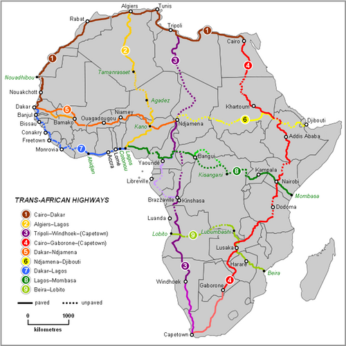
الجزائر


في الجزائر ، يبلغ طول شبكة الطرق السريعة حوالي 2318 كيلومترًا (1440 ميلًا) موزعة على ثلاثة مسارات في كل اتجاه. وتشهد هذه الشبكة توسعًا متزايدًا، إلى جانب أنواع أخرى من البنية التحتية، وإن كان هذا يقتصر على المنطقة الشمالية من البلاد، حيث يقطن معظم السكان. وتُعد هذه البنية التحتية متطورة نسبيًا وفقًا لمعايير شمال أفريقيا .
في الوقت الحالي، شبكة الطرق السريعة الجزائرية بأكملها مجانية. ويجري حالياً وضع اللمسات الأخيرة على محطات تحصيل الرسوم، ومن المقرر إطلاق نظام تحصيل الرسوم على الطرق السريعة في أوائل عام 2021.السرعة القصوى المسموح بها على الشبكة بأكملها هي 120 كم/ساعة (75 ميل/ساعة) .
 الطريق السريع بين الشرق والغرب بالقرب من وهران
 الطريق السريع الشرقي الغربي قرب غمري ولاية غليزان
 الطريق السريع A2 بالقرب من البويرة
 الطريق السريع Nord-Sud بالقرب من Médéa
مصر

تضم مصر العديد من الطرق السريعة متعددة المسارات. وينطلق مساران من شبكة الطريق السريع العابر لأفريقيا من القاهرة . كما تربط مصر العديد من الطرق السريعة بآسيا عبر شبكة طريق المشرق العربي الدولي . وتشهد مصر نموًا متسارعًا في شبكة الطرق السريعة، التي تربط القاهرة بالإسكندرية ومدن أخرى. ورغم أن معظم حركة النقل في البلاد لا تزال تتم عبر الطرق الوطنية، إلا أن الطرق السريعة أصبحت خيارًا متزايد الأهمية في النقل البري داخل البلاد. ومن الطرق السريعة الموجودة في مصر:
- الطريق الصحراوي القاهرة - الإسكندرية: يمتد بين القاهرة والإسكندرية، بطول 215 كم (134 ميلاً) ، وهو الطريق السريع الرئيسي في مصر.
- الطريق الساحلي الدولي: يمتد من الإسكندرية إلى بورسعيد ، على طول الجزء الشمالي من دلتا النيل . يبلغ طوله 280 كيلومترًا (170 ميلًا) . كما يربط، من بين مدن أخرى، دمياط وبلطيم .
- طريق جيش: يمتد بين حلوان وأسيوط ، على طول نهر النيل ، ويربط أيضاً بين بني سويف والمنيا . يبلغ طوله 306 كيلومترات (190 ميلاً) .
- الطريق الدائري: هو بمثابة طريق دائري داخلي للقاهرة. يبلغ طوله 103 كيلومترات (64 ميلاً) .
- الطريق الدائري الإقليمي: يعمل كطريق دائري خارجي للقاهرة، ويربط أيضاً ضواحيها مثل حلوان ومدينة العاشر من رمضان . يبلغ طوله 130 كيلومتراً (81 ميلاً) .
أثيوبيا

يشهد جزء كبير من شبكة الطرق السريعة في إثيوبيا تطوراً مستمراً. وتمثل مشاريع الطرق حالياً نحو ربع ميزانية البنية التحتية السنوية للحكومة الإثيوبية. إضافةً إلى ذلك، خصصت الحكومة، من خلال برنامج تطوير قطاع الطرق، مبلغ 4 مليارات دولار أمريكي لإنشاء الطرق وصيانتها وتطويرها على مدى العقد القادم. تمتلك إثيوبيا شبكة طرق يزيد طولها عن 100 ألف كيلومتر (62 ألف ميل) . وفي عام 2014، تم افتتاح طريق أديس أبابا-أداما السريع ، ليصبح أول طريق سريع في إثيوبيا.
كينيا

تتولى الهيئة الوطنية للطرق السريعة في كينيا مسؤولية صيانة الطرق السريعة وإدارتها وتطويرها وإعادة تأهيلها. ووفقًا لمجلس الطرق الكيني، يبلغ طول شبكة الطرق في كينيا 160,886 كيلومترًا (99,970 ميلًا) . يمر عبر كينيا مساران من شبكة الطرق السريعة العابرة لأفريقيا : طريق القاهرة-كيب تاون السريع وطريق لاغوس-مومباسا السريع . تُصنّف الطرق في كينيا إلى فئات.
- الفئة S: "طريق سريع يربط بين مدينتين أو أكثر ويحمل بأمان حجمًا كبيرًا من حركة المرور بأعلى سرعة تشغيل."
- الفئة أ: "طريق سريع يشكل مسارًا وممرًا استراتيجيًا يربط الحدود الدولية عند نقاط دخول وخروج الهجرة المحددة والمحطات الدولية مثل الموانئ الجوية أو البحرية الدولية."
- الفئة ب: "طريق سريع يشكل طريقًا وطنيًا مهمًا يربط المراكز التجارية أو الاقتصادية الوطنية، ومراكز المقاطعات، وغيرها من المراكز ذات الأهمية الوطنية ببعضها البعض وبالعاصمة الوطنية أو بطرق الفئة أ".
المغرب


تُعدّ الطرق السريعة والطرق الرئيسية في المغرب شبكة من الطرق السريعة متعددة المسارات وعالية السرعة وذات الوصول المتحكم به.
حتى نوفمبر 2016، بلغ إجمالي طول الطرق السريعة في المغرب 1808 كيلومترات (1123 ميلاً) ، منها 1093 كيلومتراً (679 ميلاً) للطرق السريعة الرئيسية. وتخطط المغرب لتوسيع شبكة الطرق، حيث يجري حالياً إنشاء 3400 كيلومتر (2100 ميل) من الطرق السريعة الرئيسية و 2100 كيلومتر (1300 ميل) من الطرق السريعة الرئيسية في مناطق مختلفة من البلاد.
بحلول عام 2035، سيبلغ إجمالي طول الطرق السريعة 5185 كيلومترًا (3222 ميلًا) و 3700 كيلومتر (2300 ميل) من الطرق الرئيسية. ووفقًا لوزير الخارجية المغربي، تتضمن هذه الخطة أيضًا برنامجًا خاصًا بالطرق الريفية لإنشاء 30 ألف كيلومتر (19 ألف ميل) من الطرق باستثمار قدره 30 مليار درهم.
 أول طريق سريع في المغرب - الطريق السريع A1 الدار البيضاء - الرباط
 محطة تحصيل الرسوم في بوزنيقة
موزمبيق
تُصنّف الطرق السريعة في موزمبيق إلى طرق وطنية أو رئيسية ( estrada nacional أو estrada primária )، أو طرق إقليمية - ثانوية أو ثالثية ( estradas secundárias و estradas terciárias ). يُرمز للطرق الوطنية بالحرف "N" أو "EN" متبوعًا برقم من خانة واحدة أو خانتين، وتزداد هذه الأرقام عمومًا من جنوب البلاد إلى شمالها. أما الطرق الإقليمية، فيُرمز لها بالحرف "R" متبوعًا برقم من ثلاث خانات. يبلغ طول شبكة الطرق المعبدة في موزمبيق أكثر من 32,000 كيلومتر (20,000 ميل) .
نيجيريا
تمتلك نيجيريا أكبر شبكة طرق سريعة في غرب أفريقيا . ورغم أن معظم هذه الطرق تعاني من سوء الصيانة، إلا أن الوكالة الفيدرالية لصيانة الطرق قد حسّنتها بشكل ملحوظ. وبفضل موقع نيجيريا الاستراتيجي، تمر أربعة مسارات من شبكة الطرق السريعة العابرة لأفريقيا عبر أراضيها: الطريق السريع العابر للصحراء إلى الجزائر؛ والطريق السريع العابر للساحل إلى داكار ، السنغال؛ والطريق السريع الساحلي العابر لغرب أفريقيا ؛ والطريق السريع بين لاغوس ومومباسا .
جنوب أفريقيا


في جنوب أفريقيا ، يختلف مصطلح الطريق السريع عن معظم أنحاء العالم الأخرى. فالطريق السريع هو طريق تُطبق عليه قيود معينة. [ 73 ]
يُمنع على الفئات التالية استخدام الطريق السريع:
- مركبة تجرها حيوان؛
- دراجة هوائية (مثل الدراجة الهوائية)؛
- دراجة نارية ذات محرك بسعة أسطوانة لا تتجاوز 50 سم مكعب أو يتم تشغيلها بواسطة الطاقة الكهربائية؛
- دراجة ثلاثية العجلات بمحرك أو دراجة رباعية العجلات بمحرك؛
- المشاة
لا يجوز للسائقين استخدام إشارات اليد على الطرق السريعة (إلا في حالات الطوارئ)، والحد الأدنى للسرعة على الطرق السريعة هو 60 كم/ساعة (37 ميل/ساعة) . يجب على السائقين في المسار الأيمن من الطرق السريعة متعددة المسارات الانتقال إلى اليسار إذا اقتربت مركبة أسرع من الخلف للتجاوز.
على الرغم من الاعتقاد الشائع بأن "الطريق السريع" يعني طريقًا يحتوي على مسارين على الأقل، إلا أن هناك طرقًا سريعة ذات مسار واحد، كما يتضح من البيان الذي ينص على أن "طرق [جنوب إفريقيا] تشمل 1400 كم (870 ميلًا) من الطرق السريعة ذات المسارين، و 440 كم (270 ميلًا) من الطرق السريعة ذات المسار الواحد، و 5300 كم (3300 ميلًا) من الطرق الرئيسية ذات المسار الواحد مع إمكانية الوصول غير المحدود." [ 74 ]
الأمريكتين

الأرجنتين

تمتلك الأرجنتين شبكة طرق وطنية متصلة بالطريق السريع لعموم الأمريكتين . ويبلغ إجمالي طول الطرق المعبدة في الأرجنتين أكثر من 82,000 كيلومتر (51,000 ميل) . [ 75 ]
البرازيل

تُحظر طرق سريعة قليلة في البرازيل مرور الدراجات أو المشاة، وهي مصممة وفقًا لمعايير الطرق السريعة المحددة في اتفاقية فيينا لحركة المرور على الطرق ، [ 76 ] التي صادقت عليها البرازيل عام 1980. [ 77 ] لا يوجد تصنيف محدد للطرق السريعة ذات الوصول المُتحكم به في شبكات الطرق السريعة الفيدرالية والولائية البرازيلية . لا يُستخدم مصطلح " autoestrada " (البرتغالية، ويعني "الطريق السريع") بشكل شائع في البرازيل؛ بل يُفضل استخدام مصطلحي " estrada " (الطريق) وخاصة " rodovia " (الطريق السريع)، مع أن أياً منهما لا يُشير تحديدًا إلى الطرق السريعة. ومع ذلك، تُصنف الطرق السريعة الأكثر تطورًا من الناحية التقنية في البرازيل ضمن فئة الطرق السريعة من الفئة 0 من قِبل الإدارة الوطنية للبنية التحتية للنقل (DNIT). صُممت هذه الطرق السريعة لتسمح بسرعات آمنة للمركبات تصل إلى 130 كم/ساعة (81 ميل/ساعة) . في التضاريس الجبلية، يبلغ الحد الأقصى المسموح به للانحدار 5٪، ويبلغ الحد الأدنى المسموح به لنصف قطر الانحناء 665 مترًا (2182 قدمًا) (مع ارتفاع فائق بنسبة 12٪).
تضم ولاية ساو باولو أكبر عدد من الطرق السريعة في البلاد، وهي أيضاً الولاية التي تضم أكبر عدد من الطرق السريعة التي تم منحها للقطاع الخاص.
تم الانتهاء من أول طريق سريع في البرازيل، رودوفيا أنهانغيرا في ولاية ساو باولو، في عام 1953 كتحديث للطريق السريع غير المقسم السابق. في نفس العام، بدأ بناء الطريق السريع الثاني، رودوفيا أنشييتا ، بين ساو باولو وساحل المحيط الأطلسي. تسارعت وتيرة بناء الطرق السريعة، ومعظمها عبارة عن تحسينات للطرق السريعة القديمة غير المقسمة، في العقود التالية. تشمل الطرق السريعة الحالية من الفئة 0 ما يلي: رودوفيا دوس بانديرانتس ، رودوفيا دوس إمغرانتس ، رودوفيا كاستيلو برانكو ، رودوفيا أيرتون سينا/كارفالهو بينتو ، رودوفيا أوسفالدو أرانها (المعروفة أيضًا باسم "الطريق الحر") وطريق متروبوليتان بيلتواي رودوانيل ماريو كوفاس في ساو باولو - جميع الطرق السريعة الحديثة التي تعود إلى ما بعد السبعينيات تلبي المعايير الأوروبية الحديثة. أما أجزاء أخرى من الطريق السريع مثل الطريق الجنوبي BR-101 قيد الإنشاء وطريق رودوفيا ريجيس بيتينكورت فهي ذات معايير تصميم أقدم.


 الطريق السريع BR-116 في سيارا
الأراضي البريطانية ما وراء البحار

يوجد في عدد من الأقاليم التابعة للمملكة المتحدة في الخارج طرق سريعة ذات وصول مقيد، بما في ذلك جزر تركس وكايكوس وجزر كايمان .
كندا

لا يوجد في كندا حاليًا نظام وطني للطرق السريعة ذات الوصول المُتحكم به. جميع الطرق السريعة ذات الوصول المُتحكم به، بما في ذلك الأجزاء التي تُشكل جزءًا من الطريق السريع العابر لكندا ، تخضع لسلطة المقاطعات، ولا يوجد امتداد رقمي لها عبر حدود المقاطعات. تقع أكبر شبكات الطرق في البلاد في أونتاريو ( الطرق السريعة من سلسلة 400 ) وكيبيك ( الطرق السريعة ذات المسارين ). لا تُحدد حدود السرعة على المستوى الفيدرالي، إذ تُحددها حكومات المقاطعات لمناطقها. تتأثر هذه الطرق بالمعايير الأمريكية، وقد أثرت فيها بدورها، ولكنها تتميز بابتكارات واختلافات في التصميم. يبلغ الطول الإجمالي للطرق المزدوجة ذات الوصول المتحكم به في كندا 6350 كم (3950 ميلاً) ، منها 564 كم (350 ميلاً) في كولومبيا البريطانية ، و642 كم (399 ميلاً) في ألبرتا ، و59 كم (37 ميلاً) في ساسكاتشوان ، و2135 كم (1327 ميلاً) في أونتاريو، و1941 كم (1206 ميلاً) في كيبيك، و 1000 كم (620 ميلاً) في المقاطعات البحرية .
السلفادور
الطريق السريع الوطني رقم 21 (شرق-غرب، بوليفارد مونسنيور روميرو) هو أول طريق سريع يُبنى في السلفادور وأمريكا الوسطى . يمر الطريق بالمنطقة الشمالية من مدينة سانتا تيكلا ، لا ليبرتاد. ويخدم جزء صغير منه مدينة أنتيكو كوسكاتلان ، لا ليبرتاد، ويلتقي بالطريق السريع الوطني رقم 5 (شرق-غرب، بوليفارد دي لوس بروسيريس/أوتوبيستا ديل أيروبويرتو) في سان سلفادور . يبلغ طول الطريق السريع الوطني رقم 21 الإجمالي 9.35 كيلومتر (5.81 ميل) ، ويُستخدم حاليًا لتخفيف الازدحام المروري في المنطقة الحضرية. مع أن الطريق السريع الوطني رقم 21 كان من المقرر تسميته تكريمًا لأول رئيس بلدية لسان سلفادور، دييغو دي هولغين ، إلا أنه لأسباب سياسية، أُعيد تسميته إلى بوليفارد مونسنيور روميرو، تكريمًا لأوسكار روميرو . تم الانتهاء من المرحلة الأولى من الطريق السريع في عام 2009، وتم الانتهاء من المرحلة الثانية وافتتاحها في نوفمبر 2012.
المكسيك


في المكسيك ، الطرق السريعة الفيدرالية ( بالإسبانية : Carretera Federal ) هي سلسلة من الطرق السريعة التي تتصل بالطرق القادمة من الدول الأجنبية أو التي تربط بين ولايتين أو أكثر من ولايات الاتحاد.
 جسر ميزكالا على الطريق السريع 95 في المكسيك
 تيهوانتيبيك، باجا كاليفورنيا
 الطريق السريع الفيدرالي المكسيكي 1 تقاطع في سان إجناسيو، باجا كاليفورنيا سور
 الطريق السريع الفيدرالي رقم 2 المتجه شرقاً خارج ألتار، سونورا ، بعد هطول أمطار صيفية
الولايات المتحدة
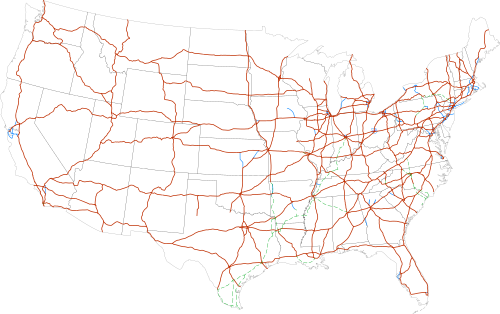
في الولايات المتحدة ، يُعرّف دليل الحكومة الأمريكية لأجهزة التحكم المروري الموحدة الطريق السريع بأنه طريق سريع مقسم مع تحكم كامل في الوصول إليه. [ 78 ] وهذا يعني أمرين: أولاً، لا يملك مالكو العقارات المجاورة حقًا قانونيًا في الوصول، [ 79 ] مما يعني أنه يجب إزالة جميع المداخل القائمة وإغلاق الوصول إلى الأراضي الخاصة المجاورة بالأسوار أو الجدران؛ وبدلاً من ذلك، توفر الطرق الأمامية الوصول إلى العقارات المجاورة للطريق السريع في كثير من الأماكن.
ثانيًا، تتميز حركة المرور على الطرق السريعة بانسيابيتها. إذ تُحوّل جميع حركة المرور المتقاطعة (وحركة المرور المتجهة يسارًا) إلى الجسور العلوية أو السفلية، مما يمنع حدوث أي تداخلات مرورية على الطريق الرئيسي، الذي يتطلب تنظيمه إشارات المرور أو علامات التوقف أو غيرها من وسائل التحكم المروري. ويتطلب تحقيق هذه الانسيابية إنشاء العديد من الجسور العلوية والأنفاق وأنظمة المنحدرات. وتكمن ميزة التقاطعات ذات المستويات المنفصلة في قدرة سائقي الطرق السريعة على الحفاظ على سرعتهم عند التقاطعات في أغلب الأحيان، إذ لا يحتاجون إلى إفساح المجال للمركبات التي تعبر بشكل عمودي على حركة المرور على الطريق الرئيسي.
في المقابل، يُعرَّف الطريق السريع بأنه طريق سريع مقسم مع تحكم جزئي في الوصول. [ 80 ] قد تحتوي الطرق السريعة على مداخل خاصة وتقاطعات على مستوى الأرض، على الرغم من أن هذه عادةً ما تكون أقل عددًا من الطرق الشريانية العادية.
طُوِّر هذا التمييز لأول مرة عام 1949 من قِبَل اللجنة الخاصة بالتسميات التابعة لما يُعرف الآن بالرابطة الأمريكية لمسؤولي الطرق السريعة والنقل بالولايات . [ 81 ] وقبل ذلك، اكتملت أولى الطرق السريعة عام 1940، وهما طريق بنسلفانيا السريع وطريق أرويو سيكو السريع (طريق باسادينا السريع). [ 82 ]
وبدورها، أُدرجت هذه التعريفات في كتاب المعايير الرسمي لجمعية مسؤولي الطرق السريعة والنقل الأمريكية (AASHTO)، وهو دليل أجهزة التحكم المروري الموحدة ، والذي أصبح فيما بعد كتاب المعايير الوطني لوزارة النقل الأمريكية (USDOT) بموجب قانون اتحادي صدر عام 1966. كما تم تقنين هذا التمييز نفسه في القوانين التشريعية لثماني ولايات: كاليفورنيا ، [ 83 ] مينيسوتا ، [ 84 ] ميسيسيبي ، [ 85 ] ميزوري ، [ 86 ] نبراسكا ، [ 87 ] داكوتا الشمالية ، [ 88 ] أوهايو ، [ 89 ] وويسكونسن . [ 90 ]
مع ذلك، قامت كل ولاية بتقنين التمييز الفيدرالي بشكل مختلف قليلاً. ففي كاليفورنيا ، لا يُشترط بالضرورة أن تكون الطرق السريعة مقسمة، وإن كان يجب أن تتمتع على الأقل بنظام تحكم جزئي في الوصول. أما في ويسكونسن ، فلكي ينطبق كلا المصطلحين ، يجب أن يكون عرض الطريق السريع المقسم أربعة مسارات على الأقل؛ وفي ميسوري ، ينطبق كلا المصطلحين فقط على الطرق السريعة المقسمة التي لا يقل طولها عن 16 كيلومترًا (10 أميال) والتي لا تُعد جزءًا من نظام الطرق السريعة بين الولايات. وفي داكوتا الشمالية وميسيسيبي ، قد تتمتع الطرق السريعة بنظام تحكم "كامل أو جزئي" في الوصول ، و"عمومًا" ما يكون بها فواصل مستويات عند التقاطعات؛ ويُعرَّف الطريق السريع حينها بأنه طريق سريع يتمتع بنظام تحكم كامل في الوصول. ويتشابه قانون أوهايو، ولكنه يشترط، بدلاً من كلمة "عمومًا" المبهمة، أن تكون 50% من تقاطعات الطريق السريع مفصولة المستويات حتى ينطبق المصطلح. [ 91 ] وكانت مينيسوتا الولاية الوحيدة التي سنّت تعريفات MUTCD الدقيقة، وذلك في مايو 2008.
يُستخدم مصطلح "الطريق السريع" أيضاً في بعض مناطق البلاد للإشارة إلى ما تسميه الحكومة الفيدرالية "الطرق الحرة". [ 92 ] وعند التمييز بين المصطلحين، يمكن وصف الطرق الحرة بأنها طرق سريعة تم تطويرها لتشمل نظام تحكم كامل في الوصول، مع العلم أن ليس كل الطرق السريعة طرقاً حرة.
أمثلة في الولايات المتحدة على الطرق التي تعتبر من الناحية الفنية طرقًا سريعة (وفقًا للتعريف الفيدرالي)، ولكنها تحتوي على كلمة "طريق سريع" في أسمائها: طريق ستيت فير السريع في كانساس ، طريق تشينو فالي السريع في كاليفورنيا، طريق روكاواي السريع في نيويورك ، وطريق شينانغو فالي السريع (جزء من الطريق السريع الأمريكي 62 ) في بنسلفانيا .
على عكس بعض الولايات القضائية، لا تُشكّل جميع الطرق السريعة في الولايات المتحدة جزءًا من شبكة طرق سريعة وطنية واحدة (مع أنها تُشكّل مع الطرق غير السريعة نظام الطرق السريعة الوطنية ). فعلى سبيل المثال، تحتوي العديد من الطرق السريعة في الولايات، مثل طريق كاليفورنيا السريع رقم 99، على أقسام كبيرة منها تُعتبر طرقًا سريعة. وقد تمّ تحديث العديد من أقسام نظام الطرق السريعة الأمريكي القديم إلى طرق سريعة، لكنها احتفظت بأرقامها الأصلية.
في بورتوريكو ، تُسمى الطرق السريعة ذات الوصول المُتحكم به "أوتوبيستا" . [ 93 ] تُفرض رسوم على استخدام الأوتوبيستا في الجزيرة، ولكن توجد أكشاك تحصيل الرسوم على أنواع أخرى من الطرق أيضًا. يُعد طريق لويس أ. فيري السريع (Autopista Luis A. Ferré Expressway) أحد أشهر الأوتوبيستا في بورتوريكو، ويمتد من سان خوان ، العاصمة شمالًا، إلى بونس ، ثاني أكبر مدن الجزيرة جنوبًا.
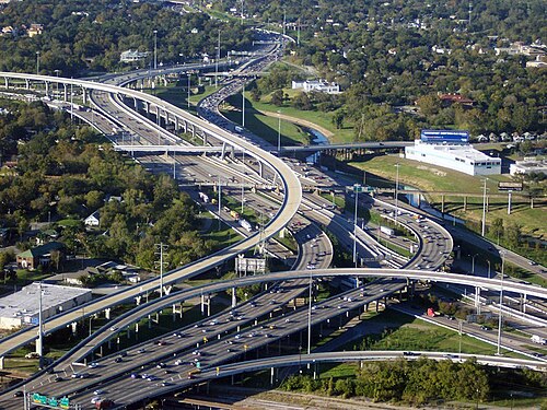 الطريق السريع I-45 والطريق السريع I-10/US 90 بجوار وسط مدينة هيوستن
 يمر الطريق السريع I-70 عبر وادي سبوتد وولف على الحافة الشرقية لـ سان رافائيل سويل .
 عبور الطريق السريع I-90 لبحيرة واشنطن
 في مركز التسوق "بيج آي" في مدينة ألبوكيرك، نيو مكسيكو
 منظر جوي للطريق السريع I-15 باتجاه الجنوب من طريق صن سيت في وادي لاس فيغاس
 الطرف الغربي للطريق السريع I-10 عند نفق ماكلور في سانتا مونيكا
آسيا
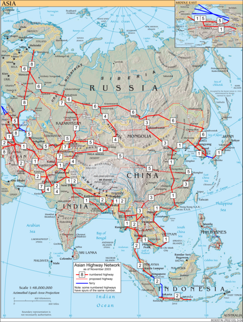

أفغانستان

شُيِّدت العديد من الطرق السريعة في أفغانستان خلال ستينيات القرن الماضي بمساعدة أمريكية وسوفيتية. ففي عام 1964، أنشأ السوفيت طريقًا ونفقًا عبر ممر سالانغ، رابطين بذلك شمال أفغانستان بشرقها. وشكّل الطريق السريع الذي يربط المدن الرئيسية هرات وقندهار وغزني وكابول بشبكة طرق سريعة في باكستان المجاورة، الطريق السريع الرئيسي. ويربط الطريق السريع التاريخي رقم 1 حاليًا المدن الرئيسية. تمتلك أفغانستان شبكة طرق يزيد طولها عن 42,000 كيلومتر (26,000 ميل) ، منها 12,000 كيلومتر (7,500 ميل) مُعبَّدة. وتخضع البنية التحتية للطرق السريعة حاليًا لعملية إعادة تأهيل، وقد تكون محفوفة بالمخاطر في كثير من الأحيان نظرًا لعدم استقرار البلاد.
أرمينيا
تمتلك أرمينيا حوالي 8140 كيلومترًا (5060 ميلًا) من الطرق المعبدة، 96% منها مُعبّدة بالإسفلت. وترتبط أرمينيا بأوروبا عبر شبكة الطرق السريعة الدولية (E-road Network) وبآسيا عبر شبكة الطرق السريعة الآسيوية ( ASPN ). أرمينيا عضو في الاتحاد الدولي للنقل البري واتفاقية النقل الدولي البري (TIR Agreement).
أذربيجان
تمتلك أذربيجان حوالي 29,000 كيلومتر (18,000 ميل) من الطرق المعبدة؛ وقد شُيِّدت أولى الطرق المعبدة خلال الحقبة الإمبراطورية الروسية. وتشهد شبكة الطرق، من الطرق الريفية إلى الطرق السريعة، تحديثًا سريعًا يشمل عمليات إعادة تأهيل وتوسيع. يوجد 334 كيلومترًا (208 أميال) من الطرق لكل 1,000 كيلومتر مربع (390 ميلًا مربعًا ) من أراضي البلاد . وترتبط أذربيجان بأوروبا عبر شبكة الطرق السريعة الدولية (E-road Network) وبآسيا عبر شبكة الطرق السريعة الآسيوية ( ASPN ).
الصين


شبكة الطرق السريعة في الصين، مع نظام الطرق السريعة على المستوى الوطني المعروف رسميًا باسم نظام الطريق السريع الوطني ( الصينية :中国国家干线公路系统؛ بينيين : Zhōngguó Guójiā Gànxiàn Gōnglù Xìtƒng ؛ والمختصر كـ NTHS )، هو نظام متكامل من الطرق السريعة على المستوى الوطني والإقليمي في الصين. . [ 94 ] [ 95 ]
بحلول نهاية عام 2019، بلغ الطول الإجمالي لشبكة الطرق السريعة في الصين 149,600 كيلومتر (93,000 ميل) ، [ 96 ] وهو أكبر نظام طرق سريعة في العالم من حيث الطول، بعد أن تجاوز الطول الإجمالي لنظام الطرق السريعة بين الولايات الأمريكية في عام 2011. [ 97 ] ومن المخطط أن يصل الطول إلى 168,478 كيلومتر (104,687 ميل) بحلول عام 2020. [ 97 ]
تُعدّ الطرق السريعة في الصين إضافة حديثة نسبياً إلى شبكة الطرق المعقدة. ووفقاً لمصادر حكومية صينية، لم تكن الصين تمتلك أي طرق سريعة قبل عام 1988. [ 98 ] وكان طريق جينغشي السريع، الذي يربط بين بكين وشيجياتشوانغ في مقاطعة خبي ، من أوائل الطرق السريعة على مستوى البلاد . ويُشكّل هذا الطريق الآن جزءاً من طريق جينغتشو السريع ، الذي يُعدّ حالياً من أطول الطرق السريعة في الصين، إذ يزيد طوله عن 2000 كيلومتر (1200 ميل) .
 يعبر الطريق السريع نهر اليانغتسي فوق جسر جيانغين المعلق
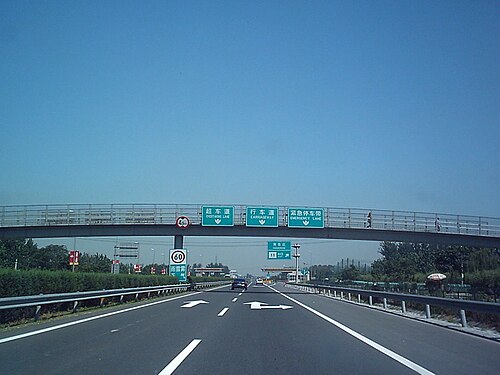 G106، قسم من طريق جينغكاي السريع في جنوب بكين
 الطريق السريع G6 عند تقاطعه مع الطريق الدائري الخامس في شمال بكين
 اللافتات التي تستخدم نظام الترقيم الجديد كما هو موضح على الطريق السريع الوطني الصيني رقم 1 في تيانجين
جورجيا

تتألف شبكة الطرق في جورجيا من 1595 كيلومترًا (991 ميلًا) من الطرق السريعة الرئيسية والدولية بحالة جيدة، منها حوالي 230 كيلومترًا (140 ميلًا) من الطرق السريعة ذات الوصول المحدود بحلول عام 2021، مع استمرار التوسع. أما الطرق الرئيسية الداخلية، التي يبلغ طولها 7000 كيلومتر (4300 ميل) ، فهي متفاوتة الجودة، إلا أن حالتها تتحسن. في المقابل، يبلغ طول حوالي 12400 كيلومتر (7700 ميل) من الطرق المحلية، وهي عمومًا في حالة سيئة. وترتبط جورجيا بأوروبا عبر شبكة الطرق السريعة الدولية (E-road) وبآسيا عبر شبكة الطرق السريعة الآسيوية .
هونغ كونغ


في هونغ كونغ، تُرقّم الطرق السريعة الرئيسية من 1 إلى 10 بالإضافة إلى أسمائها. وتتراوح حدود السرعة على الطرق السريعة عادةً بين 70 و110 كم/ساعة (43 إلى 68 ميل/ساعة) .
 الطريق السريع الشمالي لجزيرة لانتاو
 طريق تولو السريع في ما ليو شوي
 طريق فانلينغ السريع في شونغ شوي
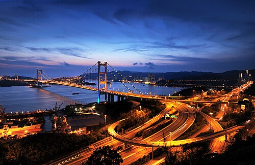 تقاطع تسينغ يي الشمالي الغربي بالقرب من جسر تسينغ ما ( وصلة لانتاو )
الهند

الطرق السريعة (المعروفة باسم "غاتيمارغ " أو "الطرق السريعة" باللغة الهندية ولغات هندية أخرى) هي أعلى فئة من الطرق في شبكة الطرق الهندية، وتشكل حاليًا حوالي 45,890 كيلومترًا (28,510 ميلًا) من نظام الطرق السريعة الوطنية ، بالإضافة إلى 21,637 كيلومترًا (13,445 ميلًا) قيد التنفيذ في مراحل مختلفة. تتكون هذه الطرق من ستة أو ثمانية مسارات على الأقل، وتُدار فيها مداخل ومخارج الطرق السريعة باستخدام طرق فرعية . وتتولى الحكومة الاتحادية ، من خلال الهيئة الوطنية للطرق السريعة في الهند ، تشغيل وصيانة هذه الطرق السريعة .
 جزء من طريق دلهي جورجاون السريع
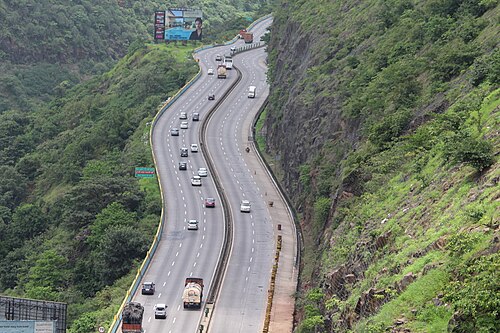 الطريق السريع بين مومباي وبونا
 الطريق السريع بين دلهي وميروت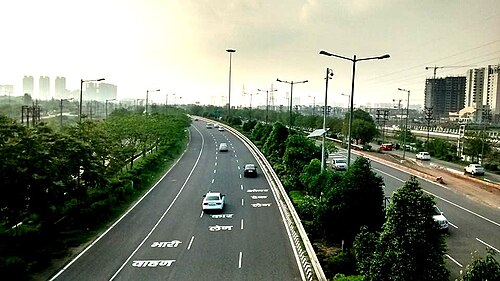
أندونيسيا


في إندونيسيا، جميع الطرق السريعة ( بالإندونيسية : Jalan Bebas Hambatan ، وتعني "الطريق الخالي من العوائق") تخضع لرسوم مرور، ولذلك تُعرف باسم الطرق ذات الرسوم ( Jalan Tol ). يبلغ طول شبكة الطرق السريعة في إندونيسيا 1710 كيلومترات (1060 ميلاً) حتى الآن، ويقع ما يقرب من 70% منها في جزيرة جاوة.
In 2009, the Indonesian government had planned to expand more expressway network in Java island by connecting Merak to Banyuwangi which is the total length of Trans-Java toll road including large cities expressway in Java such as Jakarta, Surabaya, Bandung and its complements is more than 1,000 km (620 mi). The Indonesian government also had planned to build the Trans-Sumatra toll road which connects Banda Aceh to Bakauheni spanning 2,700 km (1,700 mi). In 2012, the government allocated 150 trillion rupiah for the construction of the toll roads. There are three stages of construction of Trans-Sumatra toll road which is expected to be connected together in 2025.[99]
The other islands in Indonesia such as Kalimantan, Sulawesi also has begun constructed its expressways including connecting Manado to Makassar in Sulawesi and also Pontianak to Balikpapan in Kalimantan.[100] However, there are still no plans to build an expressway in Western New Guinea due to its slow population growth. Indonesia is expected to have at least 7,000 km (4,300 mi) of expressway in 2030.
Iran

The history of freeways in Iran goes back to before the Iranian Revolution. The first freeway in Iran was built at that time, between Tehran and Karaj with additional construction and the studies of many other freeways started as well. Today Iran has about 2,160 km (1,340 mi) of freeway.
Iraq

Iraq's network of highways connects it from the inside to adjacent countries such as Syria, Turkey, Kuwait, Saudi Arabia, Jordan and Iran. When Saddam Hussein visited the United States, he was impressed at the highway style and ordered the highways to be built in American form. Freeway 1 is the longest freeway in the country, connecting from Umm Qasr Port in Basra to Ar Rutba in Anbar, spreading to a new freeway connecting it to Syria and Jordan. Iraq has about 45,550 km (28,300 mi) of highways, with 38,400 km (23,900 mi) of them paved.
Israel

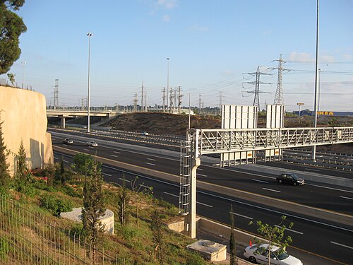
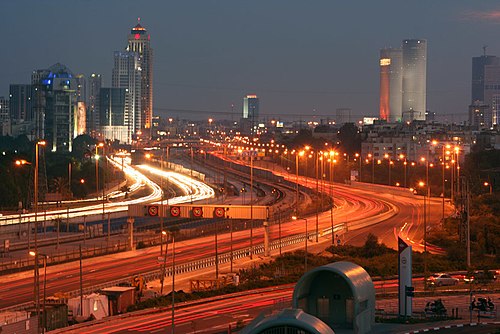
Controlled-access highways in Israel are designated by a blue colour. Blue highways are completely grade-separated but may include bus stops and other elements that may slow down traffic on the right lane. Highway 6 is Israel's longest freeway. It will extend to 260 km (160 mi) in length, from Shlomi in the north to the Negev Junction in the south.[101]
Japan

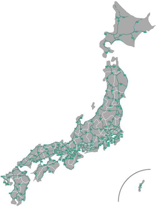

National expressways (高速自動車国道, Kōsoku Jidōsha Kokudō), generally known as 高速道路 (Kōsoku Dōro), make up the majority of controlled-access highways in Japan. The network boasts an uninterrupted link between Aomori Prefecture at the northern part of Honshū and Kagoshima Prefecture at the southern part of Kyūshū, linking Shikoku as well. Additional expressways serve travellers in Hokkaidō and on Okinawa Island, although those are not connected to the Honshū-Kyūshū-Shikoku grid. Expressways have a combined length of 9,429 km (5,859 mi)as of April 2018.[102][103][104]
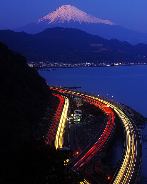 Many Japanese expressways go through the steep mountains.
 A group of green-coloured directional signs on a Japanese expressway
 Toll gates are placed at most of the entrances and exits of Japanese expressways.
 Aerial view of Toyota Junction, connecting Tomei Expressway and Ise-Wangan Expressway
Lebanon
Lebanon has an extensive network of highways that are in varying condition throughout the country. Many highways are part of the Arab Mashreq International Road Network. Some highways have been upgraded to four-lane motorways, including the Beirut–Tripoli highway.
Malaysia

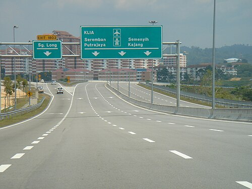

Controlled-access highways in Malaysia are known as expressways (Malay: lebuhraya – this is also the name for highways). However, some expressways, particularly bridges and tunnels such as the Penang Bridge, do not formally use the expressway name; a small number confusingly use the term highway, which is normally the designation for limited-access roads. Route numbers of designated expressways begin with the letter E. All expressways (excluding a section of the South Klang Valley Expressway, which is a two-lane expressway) are built with dual carriageways and at least two lanes in each direction; urban expressways generally have three or more lanes in each direction.
While all expressways are grade separated at major roadways, many urban expressways in the Greater Kuala Lumpur region often have at-grade intersections, including with residential roads and shopfronts, thus do not meet the strict definition of a controlled-access highway. These expressways were previously normal arterial or collector roads that had such intersections, and were not removed when the roads were converted to expressways due to the resulting accessibility and sometimes political issues. Despite this, no expressway allows traffic to cross the median strip (apart from U-turns on a limited number of expressways) and expressways do not have at-grade traffic signals or roundabouts. Expressways have a maximum speed limit of 110 km/h (68 mph), while speed limits of 90 km/h (56 mph) or lower are typical in built-up areas.
As of 2017, expressways have only been designated in Peninsular Malaysia. There are 34 fully or partially open expressways with an approximate total length of 1,821 km (1,132 mi).[105][106] The vast majority of expressways are tolled; the North–South Expressway network, East Coast Expressway and West Coast Expressway predominantly use the ticket system of toll collection, while all other expressways use the barrier system. The construction and operation of expressways in Malaysia are usually privatized via concession agreements with the federal government, using the build–operate–transfer system.
Pakistan

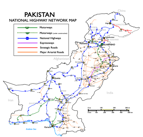
The motorways of Pakistan and expressways of Pakistan are a network of multiple-lane, high-speed, limited-access or controlled-access highways in Pakistan, which are owned, maintained and operated federally by Pakistan's National Highway Authority. The total length of Pakistan's motorways and expressways is 1,670 km (1,040 mi) as of November 2016.[107] Around 3,690 km (2,290 mi) of motorways are currently under construction in different parts of the country. Most of these motorway projects will be complete between 2018 and 2020.[108]
Pakistan's motorways are part of Pakistan's National Trade Corridor project that aims to link Pakistan's three Arabian Sea ports of Karachi, Port Qasim and Gwadar to the rest of the country. These would further link with Central Asia and China, as proposed in the China Pakistan Economic Corridor.
Pakistan's first motorway, the M-2, was inaugurated in November 1997; it is a 367-kilometre-long (228 mi), six-lane motorway that links Pakistan's federal capital, Islamabad, with Punjab's provincial capital, Lahore.[109] It is ranked among the world's top five speed highways/motorways. Other completed motorways and expressways are M1 Peshawar–Islamabad Motorway, M4 PindiBhattian–Faisalabad-Multan Motorway, E75 Islamabad-Murree–Kashmir Expressway, M3 Lahore–Multan Motorway, M8 Ratadero–Gawader Motorway, E8 Islamabad Expressway, M5 Multan-Sukkur Motorway, M9 Karachi-Hyderabad, Sindh and few others.[110]
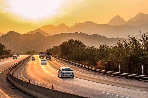 The motorway M-2 passes through the Salt Range mountains.
 M-1 motorway westbound towards Peshawar
 M-1 Peshawar Toll Plaza
 The Makran Coastal Highway (N10) passing through Balochistan
Philippines


Full control-access highways in the Philippines are referred to as expressways, which are usually toll roads. The expressway network is concentrated in Luzon, with the North Luzon Expressway and South Luzon Expressway being the most important ones. The expressway network in Luzon do not form an integrated network, but there are ongoing construction projects to interconnect those highways as well as to decongest the existing roads in the areas they serve. Expressways are being introduced to Visayas and Mindanao through the construction of the Cebu–Cordova Link Expressway in Metro Cebu and Davao City Expressway in Davao City.
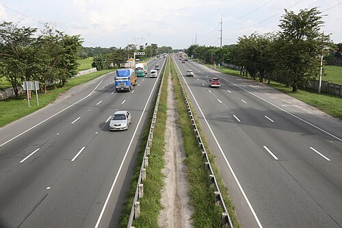 A portion of North Luzon Expressway in Guiguinto, Bulacan
Saudi Arabia

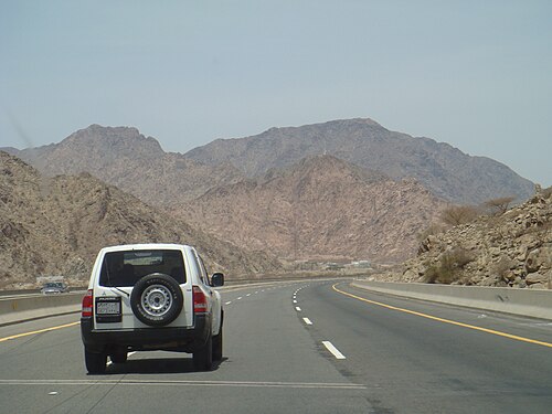
Highways in Saudi Arabia vary from eight-laned roads to small two-lane roads in rural areas. The city highways and other major highways are well maintained, especially the roads in the capital Riyadh. The roads have been constructed to resist the consistently high temperatures and do not reflect the strong sunshine. The other city highways such as the one linking coast to coast are not as great as the inner-city highways but the government is now working on rebuilding those roads. Saudi Arabia is part of the Arab-Mashreq Highway Network and connects to the rest of Asia through the Asian Highway Network.
Singapore

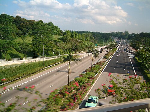
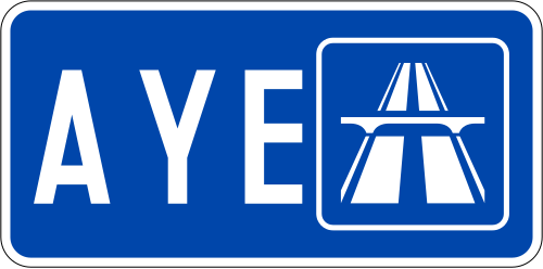
The expressways of Singapore are special roads that allow motorists to travel quickly from one urban area to another. All of them are dual carriageways with grade-separatedaccess. They usually have three to four lanes in each direction, although there are two-lane carriageways at many expressway—expressway intersections and five-lane carriageways in some places. There are ten expressways, including the new Marina Coastal Expressway. Studies about the feasibility of additional expressways are ongoing.
Construction on the first expressway, the Pan Island Expressway, started in 1966. As of 2014, there are 163 km (101 mi) of expressways in Singapore.[111]
The Singaporean expressway networks are connected with Malaysian expressway networks via Ayer Rajah Expressway (connects with the Second Link Expressway via the Malaysia–Singapore Second Link) and Bukit Timah Expressway (connects with the Eastern Dispersal Link via the Johor–Singapore Causeway).
South Korea


Since Gyeongin Expressway linking Seoul and Incheon opened in 1968, national expressway system in South Korea has been expanded into 36 routes, with total length of 4,481 km (2,784 mi) as of 2017. Most of expressways are four-lane roads, while 1,030 km (640 mi) (26%) have six to ten lanes. Speed limit is typically 100 km/h (62 mph) for routes with four or more lanes, while some sections having fewer curves have limit of 110 km/h (68 mph).
Expressways in South Korea were originally numbered in order of construction. Since 24 August 2001, they have been numbered in a scheme somewhat similar to that of the Interstate Highway System in the United States. Furthermore, the symbols of the South Korean highways are similar to the US red, white and blue.
- Arterial routes are designated by two-digit numbers, with north–south routes having odd numbers, and east–west routes having even numbers. Primary routes (i.e. major thoroughfares) have 5 or 0 as their last digit, while secondary routes end in other digits.
- Branch routes have three-digit route numbers, where the first two digits match the route number of an arterial route. This differs from the American system, whose last two digits match the primary route.
- Belt lines have three-digit route numbers where the first digit matches the respective city's postal code. This also differs from American numbering.
- Route numbers in the range 70–99 are not used in South Korea; they are reserved for designations in the event of Korean reunification.
- The Gyeongbu Expressway kept its Route 1 designation, as it is South Korea's first and most important expressway.
 Approaching Seoul from Incheon Airport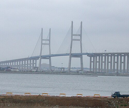
 Airport Town Square junction
 Incheon Bridge Toll Gate
Sri Lanka

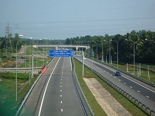

Sri Lanka currently has over 350 km (220 mi) of designated expressways serving the southern part of the country. The first stage of the E01 Expressway (Southern Expressway) which opened in 2011 was Sri Lanka's first expressway spanning a distance of 95.3 km (59.2 mi). The second stage of the Southern Expressway opened in 2014 and extends to Matara. The E03 Expressway (Colombo–Katunayake Expressway) opened in 2013 and connects Sri Lanka's largest city Colombo with the Bandaranaike International Airport covering a distance of 25.8 km (16.0 mi). All E-Grade highways in Sri Lanka are access controlled, toll roads with speeds limits in the range of 80–110 km/h (50–68 mph). The network is to be expanded to 518.5 km (322.2 mi) by 2024.
Operational (fully or partially):
- E01Kottawa-Hambantota
 E02Kottawa-Kerawalapitiya
 E03Colombo-Katunayake
 E04 Enderamulla-Kurunegala-Kandy
 E06 Kahatuduwa-Pelmadulla
Planned:
- Colombo Metropolitan expressway (Colombo Fort to Peliyagoda, connecting Colombo with the E03 expressway (Sri Lanka) Colombo-Katunayaka expressway.)
Syria
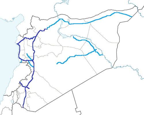
Syria has a well-developed system of motorways in the western half of the country. As the eastern part is underpopulated, it only has two lanes. Highways have been important in terms of transport for the ongoing civil war. The main motorways are:
- M1 - Runs from Homs to Latakia. It also connects Tartus, Baniyas and Jableh. Its length is 174 km (108 mi).
- M2 - Runs from Damascus to Jdeidat Yabous, on the border with Lebanon. It also connects Al-Sabboura. Its length is 38 km (24 mi).
- M4 - Runs from Latakia to Saraqib. It also connects Arihah and Jisr al-Shughur. Its length is 120 km (75 mi). It continues to the Iraqi border all the way to Mosul.
- M5 - Often described as the most important highway, it runs through much of the major cities in Syria and runs to the Jordanian border.
Taiwan (Republic of China)

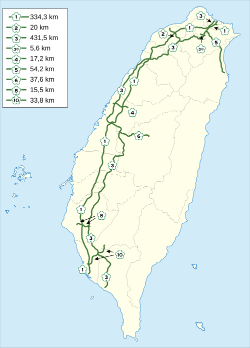
Taiwan has an extensive road network that includes two types of controlled-access highway: freeways and expressways. Only cars and trucks are allowed onto freeways, the first of which — Freeway 1 — was completed in 1974. Expressways allow car and truck traffic as well as motorcycles with engines of 250cc or more.
Expressways in Taiwan may be controlled-access highways similar to national freeways or limited-access roads. Most have urban roads and intra-city expressways (as opposed to Highway system) status, although some are built and maintained by cities.

 Taichung section
 Freeway entrance
Thailand


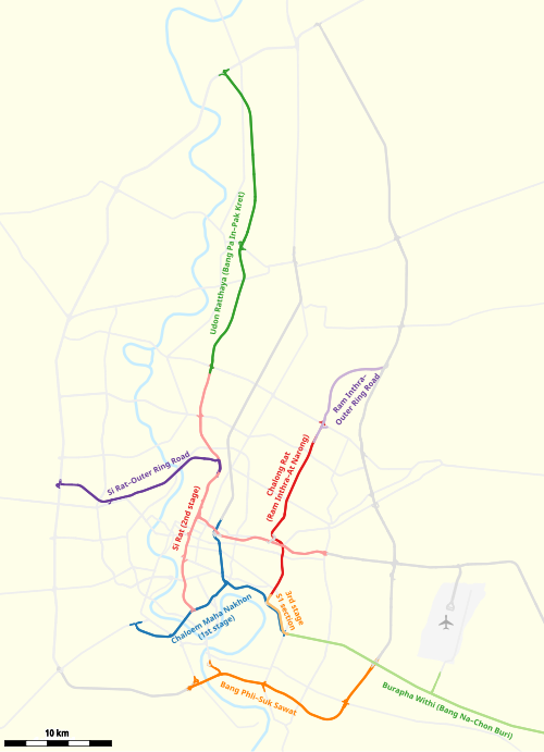
Controlled-access highways in Thailand are separated into urban expressways called expressways, which are operated by the Expressway Authority of Thailand and BEM (except Don Mueang Tollway, which is operated by Don Muang Tollway Public Company Limited) and have a span of 280.4 km (174.2 mi), while intercity expressways are called motorways, which have a span of 187 km (116 mi). The network is to be extended to 4,154.7 km (2,581.6 mi) according to the master plan.
 A motorway interchange in Makkasan, Bangkok
 Srinagarindra Interchange head to Rama IX Road
Uzbekistan

Uzbekistan has 84,400 km (52,400 mi) of roads, about 72,000 km (45,000 mi) of which were paved. Much of the highways are in need of repair, although the condition has been improving. In 2017, the governments of Kazakhstan and Uzbekistan agreed to open a section of the M39 Highway by the Kazakh border.
Vietnam


At present, the expressway system of Vietnam is 3,345 km (2,078 mi) long. The Vietnamese government plans to complete the national expressway system with a total length of 9,000 km (5,600 mi) by 2045. The expressway system in Vietnam is separate from the national highway system.[112]
Most of the expressways are located in the North, especially around Hanoi. Of the 21 expressways in Vietnam, 8 emanate from Hanoi and 14 are in the north, with a length of 1,368 km (850 mi). The first expressway in Vietnam is the Ho Chi Minh City - Trung Luong Expressway, which is inaugurated and opened for traffic on 3 February 2010.
Currently, most of the expressways in Vietnam are four-lane highways, with some routes like Ha Noi - Haiphong, and Phap Van - Cau Gie being six-lane. The only elevated expressway in Vietnam is Mai Dich - Thanh Tri Bridge (also known as the third beltway in Hanoi). The cost of building Vietnam's highways is one of the most expensive in the world, with an average cost of $12 million per kilometre. Compared with China, where there are similarities, their highway costs only $5 million per kilometre, where in the US and European countries, costs $3–4 million per kilometre.[113]
According to road traffic laws of Vietnam, an expressway is a road for motor vehicles, with a divider separating opposing traffic directions, no at-grade crossings with intersecting roads, fully equipped facilities to ensure continuous traffic flow, safety and short journey times, and access allowed only at interchanges.
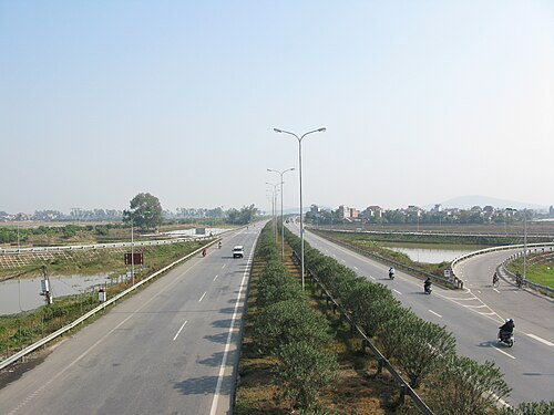 Ha Noi - Bac Giang Expressway in Bac Ninh
 Long Thanh bridge of Ho Chi Minh City - Long Thanh - Dau Giay Expressway
 Cho Dem - Ben Luc elevated part of Ho Chi Minh City - Trung Luong Expressway
 Lien Khuong - Prenn Pass Expressway
 Van Tien bridge of Hai Phong - Mong Cai Expressway
Europe
Regarding road function, motorways serve exclusively the function of flow. They allow for efficient throughput of, usually long distance, motorized traffic, with unhindered flow of traffic, no traffic signals, at-grade intersections or property access and elimination of conflicts with other directions of traffic, thus, dramatically improving both safety and capacity.[24]
Although roads are under the responsibility of each individual state, including within the European Union, there are some legal conventions (international treaties) and some European directives which give a legal framework for roads of a European importance with the goal to introduce some kind of homogenization between various members. They basically consider, at European level, three types of roads: motorways, express roads, and ordinary roads.[114]
Some European treaties also define aspects such as the range of speed limit, or for some geometric aspects of roads, in particularly for the International E-road network.
According to Eurostat:
A motorway is a road specially designed and built for motor vehicle traffic, which does not directly provide access to the properties bordering on it. Other characteristics of motorways include:
- two separated carriageways for the opposing directions of traffic, except at special points or, temporarily, due to carriageway repairs etc.;
- carriageways that are not crossed at the level of the carriageway by any other road, railway or tramway track, or footpath; and
- the use of special signposting to indicate the road as a motorway and to exclude specific categories of road vehicles and/ or road users.
In determining the extent of a motorway its entry and exit lanes are included irrespective of the location of the motorway signposts. Urban motorways are also included in this term.
Most of the European countries use the above motorway definition but different national definitions of motorways can be found in some countries.[24]
It is usually[24] considered that:
- Motorways serve exclusively motorized traffic.
- Motorways have separate carriageways for the two directions of traffic.
- Motorways are not crossed at the same level by other roads, footpaths, railways
- Traffic entrance and exit is performed at interchanges only.
- Motorways have no access for traffic between interchanges and do not provide access to adjacent land.
- Motorways are especially sign-posted
Motorways status is signalled at the entry and exit of the motorway by a symbol conforming to international agreements, but specific to each country.[115]
 Sweden
 Spain
Spain Germany
 United Kingdom, Ireland
 Switzerland
 France
 Italy and Albania
 Romania
 Slovakia
 Portugal
 North Macedonia
The peripheral northern and eastern regions of the EU have a lower density motorway network. Within the European Union, there are 26 regions (NUTS level 2) with no motorway network in 2013. Those regions are islands or remote regions, for instance four overseas French regions and Corsica. The Baltic member state of Latvia, as well as four regions from Poland, and two regions from each of Bulgaria and Romania also reported no motorway network; several of these regions bordered onto adjacent non-member countries to the east of the EU.[116]
European motorways provide reduced accident risks: 50% to 90% lower compared to standard roads, when new motorways only reduce injuries by 7%.[24]
Some of the things which are considered as providing safety in the European motorways are central medians, grade separated interchanges, and access restrictions.[24]
Nonetheless, some specific conditions provide a height risk of a more severe accidents, such as:
- improper use of emergency lane,
- cross-median head-on accidents,
- wrong direction accidents.[24]
Albania


Highways in Albania form part of the recent Albanian road system. Following the collapse of communism in 1991, the first highways in Albania started being constructed, The first was SH2, connecting Tirane with Durrës via Vora. Since the 2000s, main roadways have drastically improved, though lacking standards in design and road safety.[117][118] This involved the construction of new roadways and the putting of contemporary signs. However, some state roads continue to deteriorate from lack of maintenance while others remain unfinished.
 A1 Nation's Highway in Northern Albania connecting Albania with Kosovo
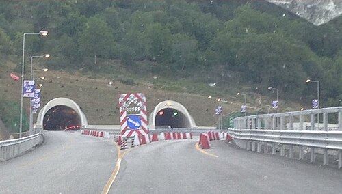 Krraba Tunnel on the A3 Tirana, Elbasan, Albania
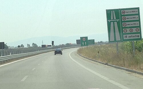 A2 Fier - Vlore known as the Independence Highway
Austria
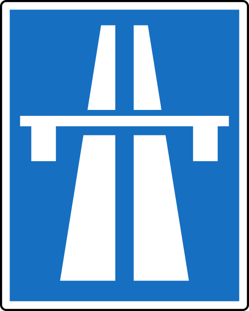



The Austrian autobahns (German: Autobahnen) are controlled-access highways in Austria. They are officially called German: Bundesstraßen A (Bundesautobahnen) under the authority of the federal government according to the Austrian Federal Road Act (Bundesstraßengesetz),[119] not to be confused with the former Bundesstraßen highways maintained by the Austrian states since 2002.
Austria currently has 18 Autobahnen, since 1982 built and maintained by the self-financed ASFiNAG stock company in Vienna, which is wholly owned by the Austrian republic and earns revenue from road-user charges and tolls. Each route bears a number as well as an official name with local reference, which however is not displayed on road signs. Unusually for European countries, interchanges (between motorways called Knoten, "knots") are numbered by distance in kilometres starting from where the route begins; this arrangement is also used in the Czech Republic, Slovakia, Hungary, Spain, and most provinces of Canada (and in most American states, albeit in miles). The current Austrian Autobahn network has a total length of 1,720 km (1,070 mi).
 Brenner Autobahn near Innsbruck
 A22 Donauuferautobahn, near the exit Floridsdorfer Brücke
Belgium


In 1937, the first motorway between Brussels and Ostend was completed, following the example of neighbouring countries such as Germany. It mainly served local industries and tourism as a connection between the capital city and a coastal region. However, the Second World War and the reparation of the complete road network after the war caused a serious delay in the creation of other motorways. In 1949, the first plans were made to build a complete motorway network of 930 km (580 mi) that would be integrated with the neighbouring networks. Although the plans were ready, the construction of the motorway network was much slower than in neighbouring countries because the project was deemed not to be urgent.
Because of economic growth in the 1960s, more citizens could afford cars, and the call for good-quality roads was higher than ever before. In each year between 1965 and 1973, over 100 km (62 mi) of motorway were built. At the end of the 1970s, the construction of motorways slowed down again due to costs, combined with an economic crisis, more expensive fuel and changing public opinion. In the following years, the only investments done were to complete already started motorway constructions. But most important cities were already connected. In 1981, the responsibilities for construction and maintenance of the motorways shifted from the federal to the regional governments. This sometimes caused tensions between the governments. For example, the part of the ring road around Brussels that crosses Wallonian territory has never been finished, since only Flanders suffers from the unfinished ring.[120]
Belgium today has the longest total motorway length per area unit of any country in the world. Most motorway systems in Belgium have at least three lanes in each direction. Nearly all motorways have overhead lighting including those in rural areas. The dense population of Belgium and the still unfinished state of some motorways, such as the ring roads around Brussels and Antwerp cause major traffic congestion on motorways. On an average Monday morning in 2012, there was a total of 356 km (221 mi)[121] of traffic jams and the longest traffic jam of the year was 1,258 km (782 mi),[122] purely on the motorways.
Bosnia and Herzegovina

Bosnia and Herzegovina has more than 208 km (129 mi) of highway, which connects Kakanj-Sarajevo. There is a plan to build highway on Corridor Vc, which will go from river Sava, across Doboj, Sarajevo and Mostar to Adriatic Sea. Next sections are Kakanj-Drivuša 16 km (9.9 mi), Zenica Sjever-Drivuša 11 km (6.8 mi), Svilaj-Odžak 11 km (6.8 mi), Vlakovo-Tarčin 20 km (12 mi), Počitelj-Bijača 21 km (13 mi). The speed limit is 130 km/h (81 mph) or 100 km/h (62 mph) in tunnels.[123]

 Mahovljanska interchange
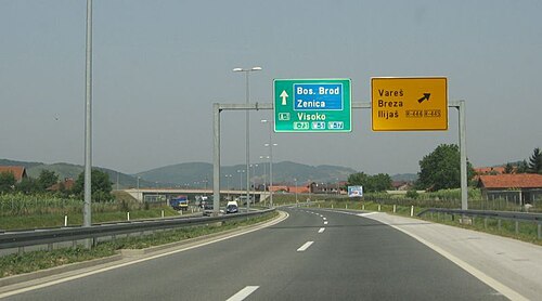 A1 motorway
Bulgaria


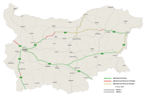
Legislation in Bulgaria defines two types of highways: motorways (Aвтомагистрала, Avtomagistrala) and expressways (Скоростен път, Skorosten pat). The main differences are that motorways have emergency lanes and the maximum allowed speed limit is 140 km/h (87 mph), while expressways do not have emergency lanes and the speed limit is 120 km/h (75 mph). As of June 2018, 777 km (483 mi) of motorways are in service, with another 62 km (39 mi) under various stages of construction. More than 590 km (370 mi) are planned. Also, several expressways are planned.
 Trakia motorway near Nova Zagora
 Europe motorway
Croatia


The primary high-speed motorways in Croatia are called autoceste (singular: autocesta; Croatian pronunciation:[ˈaʊtotsesta]), and they are defined as roads with at least two lanes in each direction (including hard shoulder) and a speed limit of not less than 80 km/h (50 mph). The typical speed limit is 130 km/h (81 mph). As of 2025, there are 1,360.5 km (845.4 mi) of motorways in Croatia. There is also a category known as brza cesta, meaning "expressway". These roads have a speed limit up to 110 km/h (68 mph) and are not legally required to be grade-separated, but nearly all are.
Cyprus
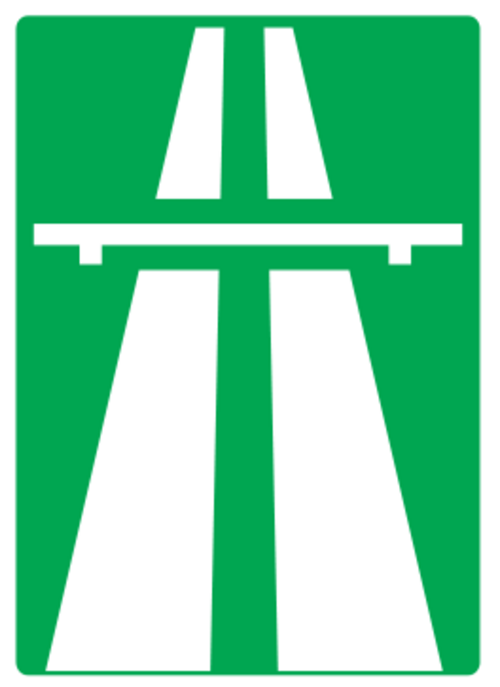
Motorways (Greek: αυτοκινητόδρομος, Turkish: Otoyol) connect all cities in Cyprus, although in the territory under de facto Turkish control these do not meet international standards for the definition of motorways. In the areas administered by the Republic of Cyprus, motorway numbers are prefaced with the letter A, and run from A1 to A6, to distinguish them from all other roads, designated B roads. Of the A roads, all are designated motorways, except for the A4, linking Larnaca with Larnaca Airport.
Motorways are also distinguishable by the use of green-backed road signs, with standard international graphics, and text in yellow in Greek and white in English, distinguishable from B road signage, which has signs with blue backgrounds.
Motorway junctions are theoretically designated with junction numbers, but signage is not consistent is indicating the exit numbers.
Czech Republic


The Czech Republic has currently (2023) 1,363 km (847 mi)[124] of motorways (dálnice) whose speed limit is 130 km/h (81 mph) (or 80 km/h (50 mph) within a town). The total length should be 2,000 km (1,200 mi) around 2030. The number of a motorway (in red) copies the number of the national route (in blue) which has been replaced by the motorway. There are also roads for motorcars (silnice pro motorová vozidla). Those common roads are not subject to a fee (in form of vignette) for vehicles with total weight up to 3.5 t (3.4 long tons; 3.9 short tons) and their speed limit is 110 km/h (68 mph), partially up to 130 km/h (81 mph).
Denmark


Denmark has a well covered motorway system today, which has been difficult to build due to the county's geography with many islands. The longest bridges are the Great Belt and the Øresund bridges to Skåne (Scania) in southern Sweden. Both are motorways with dual electrical train tracks added.
Finland

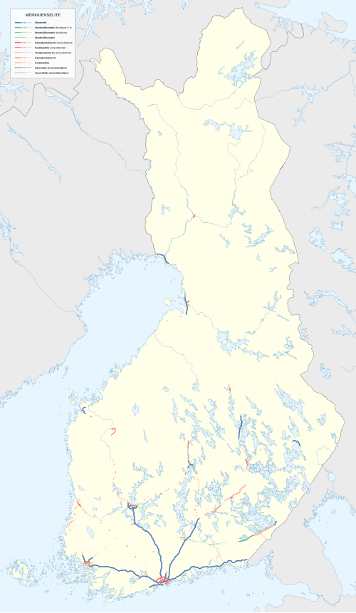

Finland has 863 km (536 mi) of motorway, which is only a small proportion of the whole highway network. More than half of the length of the motorway network consists of six radial motorways originating in Helsinki, to Kirkkonummi (Länsiväylä), Turku (Vt1/E18), Tampere (Vt3/E12), Tuusula (Kt45), Heinola (Vt4/E75) and Vaalimaa (Vt7/E18). These roads have a total length of 653 km (406 mi). The other motorways are rather short sections close to the biggest cities, often designed to be bypasses. The motorway section on national roads 4 and 29, between Simo and Tornio, is said to be the northernmost motorway in the world.
Finnish motorways do not have a separate road numbering scheme. Instead, they carry national highway numbers. In addition to signposted motorways, there are also some limited-access two-lane expressways, and other grade-separated four-lane expressways (perhaps the most significant example being Ring III near Helsinki).
 Valtatie 1 near Halikko

France


The autoroute system in France consists largely of toll roads, except around large cities and in parts of the north. It is a network of 11,882 km (7,383 mi) worth of motorways. Autoroute destinations are shown in blue, while destinations reached through a combination of autoroutes are shown with an added autoroute logo. Toll autoroutes are signalled with the word péage (toll).
 Cross between A430 motorway and A43 motorway
 Toll barrier in Hordain (south of Hordain), on autoroute A2
Germany


Germany's network of controlled-access expressways includes all federal Autobahnen and some parts of Bundesstraßen and usually no Landesstraßen (state highways), Kreisstraßen (district highways) nor Gemeindestraßen (municipal highways). The federal Autobahn network has a total length of 13,183 km (8,192 mi) in 2020, making it one of the densest networks in the world. The German autobahns have no general speed limit for some classes of vehicles (though nearly 30% of the total autobahn network is subject to local and/or conditional limits[125]), but the advisory speed limit (Richtgeschwindigkeit) is 130 km/h (81 mph). The lower class expressways usually have speed limits of 120 km/h (75 mph) or lower.

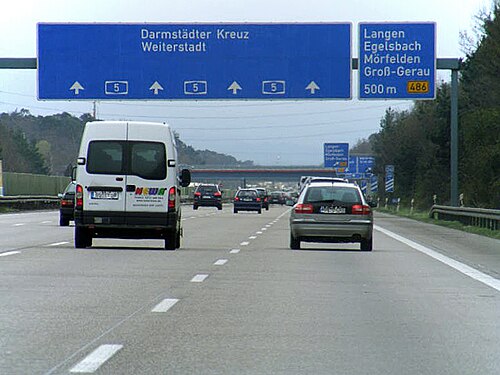


Greece


Greece's motorway network has been extensively modernised throughout the 1980s, 1990s and especially the 2000s, while part of it is still under construction. Most of it was completed by mid 2017 numbering around 2,500 km (1,600 mi) of motorways, making it the biggest highway network in Southeastern Europe and the Balkans and one of the most advanced in Europe.[126]
There are a total of 10 main routes throughout the Greek mainland and Crete, from which some feature numerous branches and auxiliary routes. Most important motorways are the A1 Motorway connecting Greece's two largest cities (Athens and Thessaloniki), the A2 motorway (Egnatia Odos), also known as the "horizontal road axis" of Greece, connecting almost all of Northern Greece from west to east and the A8 motorway (Olympia Odos) connecting Athens and Patras. Another important motorway is the A6 motorway (Attiki Odos), the main beltway of the Athens Metropolitan area.


Hungary


In Hungary, a controlled-access highway is called an autópálya (plural autópályák).
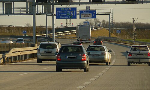 Eastern section of M0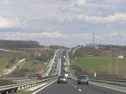
 M7 motorway in Köröshegyi völgyhíd
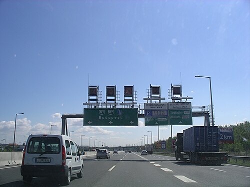 M1 - M7 common phase, near Budapest
Ireland
In Ireland the Local Government (Roads and Motorways) Act 1974 made motorways possible, although the first section, the M7 Naas Bypass, did not open until 1983. The first section of the M50 opened in 1990, a part of which was Ireland's first toll motorway, the West-Link. However it would be the 1990s before substantial sections of motorway were opened in Ireland, with the first completed motorway—the 83-kilometre (52 mi)M1 motorway—being finished in 2005.
Under the Transport 21 infrastructural plan,[127] motorways or high quality dual carriageways were built between Dublin and the major cities of Cork, Galway, Limerick and Waterford by the end of 2010. Other shorter sections of motorway either have been or will be built on some other main routes. In 2007 legislation (the Roads Bill 2007) was created to allow existing roads be designated motorways by order because previously legislation allowed only for newly built roads to be designated motorways.
As a result, most HQDCs nationwide (other than some sections near Dublin on the N4 and N7, which did not fully meet motorway standards) were reclassified as motorways. The first stage in this process occurred when all the HQDC schemes open or under construction on the N7 and N8, and between Kinnegad and Athlone on the N6 and Kilcullen and south of Carlow on the N9, were reclassified motorway on 24 September 2008. Further sections of dual carriageway were reclassified in 2009.
As of December 2011, the Republic of Ireland has around 1,017 km (632 mi) of motorways.
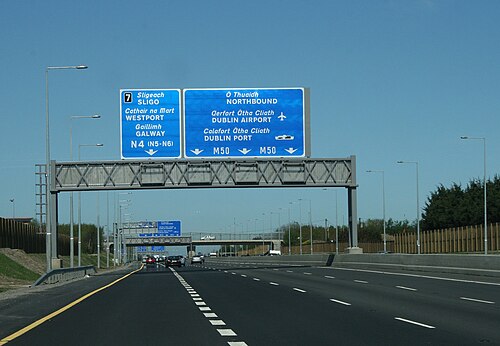

Italy


Roads in Italy are an important mode of transport in Italy. The world's first motorway was the Autostrada dei laghi, inaugurated on 21 September 1924 in Italy. It linked Milan to Varese; it was then extended to Como, near the border with Switzerland, inaugurated on 28 June 1925. Piero Puricelli, the engineer who designed this new type of road, decided to cover the expenses by introducing a toll.[128][129]
Other motorways (or autostrade) built before World War II in Italy were Naples-Pompeii, Florence-Pisa, Padua-Venice, Milan-Turin, Milan-Bergamo-Brescia and Rome-Ostia. The total length of the Italian motorway system is about 7,016 kilometres (4,360 mi), as of 30 July 2022.[130] To these data are added 13 motorway spur routes, which extend for 355 kilometres (221 mi).[131] The density is 22.4 kilometres (13.9 mi) of motorway for every 1,000 square kilometres (390 sq mi) of Italian territory.[132]
Italian motorways (or autostrade) are mostly managed by concessionaire companies. From 1 October 2012 the granting body is the Ministry of Infrastructure and Transport and no longer Anas[133] and the majority (5,773.4 kilometres (3,587.4 mi) in 2009[134]) are subject to toll payments. On Italian motorways, the toll applies to almost all motorways not managed by Anas. The collection of motorway tolls, from a tariff point of view, is managed mainly in two ways: either through the "closed motorway system" (km travelled) or through the "open motorway system" (flat-rate toll).[135]
Italy's motorways (or autostrade) have a standard speed limit of 130 km/h (80 mph) for cars. Limits for other vehicles (or when visibility is poor due to weather) are lower. Legal provisions allow operators to set the limit to 150 km/h (95 mph) on their concessions on a voluntary basis if there are three lanes in each direction and a working SICVE, or Safety Tutor, which is a speed-camera system that measures the average speed over a given distance.
Type B highway (Italian: strada extraurbana principale), commonly but unofficially known as superstrada (Italian equivalent for expressway), is a divided highway with at least two lanes in each direction, paved shoulder on the right, no cross-traffic and no at-grade intersections. Access restrictions on such highways are exactly the same as motorways (or autostrade). The signage at the beginning and the end of the strade extraurbane principali is the same, except the background colour is blue instead of green. The general speed limit on strade extraurbane principali is 110 km/h (70 mph), unless otherwise indicated. Strade extraurbane principali are not tolled.


 Autostrada A22 runs through Po Valley and Alps linking Modena to Brenner Pass, a mountain pass which forms the border betweenItaly and Austria
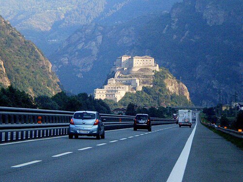
Kosovo
Kosovo's motorways (pronounced Austostrada/Autostradë in Albanian, and Autoput in Serbian) include for example, R7 (Ibrahim Rugova Highway) connecting to Albania's A1 (Rruga e Kombit), and it also connects to E80 in the E-Road network.
Latvia
There is currently one category of controlled-access highways in Latvia, which are expressways (Latvian: ātrgaitas ceļš) with maximum speed 120 km/h (75 mph). The first expressway in Latvia opened in October 2023, the Ķekava Bypass, which is a part of the A7.[136] Current length of the expressway network is 11 km (6.8 mi).
Lithuania

There are two categories of controlled-access highways in Lithuania: expressways (Lithuanian: greitkeliai) with maximum speed 120 km/h (75 mph) and motorways (Lithuanian: automagistralės) with maximum speed 130 km/h (81 mph). The first section Vilnius–Kaunas of A1 highway was completed in 1970. Kaunas–Klaipėda section of A1 was completed in 1987.[137]Vilnius-Panevėžys (A2 highway) was completed in stages during the 1980s and finished in the 1990s. Complete length of the motorway network is 310 km (190 mi). Expressway network length - 80 km (50 mi). Motorway section between Kaunas and the Polish border is planned to be completed in the 2020s.
 A1 motorway near Kaunas
 A2 motorway near Taujėnai
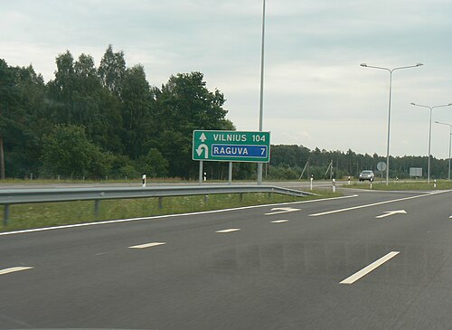 Motorway junction with U-turns. A2 motorway near Raguva.
Montenegro


Montenegro has had a motorway since 13 July 2022, when the first section of the Bar-Boljare motorway was inaugurated. On Montenegrin motorways, the speed-limit is 100 kilometres per hour (62 mph). In May 2015 work started on the first section in Montenegro, Smokovac - Uvač - Mateševo, with a length of 41 kilometres
 Princess Xenia motorway A-1 of July 2022
Netherlands


Roads in the Netherlands include at least 2,758 km (1,714 mi) of motorways and expressways,[138] and with a motorway density of 64 kilometres per 1,000 km2 (103 mi/1,000 mi2), the country has one of the densest motorway networks in the world.[139] About 2,500 km (1,600 mi) are fully constructed to motorway standards,[140] These are called Autosnelweg or simply snelweg, and numbered and signposted with an A and up to three digits, like A12.
They are consistently built with at least two carriageways, guard rails and interchanges with grade separation. Since September 2012, the nationwide maximum speed has been raised to 130 km/h (81 mph), but on many stretches speed is still limited to 120 or 100 km/h (75 or 62 mph). Dutch motorways may only be used by motor vehicles both capable and legally allowed to go at least 60 km/h (37 mph).
In March 2020, the general speed limit on Dutch motorways was lowered to 100 km/h (62 mph) during the day (6 am until 7 pm). At night, the maximum speed is different per stretch, but 130 km/h (81 mph) remained the upper limit.
Dutch roads are used with a very high intensity in relation to the network length[139] and traffic congestion is common, due to the country's high population density. Therefore, since 1979 large portions of the motorway network have been equipped with variable message signs and dynamic electronic displays, both of which are aspects of intelligent transportation systems. These signs can show a lower speed limit, as low as 50 km/h (31 mph), to optimize the flow of heavy traffic, and a variety of other communications. Additionally there are peak, rushhour or plus lanes, which allow motorists to use the hard shoulder as an extra traffic lane in case of congestion. These extra lanes are observed by CCTV cameras from a traffic control center.
Less common, but increasingly, separate roadways are created for local/regional traffic and long-distance traffic. This way the number of weaving motions across lanes is reduced, and the traffic capacity per lane of the road is optimized. A special feature of Dutch motorways is the use of Porous Asphalt Concrete, which allows water to drain efficiently, and even in heavy rain no water will splash up, in contrast to concrete or other road surfaces. The Netherlands is the only country that uses PAC this extensively, and the goal is to cover 100% of the motorways with PAC, in spite of the high costs of construction and maintenance.
 Local and express lanes connected using a basketweave
 Dynamic Route Information Panel (DRIP) on Dutch A13 freeway during evening rush hour
North Macedonia

The total motorway network length in North Macedonia is 317 km (197 mi) as of Spring 2019. Another 70 km (43 mi) are under construction, 57 km (35 mi) (Ohrid to Kicevo) and 13 km (8.1 mi) (Skopje to Kosovo border). The stretch from Gostivar to Kicevo is planned to start with construction in 2021. The three motorway routes are A1, which is part of the European corridor E-75, A2 (part of E-65) and the recently built A4 corridor that connects Skopje to Stip. A1 connects the northern border (Serbia) with the southern one (Greece), while A2 traverses the country from the East (Bulgaria border) to West (Albania border), but only the stretch from Kumanovo to Gostivar is a divided motorway, while the rest of the length is either an undivided two-way road or in the process of turning into a motorway.[141]
Norway

Norway has (2022) 770 km (480 mi) of motorways, in addition to 498 km (309 mi) of limited-access roads (in Norwegian motortrafikkvei) where pedestrians, bicycles, etc. are forbidden, though with a bit lower standard than true motorway. Most of the network serves the big cities, chiefly Oslo, Stavanger and Bergen. Northernmost motorway is, as of 2022, on E6 just south of Trondheim: see also the E6, E18 and the E39. Most motorways use four-ramp Dumbbell interchanges, but also Roundabout interchanges can be found. The first motorway was built in 1964, just outside Oslo. The motorways' road pattern layout is similar to those in the United States and Canada, featuring a yellow stripe towards the median, and white stripes between the lanes and on the edge. The speed limits are 90–110 km/h (56–68 mph).
Poland
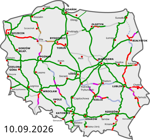
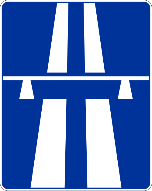
The highways in Poland are divided into motorways and expressways, both types featuring grade-separated interchanges with all other roads, emergency lanes, feeder lanes, wildlife protection measures and dedicated roadside rest areas. Motorways can be only dual carriageways, while expressways can be dual or, rarely, single carriageways. The start of an expressway in Poland is marked with a sign of white car on blue background, while number sign for an expressway is of red background and white letters, with the letter S preceding a number. Speed limits in Poland are 140 km/h (87 mph) on motorways and 120 km/h (75 mph) on dual-carriageway expressways.
The Regulation of the Council of Ministers defines the network of motorways and expressways in Poland totalling about 7,980 km (4,960 mi) (including about 2,100 km (1,300 mi) of motorways).[142]
As of July 2022, there are 4,688 km (2,913 mi) of motorways and expressways in operation (58% of the intended network), while contracts for construction of further 1,170 km (727 mi) of motorways and expressways (15% of the intended network) are ongoing.[143]
 A4 near Jaworzno, opened in 1983

 Wrocław Stadion junction
 Expressway S5 near Bydgoszcz
Portugal
Portugal was the third country in Europe—after Italy and Germany—to build a motorway (Portuguese: autoestrada, plural: autoestradas), opening, in 1944, the Lisbon-Estádio Nacional section of the present A5 (Autoestrada da Costa do Estoril).[144]
Additional motorway sections were built in the 1960s, 1970s and early 1980s. However, the large-scale building of motorways started only in the late 1980s. Currently, Portugal has a very well-developed network of motorways, with about a 3,000-kilometre (1,900 mi) extension, that connects all the highly populated coastal regions of the country and the main cities of the less populous interior. This means that 87% of the Portuguese population lives at less than 15 minutes' driving time from a motorway access.[145]
Unlike the neighbouring Spanish network, most of Portuguese motorways are tolled, although there are also some non-tolled highways, mostly in urban areas, like those of Greater Lisbon and Greater Oporto. In the late 1990s and early 2000s, the Government of Portugal created seven shadow toll concessions, the SCUT toll (Sem custos para o utilizador, no costs for the user). In those concessions it were included more than 900 km (560 mi) of motorways and highways, some of them already built, others which were built in the following years. However, due to economical and political reasons, the shadow toll concept was abolished between 2010 and 2011, with electronic toll equipment being installed in these motorways, to charge their users. Having only electronic tolls, former SCUT motorways can now only be used by vehicles equipped with electronic payment devices or vehicles registered in the system.
Portuguese motorways form an independent network (Rede Nacional de Autoestradas, National Motorway Network), that overlaps with the Fundamental and Complementary subnetworks of the National Highway Network (Rede Rodoviária Nacional). Each motorway section overlapping with the Fundamental subnetwork is part of an IP (Itinerário principal, Principal route) and each motorway section overlapping with the Complementary subnetwork is part of an IC (Itinerário complementar, Complementary route). Thus, a motorway can overlap with sections of different IP or IC routes and - on the other hand - an IP or IC route can overlap with sections of different motorways. An example is A22 motorway, which overlaps with sections of IP1 and of IC4 routes; another example is IP1 route, which overlaps with sections of the A22, A2, A12, A1 and A3 motorways.
The National Motorway Network has a proper numbering system in which each motorway has a number prefixed by the letter "A". In most cases, a motorway signage indicates only its A number. The number of the IP or IC of which a motorway section is a part is not signed except in some short motorways which lack a proper A number.
 A5 (Lisbon-Cascais) motorway, inaugurated in 1944 as the first motorway in Portugal
 A1 (Lisbon-Oporto) motorway, the main road link between the two largest cities of the country
 Corgo viaduct, part of the A4 (Oporto-Bragança) motorway
 Tunnel at the A27 (Ponte de Lima-Viana do Castelo) motorway
Romania

As of 27 November 2025, Romania has 1,367.635 km (849.809 mi) of highways in use, with more under construction.[146]
The first motorway in Romania was completed in 1972, linking Bucharest and Pitești.[147] The Romanian Government has adopted a General Master Plan for Transport that was approved by the European Union in July 2015, containing the strategy for expanding the road (including motorway) network until 2040, using EU co-financing.[148]
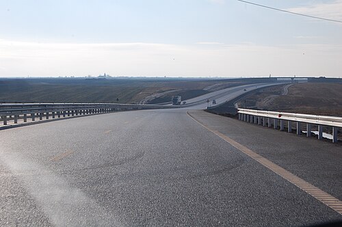 A1 motorway between Arad and Timișoara
 A1 motorway near Sibiu
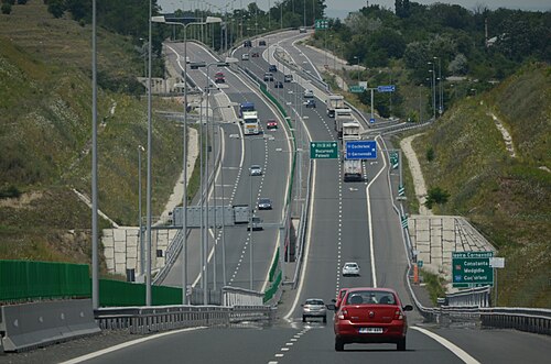 A2 motorway near Cernavodă interchange
 A3 motorway between Gilău and Turda
 A7 motorway near Bacău Bypass
 A10 motorway and the hills of Transilvania
Russia
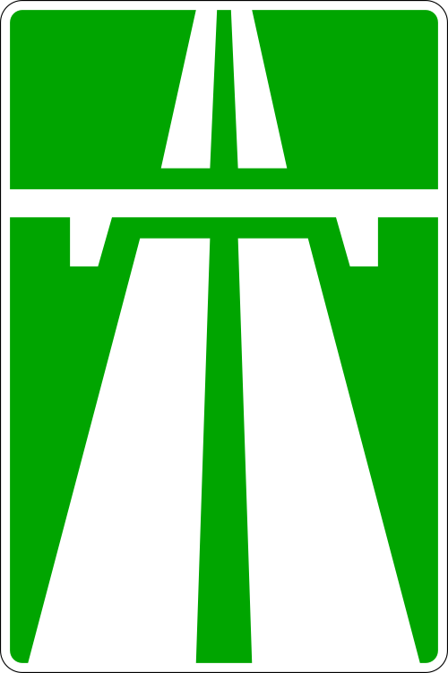

In 2025, Russia will have a nationwide motorway network with a length of 2,140.9 km (1,330.3 mi) and expressway network of 2,752 km (1,710 mi).
The motorways and expressways have the numbering of the Russian federal highway network or their own name, as there is no separate numbering system for motorways and expressways and their sections are mostly part of the Russian federal highway network. The legal speed limit on motorways and expressways is 110 km/h, and 130 km/h[149] on some newly upgraded sections of motorway. Sections of Russian federal highway that have been upgraded to motorway status are marked with green signs. Federal highway roads that have been upgraded to expressways or dual and single carriageway with road junction are marked with blue signs.
In the classification of Russian federal highway roads, motorways are assigned to technical category IA and expressways to technical category IB.[150]


 Motorway M4 in Novocherkassk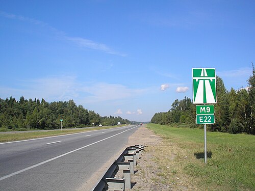

 The Western High-Speed Diameter next to the Krestovsky Stadium
Serbia

Motorways (Serbian: Аутопут, romanized: Autoput) and expressways (Serbian: Брзи пут, romanized: Brzi put) are the backbone of the road system in Serbia. As of July 2025 there are 1,048 km (651 mi) of motorways in total.
Motorways in Serbia have three lanes (including emergency lane) in each direction, signs are white-on-green, as in the rest of former Yugoslavia and the normal speed limit is 130 km/h (81 mph).
Expressways, unlike motorways, do not have emergency lanes, signs are white-on-blue and the normal speed limit is 100 km/h (62 mph).
As the Serbian word for motorway is autoput, the "A1", "A2" or "A3" road designations are used since November 2013.[151] All state roads categorized as class I, that are motorways currently of in the future, are marked with one-digit numbers and known as class Ia. All other roads, which belong to class I, are marked with two-digit numbers and known as class Ib. Expressways belong to class Ib, too. E-numeration is also widely used on motorways.
The core of the motorways is what was once called during Yugoslav period, the Brotherhood and Unity Highway, which was opened in 1950 and goes from the border with Croatia, through Belgrade, Central Serbia, Niš, and to border with North Macedonia. It was one of the first modern highways in Central-Eastern Europe. It is the most direct link between Central and Western Europe with Greece and Turkey, and subsequently the Middle-East.


 Motorway A2, Tunnel Savinac
Slovakia

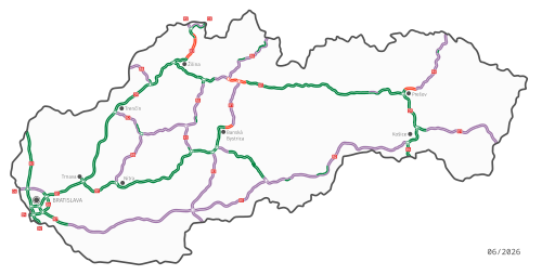
Slovakia has currently (2022) 854 km (531 mi) of motorways (Slovak: diaľnica, D) and expressways (rýchlostná cesta, R) whose speed limit is 130 km/h (81 mph). They are split into expressways and motorways with expressways starting with a R, short for "rýchlostná cesta", but from April 2020 all the expressways in Slovakia were known as motorways due to that the expressways are very similar to the motorways in Slovakia. An e-vignette is paid to use the motorways in Slovakia, while before drives used to pay a sticker vignette, but from 2016 drivers pay electronically through the website.
There is another type of road called road for motor vehicles (Slovak: cesta pre motorové vozidlá) and the speed limits on these roads range from 90 to 130 km/h (56 to 81 mph) (but most are limited to 100 km/h [62 mph]). They are built as dual carriageways with a few sections being single carriageways. Some motorways that are single carriageways are labeled as "roads for motor vehicles".
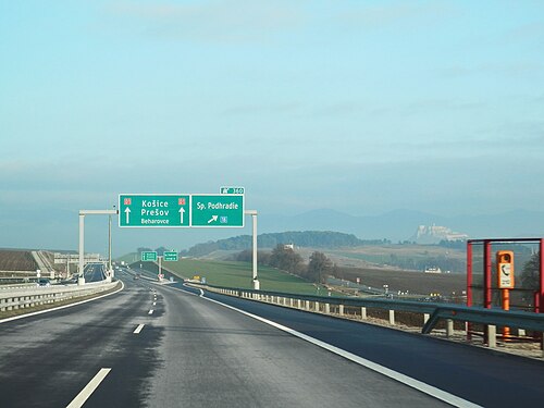
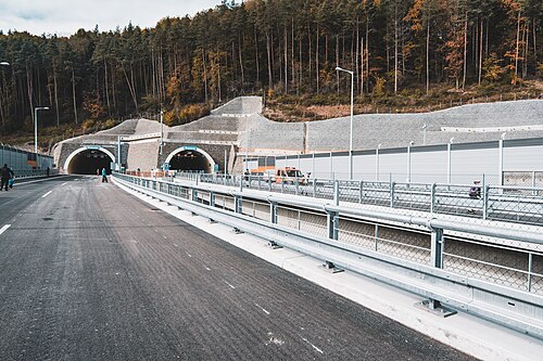 Považský Chlmec Tunnel on D3 before opening
 View of the High Tatras from the D1 near Poprad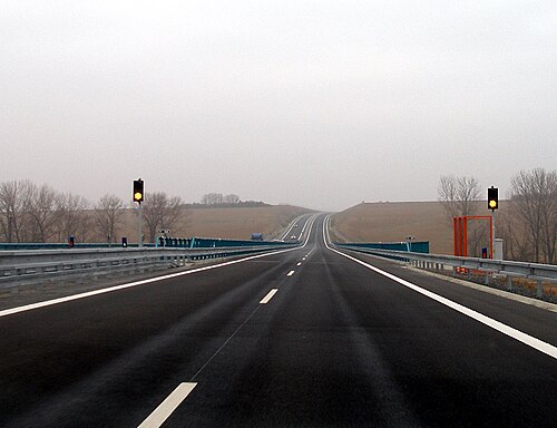
 Old sign for motorways
 Old sign for expressways
 The Považská Bystrica viaduct
Slovenia

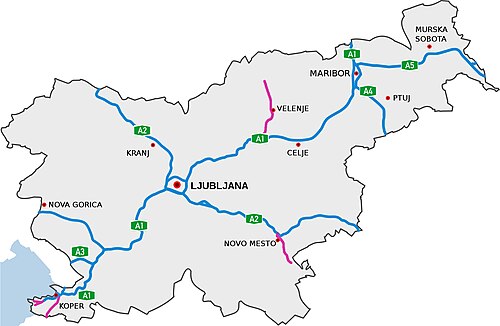
The highways in Slovenia are the central state roads in Slovenia and are divided into motorways (Slovene: avtocesta, AC) and expressways (hitra cesta, HC). Motorways are dual carriageways with a speed limit of 130 km/h (81 mph). They have white-on-green road signs as in Italy, Croatia and other countries nearby. Expressways are secondary roads, also dual carriageways, but without an emergency lane. They have a speed limit of 110 km/h (68 mph) and have white-on-blue road signs.

 The Medvedjek Slope on the eastern part of the A2 (Lower Carniola)
 The toll station at Log pri Brezovici
 A1 near Postojna
Spain


The Spanish network of autopistas and autovias has a length of 17,228 km (10,705 mi), making it the largest in Europe and the third in the world.[152]Autopistas are specifically reserved for automobile travel, so all vehicles not able to sustain at least 60 km/h (37 mph) are banned from them. General speed limits are mandated by the Spanish Traffic Law as 60–120 km/h (37–75 mph). Specific limits may be imposed based on road, meteorological or traffic conditions. Spanish legislation requires an alternate route to be provided for slower vehicles. Many, but not all, autopistas are toll roads, which also mandates an alternate toll-free route under the Spanish laws.


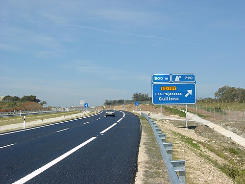
Sweden
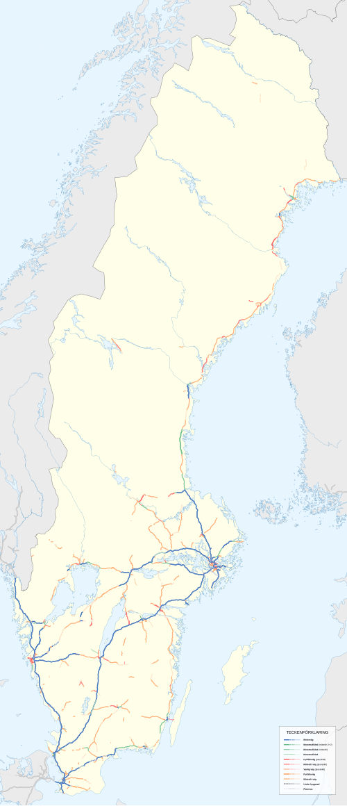

Sweden has the largest motorway network in Scandinavia (2,050 kilometres, 1,274 mi).[153] It is, however, unevenly allocated. Most motorways are located in the south of the country, where the population density is the highest.
The first motorway in Sweden opened in 1953, between Lund and Malmö. Four-lane expressways had been built before, an early example is E20 between Gothenburg and Alingsås, built in the early 1940s. Most of the current network was built in the 1970s and 1990s.
E6 starts i Trelleborg in southern Sweden, it then continues along the Swedish western coast, up to the Svinesund bridge which is where Sweden borders to Norway. Its length is close to 600 km (370 mi) on Swedish territory alone, and it connects four of Scandinavia's six largest cities, Copenhagen, Malmö, Gothenburg and Oslo together,[154][155][156] as well as around 20 other more or less notable towns and cities.
A Swedish (partly motorway) route (rather than road) that also has a significant portion of the Swedish motorway network, is European route E4, which runs from the border city of Tornio in northern Finland to Helsingborg in southern Sweden. E4 is the main route that connects the capital Stockholm with Scania. All of E4 south of the city Gävle is of motorway standard. The part of E4 that runs through western Stockholm is called Essingeleden and is the busiest road in Sweden.
Other highways that have a significant portion of motorway standard are E20, E18 and E22. Motorways in Sweden are however not restricted to European routes; so called Riksvägar and other regional road types can also be of motorway standard. An example of this is Riksväg 40. Riksväg 40 is the main link between the largest cities in the country, Stockholm and Gothenburg. Notably, not even the majority of the European route- network in Sweden is motorway or even have expressway standard. All of this is because road numbering and road standard is separate in Sweden, as in the rest of Scandinavia.
 E22 Motorway westbound towards Karlskrona
 The Södra länken Rv-75 ring road in Stockholm
Switzerland
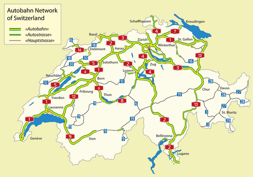

Switzerland has a two-class highway system: motorways with separated roads for oncoming traffic and a standard maximal speed limit of 120 km/h (75 mph), and expressways often with oncoming traffic and a standard maximal speed limit of 100 km/h (62 mph).
In Switzerland as of April 2011, there were 1,763.6 kilometres (1,095.9 mi) of a planned 1,893.5 kilometres (1,176.6 mi) of motorway completed. The country is mountainous with a high proportion of tunnels: there are 220 totalling 200 kilometres (120 mi), which is over 12% of the total motorway length.[157]
 Autobahn A2 near the northern portal of the Gotthard tunnel
 Autobahn A1/A3 near Birrfeld
Turkey


Motorways (Turkish: Otoyol) of Turkey are a network in constant development. All motorways (O coded), except beltways, are toll roads (using only RFID methods for the roads that operated by KGM; cash and credit card payment is also possible for the roads that operated by private companies), mostly six lanes wide, illuminated and with 130 or 140 km/h (81 or 87 mph) speed limit. As of 2024, total length of the motorways is 3,726 km (2,315 mi) long in total.[158]

 Orhangazi Junction in Bursa, O-5
United Kingdom


Great Britain

A map Showing Future Pattern of Principal National Routes was issued by the Ministry of War Transport in 1946[159] shortly before the law that allowed roads to be restricted to specified classes of vehicle (the Special Roads Act 1949) was passed.[160] The first section of motorway, the M6 Preston Bypass, opened in 1958[161] followed by the first major section of motorway (the M1 between Crick and Berrygrove in Watford), which opened in 1959.[161] From then until the 1980s, motorways opened at frequent intervals;[162] by 1972 the first 1,600 km (1,000 mi) of motorway had been built.[163]
While roads outside of urban areas continued to be built throughout the 1970s, opposition to urban routes became more pronounced. Most notably, plans by the Greater London Council for a series of ringways were cancelled following extensive road protests and a rise in costs. In 1986 the single-ring, M25 motorway was completed as a compromise.[164] In 1996 the total length of motorways reached 3,200 kilometres (2,000 mi).[165]
Motorways in Great Britain, as in numerous European countries, will nearly always have the following characteristics:
- No traffic lights (except occasionally on slip roads before reaching the main carriageway).
- Exit is nearly always via a numbered junction and slip road, with rare minor exceptions.
- Pedestrians, cyclists and vehicles below a specified engine size are banned.
- There is a central reservation separating traffic flowing in opposing directions (the only exception to this is the A38(M) in Birmingham where the central reservation is replaced by another lane in which the direction of traffic changes depending on the time of day. There was another small spur motorway near Manchester with no solid central reservation, but this was declassified as a motorway in the 2000s.)
- No at grade junctions.
On motorways in Great Britain there were 99 fatalities in 2017 for 69 billion vehicle miles travelled, a reduction from 183 fatalities in 2007.[166] which is equivalent to 1.43 fatalities per billion vehicle miles travelled.
Northern Ireland
Legal authority existed in the Special Roads Act (Northern Ireland) 1963 similar to that in the 1949 Act.[167] The first motorway to open was the M1 motorway, though it did so under temporary powers until the Special Roads Act had been passed.[168] Work on the motorways continued until the 1970s when the oil crisis and The Troubles both intervened causing the abandonment of many schemes.[169]
Oceania
Australia

Australia's major cities, Sydney, Melbourne, Brisbane, Perth, and Adelaide feature a network of freeways within their urban areas, while Canberra, Hobart, Darwin, and the regional centres of Newcastle, Geelong, Gold Coast and Wollongong feature a selection of limited-access routes. Outside these areas traffic volumes do not generally demand freeway-standard access, although heavily trafficked regional corridors such as Sydney–Newcastle (M1 Pacific Motorway (F3)), Sydney–Wollongong (M1 Princes Motorway (F6)), Brisbane–Gold Coast (M1 Pacific Motorway), Melbourne–Geelong (M1 Princes Freeway), Perth-Mandurah (SR2 Kwinana Freeway) and that form part of major long-distance routes feature high-standard freeway links.
The M31 Hume Highway/Freeway/Motorway connecting Sydney and Melbourne, the M23 Federal Highway spur route that connects Canberra with Sydney and the A1/M1 Pacific Highway/Motorway connecting Sydney and Brisbane are the only major interstate highways that are completed to a continuous dual carriageway standard. There are also plans to upgrade the A25 Barton Highway, another spur off the M31 that connects Canberra with Melbourne, to a dual carriageway highway. Although these inter-city highways are dual carriageway they are not all controlled access highways. Some of these inter-city highways have driveways to adjacent property and at-grade junctions with smaller roads.
Unlike many other countries, some of Australia's freeways are being opened to cyclists. As the respective state governments upgrade their state's freeways, bicycle lanes are being added and/or shoulders widened alongside the freeways. The state of Queensland is an exception however, as cyclists are banned from all freeways, including the breakdown lane.
Motorways referred to as an expressway in Australia include the Hunter Expressway, which connects the Hunter Valley with Newcastle, and the Southern Expressway, which connects Adelaide's outer southern suburbs to the southwestern suburbs.
 Aerial view of Tuggeranong Parkway in the Australian Capital Territory
 Deer Park Bypass on the Western Freeway
 The Tasman Highway in Tasmania
New Zealand


The term motorway in New Zealand encompasses multilane divided freeways as well as narrower two- to four-lane undivided expressways with varying degrees of grade separation; the term motorway describes the legal traffic restrictions rather than the type of road.[170]
New Zealand's motorway network is small due to the nation's low population density and low traffic volumes making it uneconomical to build controlled-access highways outside the major urban centres.
New Zealand's first motorway opened in December 1950 near Wellington, running from Johnsonville to Tawa. This five-kilometre (3.1 mi) motorway now forms the southern part of the Johnsonville-Porirua Motorway and part of State Highway 1.[171] Auckland's first stretch of motorway was opened in 1953 between Ellerslie and Mount Wellington (between present-day exit 435 and exit 438), and now forms part of the Southern Motorway.[172]
Most major urban areas in New Zealand feature limited-access highways. Auckland, Wellington, Christchurch, Hamilton, Tauranga, and Dunedin contain motorways, with only Auckland having a substantial motorway network.
See also
Notes
- ↑Used in the western part of the United States, parts of Australia, parts of Canada, and South Africa.
- ↑Used in the United Kingdom, Hong Kong, Ireland, Pakistan, New Zealand, and parts of Australia.
- ↑Used in parts of the United States, parts of Canada, Australia, China, India, Japan, the Philippines, South Korea, and an official term in the UK and Hong Kong. In some parts of the United States, this also designates a type of limited-access road of lower class than a freeway. In the UK it officially refers to main roads of a lower class than a motorway. Depending on the region, the term is also often applied to limited-access roads, sometimes combining them with controlled-access highways into a single category.[1]
- ↑Columbia Guide to Standard American English: "Thruway is the Standard spelling of the word meaning a 'high-speed, limited access, multiple-lane highway. [...] Throughway is a variant."
- ↑Portions of the Downtown Connector in Atlanta, Georgia, have eight lanes in each direction.
References
- ↑Department for Transport. Road Investment Strategy: Strategic Vision(PDF). gov.uk (Report). p. 48.
- 12Jost, Graziella & Pogorelov, Evgueni (19 February 2008). "Fate of EU Motorway Safety in Hands of MEPs"(PDF) (Press release). European Transport Safety Council. Archived(PDF) from the original on 8 April 2014. Retrieved 7 April 2014.
- 123Lenarduzzi, Thea (30 January 2016). "The motorway that built Italy: Piero Puricelli's masterpiece". The Independent. Retrieved 12 May 2022.
- 1234"The 'Milano-Laghi' by Piero Puricelli, the first motorway in the world". Retrieved 10 May 2022.
- ↑"Avus highway | German expressway | Britannica". Encyclopedia Britannica.
- ↑"Convention on Road Signs and Signals, Done at Vienna on 8 November 1968"(PDF). Archived from the original(PDF) on 4 March 2016. Retrieved 13 May 2016.
- ↑"Glossary of Statistical Terms". OECD. 26 February 2004. Archived from the original on 10 August 2011. Retrieved 3 September 2009.
- ↑Dictionary: PIARC Road Dictionary/ English
- 12"Common Accident Data: Reference Guide"(PDF). Ec.europa.eu. Version. 3.4. April 2015. Archived from the original(PDF) on 4 June 2016. Retrieved 18 July 2017.
- ↑Elvik, Vaa, 2004
- ↑Eurostat / UNECE / ECMT, 2003
- ↑NTUA, 2005
- ↑Patton, Phil (9 October 2008). "A 100-Year-Old Dream: A Road Just for Cars". The New York Times.
- ↑"Built to Meander, Parkway Fights to Keep Measured Pace". The New York Times. 6 June 1995. Archived from the original on 14 May 2013. Retrieved 13 April 2010.
- ↑Hershenson, Roberta (18 June 1995). "Bronx River Parkway on an Endangered List". The New York Times. Archived from the original on 14 May 2013. Retrieved 13 April 2010.
- ↑"German Myth 8: Hitler and the Autobahn". German.about.com. Archived from the original on 8 May 2006.
- ↑"Autobahn | High-Speed, Safety, Efficiency | Britannica". Encyclopedia Britannica. 16 August 2024.
- ↑Shragge, John & Bagnato, Sharon (1984). From Footpaths to Freeways. Ontario Ministry of Transportation and Communications, Historical Committee. p. 55. ISBN 978-0-7743-9388-1.
- 1234Bassett, Edward M. (February 1930). "The Freeway: A New Kind of Thoroughfare". American City. 42: 95.
- ↑Korr, Jeremy (2008). "Physical and Social Constructions of the Capital Beltway". In Mauch, Christof & Zeller, Thomas (eds.). The World Beyond the Windshield: Roads and Landscapes in the United States and Europe. Athens: Ohio University Press. p. 195. ISBN 9780821417676.
- ↑Karnes, Thomas L. (2009). Asphalt and Politics: A History of the American Highway System. Jefferson, NC: McFarland & Co. p. 131. ISBN 9780786442829.
- ↑Swift, Earl (2011). The Big Roads: The Untold Story of the Engineers, Visionaries, and Trailblazers Who Created the American Superhighways. Boston: Houghton Mifflin Harcourt. p. 110. ISBN 9780547549132. Retrieved 27 February 2023.
- ↑Roig-Franzia, Manuel (22 November 2001). "The Town That Stops Traffic: Travelers Encounter Way Station as Way of Life in Breezewood". The Washington Post. p. B1.
- 1234567"Motorways 2018"(PDF). European Road Safety Observatory. Archived(PDF) from the original on 8 June 2019. Retrieved 1 September 2021.
- ↑"Chapter 2, Section 5". Access Management Manual. Texas Department of Transportation. Archived from the original on 21 July 2011.
- ↑"Median Barriers Prove Their Worth". Public Works. 123 (3): 72–73. March 1992.
- ↑"Controlled-Access Highways as Bikeways"(PDF). Arizona Department of Transportation. PGP 1030. Archived from the original(PDF) on 24 December 2005.
- ↑"OAR Banning Non-Motorized Travel on Some Interstate Freeways in Oregon"(PDF). Oregon Department of Transportation. Archived from the original(PDF) on 31 May 2010. Retrieved 12 October 2009.
- ↑"Using the Highway". Your Rights: The Liberty Guide to Human Rights. Liberty. 18 August 2008. Archived from the original on 9 February 2013. Retrieved 31 January 2013.
- ↑"Roadway Design Manual". Texas Department of Transportation. March 2010. 6: Freeways. Archived from the original on 14 May 2013. Retrieved 28 March 2013.
- ↑"Woodruff Road Corridor Study"(PDF). 2013. Chapter 4*: Interchange Modifications. Archived from the original(PDF) on 1 June 2013. Retrieved 28 March 2013.
- ↑"13: Motorway Signs, Signals and Road Markings". Road Signs. ukmotorists.com. Archived from the original on 29 May 2012. Retrieved 24 April 2012.
- ↑"Introduction: Highway Statistics 2011, Highway Statistics Series". Federal Highway Administration. Archived from the original on 22 March 2014. Retrieved 21 March 2014.
- 1234Adminaite, Docile; Allsop, Richard & Jost, Graziella (March 2015). Ranking EE Progress on Improving Motorway Safety(PDF). European Transport Safety Council. PIN Flash Report 28. Retrieved 4 July 2018.
- ↑"International Traffic and Accident Data: Selected Risk Values for the Year 2010"(PDF). Bundesanstalt für Straßenwesen (Federal Highway Research Institute). December 2012. Archived(PDF) from the original on 7 April 2014. Retrieved 10 September 2013.
- ↑"Highway Statistics: Table VM-2: Vehicle-miles of travel, by functional system; Table FI-10: Persons fatally injured in motor vehicle crashes, by Federal-aid highways". Federal Highway Administration. December 2012. Archived from the original on 7 September 2013. Retrieved 10 September 2013.
- ↑"Traffic and Accident Data: Summary Statistics: Germany"(PDF). Bundesanstalt für Straßenwesen (Federal Highway Research Institute). December 2012. Archived(PDF) from the original on 8 April 2014. Retrieved 7 April 2014.
- ↑"Unfallentwicklung auf deutschen Straßen 2012"[Crashes on German Roads 2012](PDF) (in German). Statistisches Bundesamt (Federal Statistics Office). 10 July 2013. Archived(PDF) from the original on 14 November 2013. Retrieved 23 September 2013.
- ↑"German minister rules out end to unlimited motorway speeds | ETSC". Etsc.eu. 19 January 2015. Archived from the original on 25 May 2017. Retrieved 18 July 2017.
- ↑"German Autobahn: The Speed Limit Debate"(PDF). SPEED Fact Sheet. February 2008.
- ↑"Rapport d'activité 2012"(PDF) (in French). Vinci Autoroutes. Archived from the original(PDF) on 5 March 2016. Retrieved 14 May 2016.
- 12European Road Safety Observatory (June 2017). Traffic Safety Basic Facts 2017: Motorways(PDF). European Road Safety Observatory. Retrieved 4 July 2018.
- ↑Albalate, Daniel; Bel, Germà (2012). "Motorways, tolls and road safety: Evidence from Europe". SERIEs. 3 (4): 457–473. doi:10.1007/s13209-011-0071-6. hdl:10419/77726.
- ↑Olsen, Jonathan R.; Mitchell, Richard; MacKay, Daniel F.; Humphreys, David K.; Ogilvie, David (2016). "Effects of new urban motorway infrastructure on road traffic accidents in the local area: A retrospective longitudinal study in Scotland". Journal of Epidemiology and Community Health. 70 (11): 1088–1095. doi:10.1136/jech-2016-207378. PMC 5541177. PMID 27279082.
- ↑Montella, Alfonso; Imbriani, Lella Liana; Marzano, Vittorio; Mauriello, Filomena (2015). "Effects on speed and safety of point-to-point speed enforcement systems: Evaluation on the urban motorway A56 Tangenziale di Napoli". Accident Analysis & Prevention. 75: 164–178. doi:10.1016/j.aap.2014.11.022. PMID 25482322.
- ↑Aron, Maurice; Billot, Romain; Faouzi, Nour-Eddin EL; Seidowsky, Régine (2015). "Traffic Indicators, Accidents and Rain: Some Relationships Calibrated on a French Urban Motorway Network". Transportation Research Procedia. 10: 31–40. doi:10.1016/j.trpro.2015.09.053.
- ↑"Freeway Geometric Design for Active Traffic Management in Europe"(PDF). Federal Highway Administration. March 2011. Archived(PDF) from the original on 6 May 2017.
 This article incorporates text from this source, which is in the public domain.
 - ↑"Public Roads - Comparison of The Safety of Lighting Options on Urban Freeways, Autumn 1994". Federal Highway Administration. 31 January 2017. Archived from the original on 4 September 2017. Retrieved 18 July 2017.
- ↑Recker, Wilfred W.; Golob, Thomas F. (December 2001). "MOU 3007 report.PDF"(PDF). Path.berkeley.edu. Archived(PDF) from the original on 9 August 2017. Retrieved 18 July 2017.
- ↑Martin, Hugo (20 April 2003). "Sounding Off on Noise: Freeways' Neighbors Struggle to Drown Out Road Racket, Experts Say the Din Creates Mental and Physical Hazards". Los Angeles Times. p. B1.
- ↑Jacobs, Jane. The Death and Life of Great American Cities.
- ↑McCreery, Sandy (23 July 2001). "Don't just sit there, enjoy it!". New Statesman. p. 23.
- ↑Smilgis, Martha (20 July 1987). "Trapped Behind the Wheel: Clever Commuters Learn to Live in the Slow Lane". Time. pp. 64–65.
- ↑Coulombe, Gerard (6 July 1986). "Doing the Turnpike Crawl". The New York Times. p. CN16.
- ↑Spivak, Jeffrey (27 July 1999). "Today's Road Opening Represents Progress, Pain". Kansas City Star. p. A1.
- ↑Noise Pollution and Abatement Act of 1972. S. Rep. No. 1160, 92nd Cong. 2nd session.
- ↑Hogan, C. Michael & Latshaw, Gary L. (21–23 May 1973). The Relationship between Highway Planning and Urban Noise. Proceedings of the ASCE, Urban Transportation Division Specialty Conference. Chicago: American Society of Civil Engineers, Urban Transportation Division. Archived from the original on 18 May 2007.
- ↑"TransApex - Brisbane City Council". 17 June 2007.
{{cite web}}: CS1 maint: deprecated archival service (link) - ↑"Myth: We need big roads anyway, even for sustainable transport". Victoria: Public Transport Users Association. Archived from the original on 22 January 2018. Retrieved 22 January 2018.
- ↑Cervero, Robert (Spring 2003). "Road Expansion, Urban Growth, and Induced Travel: A Path Analysis"(PDF). Journal of the American Planning Association (Submitted manuscript). 69 (2): 145–164. doi:10.1080/01944360308976303. S2CID 18229524.
- ↑Martin, Hugo (10 April 2002). "Will More Freeways Bring More Traffic?". Los Angeles Times. p. B1.
- ↑Van Hengel, Drusilla; Dimento, Joseph; Ryan, Sherry (1999). "Equal Access? Travel Behaviour Change in the Century Freeway Corridor, Los Angeles". Urban Studies. 36 (3): 547–562. Bibcode:1999UrbSt..36..547V. doi:10.1080/0042098993529. S2CID 154924700.
- ↑Borth, Christy (1969). Mankind on the Move: The Story of Highways. Washington, DC: The Automobile Safety Foundation. pp. 248, 264.
- ↑Mohl, Raymond A. (2008). "The Interstates and the Cities: The US Department of Transportation and the Freeway Revolt, 1966–1973". The Journal of Policy History. 20 (2): 193–226. doi:10.1353/jph.0.0014.
- ↑Taylor, Brian D. (Winter 1995). "Public Perceptions, Fiscal Realities, and Freeway Planning: The California Case"(PDF). Journal of the American Planning Association (Submitted manuscript). 61 (1): 43–59. doi:10.1080/01944369508975618.
- ↑"M1".
- ↑"The Northern Ireland Assembly". Northern Ireland Assembly. Archived from the original on 23 December 2008. Retrieved 10 August 2009.
- 12"Roads Act 1993 (Classification of National Roads) Order 2006"(PDF). Department of Transport (Republic of Ireland). 2006. Archived from the original(PDF) on 17 December 2008. Retrieved 8 April 2007.
- ↑"CIPE - Esito seduta del 24 luglio 2019"(PDF) (in Italian). Archived from the original(PDF) on 27 September 2019. Retrieved 27 September 2019.
- ↑"La Società - Società Autostradale Alto Adriatico" (in Italian). Archived from the original on 25 July 2019. Retrieved 21 September 2019.
- ↑KeNHA (3 April 2016). "Kenya National Highway Authority: Who We Are". Nairobi: Kenya National Highway Authority (KeNHA). Retrieved 3 April 2016.
- ↑Muthoni, Sophia (27 January 2016). "How Kenya National Highways Authority plans to deal with vandalism". The Standard (Kenya). Nairobi. Retrieved 3 April 2016.
- ↑"Home - Department-of-Transport". www.transport.gov.za. Archived from the original on 17 June 2011.
- ↑"Transportation: Roads". South Africa: Stats and Facts. Archived from the original on 27 July 2011. Retrieved 15 June 2010.
- ↑"Argentina". Latin America and Caribbean Transport Working Group. Retrieved 13 January 2024.
- ↑Silva Junior, Silvio Barbosa da (June 2019). Woischnik, Jan (ed.). "Proposta para uma rede brasileira de autoestradas"[Proposal for a Brazilian motorway network](PDF). Cadernos Adenauer[Adenauer Journals] (in Portuguese). 2019 (2). Rio de Janeiro: Konrad Adenauer Foundation: 29–46. ISBN 978-85-7504-228-1. Archived(PDF) from the original on 1 September 2024. Retrieved 3 April 2025.
- ↑"Convention on Road Traffic". United Nations Treaty Collection. Retrieved 4 April 2025.
- ↑"Section 1A.13". Manual on Uniform Traffic Control Devices (Rev 1, 2003 ed.). Federal Highway Administration. para. 29. Archived from the original on 13 May 2006. See also 23 CFR 750.153(k).
- ↑This part of the word's meaning was codified in 1939 at Section 23.5 of the California Streets and Highways Code."California Code". Archived from the original on 27 July 2009. Retrieved 30 May 2011. See also People v. Scheinman, 248 Cal. App. 2d 180, 182, 56 Cal. Rptr. 168, 168–169 (1967) (interpreting Section 23.5 to find that a property owner had deeded to the State just the access from the side of his property directly abutting a future freeway but not the access through a connecting road that the state wished to close in order to upgrade an expressway to a freeway).
- ↑"Section 1A.13". Manual on Uniform Traffic Control Devices (Rev. 1, 2003 ed.). para. 27. Archived from the original on 13 May 2006.
- ↑AASHO Highway Definitions. Washington DC: American Association of State Highway Officials. 1962. pp. 1–3.
- ↑Raitz, Karl B.; Thompson, George F. (1996). The National Road. JHU Press. pp. 34–. ISBN 978-0-8018-5155-1.Taylor, Craig; Mittler, Elliott; Lund, Le Val (1998). Overcoming Barriers: Lifeline Seismic Improvement Programs. ASCE Publications. pp. 173–174. ISBN 978-0-7844-7460-0.Schwantes, Carlos A. (2003). Going Places: Transportation Redefines the Twentieth-Century West. Indiana University Press. pp. 272–273. ISBN 978-0-253-34202-7.
- ↑California Streets & Highways Code § 257.
- ↑"§ 160.02, subds. 18b & 19". Minnesota Statutes.
- ↑"§ 65-5-3, subds. (b) and (c)". Mississippi Code Annotated.
- ↑"§ 304.010". Missouri Revised Statutes.
- ↑"§§ 60-618.01 and 60-621". Nebraska Revised Statutes.
- ↑"§ 24-01-01.1". North Dakota Century Code. 2006.
- ↑"§ 4511.01, subds. (YY) and (ZZ)". Ohio Revised Code Annotated. Archived from the original on 6 October 2014. Retrieved 4 October 2014.
- ↑"§§ 59.84(1)(b) and 346.57(1)(am)". Wisconsin Statutes.
- ↑"§ 4511.01, subd. (ZZ)". Ohio Revised Code Annotated. Archived from the original on 6 October 2014. Retrieved 4 October 2014.
- ↑"freeway". American Heritage Dictionary. Archived from the original on 24 August 2008 – via bartleby.com.
- ↑"Puerto Rico toll roads - Toll roads - the Group - Abertis".
- ↑Li, Si-ming and Shum, Yi-man. Impacts of the National Trunk Highway System on accessibility in ChinaArchived 22 June 2010 at the Wayback Machine. Journal of Transport Geography.
- ↑"国家高速公路网规划"[National Trunk Highway System Planning] (in Chinese). 13 January 2005. Archived from the original on 14 January 2014.
- ↑"去年交通固定资产投资超3万亿 高速公路里程13.65万公里" (in Chinese). 人民网. 30 March 2018. Archived from the original on 6 January 2019.
- 12"我国高速公路通车里程位居世界第一 骨架网络正加快贯通" (in Chinese). 第一财经日报. Archived from the original on 3 May 2019. Retrieved 7 December 2019.
- ↑MacLeod, Calum (29 January 2006). "China's Highways Go the Distance". USA Today. Archived from the original on 5 October 2010. Retrieved 2 May 2010.
- ↑"Portal Berita Info Publik - Kementerian Komunikasi dan Informatika" (in Indonesian). Archived from the original on 22 December 2015. Retrieved 13 October 2015.
- ↑"Manado people ask govt accelerate Trans Sulawesi". Antaranews.com. 22 April 2012. Archived from the original on 29 November 2016. Retrieved 5 September 2016.
- ↑MinistryOfFinance, MinistryOfFinance (11 September 2020). "Highway_6_MinistryOfFinance". Ministry Of Finance. Retrieved 29 December 2020.
- ↑"2014 Roads in Japan"(PDF). Archived from the original(PDF) on 3 April 2015. Retrieved 20 June 2015.
- ↑"Statistics Bureau Home Page/Japan Statistical Yearbook 2016 – Chapter 12 Information and Communication". Stat.go.jp. Archived from the original on 25 May 2017. Retrieved 18 July 2017.
- ↑"道路:道の相談室:道に関する各種データ集". 国土交通省 (in Chinese). Retrieved 16 March 2019.
- ↑"LLM-Senarai FAQ". Archived from the original on 21 March 2012. Retrieved 13 October 2015.
- ↑"TravelSmarter". TravelSmarter.com.my. Archived from the original on 25 June 2017. Retrieved 18 July 2017.
- ↑"National Highways Authority – Committed to Excellence". Retrieved 27 November 2020.
- ↑"Peshawar-Karachi Motorway (Multan-Sukkur Section) | China-Pakistan Economic Corridor (CPEC) Official Website". cpec.gov.pk. Retrieved 27 November 2020.
- ↑"Lahore-Islamabad Motorway (M-2) – National Highways Authority". Retrieved 27 November 2020.
- ↑"Karachi- Hyderabad Motorway (M-9) – National Highways Authority". Retrieved 27 November 2020.
- ↑"Expressways in Singapore: Did you know?". The Highway. Automobile Association of Singapore. July 2001. Archived from the original on 10 March 2006. Retrieved 5 April 2006.
- ↑"Quy hoạch phát triển mạng đường bộ cao tốc Việt Nam đến năm 2020 và định hướng đến năm 2030"[Planning on development of Vietnam's expressway network up to 2020 and orientation to 2030]. Thư viện Pháp luật (in Vietnamese). 1 March 2016.
- ↑"Đường cao tốc Việt Nam đắt gấp 2-4 lần thế giới?". news.zing.vn (in Vietnamese). 15 June 2017. Archived from the original on 15 June 2017.
- ↑including European main international traffic arteries are defined by ECE/TRANS/SC 1/384
- ↑SitiosArgentina.com.ar. "Señales De Transito". Sitiosargentina.com.ar (in Spanish). Archived from the original on 25 May 2017. Retrieved 18 July 2017.
- ↑"Transport statistics at regional level - Statistics Explained". Ec.europa.eu. 18 January 2012. Archived from the original on 20 July 2017. Retrieved 18 July 2017.
- ↑"Archived copy"(PDF). Archived from the original(PDF) on 20 May 2013. Retrieved 19 June 2015.
{{cite web}}: CS1 maint: archived copy as title (link) - ↑"Albania – National Transport Plan Phase 2 Study Phase"(PDF). September 2004. Archived from the original(PDF) on 3 March 2016. Retrieved 19 June 2015.
- ↑"RIS - Gesamte Rechtsvorschrift für Bundesstraßengesetz 1971 - Bundesrecht konsolidiert, Fassung vom 18.07.2017". Ris.bka.gv.at (in German). 29 November 2008. Archived from the original on 25 May 2017. Retrieved 18 July 2017.
- ↑"Wegen-routes.be". Archived from the original on 18 December 2014.
- ↑"Overzicht. Hier staan we het meest in de file - Het Nieuwsblad". Nieuwsblad.be (in Dutch). 22 March 2013. Archived from the original on 22 June 2017. Retrieved 18 July 2017.
- ↑"Nooit gezien: 1.258 km file door sneeuwval - België". Knack.be (in Dutch). 3 February 2012. Archived from the original on 27 June 2017. Retrieved 18 July 2017.
- ↑https://bihamk.ba/bs/vijesti/voznja-autocestom/112, (in Bosnian)
- ↑Délky a další data komunikací (in Czech) Archived 23 March 2023 at the Wayback Machine
- ↑"BASt 2017 – Publikationen – Tempolimits auf Bundesautobahnen 2015". www.bast.de (in German).
- ↑"Greek Motorways: The country's "road Metro" has now emerged - ypodomes.com" (in Greek). Archived from the original on 4 August 2017. Retrieved 3 August 2017.
- ↑"Transport 21 Infrastructure Plan, Ireland". Transport21.ie. Archived from the original on 21 November 2010. Retrieved 15 December 2010.
- ↑"German Myth 8: Hitler's Autobahn?". About.com German Language. Archived from the original on 8 May 2006. Retrieved 3 April 2006.
- ↑"1924 Mile Posts". Archived from the original on 12 March 2008. Retrieved 3 April 2006.
- ↑"Aggiornamenti sull'evoluzione del regolamento europeo (AFIR) per la modifica della direttiva europea in materia di combustibili alternativi (DAFI)"[Updates on the evolution of the European regulation (AFIR) for the amendment of the European directive on alternative fuels (DAFI)](PDF) (in Italian). AISCAT.
- ↑"Le autostrade". Anas S.p.A. (in Italian). 19 September 2018. Archived from the original on 14 January 2024. Retrieved 2 March 2024.
- ↑"Le strade dell'informazione" (in Italian). Retrieved 3 March 2024.
{{cite web}}: CS1 maint: deprecated archival service (link) - ↑"nas S.p.A. - Le società concessionarie" (in Italian). Retrieved 3 March 2024.
- ↑"Ispettorato Vigilanza Concessioni Autostradali - Attività ed obiettivi" (in Italian). Retrieved 3 March 2024.
- ↑"Come si calcola il pedaggio". Autostrade per l'Italia S.p.A (in Italian). Archived from the original on 6 April 2010.
- ↑"Fotoreportāža: satiksmei atklāts Ķekavas apvedceļš". Latvijas Valsts Ceļi (in Latvian). 13 June 2023. Retrieved 1 November 2024.
- ↑"Magistralės jubiliejus" (in Lithuanian). Transporto pasaulis. Archived from the original on 22 July 2011. Retrieved 25 March 2010.
- ↑"CIA World Factbook | Field listing: Roadways". Central Intelligence Agency. 2012. Archived from the original on 22 May 2014. Retrieved 7 July 2014.
- 12"Road traffic, vehicles and networks | Environment at a Glance 2013: OECD Indicators"(PDF) (Press release). Paris, France: OECD Publishing. 2013. Retrieved 10 July 2014.
- ↑"Autosnelweg"[Motorway]. WegenWiki (in Dutch). 2012. Archived from the original on 11 July 2014. Retrieved 17 July 2014.
- ↑"Start Page | Public enterprise for state roads". Roads.org.mk. Archived from the original on 8 August 2017. Retrieved 18 July 2017.
- ↑"Lex". sip.lex.pl.
- ↑"Autostrady:: Generalna Dyrekcja Dróg Krajowych i Autostrad - Strona Główna". www.gddkia.gov.pl.
- ↑"Portugal". IPIM. Archived from the original on 14 February 2015.
- ↑"Portugal é dos países com mais autoestradas na Europa". Diário de Notícias—acedido em 21 April 2009.
{{cite web}}: CS1 maint: deprecated archival service (link) - ↑1,367.635 Km (2025-11-27) [A0 → 6.7 Km are not yet in use] (3 December 2025). "Motorway (A) and Expressway (DEx) in use"(PDF). www.cnadnr.ro (in Romanian). Ministry of Transportation - Romania (CNAIR). Retrieved 4 December 2025.
{{cite web}}: CS1 maint: numeric names: authors list (link) - ↑"Iptana, 50 de ani de proiectare pentru infrastructura transporturilor"(PDF) (in Romanian). Iptana. 10 September 2003. Archived(PDF) from the original on 24 September 2015. Retrieved 8 August 2015.
- ↑"Documente Master Plan General de Transport" (in Romanian). Romanian Ministry of Transport. Archived from the original on 22 March 2015. Retrieved 8 August 2015.
- ↑"На трассах М-11 и М-4 повысят скоростной режим до 130 км/ч". Autonews (in Russian). Retrieved 30 August 2024.
- ↑"Классификация автомобильных дорог"(PDF) (in Russian). Retrieved 21 January 2024.
- ↑"Uredba o kategorizaciji državnih puteva". Official Gazette of the Republic of Serbia (in Serbian) (105). 29 November 2013. Archived from the original on 24 September 2015.
- ↑"Catálogo y evolución de la red de carreteras" (in Spanish). Ministerio de Transportes, Movilidad y Agenda Urbana. Retrieved 10 March 2021.
- ↑"Sveriges vägnät - Trafikverket". Trafikverket.se (in Swedish). 28 June 2016. Archived from the original on 18 July 2015. Retrieved 18 July 2017.
- ↑"150706 Hela E6 motorväg från Köpenhamn till Oslo –". E6.se (in Swedish). Archived from the original on 25 May 2017. Retrieved 18 July 2017.
- ↑"I dag invigs sista etappen av E 6 | Göteborgs-Posten - Göteborg". Gp.se (in Swedish). 6 July 2015. Archived from the original on 25 May 2017. Retrieved 18 July 2017.
- ↑Bergh, Linda (6 July 2015). "Tog 60 år att bygga klart motorvägen | GT". Expressen.se (in Swedish). Archived from the original on 25 May 2017. Retrieved 18 July 2017.
- ↑"European Traffic Police Network (TISPOL)"(PDF). TISPOL. Archived(PDF) from the original on 2 June 2013. Retrieved 7 April 2012.
- ↑"Yillar İtıbariyla Yapimi Tamamlanmiş Otoyollar (Mart 2022)"(PDF). Kgm.gov.tr (in Turkish). Archived from the original(PDF) on 24 June 2021. Retrieved 26 March 2022.
- ↑"A New Way to Travel". December 2008. Archived from the original on 24 November 2011.
- ↑"Special Roads Act 1949"(PDF). Office of Public Sector Information. Archived(PDF) from the original on 29 February 2008. Retrieved 31 December 2007.
- 12"Statistics". Motorway Archive. The Motorway Archive Trust. Archived from the original on 3 October 2007. Retrieved 18 November 2007.
- ↑"Opening dates for Motorways in the UK in chronological order". Motorway Archive. The Motorway Archive Trust. Archived from the original on 2 December 2008. Retrieved 18 November 2007.
- ↑Porter, John & Bridle, Ron (2002). The Motorway Achievement. Thomas Telford. p. 223. ISBN 978-0-7277-3196-8.
- ↑"M25 London Orbital Motorway (Junctions 13 to 30)". Motorway Archive. The Motorway Archive Trust. Archived from the original on 22 December 2008. Retrieved 31 December 2007.
- ↑Porter, John & Bridle, Ron (2002). The Motorway Achievement. Thomas Telford. p. 189. ISBN 978-0-7277-3196-8.
- ↑"Reported road casualties in Great Britain: 2017 annual report"(PDF). Department for Transport. 27 September 2018. Archived(PDF) from the original on 10 November 2018. Retrieved 1 September 2021.
- ↑"Conceptions and early history of the motorways in Northern Ireland". Motorway Archive. The Motorway Archive Trust. Archived from the original on 11 October 2007. Retrieved 31 December 2007.
- ↑"M1 Belfast to Dungannon and M12 to Craigavon". Motorway Archive. The Motorway Archive Trust. Archived from the original on 9 October 2007. Retrieved 31 December 2007.
- ↑"Westlink (M1 to M2)". Motorway Archive. The Motorway Archive Trust. Archived from the original on 13 October 2007. Retrieved 31 December 2007.
- ↑"Part 3: Motorways and Expressways". Manual of Traffic Signs and Markings (MOTSAM). NZ Transport Agency. June 2009.
- ↑"FAQs". Transit New Zealand. Archived from the original on 19 June 2008. Retrieved 21 March 2007.
- ↑"CMI Transit". Archived from the original on 22 February 2008. Retrieved 7 June 2007.
External links
 Media related to Controlled-access highways at Wikimedia Commons
- Controlled-access highways
- Types of roads